Great Wood

Wood, Forest in Surrey Runnymede

England

Great Wood

Wick Pond, Windsor Great Park Looking across Wick Pond to the totem pole.
Wick Pond, Windsor Great Park Credit: Mark Percy

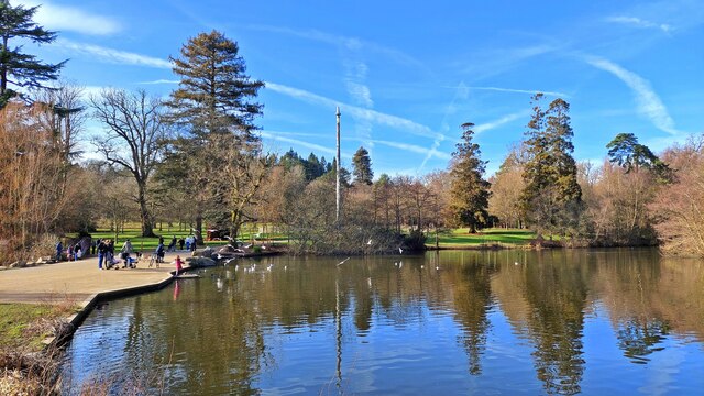
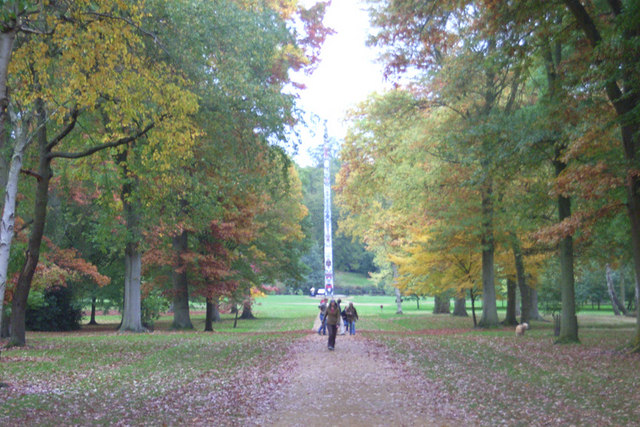
Great Wood, Surrey, also known as Great Wood Forest, is a prominent woodland area located in Surrey, England. Spread across an expansive area, it is a popular destination for nature enthusiasts and locals seeking tranquility away from the bustling city life.

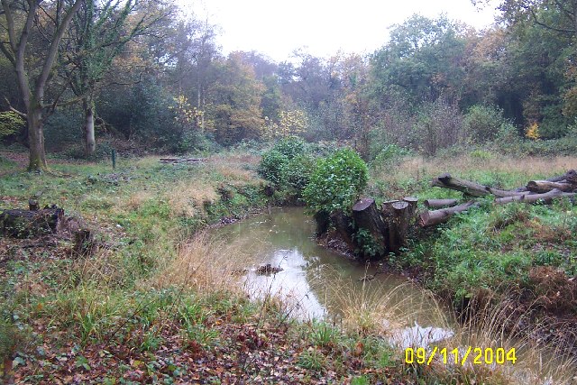
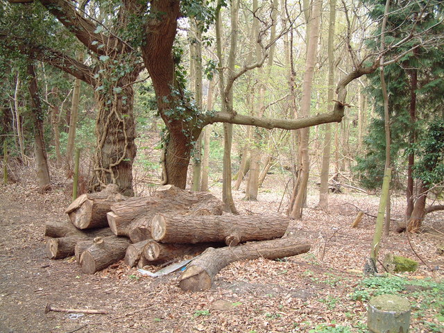
The forest is characterized by its diverse range of tree species, including oak, beech, and ash, which create a rich and vibrant ecosystem. The woodland floor is carpeted with a variety of wildflowers and ferns, adding to its natural beauty. Great Wood is also home to a wide array of wildlife, such as deer, foxes, badgers, and numerous bird species, making it an important habitat for nature conservation.

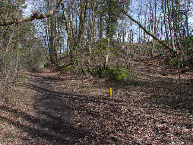
For visitors, Great Wood offers several walking trails and paths, allowing them to explore the forest at their own pace. These trails are well-maintained and provide opportunities for both leisurely strolls and more challenging hikes. Along the way, visitors may come across picturesque clearings, where they can pause to admire the scenic views or have a picnic.

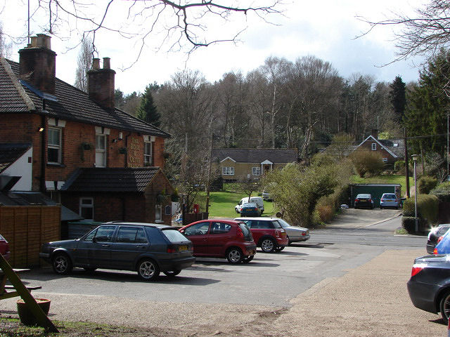
The forest is also well-equipped with visitor facilities, including parking areas, picnic spots, and information boards, ensuring a comfortable and informative experience for all. It is advisable for visitors to bring appropriate footwear and clothing, as the woodland terrain can be uneven and muddy, particularly during wet weather.

Overall, Great Wood, Surrey, is a captivating natural haven, providing a peaceful retreat for those seeking solace amidst the beauty of nature.

If you have any feedback on the listing, please let us know in the comments section below.

Great Wood Images

Images are sourced within 2km of 51.413999/-0.56334424 or Grid Reference TQ0069. Thanks to Geograph Open Source API. All images are credited.

Wick Pond, Windsor Great Park Looking across Wick Pond to the totem pole.
Wick Pond, Windsor Great Park
Looking across Wick Pond to the totem pole.
The Bourne, Virginia Water Recent clearance of trees has opened up this scene of The Bourne in the woodland between Virginia Water and Trumps Green. This view is taken looking westwards and upstream.
The Bourne, Virginia Water
Recent clearance of trees has opened up this scene of The Bourne in the woodland between Virginia Water and Trumps Green. This view is taken looking westwards and upstream.
Christ Church, Virginia Water
Station Approach Local shops near Virginia Water station.
Station Approach
Local shops near Virginia Water station.
Callow Hill Wood As seen from the track that leads east from the Rose and Olive Branch public house.
Callow Hill Wood
As seen from the track that leads east from the Rose and Olive Branch public house.
Totem pole, Virginia Water, Surrey Autumn in the park
Totem pole, Virginia Water, Surrey
Autumn in the park
Christ Church, Virginia Water Built in 1839.
Christ Church, Virginia Water
Built in 1839.
Totem Pole near Virginia Water This totem pole stands at the Egham Wick end of Virginia Water, having ended its long journey from British Columbia in 1958. The notice at the foot of the pole reads as follows: "TOTEM POLE - BRITISH COLUMBIA, CANADA. THIS POLE, 100 feet high - a foot for every year - marks the centenary of British Columbia which, named by Queen Victoria and proclaimed a Crown Colony on November 19th, 1858, is now the Pacific Coast Province of Canada".
Totem Pole near Virginia Water
This totem pole stands at the Egham Wick end of Virginia Water, having ended its long journey from British Columbia in 1958. The notice at the foot of the pole reads as follows: "TOTEM POLE - BRITISH COLUMBIA, CANADA. THIS POLE, 100 feet high - a foot for every year - marks the centenary of British Columbia which, named by Queen Victoria and proclaimed a Crown Colony on November 19th, 1858, is now the Pacific Coast Province of Canada".
Beech trees beside Virginia Water in the autumn A typical view through trees to Virginia Water beyond. In the 18th century this area, known as “the Surrey bog”, began to be transformed into the man-made lake and watercourses now known as “Virginia Water”. The circuit of paths through the woodland around the lake is some 4.5 miles long and provides the public with easy access to some of the most beautiful lake-side walks in the London region. Virginia Water, which is fed by the River Bourne, also acts as a most efficient drainage system for Windsor Great Park immediately to the north 
<span class="nowrap"><a title="http://www.thamesweb.co.uk/windsor/info/grtpk.html#anchor445739" rel="nofollow ugc noopener" href="http://www.thamesweb.co.uk/windsor/info/grtpk.html#anchor445739">Link</a><img style="margin-left:2px;" alt="External link" title="External link - shift click to open in new window" src="https://s1.geograph.org.uk/img/external.png" width="10" height="10"/></span>
Beech trees beside Virginia Water in the autumn
A typical view through trees to Virginia Water beyond. In the 18th century this area, known as “the Surrey bog”, began to be transformed into the man-made lake and watercourses now known as “Virginia Water”. The circuit of paths through the woodland around the lake is some 4.5 miles long and provides the public with easy access to some of the most beautiful lake-side walks in the London region. Virginia Water, which is fed by the River Bourne, also acts as a most efficient drainage system for Windsor Great Park immediately to the north LinkExternal link
Callow Hill The footpath that runs through the woods at the back of the Rose And Olive Branch pub. This area appears to have been used as landfill in the past. the yellow pipe is there to prevent build up of gas.
Callow Hill
The footpath that runs through the woods at the back of the Rose And Olive Branch pub. This area appears to have been used as landfill in the past. the yellow pipe is there to prevent build up of gas.
Callow Hill The Rose and Olive Branch car park from the footpath that runs behind the pub. The road between the pub and the houses is Callow Hill
Callow Hill
The Rose and Olive Branch car park from the footpath that runs behind the pub. The road between the pub and the houses is Callow Hill
The Rose and Olive Branch The Rose and Olive Branch pub in Callow Hill. This small traditional pub faces onto Callow Hill
The Rose and Olive Branch
The Rose and Olive Branch pub in Callow Hill. This small traditional pub faces onto Callow Hill
Callow Hill A view down Callow Hill. The Rose and Olive Branch pub is just around the bend on the right.Callow Hill runs from Christchurch Road towards the Royal Holloway College in Englefield Green
Callow Hill
A view down Callow Hill. The Rose and Olive Branch pub is just around the bend on the right.Callow Hill runs from Christchurch Road towards the Royal Holloway College in Englefield Green
Hollow Lane, Virginia Water The access road and bridleway that runs from Callow Hill towards Stroude Farm.
Hollow Lane, Virginia Water
The access road and bridleway that runs from Callow Hill towards Stroude Farm.
Virginia Water A fine display of daffodils on the green between Station Approach and Christchurch Road (in the background)
Virginia Water
A fine display of daffodils on the green between Station Approach and Christchurch Road (in the background)
Trumps Green railway arch The railway arch just down line from Virginia Water station carrying the Sunningdale line over Trumps Green Road
Trumps Green railway arch
The railway arch just down line from Virginia Water station carrying the Sunningdale line over Trumps Green Road
Beechmont Avenue, Trumps Green Beechmont Avenue from its junction with Trumps Green Road.
Beechmont Avenue, Trumps Green
Beechmont Avenue from its junction with Trumps Green Road.
Wick Pond Small pond lined by lawns and trees east of the Totem Pole at Virginia Water. This is within the landscaped Windsor Great Park.

<span class="nowrap"><a title="http://www.theroyallandscape.co.uk/" rel="nofollow ugc noopener" href="http://www.theroyallandscape.co.uk/">Link</a><img style="margin-left:2px;" alt="External link" title="External link - shift click to open in new window" src="https://s1.geograph.org.uk/img/external.png" width="10" height="10"/></span>
Wick Pond
Small pond lined by lawns and trees east of the Totem Pole at Virginia Water. This is within the landscaped Windsor Great Park. LinkExternal link
Show me another place!

Great Wood is located at Grid Ref: TQ0069 (Lat: 51.413999, Lng: -0.56334424)

Administrative County: Surrey

District: Runnymede

Police Authority: Surrey

What 3 Words

///attend.hips.many. Near Virginia Water, Surrey

Nearby Locations

Stroude Great Wood

Related Wikis

Holloway Sanatorium

Holloway Sanatorium was an institution for the treatment of those suffering temporary mental illness, situated on 22 acres (9 ha) of aesthetically landscaped...
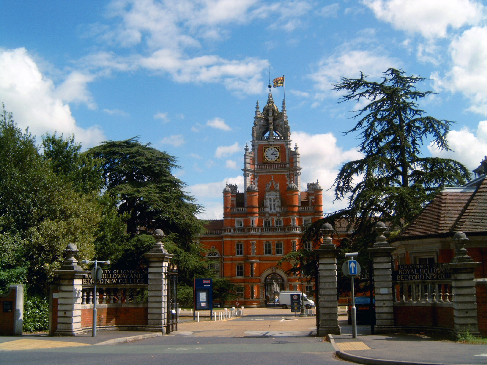
Founder's Building

The Founder's Building is the original building of Royal Holloway College, University of London (RHUL), in Egham, Surrey, England. It is an example of...

Royal Holloway, University of London

Royal Holloway, University of London (RHUL), formally incorporated as Royal Holloway and Bedford New College, is a public research university and a member...
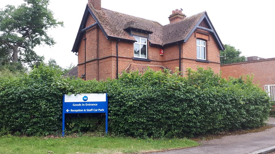
Rusham Park

Rusham Park is an industrial site in Egham, Surrey, England. It was formally owned by Shell, Richardson Vicks, and Procter & Gamble. It is now owned by...

Nearby Amenities

Located within 500m of 51.413999,-0.56334424
Note: continues
Lat/Long: 51.4137154/-0.5689398
The Dell
Place: locality
Lat/Long: 51.4120983/-0.5640388
Ford: yes
Lat/Long: 51.4170357/-0.5605508
The data included in this document is from www.openstreetmap.org. The data is made available under ODbL.

Have you been to Great Wood?

Leave your review of Great Wood below (or comments, questions and feedback).