Griffin's Covert

Wood, Forest in Lincolnshire North Kesteven

England

Griffin's Covert

Preceptory Tower, Temple Bruer The original floor was at the level of the top of the steps. The roof-line of the Chapel can be seen, along with where the Presbytery joined the tower. The roof is modern.
Preceptory Tower, Temple Bruer Credit: Julian P Guffogg

Griffin's Covert is a picturesque woodland located in Lincolnshire, England. This enchanting forest stretches over a vast area, offering a serene and peaceful retreat for nature enthusiasts and outdoor adventurers alike. The woodland is named after the mythical creature, the Griffin, which is often associated with strength and wisdom.

The dense canopy of trees in Griffin's Covert creates a cool and refreshing atmosphere, perfect for escaping the hustle and bustle of everyday life. The forest is home to a diverse range of flora and fauna, including ancient oaks, beech trees, and wildflowers that carpet the forest floor during the spring and summer months.

Visitors to Griffin's Covert can embark on various walking trails that wind through the forest, allowing them to explore its hidden corners and discover the natural beauty that lies within. These trails cater to all levels of fitness and range from leisurely strolls to more challenging hikes, ensuring there is something for everyone.

In addition to its natural splendor, Griffin's Covert also boasts an array of wildlife. Birdwatchers can observe an assortment of species, including woodpeckers, owls, and rare migratory birds. The forest is also home to a variety of mammals such as deer, foxes, and squirrels, making it a popular spot for wildlife enthusiasts.

Griffin's Covert is a haven for those seeking tranquility and a connection with nature. With its breathtaking scenery, diverse flora and fauna, and numerous walking trails, this woodland gem in Lincolnshire truly offers a memorable experience for all who visit.

If you have any feedback on the listing, please let us know in the comments section below.

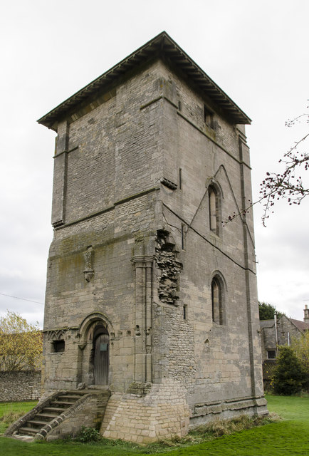
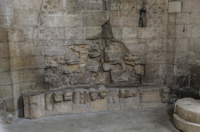
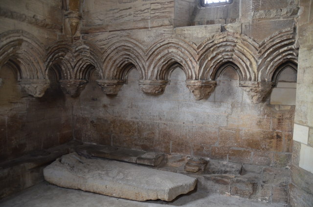
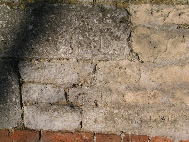
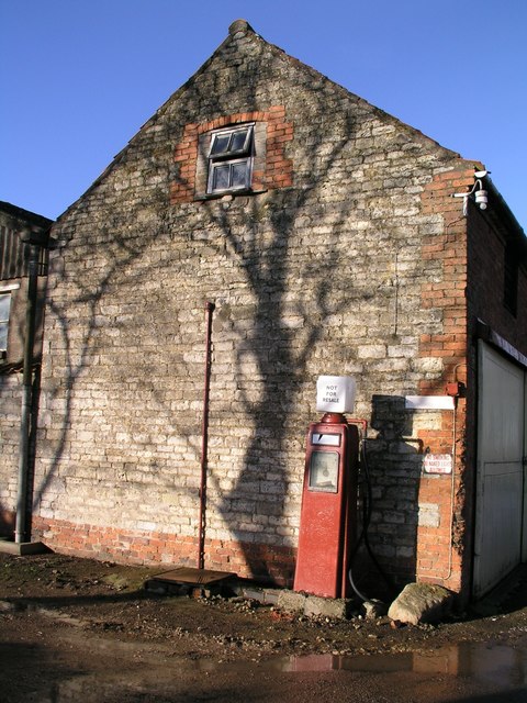
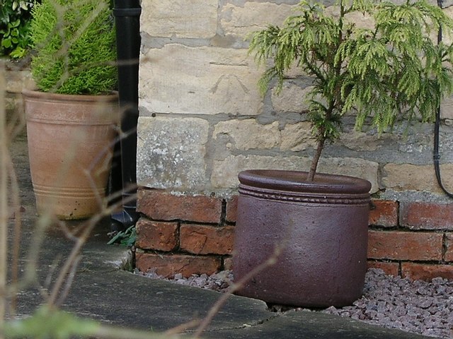
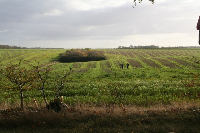
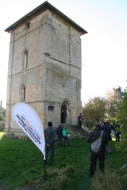
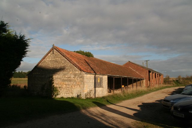
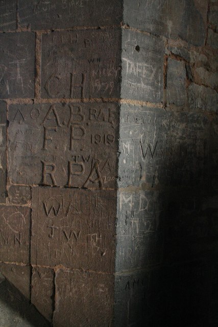
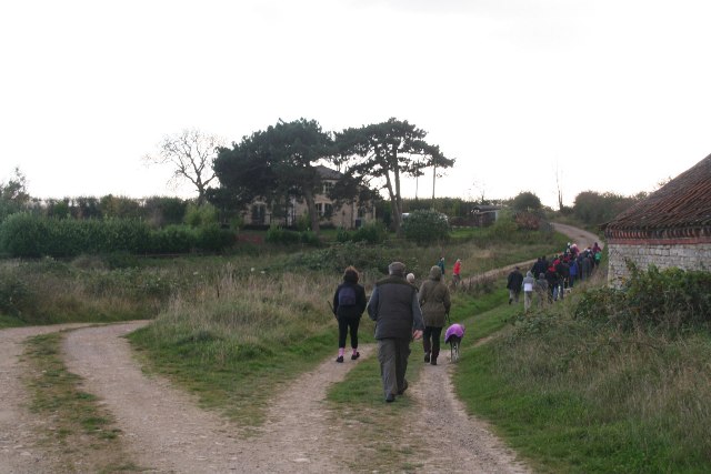
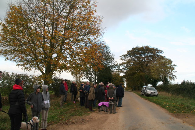
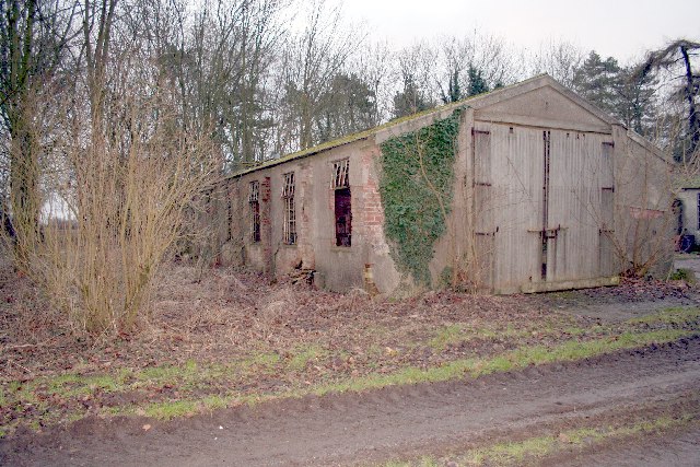
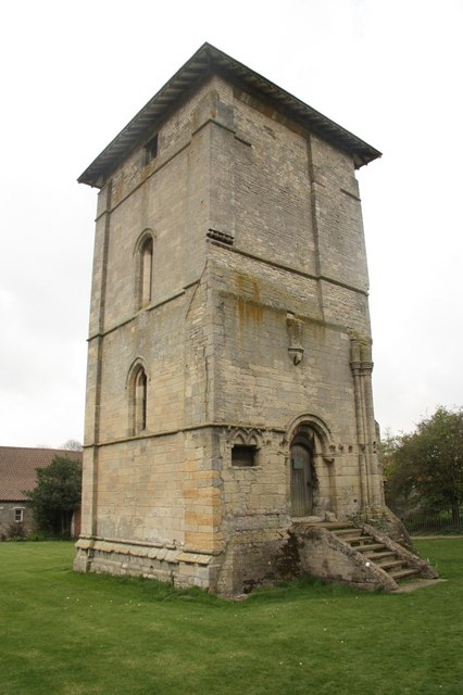
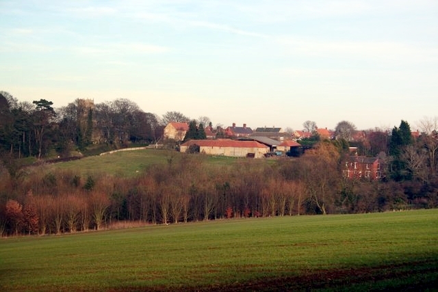
Griffin's Covert Images

Images are sourced within 2km of 53.082326/-0.51055613 or Grid Reference SK9954. Thanks to Geograph Open Source API. All images are credited.

Preceptory Tower, Temple Bruer The original floor was at the level of the top of the steps. The roof-line of the Chapel can be seen, along with where the Presbytery joined the tower. The roof is modern.
Preceptory Tower, Temple Bruer
The original floor was at the level of the top of the steps. The roof-line of the Chapel can be seen, along with where the Presbytery joined the tower. The roof is modern.
Interior, Preceptory Temple Bruer Remains of the altar inside the tower.
Interior, Preceptory Temple Bruer
Remains of the altar inside the tower.
Remains of Sedilia Inside the Temple Bruer tower.
Remains of Sedilia
Inside the Temple Bruer tower.
Field off Gorse Hill Lane
Cut Mark: Highfield House Farm Cut bench mark on the gable end of a farm building.  See <a title="https://www.geograph.org.uk/photo/5287894" href="https://www.geograph.org.uk/photo/5287894">Link</a> for a wider view and <span class="nowrap"><a title="http://www.bench-marks.org.uk/bm41219" rel="nofollow ugc noopener" href="http://www.bench-marks.org.uk/bm41219">Link</a><img style="margin-left:2px;" alt="External link" title="External link - shift click to open in new window" src="https://s1.geograph.org.uk/img/external.png" width="10" height="10"/></span> for details.
Cut Mark: Highfield House Farm
Cut bench mark on the gable end of a farm building. See Link for a wider view and LinkExternal link for details.
Farm building and fuel pump at Highfield House Farm The building carries a cut bench mark near the drain pipe on the left.  See <a title="https://www.geograph.org.uk/photo/5287890" href="https://www.geograph.org.uk/photo/5287890">Link</a> for a closer view and <span class="nowrap"><a title="http://www.bench-marks.org.uk/bm41219" rel="nofollow ugc noopener" href="http://www.bench-marks.org.uk/bm41219">Link</a><img style="margin-left:2px;" alt="External link" title="External link - shift click to open in new window" src="https://s1.geograph.org.uk/img/external.png" width="10" height="10"/></span> for details.
Farm building and fuel pump at Highfield House Farm
The building carries a cut bench mark near the drain pipe on the left. See Link for a closer view and LinkExternal link for details.
Cut Mark: Temple Farm Cut bench mark on the south-west angle south face of the cottage at Temple Farm.  See <span class="nowrap"><a title="http://www.bench-marks.org.uk/bm41218" rel="nofollow ugc noopener" href="http://www.bench-marks.org.uk/bm41218">Link</a><img style="margin-left:2px;" alt="External link" title="External link - shift click to open in new window" src="https://s1.geograph.org.uk/img/external.png" width="10" height="10"/></span> for details.
Cut Mark: Temple Farm
Cut bench mark on the south-west angle south face of the cottage at Temple Farm. See LinkExternal link for details.
Metal detectors near Temple Farm, temple Bruer
South Lincolnshire Walking Festival: tour of Temple Bruer Tower See also <a href="https://www.geograph.org.uk/gridref/TF0153">TF0153</a>, <a href="https://www.geograph.org.uk/gridref/TF0054">TF0054</a> and <a href="https://www.geograph.org.uk/gridref/TF0154">TF0154</a>.

For more information on this area, including the Templars, and the Temple Bruer Heath and its rabbit warrens, see <span class="nowrap"><a title="http://www.artsnk.org/wp-content/uploads/2016/06/Heritage-Lincolnshire-Research.pdf" rel="nofollow ugc noopener" href="http://www.artsnk.org/wp-content/uploads/2016/06/Heritage-Lincolnshire-Research.pdf">Link</a><img style="margin-left:2px;" alt="External link" title="External link - shift click to open in new window" src="https://s1.geograph.org.uk/img/external.png" width="10" height="10"/></span> .
South Lincolnshire Walking Festival: tour of Temple Bruer Tower
See also TF0153, TF0054 and TF0154. For more information on this area, including the Templars, and the Temple Bruer Heath and its rabbit warrens, see LinkExternal link .
Farm buildings at Temple Farm, Temple Bruer For more information on this area, including the Templars, and the Temple Bruer Heath and its rabbit warrens, see <span class="nowrap"><a title="http://www.artsnk.org/wp-content/uploads/2016/06/Heritage-Lincolnshire-Research.pdf" rel="nofollow ugc noopener" href="http://www.artsnk.org/wp-content/uploads/2016/06/Heritage-Lincolnshire-Research.pdf">Link</a><img style="margin-left:2px;" alt="External link" title="External link - shift click to open in new window" src="https://s1.geograph.org.uk/img/external.png" width="10" height="10"/></span> .
Farm buildings at Temple Farm, Temple Bruer
For more information on this area, including the Templars, and the Temple Bruer Heath and its rabbit warrens, see LinkExternal link .
Graffiti in Temple Bruer Tower
South Lincolnshire Walking Festival: Temple Bruer walk (1) See also <a href="https://www.geograph.org.uk/gridref/TF0153">TF0153</a>, <a href="https://www.geograph.org.uk/gridref/TF0054">TF0054</a> and <a href="https://www.geograph.org.uk/gridref/TF0154">TF0154</a>.

For more information on this area, including the Templars, and the Temple Bruer Heath and its rabbit warrens, see <span class="nowrap"><a title="http://www.artsnk.org/wp-content/uploads/2016/06/Heritage-Lincolnshire-Research.pdf" rel="nofollow ugc noopener" href="http://www.artsnk.org/wp-content/uploads/2016/06/Heritage-Lincolnshire-Research.pdf">Link</a><img style="margin-left:2px;" alt="External link" title="External link - shift click to open in new window" src="https://s1.geograph.org.uk/img/external.png" width="10" height="10"/></span> .
South Lincolnshire Walking Festival: Temple Bruer walk (1)
See also TF0153, TF0054 and TF0154. For more information on this area, including the Templars, and the Temple Bruer Heath and its rabbit warrens, see LinkExternal link .
South Lincolnshire Walking Festival: Temple Bruer walk (2) See also <a href="https://www.geograph.org.uk/gridref/TF0053">TF0053</a>, <a href="https://www.geograph.org.uk/gridref/TF0054">TF0054</a> and <a href="https://www.geograph.org.uk/gridref/TF0154">TF0154</a>.

For more information on this area, including the Templars, and the Temple Bruer Heath and its rabbit warrens, see <span class="nowrap"><a title="http://www.artsnk.org/wp-content/uploads/2016/06/Heritage-Lincolnshire-Research.pdf" rel="nofollow ugc noopener" href="http://www.artsnk.org/wp-content/uploads/2016/06/Heritage-Lincolnshire-Research.pdf">Link</a><img style="margin-left:2px;" alt="External link" title="External link - shift click to open in new window" src="https://s1.geograph.org.uk/img/external.png" width="10" height="10"/></span> .
South Lincolnshire Walking Festival: Temple Bruer walk (2)
See also TF0053, TF0054 and TF0154. For more information on this area, including the Templars, and the Temple Bruer Heath and its rabbit warrens, see LinkExternal link .
Fields opposite Temple Farm, Temple Bruer
South Lincolnshire Walking Festival: Temple Bruer walk (3) Warren Lane. For more information on this area, including the Templars, and the Temple Bruer Heath and its rabbit warrens, see <span class="nowrap"><a title="http://www.artsnk.org/wp-content/uploads/2016/06/Heritage-Lincolnshire-Research.pdf" rel="nofollow ugc noopener" href="http://www.artsnk.org/wp-content/uploads/2016/06/Heritage-Lincolnshire-Research.pdf">Link</a><img style="margin-left:2px;" alt="External link" title="External link - shift click to open in new window" src="https://s1.geograph.org.uk/img/external.png" width="10" height="10"/></span> .

See also <a href="https://www.geograph.org.uk/gridref/TF0053">TF0053</a>, <a href="https://www.geograph.org.uk/gridref/TF0054">TF0054</a> and <a href="https://www.geograph.org.uk/gridref/TF0153">TF0153</a>.
South Lincolnshire Walking Festival: Temple Bruer walk (3)
Warren Lane. For more information on this area, including the Templars, and the Temple Bruer Heath and its rabbit warrens, see LinkExternal link . See also TF0053, TF0054 and TF0153.
South Lincolnshire Walking Festival: Temple Bruer walk (4) Warren Lane. For more information on this area, including the Templars, and the Temple Bruer Heath and its rabbit warrens, see <span class="nowrap"><a title="http://www.artsnk.org/wp-content/uploads/2016/06/Heritage-Lincolnshire-Research.pdf" rel="nofollow ugc noopener" href="http://www.artsnk.org/wp-content/uploads/2016/06/Heritage-Lincolnshire-Research.pdf">Link</a><img style="margin-left:2px;" alt="External link" title="External link - shift click to open in new window" src="https://s1.geograph.org.uk/img/external.png" width="10" height="10"/></span> .

See also <a href="https://www.geograph.org.uk/gridref/TF0053">TF0053</a>, <a href="https://www.geograph.org.uk/gridref/TF0054">TF0054</a> and <a href="https://www.geograph.org.uk/gridref/TF0153">TF0153</a>.
South Lincolnshire Walking Festival: Temple Bruer walk (4)
Warren Lane. For more information on this area, including the Templars, and the Temple Bruer Heath and its rabbit warrens, see LinkExternal link . See also TF0053, TF0054 and TF0153.
South Lincolnshire Walking Festival: Temple Bruer walk (5) Returning to the Tower. For more information on this area, including the Templars, and the Temple Bruer Heath and its rabbit warrens, see <span class="nowrap"><a title="http://www.artsnk.org/wp-content/uploads/2016/06/Heritage-Lincolnshire-Research.pdf" rel="nofollow ugc noopener" href="http://www.artsnk.org/wp-content/uploads/2016/06/Heritage-Lincolnshire-Research.pdf">Link</a><img style="margin-left:2px;" alt="External link" title="External link - shift click to open in new window" src="https://s1.geograph.org.uk/img/external.png" width="10" height="10"/></span> .

See also <a href="https://www.geograph.org.uk/gridref/TF0053">TF0053</a>, <a href="https://www.geograph.org.uk/gridref/TF0154">TF0154</a> and <a href="https://www.geograph.org.uk/gridref/TF0153">TF0153</a>.
South Lincolnshire Walking Festival: Temple Bruer walk (5)
Returning to the Tower. For more information on this area, including the Templars, and the Temple Bruer Heath and its rabbit warrens, see LinkExternal link . See also TF0053, TF0154 and TF0153.
South Lincolnshire Walking Festival: Temple Bruer walk (6) See also <a href="https://www.geograph.org.uk/gridref/TF0053">TF0053</a>, <a href="https://www.geograph.org.uk/gridref/TF0154">TF0154</a> and <a href="https://www.geograph.org.uk/gridref/TF0153">TF0153</a>.

For more information on this area, including the Templars, and the Temple Bruer Heath and its rabbit warrens, see <span class="nowrap"><a title="http://www.artsnk.org/wp-content/uploads/2016/06/Heritage-Lincolnshire-Research.pdf" rel="nofollow ugc noopener" href="http://www.artsnk.org/wp-content/uploads/2016/06/Heritage-Lincolnshire-Research.pdf">Link</a><img style="margin-left:2px;" alt="External link" title="External link - shift click to open in new window" src="https://s1.geograph.org.uk/img/external.png" width="10" height="10"/></span> .
South Lincolnshire Walking Festival: Temple Bruer walk (6)
See also TF0053, TF0154 and TF0153. For more information on this area, including the Templars, and the Temple Bruer Heath and its rabbit warrens, see LinkExternal link .
Show me another place!

Griffin's Covert is located at Grid Ref: SK9954 (Lat: 53.082326, Lng: -0.51055613)

Administrative County: Lincolnshire

District: North Kesteven

Police Authority: Lincolnshire

What 3 Words

///refuse.kettles.consented. Near Navenby, Lincolnshire

Nearby Locations

Griffin's Covert

Related Wikis

RAF Wellingore

Royal Air Force Wellingore or more simply RAF Wellingore is a former Royal Air Force fighter relief landing ground located 1.9 miles (3.1 km) south of...

Temple Bruer Preceptory

Temple Bruer Preceptory is a historic building in the civil parish of Temple Bruer with Temple High Grange, North Kesteven, Lincolnshire, England. It...

Temple Bruer with Temple High Grange

Temple Bruer with Temple High Grange is a civil parish and a former extra-parochial area in North Kesteven, Lincolnshire, England which had in the Medieval...

Thompson's Bottom

Thompson's Bottom is a hamlet in the North Kesteven district of Lincolnshire, England. It is situated just under 0.5 miles (0.8 km) west from the A15 road...

Wellingore

Wellingore is a village and civil parish in the North Kesteven district of Lincolnshire, England. The population of the civil parish at the 2011 census...

Navenby

Navenby is a village and civil parish in the North Kesteven district of Lincolnshire, England. Lying 8 miles (13 km) south from Lincoln and 9 miles (14...

Welbourn

Welbourn is a village and civil parish in the North Kesteven district of Lincolnshire, England. The population of the civil parish at the 2011 census was...

Brauncewell

Brauncewell is a hamlet and former civil parish in the North Kesteven district of Lincolnshire, England. From the census 2011 the population is included...

Nearby Amenities

Located within 500m of 53.082326,-0.51055613
Griffin's Farm
Place: farm
Source: Bing
Lat/Long: 53.0784046/-0.5087375
The data included in this document is from www.openstreetmap.org. The data is made available under ODbL.

Have you been to Griffin's Covert?

Leave your review of Griffin's Covert below (or comments, questions and feedback).