Canterbury Copse

Wood, Forest in Surrey Waverley

England

Canterbury Copse

Woodland track going southwards from the Sussex Border Path(2)
Woodland track going southwards from the Sussex Border Path(2) Credit: Shazz

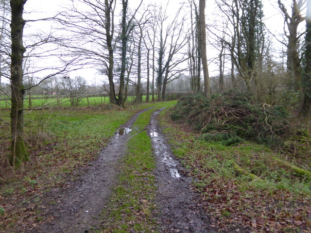
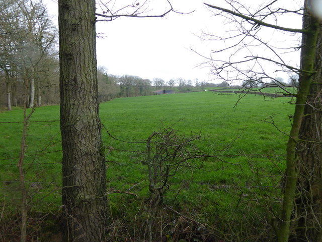
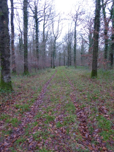
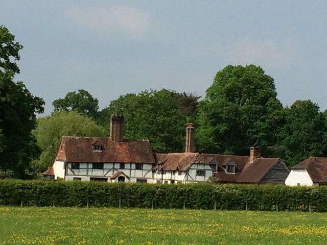
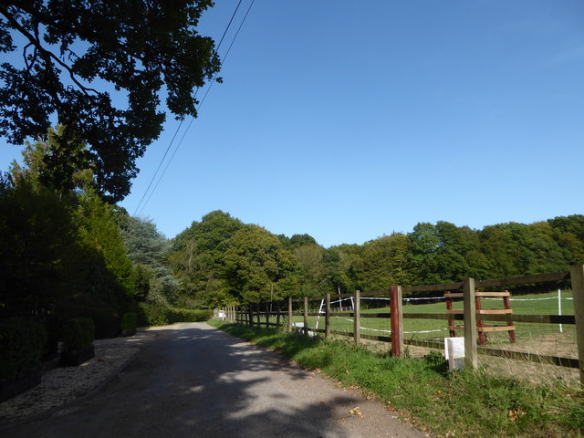
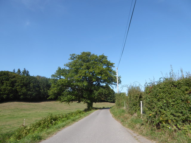
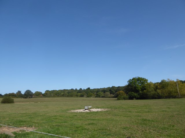
Canterbury Copse is a picturesque woodland located in Surrey, England. Covering an area of approximately 25 acres, this enchanting forest is renowned for its natural beauty and tranquil atmosphere. Situated just a short distance from the village of Shere, Canterbury Copse is a popular destination for nature enthusiasts, hikers, and families seeking a peaceful retreat.

The copse is predominantly composed of a mixture of deciduous and coniferous trees, including oak, beech, and pine, which create a diverse and captivating landscape. The woodland floor is adorned with a rich carpet of wildflowers, adding bursts of vibrant colors throughout the seasons.

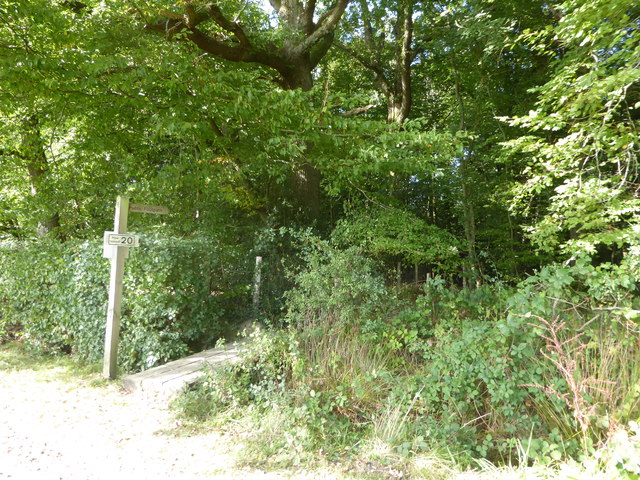
Visitors to Canterbury Copse can enjoy a variety of walking trails that wind through the forest, offering opportunities to explore its hidden corners and discover the abundance of wildlife that calls this place home. Birdwatchers can spot a wide array of species, including woodpeckers, thrushes, and owls, while small mammals like squirrels, rabbits, and foxes can often be seen darting among the trees.

This idyllic woodland is not only a haven for wildlife but also a place of historical significance. It is believed that Canterbury Copse played a role during World War II, serving as a training ground for the Home Guard. Today, remnants of old trenches and structures can still be found scattered throughout the forest, offering a glimpse into its wartime past.

Canterbury Copse is a cherished natural gem, providing a serene escape from the hustle and bustle of everyday life. Whether it's a leisurely stroll, a picnic, or a moment of reflection amidst nature, this woodland offers a truly rejuvenating experience for all who visit.

If you have any feedback on the listing, please let us know in the comments section below.

Canterbury Copse Images

Images are sourced within 2km of 51.096364/-0.57626589 or Grid Reference SU9933. Thanks to Geograph Open Source API. All images are credited.

Woodland track going southwards from the Sussex Border Path(2)
View across field to large barn On the left is the western edge of Weald Barkfold Copse.
View across field to large barn
On the left is the western edge of Weald Barkfold Copse.
Woodland track going south from the Sussex Border Path (1)
Howicks, Hurlands Lane, Dunsfold Grade II listed building (incorrectly listed as 'Lowicks') <span class="nowrap"><a title="http://www.heritagegateway.org.uk/Gateway/Results_Single.aspx?uid=1044357&resourceID=5" rel="nofollow ugc noopener" href="http://www.heritagegateway.org.uk/Gateway/Results_Single.aspx?uid=1044357&resourceID=5">Link</a><img style="margin-left:2px;" alt="External link" title="External link - shift click to open in new window" src="https://s1.geograph.org.uk/img/external.png" width="10" height="10"/></span>
Howicks, Hurlands Lane, Dunsfold
Grade II listed building (incorrectly listed as 'Lowicks') LinkExternal link
Old wooden building Beside the Wey-South Path stands a dilapidated wooden building which is marked on the OS Map.
Old wooden building
Beside the Wey-South Path stands a dilapidated wooden building which is marked on the OS Map.
Gated Entrance to the Old Lock House The Old Lock House in Sidney Wood was built beside the now disused Wey and Arun Canal. The canal route past the house is not accessible to the public and only the driveway to the house can be seen from the Wey-South Path.
Gated Entrance to the Old Lock House
The Old Lock House in Sidney Wood was built beside the now disused Wey and Arun Canal. The canal route past the house is not accessible to the public and only the driveway to the house can be seen from the Wey-South Path.
Towpath beside the Wey and Arun Canal A straight section of the Wey and Arun Canal in Sidney Wood used as part of the Wey-South Path.
Towpath beside the Wey and Arun Canal
A straight section of the Wey and Arun Canal in Sidney Wood used as part of the Wey-South Path.
Gentle turn of the old Canal The disused Wey and Arun Canal takes a number of turns as it passes through Sidney Wood.
Gentle turn of the old Canal
The disused Wey and Arun Canal takes a number of turns as it passes through Sidney Wood.
Path Junction beside the Wey and Arun Canal As the Wey-South Path continues along the old towpath a footpath leads off to the left.
Path Junction beside the Wey and Arun Canal
As the Wey-South Path continues along the old towpath a footpath leads off to the left.
Exploring eastwards along the Bashire (10) Road passing Inside Copse
Exploring eastwards along the Bashire (10)
Road passing Inside Copse
Footpath sign on  White House Lane It goes through Inside Copse to Hurlands Copse
Footpath sign on White House Lane
It goes through Inside Copse to Hurlands Copse
Post box  outside Ifold Court Lodge Post boxes come in many forms from free standing pillar boxes to those built into walls. The monarch's cypher is always present to give an indication of age.
In the British Isles the first red pillar post boxes were erected in Jersey in 1852. Roadside wall boxes first appeared in 1857 as a cheaper alternative to pillar boxes, especially in rural districts. In 1853 the first pillar box in the United Kingdom was installed at Botchergate, Carlisle. In 1856, Richard Redgrave of the Department of Science and Art designed an ornate pillar box for use in London and other large cities. In 1859 the design was improved, and this became the first National Standard pillar box. Green was adopted as the standard colour for the early Victorian post boxes. Between 1866 and 1879 the hexagonal Penfold post box became the standard design for pillar boxes and it was during this period that red was first adopted as the standard colour. The first boxes to be painted red were in London in July 1874, although it would be nearly 10 years before all the boxes had been repainted.(excerpt from Wikipedia)
Post box outside Ifold Court Lodge
Post boxes come in many forms from free standing pillar boxes to those built into walls. The monarch's cypher is always present to give an indication of age. In the British Isles the first red pillar post boxes were erected in Jersey in 1852. Roadside wall boxes first appeared in 1857 as a cheaper alternative to pillar boxes, especially in rural districts. In 1853 the first pillar box in the United Kingdom was installed at Botchergate, Carlisle. In 1856, Richard Redgrave of the Department of Science and Art designed an ornate pillar box for use in London and other large cities. In 1859 the design was improved, and this became the first National Standard pillar box. Green was adopted as the standard colour for the early Victorian post boxes. Between 1866 and 1879 the hexagonal Penfold post box became the standard design for pillar boxes and it was during this period that red was first adopted as the standard colour. The first boxes to be painted red were in London in July 1874, although it would be nearly 10 years before all the boxes had been repainted.(excerpt from Wikipedia)
Tree near Old Knightons
Exploring eastwards along the Bashire (11) Cattle trough in a field at Upper Ifold Farm
Exploring eastwards along the Bashire (11)
Cattle trough in a field at Upper Ifold Farm
Road down from Lock House Lodge to Knightons
2020 vision: Day 287 Junction of Plaistow Road, Chiddingfold Road and Wrotham Hill
Temperature 11C
BBC Radio Four, 'PM', first headline 17:00- the Health Secretary Matt Hancock has defended the government's Covid measures after it emerged that three weeks ago SAGE had advised a "circuit break" before it escalated again
2020 vision: Day 287
Junction of Plaistow Road, Chiddingfold Road and Wrotham Hill Temperature 11C BBC Radio Four, 'PM', first headline 17:00- the Health Secretary Matt Hancock has defended the government's Covid measures after it emerged that three weeks ago SAGE had advised a "circuit break" before it escalated again
The Old Lock House, Sidney Wood This was just below lock 15 of the Wey and Arun Junction Canal, and was at the main maintenance depot of the canal.
The Old Lock House, Sidney Wood
This was just below lock 15 of the Wey and Arun Junction Canal, and was at the main maintenance depot of the canal.
Bridleway through Sidney Wood
Show me another place!

Canterbury Copse is located at Grid Ref: SU9933 (Lat: 51.096364, Lng: -0.57626589)

Administrative County: Surrey

District: Waverley

Police Authority: Surrey

What 3 Words

///crusaders.massaged.clotting. Near Chiddingfold, Surrey

Related Wikis

Chiddingfold Forest

Chiddingfold Forest is a 542.5-hectare (1,341-acre) biological Site of Special Scientific Interest in Chiddingfold in Surrey and West Sussex. One part...

Dunsfold

Dunsfold is a village in the borough of Waverley, Surrey, England, 8.7 miles (14.0 kilometres) south of Guildford. It lies in the Weald and reaches in...

The Farm (recording studio)

The Farm (also known as Fisher Lane Farm) was a recording studio in Chiddingfold, Surrey owned by the rock band Genesis. The group bought the property...

Fir Tree Copse

Fir Tree Copse is a 6-hectare (15-acre) nature reserve south-east of Dunsfold in Surrey. It is managed by the Surrey Wildlife Trust and is part of the...

Plaistow, West Sussex

Plaistow ( PLAST-oh) is a village and civil parish in the north of the Chichester District of West Sussex, England. There is a village green, a recreation...

Pickhurst

Pickhurst is a grade II* listed house set in 130 acres (53 ha) of land near Chiddingfold, Surrey, England. == History == It was designed by the Scottish...

Shillinglee

Shillinglee is an 18th-century house and estate in West Sussex, England near the Surrey border, in between the villages of Chiddingfold and Plaistow. It...

Top Gear test track

The Top Gear test track is used by the BBC automotive television programme Top Gear. It is located at Dunsfold Aerodrome in Surrey, United Kingdom. The...

Nearby Amenities

Located within 500m of 51.096364,-0.57626589
Burntwood Kennels & Cattery
Building: yes
Lat/Long: 51.0946527/-0.5813649
Dunsfold House
Building: yes
Lat/Long: 51.1008327/-0.5770332
Keystone House
Building: yes
Lat/Long: 51.1001246/-0.5788601
The Copse
Natural: wood
Source: photo
Lat/Long: 51.0974506/-0.5792581
Barrier: stile
Foot: yes
Lat/Long: 51.0939513/-0.5787754
Barrier: stile
Lat/Long: 51.0941905/-0.5817896
Barrier: stile
Foot: yes
Lat/Long: 51.0975303/-0.5746382
The data included in this document is from www.openstreetmap.org. The data is made available under ODbL.

Have you been to Canterbury Copse?

Leave your review of Canterbury Copse below (or comments, questions and feedback).