Eastling

Settlement in Kent Swale

England

Eastling

Folly, Doddington Place Gardens The folly, at the eastern end of the gardens <span class="nowrap"><a title="https://www.doddingtonplacegardens.co.uk/" rel="nofollow ugc noopener" href="https://www.doddingtonplacegardens.co.uk/">Link</a><img style="margin-left:2px;" alt="External link" title="External link - shift click to open in new window" src="https://s1.geograph.org.uk/img/external.png" width="10" height="10"/></span> was built in 1997 by Doddington-based builder, G L Streeting, using local flint, and bricks made in the area. The house's owner, Richard Oldfield designed it as a memorial to his first wife, Alexndra, who died in 1995. Sir Roy Strong described it as a ‘piece of Hampton Court’.
Folly, Doddington Place Gardens Credit: Paul Harrop

Eastling is a small village located in the county of Kent, England. Situated approximately 8 miles east of the town of Faversham, it is nestled in the picturesque countryside of the North Downs.

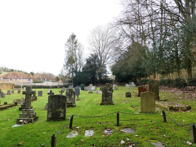
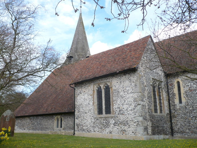
The village is known for its charming and traditional character, with many of its buildings dating back several centuries. One notable landmark is the St. Mary's Church, a Grade II listed building that stands prominently in the heart of the village. The church's origins can be traced back to the 12th century and it boasts a beautiful Norman tower.

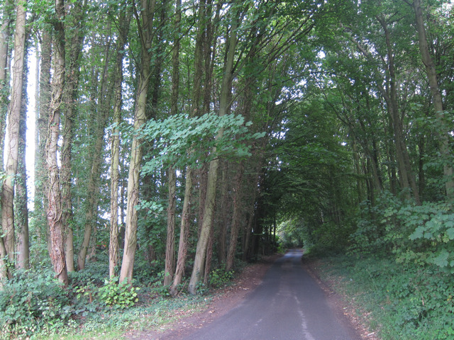
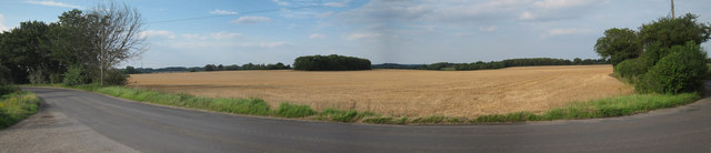
Surrounded by rolling hills and farmland, Eastling offers a peaceful and idyllic setting for its residents and visitors alike. The village is an ideal destination for nature enthusiasts, boasting numerous walking trails that provide stunning views of the surrounding countryside.

Despite its small size, Eastling is a close-knit community that enjoys a range of activities and events. The village hall is a hub of social gatherings, hosting various events throughout the year, including community meetings, art exhibitions, and local fairs.

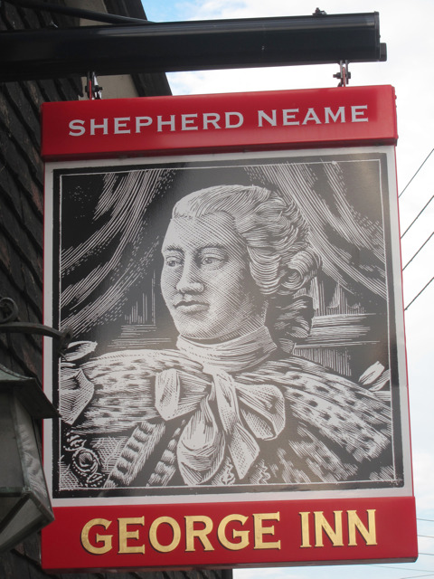
Eastling also benefits from a local pub, The Plough Inn, which offers a warm and welcoming atmosphere to both locals and tourists. The pub serves a range of food and beverages, including traditional British dishes and locally brewed ales.

Overall, Eastling is a charming and tranquil village that offers a slice of rural English life. Its rich history, stunning landscapes, and strong sense of community make it a delightful place to visit or call home.

If you have any feedback on the listing, please let us know in the comments section below.

Eastling Images

Images are sourced within 2km of 51.27435/0.812567 or Grid Reference TQ9656. Thanks to Geograph Open Source API. All images are credited.

Folly, Doddington Place Gardens The folly, at the eastern end of the gardens <span class="nowrap"><a title="https://www.doddingtonplacegardens.co.uk/" rel="nofollow ugc noopener" href="https://www.doddingtonplacegardens.co.uk/">Link</a><img style="margin-left:2px;" alt="External link" title="External link - shift click to open in new window" src="https://s1.geograph.org.uk/img/external.png" width="10" height="10"/></span> was built in 1997 by Doddington-based builder, G L Streeting, using local flint, and bricks made in the area. The house's owner, Richard Oldfield designed it as a memorial to his first wife, Alexndra, who died in 1995. Sir Roy Strong described it as a ‘piece of Hampton Court’.
Folly, Doddington Place Gardens
The folly, at the eastern end of the gardens LinkExternal link was built in 1997 by Doddington-based builder, G L Streeting, using local flint, and bricks made in the area. The house's owner, Richard Oldfield designed it as a memorial to his first wife, Alexndra, who died in 1995. Sir Roy Strong described it as a ‘piece of Hampton Court’.
Eastling: Small field
Field gate near Seed By the footpath that runs between Eastling and Seed.
Field gate near Seed
By the footpath that runs between Eastling and Seed.
Valley near Seed Sheep grazing in the field with Newnham in the distance.
Valley near Seed
Sheep grazing in the field with Newnham in the distance.
Cemetery, Newnham Belonging to  St. Peter and St. Paul's Church, Newnham.
Cemetery, Newnham
Belonging to St. Peter and St. Paul's Church, Newnham.
Sharsted Hill Through Sharsted Wood.
Sharsted Hill
Through Sharsted Wood.
Sharsted Hill Sharsted Court entrance to the left.
Sharsted Hill
Sharsted Court entrance to the left.
George Inn sign Sign for <a href="https://www.geograph.org.uk/photo/915103">TQ9557 : The George Inn, Newnham</a>, a Shepherd Neame pub on The Street.
George Inn sign
Sign for TQ9557 : The George Inn, Newnham, a Shepherd Neame pub on The Street.
The Carpenters Arms sign Sign for <a href="https://www.geograph.org.uk/photo/2563926">TQ9656 : The Carpenters Arms, Eastling</a>], a Shepherd Neame pub on The Street.
The Carpenters Arms sign
Sign for TQ9656 : The Carpenters Arms, Eastling], a Shepherd Neame pub on The Street.
The Carpenters Arms, Eastling A Shepherd Neame pub on The Street.

Also see <a href="https://www.geograph.org.uk/photo/2563924">TQ9656 : The Carpenters Arms sign</a>
The Carpenters Arms, Eastling
A Shepherd Neame pub on The Street. Also see TQ9656 : The Carpenters Arms sign
Kettle Hill Road Narrow lane
Kettle Hill Road
Narrow lane
Kettle Hill junction
Kettle Hill underground sources
North Court Farm Looking from North Eastling Road.
North Court Farm
Looking from North Eastling Road.
Wheat field by Eastling Road
Show me another place!

Eastling is located at Grid Ref: TQ9656 (Lat: 51.27435, Lng: 0.812567)

Administrative County: Kent

District: Swale

Police Authority: Kent

What 3 Words

///spine.hairspray.slumped. Near Teynham, Kent

Related Wikis

Eastling

Eastling is a small village 4½ miles to the southwest of Faversham, Kent in England. It is set in a designated Area of Outstanding Natural Beauty on the...

Newnham, Kent

Newnham is a village and civil parish in the Syndale valley in Kent, England, in the administrative borough of Swale near the medieval market town of Faversham...

Newnham Castle

Newnham Castle was a medieval castle in the village of Newnham, Kent, England. == History == Newnham Castle was built by the Normans, probably by Fulk...
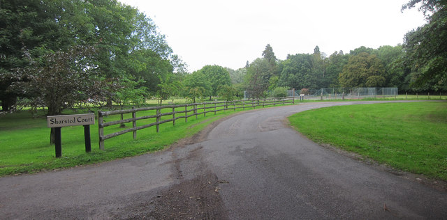
Sharsted Court

Sharsted Court is a grade I listed manor house set in woodland near the village of Newnham, Kent (in the parish of Doddington) England. A house or lodge...

Pines Garden

Pines Garden is a house and large garden, located on the winding beach road from St Margaret's at Cliffe village down to the beach at St Margeret's Bay...

Doddington Place Gardens

Doddington Place Gardens is part of a 850 acres (3,400,000 m2) Edwardian estate, located on the edge of Doddington village, near Faversham in Kent, UK...

Belmont House and Gardens

Belmont is a Georgian house and gardens in Throwley, near Faversham in east Kent. Built between 1769 and 1793, it has been described as "a marvellous example...

Faversham and Mid Kent (UK Parliament constituency)

Faversham and Mid Kent is a constituency represented in the House of Commons of the UK Parliament. Since 2015, the seat has been held by Helen Whately...

Nearby Amenities

Located within 500m of 51.27435,0.812567
Pub
The Carpenter's Arms
Wikidata: Q26322071
Lat/Long: 51.2745198/0.8126291
Bus Stop
The Carpenters Arms
Bench: no
Covered: no
Local Ref: adj
Naptan AtcoCode: 2400A037930A
Naptan Bearing: NE
Naptan BusStopType: MKD
Naptan CommonName: The Carpenters Arms
Naptan Indicator: adj
Naptan Landmark: The Carpenters Arms
Naptan NaptanCode: kntdpdjm
Naptan RevisionNumber: 3
Naptan Status: act
Naptan Street: The Street
Naptan Verified: no
Network: 660
Public Transport: platform
Ref: kntdpdjm
Shelter: no
Source: naptan_import
Source Date: 2018-03-19
Lat/Long: 51.2749259/0.8131394
Bus Stop
Primary School
Flag: no
Local Ref: o/s
Naptan AtcoCode: 2400A037940A
Naptan Bearing: NW
Naptan BusStopType: CUS
Naptan CommonName: Primary School
Naptan Indicator: o/s
Naptan Landmark: Eastling Primary School
Naptan NaptanCode: kntdpdjp
Naptan RevisionNumber: 3
Naptan Status: act
Naptan Street: Kettle Hill Road
Naptan Verified: no
Public Transport: platform
Ref: kntdpdjp
Source: naptan_import
Source Date: 2018-03-19
Lat/Long: 51.2723246/0.8159451
Post Box
Post Box Type: lamp
Postal Code: ME13
Ref: ME13 39
Source: survey
Lat/Long: 51.2751229/0.8134083
Bus Stop
The Carpenters Arms
Bench: no
Covered: no
Flag: no
Local Ref: opp
Naptan AtcoCode: 2400104715
Naptan Bearing: SW
Naptan BusStopType: CUS
Naptan CommonName: The Carpenters Arms
Naptan Indicator: opp
Naptan Landmark: The Carpenters Arms
Naptan NaptanCode: kntjpjmj
Naptan RevisionNumber: 2
Naptan Status: act
Naptan Street: The Street
Naptan Verified: no
Public Transport: platform
Ref: kntjpjmj
Shelter: no
Source: naptan_import
Source Date: 2018-03-19
Lat/Long: 51.2744611/0.8127491
Public Bookcase
Booth: K6
Disused Amenity: telephone
Listed Status: Grade II
Man Made: telephone_box
Public Bookcase Type: phone_box
Lat/Long: 51.2747564/0.8129055
Information: map
Tourism: information
Lat/Long: 51.2732435/0.8149815
Crossing
Lat/Long: 51.2737772/0.8164013
The data included in this document is from www.openstreetmap.org. The data is made available under ODbL.

Have you been to Eastling?

Leave your review of Eastling below (or comments, questions and feedback).