Winkins Wood

Wood, Forest in Sussex Chichester

England

Winkins Wood

Woodland track going southwards from the Sussex Border Path(2)
Woodland track going southwards from the Sussex Border Path(2) Credit: Shazz

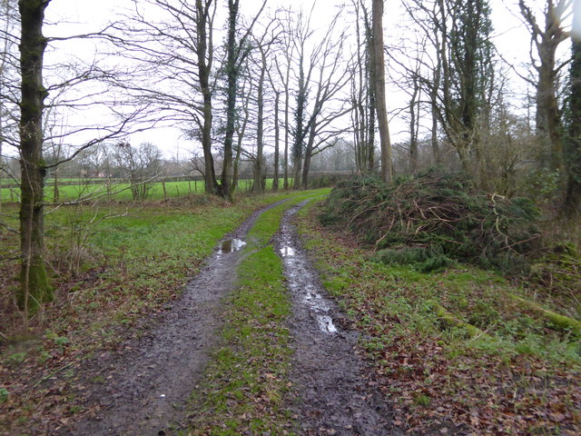
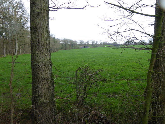
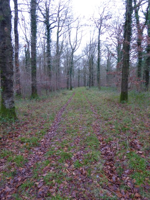
Winkins Wood is a picturesque woodland located in the county of Sussex, in the southeast region of England. Covering an area of approximately 50 acres, it is nestled within the rolling countryside, just a few miles from the charming village of Winkins. The wood is characterized by its dense canopy of towering oak and beech trees, creating a tranquil and enchanting atmosphere.

The woodland is home to a diverse range of flora and fauna, making it a popular destination for nature enthusiasts and wildlife lovers. From delicate wildflowers such as bluebells and primroses that carpet the forest floor in spring, to majestic birds of prey soaring overhead, there is always something to discover in Winkins Wood.

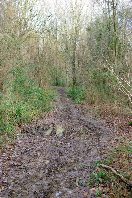
Visitors to the wood can explore its many winding pathways, which lead to enchanting clearings and hidden glades. The dappled sunlight that filters through the dense foliage adds to the magical ambiance of the wood, making it a perfect spot for a peaceful stroll or a picnic surrounded by nature's beauty.

Winkins Wood is also steeped in history, with ancient woodland dating back hundreds of years. It has witnessed generations of wildlife and humans alike, and remnants of old stone walls and ancient trees can still be found throughout the area, providing a glimpse into its past.

The wood is easily accessible, with well-maintained footpaths and ample parking available nearby. Whether one seeks solitude, a connection with nature, or simply a break from the hustle and bustle of everyday life, Winkins Wood offers a serene and idyllic retreat for all who venture into its leafy embrace.

If you have any feedback on the listing, please let us know in the comments section below.
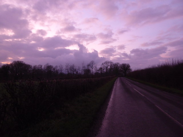
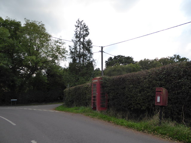
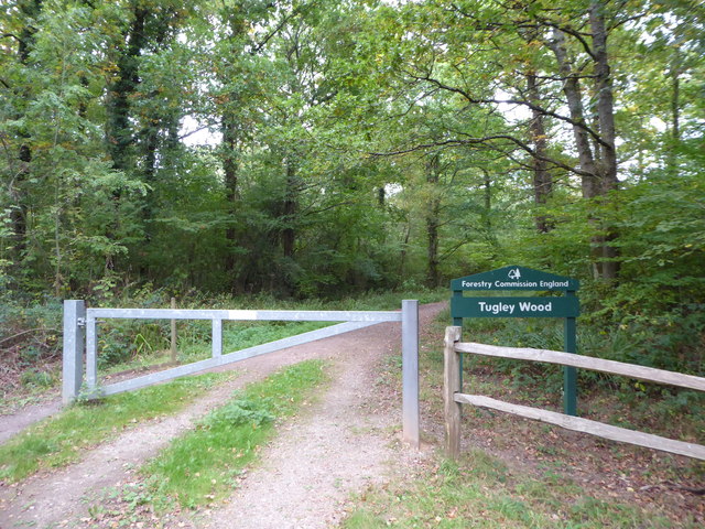
Winkins Wood Images

Images are sourced within 2km of 51.077855/-0.59317955 or Grid Reference SU9831. Thanks to Geograph Open Source API. All images are credited.

Woodland track going southwards from the Sussex Border Path(2)
View across field to large barn On the left is the western edge of Weald Barkfold Copse.
View across field to large barn
On the left is the western edge of Weald Barkfold Copse.
Woodland track going south from the Sussex Border Path (1)
Nell Ball, Plaistow
Nell Ball, Plaistow
December sky at dusk This day had the earliest sunset of the year.
December sky at dusk
This day had the earliest sunset of the year.
2016: a year on Geograph (Day 287) Approaching the junction of Plaistow Road and Fisher Lane
2016: a year on Geograph (Day 287)
Approaching the junction of Plaistow Road and Fisher Lane
Exploring eastwards along the Bashire (7) Footpath sign opposite Robin Farm Racing Stables
Exploring eastwards along the Bashire (7)
Footpath sign opposite Robin Farm Racing Stables
Exploring eastwards along the Bashire (8) Entrance to Tugley Wood
Running total: 27 B points
Exploring eastwards along the Bashire (8)
Entrance to Tugley Wood Running total: 27 B points
Barn near Sparrwood Farm At the time a public footpath passed by here, it has since been diverted.
Barn near Sparrwood Farm
At the time a public footpath passed by here, it has since been diverted.
Nissen hut barn near Sparrwood Farm At the junction of a bridleway and footpath, the path goes left following the farm track to Sparrwood Farm, then unoccupied. The path has since been diverted away from the farm, whose site has been converted into a country residence. The barn has since been demolished.
Nissen hut barn near Sparrwood Farm
At the junction of a bridleway and footpath, the path goes left following the farm track to Sparrwood Farm, then unoccupied. The path has since been diverted away from the farm, whose site has been converted into a country residence. The barn has since been demolished.
Muddy bridleway, Ifold Copse The copse is to the left, on the right the wood is mapped as Alder Platt.
Muddy bridleway, Ifold Copse
The copse is to the left, on the right the wood is mapped as Alder Platt.
House, Shillinglee Park A grade II*(star) listed building from 1735 and 1770s. Gutted by fire 1943, restored and converted to flats in the 1970s.
House, Shillinglee Park
A grade II*(star) listed building from 1735 and 1770s. Gutted by fire 1943, restored and converted to flats in the 1970s.
Warco House near Chiddingfold Warco make engineering tools <span class="nowrap"><a title="https://www.warco.co.uk/" rel="nofollow ugc noopener" href="https://www.warco.co.uk/">Link</a><img style="margin-left:2px;" alt="External link" title="External link - shift click to open in new window" src="https://s1.geograph.org.uk/img/external.png" width="10" height="10"/></span>
Warco House near Chiddingfold
Warco make engineering tools LinkExternal link
Warco House near Chiddingfold Making engineering tools <span class="nowrap"><a title="https://www.warco.co.uk/" rel="nofollow ugc noopener" href="https://www.warco.co.uk/">Link</a><img style="margin-left:2px;" alt="External link" title="External link - shift click to open in new window" src="https://s1.geograph.org.uk/img/external.png" width="10" height="10"/></span>
Warco House near Chiddingfold
Making engineering tools LinkExternal link
Fisher Lane south of Chiddingfold
Fisher Lane
Fisher Lane
Track to Durfold Wood
Farm entrance on Dunsfold Road, Plaistow
Show me another place!

Winkins Wood is located at Grid Ref: SU9831 (Lat: 51.077855, Lng: -0.59317955)

Administrative County: West Sussex

District: Chichester

Police Authority: Sussex

What 3 Words

///patching.rungs.agreeing. Near Chiddingfold, Surrey

Nearby Locations

Winkins Wood

Related Wikis

Chiddingfold Forest

Chiddingfold Forest is a 542.5-hectare (1,341-acre) biological Site of Special Scientific Interest in Chiddingfold in Surrey and West Sussex. One part...

The Farm (recording studio)

The Farm (also known as Fisher Lane Farm) was a recording studio in Chiddingfold, Surrey owned by the rock band Genesis. The group bought the property...

Shillinglee

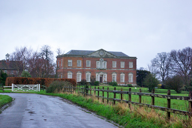
Shillinglee is an 18th-century house and estate in West Sussex, England near the Surrey border, in between the villages of Chiddingfold and Plaistow. It...

Plaistow, West Sussex

Plaistow ( PLAST-oh) is a village and civil parish in the north of the Chichester District of West Sussex, England. There is a village green, a recreation...

Shillinglee Lake

Shillinglee Lake is a 17-hectare (42-acre) biological Site of Special Scientific Interest west of Plaistow in West Sussex.The lake has been designated...

Pickhurst

Pickhurst is a grade II* listed house set in 130 acres (53 ha) of land near Chiddingfold, Surrey, England. == History == It was designed by the Scottish...

Ifold

Ifold is a hamlet in West Sussex and part of the civil Parish of Plaistow, of which it is the largest settlement. Ifold is classified as a hamlet, because...

Ramster

Ramster Garden is an open garden, near Chiddingfold, Surrey, covering over 20 acres (81,000 m2). First landscaped and laid out in the 1890s by Gauntlett...

Nearby Amenities

Located within 500m of 51.077855,-0.59317955
Bus Stop
Shillinglee Road
Naptan AtcoCode: 4400HR0901
Naptan Bearing: E
Naptan BusStopType: CUS
Naptan CommonName: Shillinglee Road
Naptan Indicator: HAR
Naptan Landmark: Hail & Ride
Naptan NaptanCode: wsxgagwg
Naptan Street: Shillinglee Road
Naptan Verified: no
Source: naptan_import
Lat/Long: 51.0765296/-0.5985414
Bus Stop
Shillinglee Road
Naptan AtcoCode: 4400HR0902
Naptan Bearing: W
Naptan BusStopType: CUS
Naptan CommonName: Shillinglee Road
Naptan Indicator: HAR
Naptan Landmark: Hail & Ride
Naptan NaptanCode: wsxgagwj
Naptan Street: Shillinglee Road
Naptan Verified: no
Source: naptan_import
Lat/Long: 51.0764218/-0.5985589
Bus Stop
Highbridge House
Naptan AtcoCode: 4400HR0903
Naptan Bearing: SE
Naptan BusStopType: CUS
Naptan CommonName: Highbridge House
Naptan Indicator: opp
Naptan Landmark: Hail & Ride
Naptan NaptanCode: wsxgagwm
Naptan Street: Shillinglee Road
Naptan Verified: no
Source: naptan_import
Lat/Long: 51.0751853/-0.5907021
Bus Stop
Highbridge House
Naptan AtcoCode: 4400HR0904
Naptan Bearing: NW
Naptan BusStopType: CUS
Naptan CommonName: Highbridge House
Naptan Indicator: adj
Naptan Landmark: Hail & Ride
Naptan NaptanCode: wsxgagwp
Naptan Street: Shillinglee Road
Naptan Verified: no
Source: naptan_import
Lat/Long: 51.0751049/-0.5907474
The data included in this document is from www.openstreetmap.org. The data is made available under ODbL.

Have you been to Winkins Wood?

Leave your review of Winkins Wood below (or comments, questions and feedback).