Green's Spinney

Wood, Forest in Bedfordshire

England

Green's Spinney

Carlton and Harrold from the air Carlton is the village to the left of centre, Harold is at the top, between the lakes.
Carlton and Harrold from the air Credit: Thomas Nugent

Green's Spinney is a small woodland located in Bedfordshire, England. Covering an area of approximately 10 acres, the spinney is a haven for nature enthusiasts and those seeking tranquility in a natural setting. It is situated in the village of Greenfield, just a short distance from the bustling town of Bedford.

The spinney is characterized by a mix of deciduous and coniferous trees, creating a diverse and vibrant habitat for a variety of plant and animal species. Oak, ash, beech, and pine are among the predominant tree species found here. The woodland floor is covered in a lush carpet of wildflowers, ferns, and mosses, adding to the charm and beauty of the area.

There are several well-marked trails that wind their way through the spinney, allowing visitors to explore its enchanting surroundings. These trails are suitable for both walking and cycling, making it a popular destination for outdoor enthusiasts of all ages. Along the trails, benches and picnic areas are scattered, providing opportunities for visitors to relax and soak in the peaceful atmosphere.

Green's Spinney is renowned for its rich biodiversity. Birdwatchers can spot a variety of species, including woodpeckers, owls, and various songbirds. Small mammals such as squirrels and rabbits are also commonly seen, while lucky visitors may even catch a glimpse of a shy deer or fox.

The spinney is managed by a local conservation group, ensuring its preservation for future generations. It serves as a valuable educational resource, with guided nature walks and workshops organized throughout the year. Overall, Green's Spinney is a cherished woodland that offers a serene escape from the hustle and bustle of everyday life, allowing visitors to reconnect with nature and appreciate the wonders of the natural world.

If you have any feedback on the listing, please let us know in the comments section below.

Green's Spinney Images

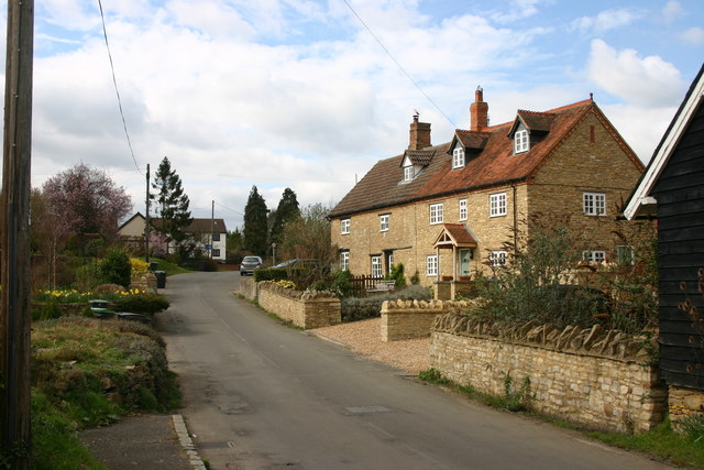
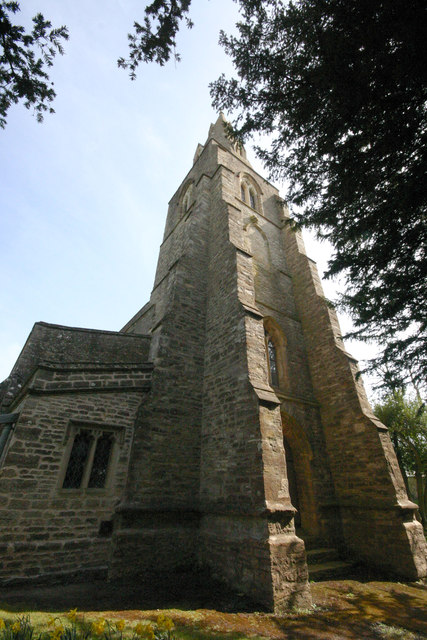
Images are sourced within 2km of 52.196849/-0.56479669 or Grid Reference SP9856. Thanks to Geograph Open Source API. All images are credited.

Carlton and Harrold from the air Carlton is the village to the left of centre, Harold is at the top, between the lakes.
Carlton and Harrold from the air
Carlton is the village to the left of centre, Harold is at the top, between the lakes.
Felmersham Causeway This ford is created when the Ouse is in flood.
Felmersham Causeway
This ford is created when the Ouse is in flood.
Felmersham bridge The bridge is early C19. The water level here is quite high. See <span class="nowrap"><a title="http://www.carltonwithchellington.co.uk/village_history.htm" rel="nofollow ugc noopener" href="http://www.carltonwithchellington.co.uk/village_history.htm">Link</a><img style="margin-left:2px;" alt="External link" title="External link - shift click to open in new window" src="https://s1.geograph.org.uk/img/external.png" width="10" height="10"/></span> for a much lower level of water.
Felmersham bridge
The bridge is early C19. The water level here is quite high. See LinkExternal link for a much lower level of water.
St Mary's church, Felmersham The church was originally built in C13. There were some alterations in C15 and restoration was carried out in C19.
St Mary's church, Felmersham
The church was originally built in C13. There were some alterations in C15 and restoration was carried out in C19.
Looking east up the River Great Ouse from the Felmersham Bridge
Felmersham bridge & River Ouse
St Mary, Felmersham - south-east elevation The church dates from c1220-1240. It is an elegant building and in places has the proportions if not the size of a cathedral. How such a church came to be built in this remote part of north Bedfordshire needs explanation.
St Mary, Felmersham - south-east elevation
The church dates from c1220-1240. It is an elegant building and in places has the proportions if not the size of a cathedral. How such a church came to be built in this remote part of north Bedfordshire needs explanation.
St Mary, Felmersham - north elevation
St Mary, Felmersham - west front Pevsner says of St Mary that it "was built at one go between about 1220 and 1230 or 1240, and it has a classicity and harmony - which rare indeed for the English C13 - includes even the W front". (And the rest of the church is pretty impressive too.)
St Mary, Felmersham - west front
Pevsner says of St Mary that it "was built at one go between about 1220 and 1230 or 1240, and it has a classicity and harmony - which rare indeed for the English C13 - includes even the W front". (And the rest of the church is pretty impressive too.)
St Mary, Felmersham - west crossing arch Four massive but delicate arches like this support the central tower of the church.
St Mary, Felmersham - west crossing arch
Four massive but delicate arches like this support the central tower of the church.
Grange Road, Felmersham
The High Road, Felmersham Taken at the junction with Grange Road.
The High Road, Felmersham
Taken at the junction with Grange Road.
'The Sun', Felmersham 'The Sun' (right) reopened as a free house in August 2013 according to its website. Taken in Grange Road facing the junction with Pavenham Road (left).
'The Sun', Felmersham
'The Sun' (right) reopened as a free house in August 2013 according to its website. Taken in Grange Road facing the junction with Pavenham Road (left).
River Great Ouse between Stevington - Pavenham
River Great Ouse near Pavenham As seen from the John Bunyan Trail footpath.
River Great Ouse near Pavenham
As seen from the John Bunyan Trail footpath.
High Street, Pavenham Most of the village is spread along High Street and looks like this.
High Street, Pavenham
Most of the village is spread along High Street and looks like this.
St Peter, Pavenham - south-east elevation
St Peter, Pavenham - tower & spire
Show me another place!

Green's Spinney is located at Grid Ref: SP9856 (Lat: 52.196849, Lng: -0.56479669)

Unitary Authority: Bedford

Police Authority: Bedfordshire

What 3 Words

///hostels.plod.arose. Near Odell, Bedfordshire

Nearby Locations

Green's Spinney

Related Wikis

Church of St Peter, Pavenham

Church of St Peter is a Grade I listed church in Pavenham, Bedfordshire, England. It became a listed building on 13 July 1964.The church has some good...

Pavenham Manor

Pavenham Manor was a country house in Pavenham, Bedfordshire, England. The house was demolished in 1960. == References ==

Pavenham

Pavenham is a small village and civil parish on the River Great Ouse in the Borough of Bedford in Bedfordshire, England, about 6 miles (10 km) north-west...

Pavenham Osier Beds

Pavenham Osier Beds is a 1.3 hectare nature reserve south of Pavenham, on the banks of the River Great Ouse, in Bedfordshire. It is managed by the Wildlife...

Nearby Amenities

Located within 500m of 52.196849,-0.56479669
The data included in this document is from www.openstreetmap.org. The data is made available under ODbL.

Have you been to Green's Spinney?

Leave your review of Green's Spinney below (or comments, questions and feedback).