King's Copse

Wood, Forest in Surrey Runnymede

England

King's Copse

Totem Pole, Windsor Great Park The 100-foot pole bears traditional First Nations carvings and was a gift from the Canadian province of British Columbia to the Queen in 1958.
Totem Pole, Windsor Great Park Credit: Mark Percy

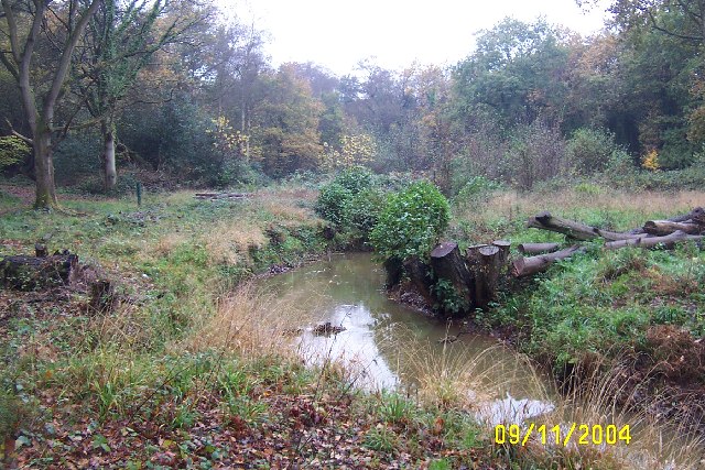
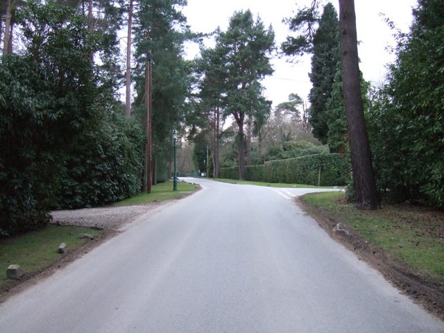
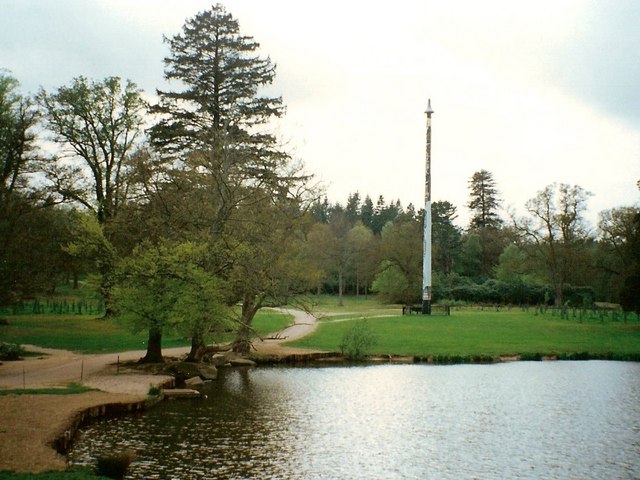
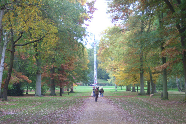
King's Copse is a picturesque woodland located in Surrey, England. Covering an area of approximately 100 acres, it is nestled in the heart of the county and is a popular destination for nature enthusiasts and outdoor adventurers. The copse is situated near the town of Haslemere, offering easy access to visitors from the surrounding areas.

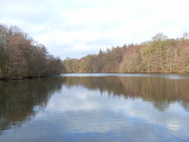
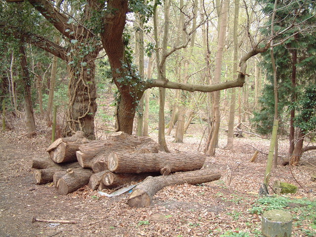
The woodland is characterized by a diverse range of tree species, including oak, beech, and birch, which create a vibrant and serene environment. The dense canopy provides ample shade and adds to the overall tranquility of the copse. The forest floor is adorned with a rich carpet of bluebells during the spring season, creating a visually stunning display.

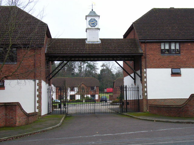
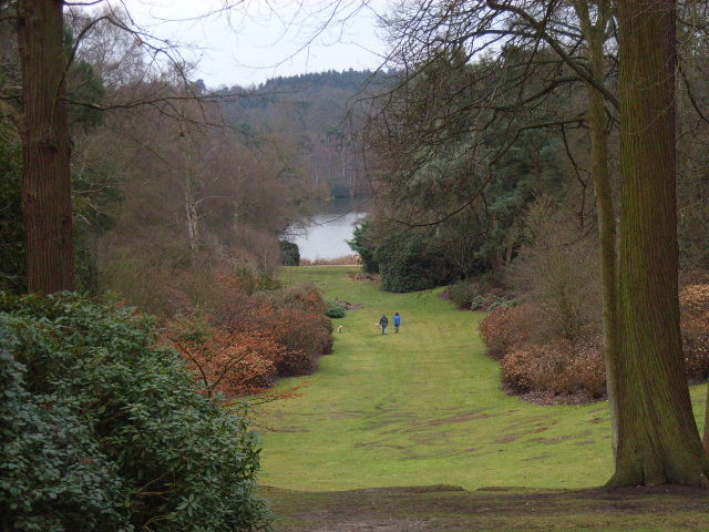
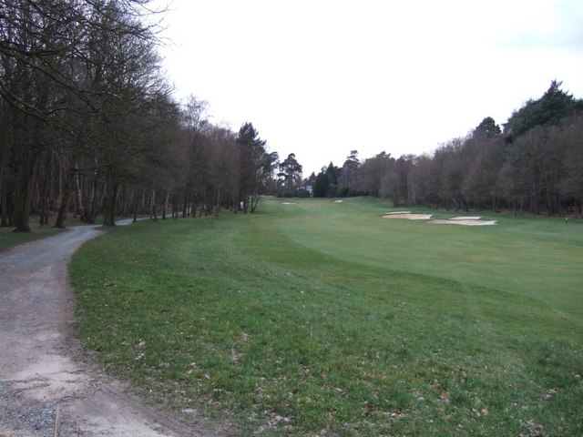
King's Copse offers a variety of walking trails that wind through its enchanting landscape, providing visitors with the opportunity to explore and immerse themselves in nature. The trails are well-maintained and suitable for all levels of fitness, making it an ideal destination for families and individuals alike.

The copse is also home to a diverse range of wildlife, including deer, foxes, and a variety of bird species. Nature enthusiasts can spot and observe these creatures in their natural habitat, adding to the overall charm of the woodland.

King's Copse is a haven for those seeking solace and tranquility away from the bustling city life. Its natural beauty and peaceful atmosphere make it a popular destination for walkers, nature lovers, and photographers, who are captivated by its timeless charm.

If you have any feedback on the listing, please let us know in the comments section below.
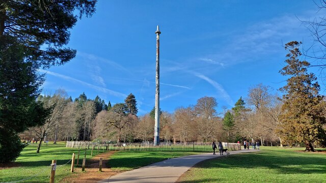
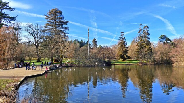
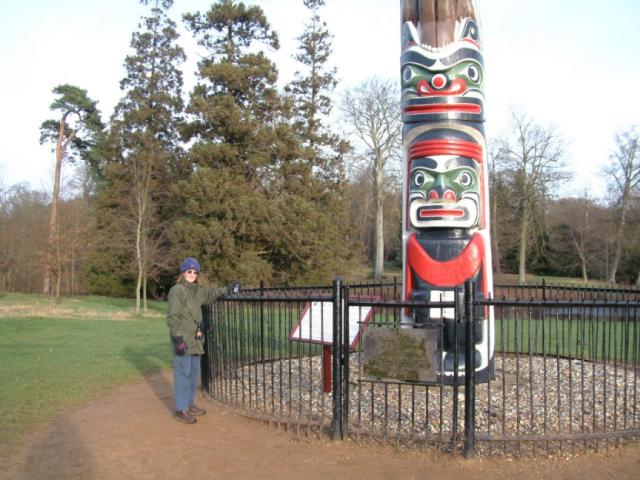
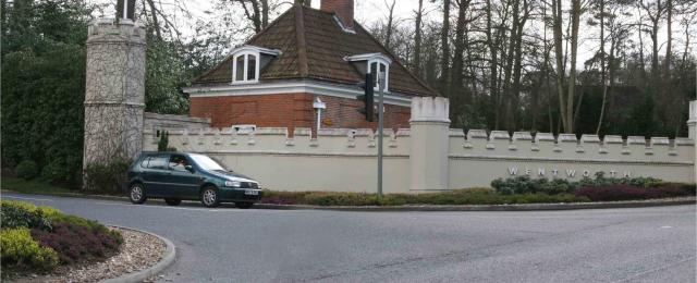
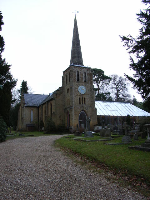
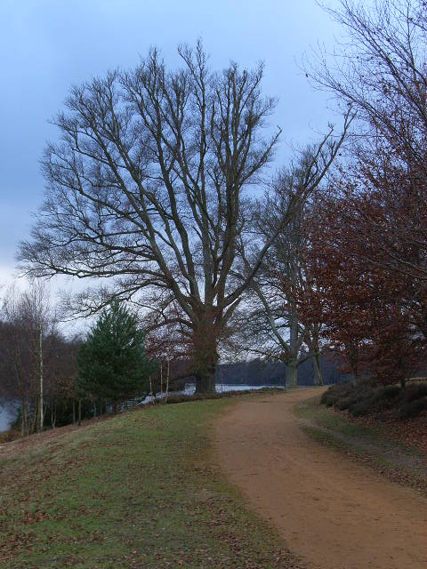
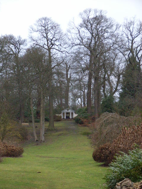
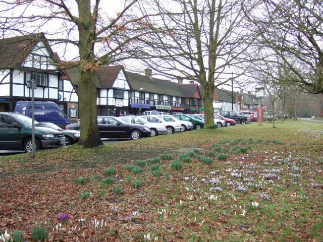
King's Copse Images

Images are sourced within 2km of 51.406739/-0.59347759 or Grid Reference SU9768. Thanks to Geograph Open Source API. All images are credited.

Totem Pole, Windsor Great Park The 100-foot pole bears traditional First Nations carvings and was a gift from the Canadian province of British Columbia to the Queen in 1958.
Totem Pole, Windsor Great Park
The 100-foot pole bears traditional First Nations carvings and was a gift from the Canadian province of British Columbia to the Queen in 1958.
Wick Pond, Windsor Great Park Looking across Wick Pond to the totem pole.
Wick Pond, Windsor Great Park
Looking across Wick Pond to the totem pole.
Virginia Water This Totem Pole is located on the extreme western edge of the square in Virginia Water.
Virginia Water
This Totem Pole is located on the extreme western edge of the square in Virginia Water.
Wentworth The entrance to the world famous championship golf course.
Wentworth
The entrance to the world famous championship golf course.
The Bourne, Virginia Water Recent clearance of trees has opened up this scene of The Bourne in the woodland between Virginia Water and Trumps Green. This view is taken looking westwards and upstream.
The Bourne, Virginia Water
Recent clearance of trees has opened up this scene of The Bourne in the woodland between Virginia Water and Trumps Green. This view is taken looking westwards and upstream.
The Polo Centre On the A329 near Blacknest
The Polo Centre
On the A329 near Blacknest
Johnson's Pond, Windsor Great Park A small waterfall connects this to Virginia Water.
Johnson's Pond, Windsor Great Park
A small waterfall connects this to Virginia Water.
The Valley Gardens, Windsor Great Park The view from a gazebo in the gardens down to Virginia Water.
The Valley Gardens, Windsor Great Park
The view from a gazebo in the gardens down to Virginia Water.
Christ Church, Virginia Water
The banks of Virginia Water in Valley Gardens
Gazebo in Valley Gardens
Station Approach Local shops near Virginia Water station.
Station Approach
Local shops near Virginia Water station.
Wentworth Estate
Wentworth Estate
Wentworth Golf Course
Callow Hill Wood As seen from the track that leads east from the Rose and Olive Branch public house.
Callow Hill Wood
As seen from the track that leads east from the Rose and Olive Branch public house.
Totem pole at Virginia Water The totem pole is situated at the northern end of Virginia Water lake in Windsor Great Park
Totem pole at Virginia Water
The totem pole is situated at the northern end of Virginia Water lake in Windsor Great Park
Totem pole, Virginia Water, Surrey Autumn in the park
Totem pole, Virginia Water, Surrey
Autumn in the park
Show me another place!

King's Copse is located at Grid Ref: SU9768 (Lat: 51.406739, Lng: -0.59347759)

Administrative County: Surrey

District: Runnymede

Police Authority: Surrey

What 3 Words

///family.aura.couches. Near Virginia Water, Surrey

Nearby Locations

King's Copse Virginia Wood

Related Wikis

Virginia Water

Virginia Water is a commuter village in the Borough of Runnymede in northern Surrey, England. It is home to the Wentworth Estate and the Wentworth Club...

1995 Volvo PGA Championship

The 1995 Volvo PGA Championship was the 41st edition of the Volvo PGA Championship, an annual professional golf tournament on the European Tour. It was...

2009 BMW PGA Championship

The 2009 BMW PGA Championship was the 55th edition of the BMW PGA Championship, an annual professional golf tournament on the European Tour. It was held...

2008 BMW PGA Championship

The 2008 BMW PGA Championship was the 54th edition of the BMW PGA Championship, an annual professional golf tournament on the European Tour. It was held...

1990 Volvo PGA Championship

The 1990 Volvo PGA Championship was the 36th edition of the Volvo PGA Championship, an annual professional golf tournament on the European Tour. It was...

2014 BMW PGA Championship

The 2014 BMW PGA Championship was the 60th edition of the BMW PGA Championship, an annual golf tournament on the European Tour, held 22–25 May at the West...

2002 Volvo PGA Championship

The 2002 Volvo PGA Championship was the 48th edition of the Volvo PGA Championship, an annual professional golf tournament on the European Tour. It was...

2007 BMW PGA Championship

The 2007 BMW PGA Championship was the 53rd edition of the BMW PGA Championship, an annual professional golf tournament on the European Tour. It was held...

Nearby Amenities

Located within 500m of 51.406739,-0.59347759
Cascade
Source: OS_OpenData_StreetView
Waterway: weir
Lat/Long: 51.4075907/-0.5967354
Restaurant
Piccolino
Addr City: Virginia Water
Addr Postcode: GU25 4QE
Addr Street: London Road
Cuisine: italian
Fhrs Id: 315502
Source: Bing 2012
Source Addr Postcode: code-point_open
Lat/Long: 51.4086937/-0.5922533
Fuel
Shell
Addr City: Virginia Water
Addr Postcode: GU25 4QE
Addr Street: London Road
Brand: Shell
Brand Wikidata: Q110716465
Opening Hours: 24/7
Phone: +44 1344 843436
Ref Navads: NVDS353_12038635
Source Addr Postcode: code-point_open
Website: https://find.shell.com/gb/fuel/12038635-shell-little-waitrose-wheatsheaf
Lat/Long: 51.4093558/-0.5912627
Crossing
Bicycle: yes
Crossing Island: yes
Kerb: lowered
Sloped Curb: yes
Lat/Long: 51.4100749/-0.5907031
Bus Stop
Wheatsheaf
Naptan AtcoCode: 40004401208A
Naptan Bearing: NE
Naptan CommonName: Wheatsheaf
Naptan Indicator: Just after
Naptan Landmark: Wheatsheaf
Naptan NaptanCode: suratwap
Naptan Street: London Road
Naptan Verified: no
Public Transport: platform
Source: naptan_import
Lat/Long: 51.4100209/-0.5909247
Bus Stop
Wheatsheaf
Naptan AtcoCode: 40004401208B
Naptan Bearing: SW
Naptan CommonName: Wheatsheaf
Naptan Indicator: Opp
Naptan Landmark: Wheatsheaf
Naptan NaptanCode: suratwaw
Naptan Street: London Road
Naptan Verified: no
Public Transport: platform
Source: naptan_import
Lat/Long: 51.408415/-0.5931824
Toilets
Lat/Long: 51.4097378/-0.5924693
Cascade
Board Type: board
Information: board
Toilets Wheelchair: no
Tourism: viewpoint
Wheelchair: limited
Wheelchair Description: Steep approach DOWN from car park. Level viewing point opposite waterfall. Steep asphalt path UP to return to car parks and lakeside.
Lat/Long: 51.4072618/-0.5956306
Bench
Lat/Long: 51.4072724/-0.5955597
Lathwaites Wine
Addr City: Virginia Water
Addr Postcode: GU25 4QE
Addr Street: London Road
Fhrs Id: 1534604
Shop: alcohol
Source: local knowledge
Source Addr Postcode: code-point_open
Lat/Long: 51.4087787/-0.5920558
Crossing
Bicycle: yes
Crossing: unmarked
Kerb: lowered
Sloped Curb: yes
Lat/Long: 51.4102945/-0.5919574
Barrier: lift_gate
Lat/Long: 51.4099499/-0.5923767
Traffic Signals
Traffic Signals Direction: forward
Lat/Long: 51.4092824/-0.5922003
Barrier: lift_gate
Lat/Long: 51.4098963/-0.5923171
Vending Machine
Vending: parking_tickets
Lat/Long: 51.4102857/-0.5920835
Vending Machine
Vending: parking_tickets
Lat/Long: 51.4103853/-0.5919324
Waste Basket
Lat/Long: 51.4103828/-0.5919202
Waste Basket
Lat/Long: 51.4102891/-0.5920905
Virginia Lodge
Place: isolated_dwelling
Lat/Long: 51.407113/-0.597843
Wentworth Farm
Historic Place: farm
Lat/Long: 51.4033237/-0.5936086
Crossing
Crossing: uncontrolled
Kerb: lowered
Sloped Curb: yes
Lat/Long: 51.4090336/-0.5920779
Crossing
Bicycle: yes
Crossing: uncontrolled
Kerb: lowered
Sloped Curb: yes
Lat/Long: 51.4092696/-0.5921775
Crossing
Crossing: uncontrolled
Kerb: lowered
Sloped Curb: yes
Lat/Long: 51.4089684/-0.5921359
Crossing
Bicycle: yes
Crossing: unmarked
Kerb: lowered
Sloped Curb: yes
Lat/Long: 51.4099134/-0.5912095
Crossing
Crossing: uncontrolled
Kerb: lowered
Sloped Curb: yes
Lat/Long: 51.4090787/-0.5919881
Crossing
Bicycle: yes
Crossing: unmarked
Kerb: lowered
Sloped Curb: yes
Lat/Long: 51.4095823/-0.5912764
Crossing
Bicycle: yes
Crossing: unmarked
Kerb: lowered
Sloped Curb: yes
Lat/Long: 51.4093898/-0.5915756
Crossing
Bicycle: yes
Crossing: unmarked
Kerb: lowered
Sloped Curb: yes
Lat/Long: 51.4101084/-0.5916039
Crossing
Bicycle: yes
Crossing: unmarked
Kerb: lowered
Sloped Curb: yes
Lat/Long: 51.4102036/-0.591788
Traffic Signals
Traffic Signals Direction: forward
Lat/Long: 51.4090161/-0.5920248
Traffic Signals
Traffic Signals Direction: forward
Lat/Long: 51.4089675/-0.5920465
Barrier: bollard
Lat/Long: 51.408869/-0.5927862
Traffic Signals
Traffic Signals Direction: forward
Lat/Long: 51.4063377/-0.5962255
Crossing
Bicycle: yes
Crossing Island: yes
Kerb: lowered
Sloped Curb: yes
Lat/Long: 51.4056069/-0.5977551
Crossing
Bicycle: yes
Crossing Island: yes
Kerb: lowered
Sloped Curb: yes
Lat/Long: 51.4055639/-0.5976914
Crossing
Crossing: uncontrolled
Kerb: lowered
Sloped Curb: yes
Lat/Long: 51.4087499/-0.5926399
Crossing
Bicycle: yes
Crossing Island: yes
Kerb: lowered
Sloped Curb: yes
Lat/Long: 51.4065328/-0.5965244
Crossing
Bicycle: yes
Crossing Island: yes
Kerb: lowered
Sloped Curb: yes
Lat/Long: 51.4064783/-0.5965989
Traffic Signals
Traffic Signals Direction: forward
Lat/Long: 51.40635/-0.5966125
Traffic Signals
Traffic Signals Direction: forward
Lat/Long: 51.406482/-0.5962225
Traffic Signals
Traffic Signals Direction: forward
Lat/Long: 51.4065395/-0.5965558
Barrier: lift_gate
Lat/Long: 51.4102662/-0.59097
Traffic Signals
Source: Bing
Traffic Signals Direction: forward
Lat/Long: 51.4090783/-0.5923543
Crossing
Crossing Island: yes
Kerb: lowered
Sloped Curb: yes
Lat/Long: 51.409106/-0.5923104
Crossing
Crossing Island: yes
Kerb: lowered
Sloped Curb: yes
Lat/Long: 51.4090469/-0.5922027
Traffic Signals
Source: Bing
Traffic Signals Direction: forward
Lat/Long: 51.4092766/-0.5918526
Information: board
Source: GPS survey
Tourism: information
Lat/Long: 51.4092918/-0.5987871
Information: board
Source: GPS survey
Tourism: information
Lat/Long: 51.408498/-0.600092
Toilets
Lat/Long: 51.4101518/-0.5924852
Cafe
Operator: Casa Caffé
Lat/Long: 51.4103567/-0.5924825
Access: yes
Drinking Water: yes
Man Made: water_tap
Lat/Long: 51.410223/-0.592316
Direction: 195
Generator Method: photovoltaic
Generator Output Electricity: yes
Generator Solar Modules: 10
Generator Source: solar
Generator Type: solar_photovoltaic_panel
Location: roof
Power: generator
Lat/Long: 51.4084803/-0.5896795
Direction: 200
Generator Method: photovoltaic
Generator Output Electricity: yes
Generator Solar Modules: 19
Generator Source: solar
Generator Type: solar_photovoltaic_panel
Location: roof
Power: generator
Lat/Long: 51.4069736/-0.5866953
Barrier: lift_gate
Lat/Long: 51.4102982/-0.5910556
The Cascade
Waterway: waterfall
Lat/Long: 51.407346/-0.5957026
Bicycle Parking
Bicycle Parking: stands
Capacity: 12
Covered: no
Lat/Long: 51.4104863/-0.5925731
The data included in this document is from www.openstreetmap.org. The data is made available under ODbL.

Have you been to King's Copse?

Leave your review of King's Copse below (or comments, questions and feedback).