Blackgrove Wood

Wood, Forest in Bedfordshire

England

Blackgrove Wood

Dunstable: Dismantled railway and National Cycle Network Route 6 Viewed looking east through the cutting for the trackbed of the long dismantled railway line between Luton and Leighton Buzzard, this is the section of former railway between Dunstable High Street and Stanbridgeford stations, now utilized as National Cycle Network Route 6 which itself runs from London to the Lake District.
Dunstable: Dismantled railway and National Cycle Network Route 6 Credit: Nigel Cox

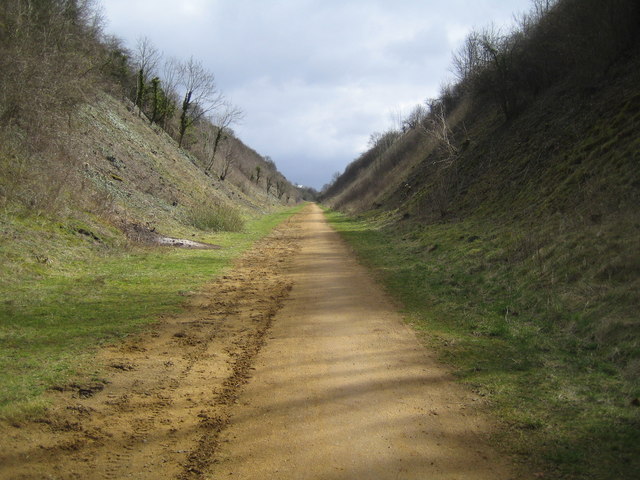
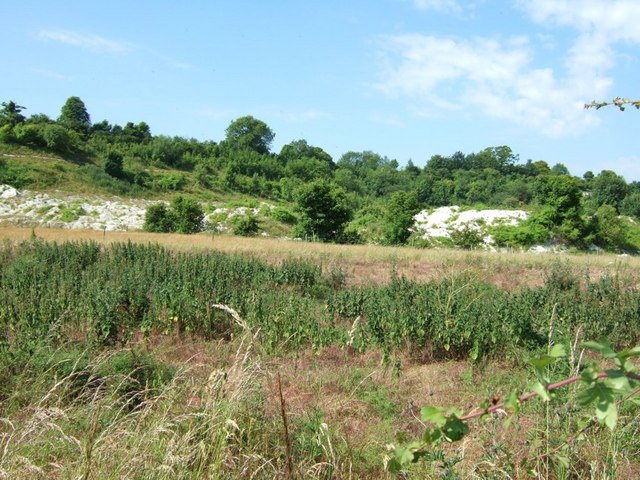
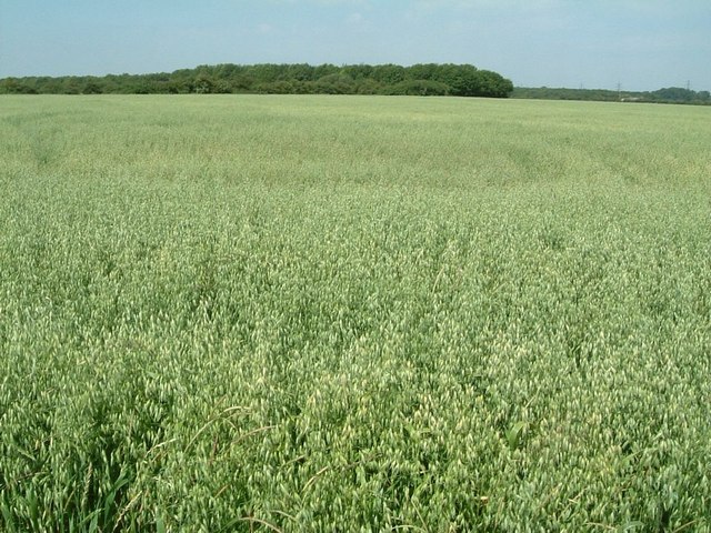
Blackgrove Wood is a picturesque forest located in the county of Bedfordshire, England. Covering an area of approximately 200 acres, it is a popular destination for nature lovers and outdoor enthusiasts alike.

The wood is characterized by its dense and diverse vegetation, comprising a mixture of deciduous and coniferous trees. These include oak, beech, pine, and spruce, among others. The forest floor is carpeted with a rich variety of wildflowers, creating a vibrant and colorful tapestry during the spring and summer months.

Blackgrove Wood is home to a wide range of wildlife, making it an ideal spot for birdwatching and animal spotting. Visitors may have the chance to observe species such as woodpeckers, kingfishers, badgers, and deer. The forest also provides habitat for numerous insects, including butterflies and dragonflies.

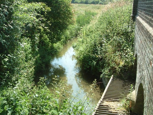
The wood offers an extensive network of walking trails, allowing visitors to explore its natural beauty at their own pace. These trails vary in length and difficulty, catering to both casual strollers and more experienced hikers. Along the way, visitors can enjoy breathtaking views of the surrounding countryside and may stumble upon hidden gems, such as tranquil ponds or ancient ruins.

Blackgrove Wood is managed by the local Bedfordshire Wildlife Trust, which ensures the conservation and preservation of its natural resources. The trust organizes various educational activities and events throughout the year, providing opportunities for visitors to learn about the forest's ecology and contribute to its protection.

Overall, Blackgrove Wood offers a serene and enchanting escape into nature, where visitors can immerse themselves in the beauty of the forest and its inhabitants.

If you have any feedback on the listing, please let us know in the comments section below.

Blackgrove Wood Images

Images are sourced within 2km of 51.901864/-0.57827156 or Grid Reference SP9723. Thanks to Geograph Open Source API. All images are credited.

Dunstable: Dismantled railway and National Cycle Network Route 6 Viewed looking east through the cutting for the trackbed of the long dismantled railway line between Luton and Leighton Buzzard, this is the section of former railway between Dunstable High Street and Stanbridgeford stations, now utilized as National Cycle Network Route 6 which itself runs from London to the Lake District.
Dunstable: Dismantled railway and National Cycle Network Route 6
Viewed looking east through the cutting for the trackbed of the long dismantled railway line between Luton and Leighton Buzzard, this is the section of former railway between Dunstable High Street and Stanbridgeford stations, now utilized as National Cycle Network Route 6 which itself runs from London to the Lake District.
St. John the Baptist, Stanbridge The parish church in Stanbridge stands just off the <a href="https://www.geograph.org.uk/photo/183131">SP9624 : The Green, Stanbridge</a>, near to the main intersection of roads in the village.
St. John the Baptist, Stanbridge
The parish church in Stanbridge stands just off the SP9624 : The Green, Stanbridge, near to the main intersection of roads in the village.
A new top ! I just happened to be passing at this rather historic moment as the old windmill at Stanbridge had a new top lowered on to it ! It's excellent to see old buildings such as this being refurbished - and I'm particularly sentimental about windmills since discovering that my great-grandfather was a journeyman millwright !
Google street view as it is now <span class="nowrap"><a title="http://maps.google.co.uk/maps?q=http:%2F%2Fwww.geograph.org.uk%2Fphoto%2F182704.kml&ll=51.910995,-0.601569&spn=0.000003,0.003473&t=m&z=19&layer=c&cbll=51.911096,-0.601662&panoid=-WvrUOU5O_f75Jt5F9_zKw&cbp=12,238.95,,0,7.64" rel="nofollow ugc noopener" href="http://maps.google.co.uk/maps?q=http:%2F%2Fwww.geograph.org.uk%2Fphoto%2F182704.kml&ll=51.910995,-0.601569&spn=0.000003,0.003473&t=m&z=19&layer=c&cbll=51.911096,-0.601662&panoid=-WvrUOU5O_f75Jt5F9_zKw&cbp=12,238.95,,0,7.64">Link</a><img style="margin-left:2px;" alt="External link" title="External link - shift click to open in new window" src="https://s1.geograph.org.uk/img/external.png" width="10" height="10"/></span>
A new top !
I just happened to be passing at this rather historic moment as the old windmill at Stanbridge had a new top lowered on to it ! It's excellent to see old buildings such as this being refurbished - and I'm particularly sentimental about windmills since discovering that my great-grandfather was a journeyman millwright ! Google street view as it is now LinkExternal link
The Green, Stanbridge Taken from near the church this is the view across the Village Green in Stanbridge.
The Green, Stanbridge
Taken from near the church this is the view across the Village Green in Stanbridge.
Totternhoe Knolls There is an NT car park for Totternhoe Knolls and a circular walk. The walk is along well defined if rather rutty tracks. This is a view from the track that runs from SP985218 to SP980225 - at about the halfway point.
The OS maps are not terribly helpful in this area, simply showing "Lime Pit" where this chalk bank exists. After checking with aerial photos and other map books I am pretty confident that I have identified the location correctly - but if anyone knows better, please let me know.
See also <a href="https://www.geograph.org.uk/photo/193753">SP9822 : Chalk Bank, Totternhoe Knolls</a>
Totternhoe Knolls
There is an NT car park for Totternhoe Knolls and a circular walk. The walk is along well defined if rather rutty tracks. This is a view from the track that runs from SP985218 to SP980225 - at about the halfway point. The OS maps are not terribly helpful in this area, simply showing "Lime Pit" where this chalk bank exists. After checking with aerial photos and other map books I am pretty confident that I have identified the location correctly - but if anyone knows better, please let me know. See also SP9822 : Chalk Bank, Totternhoe Knolls
The Cross Keys, Totternhoe A thatched country pub at the western end of this straggling village.
The Cross Keys, Totternhoe
A thatched country pub at the western end of this straggling village.
Eaton Bray Road, Lower End, Totternhoe Looking back towards Lower End from the Eaton Bray Road. The house seen on the left is the only building on this lane between Honeywick and Lower End.
Eaton Bray Road, Lower End, Totternhoe
Looking back towards Lower End from the Eaton Bray Road. The house seen on the left is the only building on this lane between Honeywick and Lower End.
Oats ! A wide open field of oats covering almost the entire eastern half of this square.
Oats !
A wide open field of oats covering almost the entire eastern half of this square.
Ouzel Brook, Stanbridgeford The Ouzel Brook seen here joins the River Ouzel (which is not much bigger) near The Rye. This photo just sneaks into this square - the bridge being bisected by the gridline.
Ouzel Brook, Stanbridgeford
The Ouzel Brook seen here joins the River Ouzel (which is not much bigger) near The Rye. This photo just sneaks into this square - the bridge being bisected by the gridline.
Bluegate Farm Hidden behind the tree is the Farmhouse to Bluegate Farm. There is a (blue) sign which as well as announcing the farm also mentions "Bluegate Farm Cottages" - which I should imagine are barn conversions.
Bluegate Farm
Hidden behind the tree is the Farmhouse to Bluegate Farm. There is a (blue) sign which as well as announcing the farm also mentions "Bluegate Farm Cottages" - which I should imagine are barn conversions.
All Saints, Tilsworth Unusually this church does not have a convenient car park - or at least I could not find one. It is situated next to a rest home. More information about Tilsworth and its church here <span class="nowrap"><a title="http://www.british-history.ac.uk/report.asp?compid=42460" rel="nofollow ugc noopener" href="http://www.british-history.ac.uk/report.asp?compid=42460">Link</a><img style="margin-left:2px;" alt="External link" title="External link - shift click to open in new window" src="https://s1.geograph.org.uk/img/external.png" width="10" height="10"/></span>
All Saints, Tilsworth
Unusually this church does not have a convenient car park - or at least I could not find one. It is situated next to a rest home. More information about Tilsworth and its church here LinkExternal link
Tilsworth Golf Course I think the ladies pictured are practising their pitching by the looks of it.
Tilsworth Golf Course
I think the ladies pictured are practising their pitching by the looks of it.
Chalk Bank, Totternhoe Knolls As with <a href="https://www.geograph.org.uk/photo/193399">SP9822 : Totternhoe Knolls</a> it is difficult to precisely pin down the location of this massive chalk bank from the map as it is not really shown. The more distant greenery is probably on Castle Hill (SP 979 221)
Chalk Bank, Totternhoe Knolls
As with SP9822 : Totternhoe Knolls it is difficult to precisely pin down the location of this massive chalk bank from the map as it is not really shown. The more distant greenery is probably on Castle Hill (SP 979 221)
Byway Totternhoe Knolls This straight byway runs from near the NT carpark at Totternhoe Knolls out to the lime works. It now forms part of a circular walk. The photographs <a href="https://www.geograph.org.uk/photo/193753">SP9822 : Chalk Bank, Totternhoe Knolls</a> and <a href="https://www.geograph.org.uk/photo/193399">SP9822 : Totternhoe Knolls</a> were taken from this pathway.
Byway Totternhoe Knolls
This straight byway runs from near the NT carpark at Totternhoe Knolls out to the lime works. It now forms part of a circular walk. The photographs SP9822 : Chalk Bank, Totternhoe Knolls and SP9822 : Totternhoe Knolls were taken from this pathway.
Pub Garden, Cross Keys The pub garden at the Cross Keys in Totternhoe also commands good views across open countryside towards Eaton Bray.
Pub Garden, Cross Keys
The pub garden at the Cross Keys in Totternhoe also commands good views across open countryside towards Eaton Bray.
Public Transport in Rural Bedfordshire A double decker bus waits on Eaton Bray Road near Totternhoe Lower End. I've categorized this as a Bus Stop on the basis that it's a stopped bus !
Public Transport in Rural Bedfordshire
A double decker bus waits on Eaton Bray Road near Totternhoe Lower End. I've categorized this as a Bus Stop on the basis that it's a stopped bus !
Tilsworth : All Saints Tower The tower of this little church in Tilsworth exhibits the brown stone (ironstone I think) that is so characteristic of churches from this point in the county northwards - especially around the Ampthill area.
Tilsworth : All Saints Tower
The tower of this little church in Tilsworth exhibits the brown stone (ironstone I think) that is so characteristic of churches from this point in the county northwards - especially around the Ampthill area.
Tilsworth Golf Centre : The Clubhouse Tilsworth Golf Centre has an 18-hole golf course and a driving range open to non-members. See <span class="nowrap"><a title="http://www.tilsworthgolf.co.uk/" rel="nofollow ugc noopener" href="http://www.tilsworthgolf.co.uk/">Link</a><img style="margin-left:2px;" alt="External link" title="External link - shift click to open in new window" src="https://s1.geograph.org.uk/img/external.png" width="10" height="10"/></span> for more details.
Tilsworth Golf Centre : The Clubhouse
Tilsworth Golf Centre has an 18-hole golf course and a driving range open to non-members. See LinkExternal link for more details.
Show me another place!

Blackgrove Wood is located at Grid Ref: SP9723 (Lat: 51.901864, Lng: -0.57827156)

Unitary Authority: Central Bedfordshire

Police Authority: Bedfordshire

What 3 Words

///sentences.steer.corn. Near Stanbridge, Bedfordshire

Related Wikis

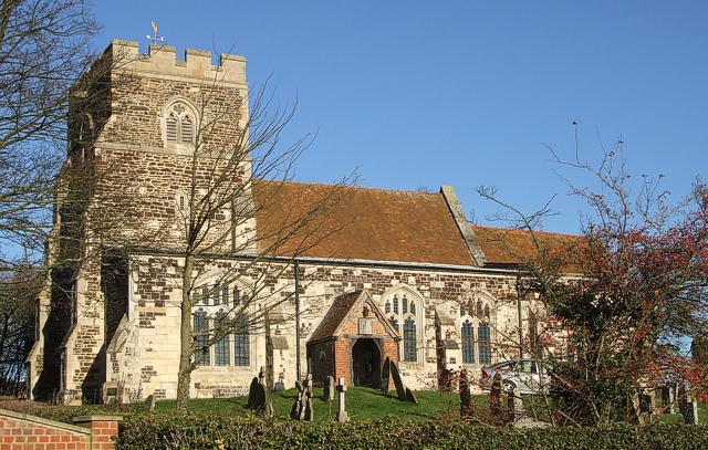
Church of All Saints, Tilsworth

Church of All Saints is a Grade I listed church in Tilsworth, Bedfordshire, England. It became a listed building on 3 February 1967. == See also == Grade...

Tilsworth Castle

Tilsworth Castle refers to both "Warren Knoll Motte" and "Tilsworth Manor", both built in the same general area, located in the civil parish of Tilsworth...

Tilsworth

Tilsworth is a small village and civil parish in Bedfordshire. It lies to the north west of Dunstable, and the Roman Watling Street (A5) forms the north...

Stanbridgeford railway station

Stanbridgeford railway station on the London and North Western Railway's branch line to Dunstable served the Bedfordshire villages of Stanbridge, Totternhoe...

Totternhoe Stone Pit

Totternhoe Stone Pit is a geological Site of Special Scientific Interest in Totternhoe in Bedfordshire, England. It is also a Geological Conservation Review...

Totternhoe Chalk Quarry

Totternhoe Chalk Quarry is a 13.4-hectare (33-acre) biological Site of Special Scientific Interest in Totternhoe in Bedfordshire. Part of it lies in Totternhoe...

Totternhoe nature reserve

Totternhoe nature reserve is managed by the Wildlife Trust for Bedfordshire, Cambridgeshire and Northamptonshire (WTBCN). The 31-hectare (77-acre) site...

Totternhoe Castle

Totternhoe Castle was a Norman castle in Totternhoe. Bedfordshire. Only earthworks survive. It is a Scheduled Monument, and part of Totternhoe Knolls Site...

Nearby Amenities

Located within 500m of 51.901864,-0.57827156
Power: tower
Lat/Long: 51.901245/-0.5843535
Power: tower
Lat/Long: 51.9010193/-0.5785906
Power: tower
Lat/Long: 51.9008762/-0.5742461
The data included in this document is from www.openstreetmap.org. The data is made available under ODbL.

Have you been to Blackgrove Wood?

Leave your review of Blackgrove Wood below (or comments, questions and feedback).