Exeter Gorse

Wood, Forest in Rutland

England

Exeter Gorse

Hedge enclosed minor road at Pickworth Triangulation Pillar Looking north-eastward.
Hedge enclosed minor road at Pickworth Triangulation Pillar Credit: Peter Wood

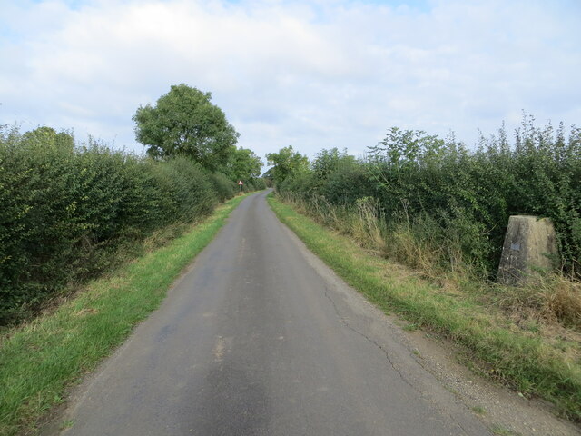
Exeter Gorse, located in Rutland, is a small wood or forest area known for its natural beauty and diverse ecosystem. Covering an area of approximately 200 acres, it is a popular destination for nature enthusiasts and those seeking tranquility away from the bustling city.

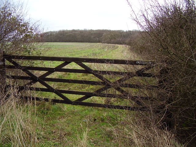
The woodland is characterized by its dense cover of gorse shrubs, from which it derives its name. Gorse is a spiky evergreen plant that blooms with vibrant yellow flowers during the spring and summer months, creating a picturesque landscape. In addition to gorse, the forest is also home to a variety of other plant species, including oak, birch, and hazel trees, which provide shelter and food for numerous animals.

The woodland is a haven for wildlife, with a rich biodiversity that attracts many species. It is particularly renowned for its birdlife, with a variety of nesting birds such as woodpeckers, nightjars, and warblers. Visitors may also spot mammals like deer, foxes, and rabbits, as well as reptiles and amphibians, including snakes and frogs.

Exeter Gorse offers a network of walking trails, allowing visitors to explore the area and immerse themselves in the tranquility of nature. The paths wind through the woodland, offering glimpses of stunning vistas and secluded spots. The forest is a popular destination for birdwatching, photography, and nature study, attracting both locals and tourists alike.

Overall, Exeter Gorse in Rutland is a beautiful woodland area, teeming with vibrant plant life and a diverse array of wildlife. It provides a peaceful retreat for nature lovers and offers a chance to connect with the natural world.

If you have any feedback on the listing, please let us know in the comments section below.

Exeter Gorse Images

Images are sourced within 2km of 52.697586/-0.55504388 or Grid Reference SK9712. Thanks to Geograph Open Source API. All images are credited.

Hedge enclosed minor road at Pickworth Triangulation Pillar Looking north-eastward.
Hedge enclosed minor road at Pickworth Triangulation Pillar
Looking north-eastward.
Hedge enclosed minor road crossing Pickworth Plain Looking south-westward.
Hedge enclosed minor road crossing Pickworth Plain
Looking south-westward.
Minor road at The Lodge Looking south-westward.
Minor road at The Lodge
Looking south-westward.
Losecoat Field Looking south-eastward. Here on 12th March 1470 The Battle of Empingham (War of the Roses) took place.
Losecoat Field
Looking south-eastward. Here on 12th March 1470 The Battle of Empingham (War of the Roses) took place.
Hedge enclosed minor road heading towards the A1 Looking south-westward.
Hedge enclosed minor road heading towards the A1
Looking south-westward.
Access Drive from Woolfox Golf and Country Club Looking south-westward towards the Great North Road.
Access Drive from Woolfox Golf and Country Club
Looking south-westward towards the Great North Road.
Ordnance Survey Flush Bracket 1227 This bracket can be found on the wall of a building at Hardwick Farm.
The recorded details give a height of 89.4023 metres above sea level.
For more details see : <span class="nowrap"><a title="https://www.bench-marks.org.uk/bm1975" rel="nofollow ugc noopener" href="https://www.bench-marks.org.uk/bm1975">Link</a><img style="margin-left:2px;" alt="External link" title="External link - shift click to open in new window" src="https://s1.geograph.org.uk/img/external.png" width="10" height="10"/></span>
Ordnance Survey Flush Bracket 1227
This bracket can be found on the wall of a building at Hardwick Farm. The recorded details give a height of 89.4023 metres above sea level. For more details see : LinkExternal link
Great North Road, Woolfox
Great North Road heading to Tickencote
Great North Road heading to Tickencote Joining the main A1
Great North Road heading to Tickencote
Joining the main A1
Track towards Middle Lodge Part of the Empingham Estate.
Track towards Middle Lodge
Part of the Empingham Estate.
A1 northbound, approaching the turn-off to Empingham A few miles away in Empingham village, a fingerpost points back to the Great North Road at the junction seen signed here: <a href="https://www.geograph.org.uk/photo/2903622">SK9408 : Fingerpost, crossroads, Empingham</a>.
A1 northbound, approaching the turn-off to Empingham
A few miles away in Empingham village, a fingerpost points back to the Great North Road at the junction seen signed here: SK9408 : Fingerpost, crossroads, Empingham.
A1 northbound, approaching the turn-off to Empingham The A1 is the longest numbered road in the UK at 410 miles long. It connects London with Edinburgh, via the east of England. 
For much of its path it follows the Great North Road the old coaching route between London and Edinburgh. Several sections of the route are classified as motorway A1(M). The modern A1 bypasses the towns the Great North Road passed through and is dual carriageway for most of its route through England.
A1 northbound, approaching the turn-off to Empingham
The A1 is the longest numbered road in the UK at 410 miles long. It connects London with Edinburgh, via the east of England. For much of its path it follows the Great North Road the old coaching route between London and Edinburgh. Several sections of the route are classified as motorway A1(M). The modern A1 bypasses the towns the Great North Road passed through and is dual carriageway for most of its route through England.
Lose Coat Field Site of a battle in 1471. North of Stamford just next to the A1
Lose Coat Field
Site of a battle in 1471. North of Stamford just next to the A1
Hardwick Farm This farm is on the edge of RAF Woolfox Lodge and is now a golf club
Hardwick Farm
This farm is on the edge of RAF Woolfox Lodge and is now a golf club
Field Boundary on Pickworth Plain
Top Pickworth open field
Show me another place!

Exeter Gorse is located at Grid Ref: SK9712 (Lat: 52.697586, Lng: -0.55504388)

Unitary Authority: Rutland

Police Authority: Leicestershire

What 3 Words

///drifters.womb.peach. Near Pickworth, Rutland

Related Wikis

Bloody Oaks Quarry

Bloody Oaks Quarry is a 1.3-hectare (3.2-acre) biological Site of Special Scientific Interest north-west of Great Casterton in Rutland. It is owned and...

Battle of Losecoat Field

The Battle of Losecoat Field (also known as the Battle of Empingham) was fought on 12 March 1470, during the Wars of the Roses. Spellings of "Losecoat...

RAF Woolfox Lodge

Royal Air Force Woolfox Lodge, or more simply RAF Woolfox Lodge, is a former Royal Air Force station next to the A1 road in Rutland, UK. The airfield is...

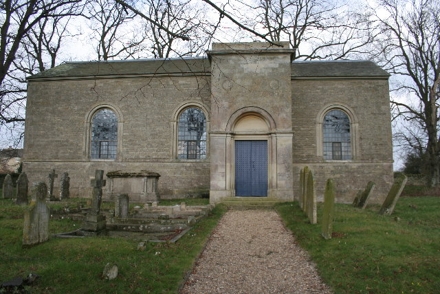
All Saints' Church, Pickworth

All Saints' Church is the Church of England parish church in Pickworth, Rutland. Built in 1821, it is a Grade II listed building. == History == The current...

Pickworth, Rutland

Pickworth is a civil parish and small village in the county of Rutland. The population of the civil parish at the 2001 census was 81. This remained less...

Horn, Rutland

Horn is a former civil parish, now in the parish of Exton and Horn, in the county of Rutland, England. In 2001 it had a population of 9, which was included...

East Wood, Great Casterton

East Wood is a 6.6-hectare (16-acre) biological Site of Special Scientific Interest north of Great Casterton in Rutland.This semi-natural wood is on boulder...

Tickencote

Tickencote is a small village and civil parish in the county of Rutland in the East Midlands of England. It is noted for St Peter's Church, with its Norman...

Nearby Amenities

Located within 500m of 52.697586,-0.55504388
Pickworth Plain
Place: locality
Source: Bing
Lat/Long: 52.7018368/-0.5541085
The data included in this document is from www.openstreetmap.org. The data is made available under ODbL.

Have you been to Exeter Gorse?

Leave your review of Exeter Gorse below (or comments, questions and feedback).