Littlewick Common

Wood, Forest in Surrey Woking

England

Littlewick Common

Track off Carthouse Lane A track leading south off Carthouse Lane.
Track off Carthouse Lane Credit: Oscar

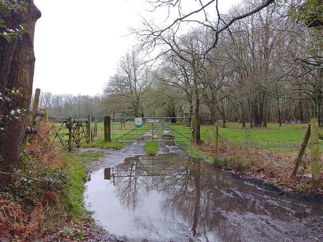
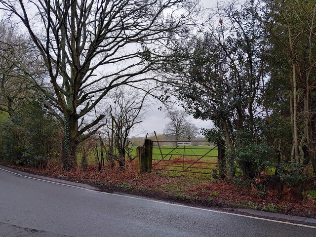
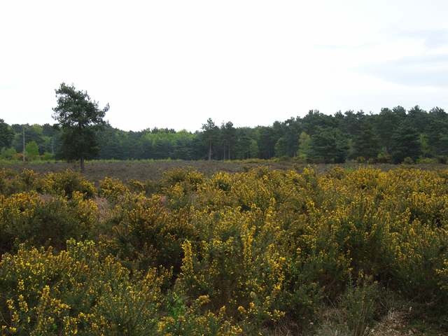
Littlewick Common is a picturesque woodland area located in Surrey, England. Situated near the village of Littlewick Green, it covers an area of approximately 32 hectares and is renowned for its natural beauty and diverse wildlife.

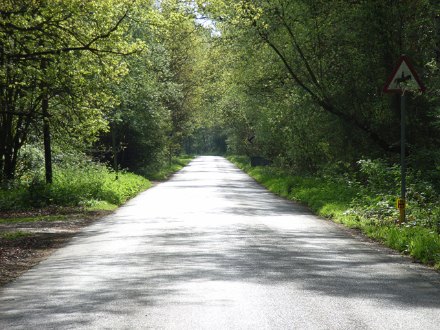
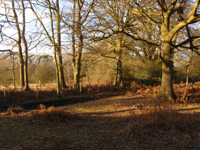
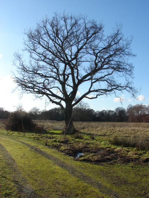
The common is predominantly composed of deciduous woodland, characterized by an abundance of oak, beech, and birch trees. These towering giants create a dense canopy, providing a shaded and tranquil environment for visitors to explore. The woodland floor is adorned with a rich carpet of bluebells during the spring months, creating a stunning visual spectacle.

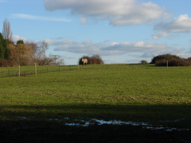
Littlewick Common is home to a wide range of wildlife species, making it a popular destination for nature enthusiasts. Birdwatchers can spot various species, including woodpeckers, owls, and thrushes, while the occasional sighting of a deer or fox adds to the charm of the area. The woodland also supports a diverse array of insects, with butterflies and dragonflies flitting between the trees and wildflowers.

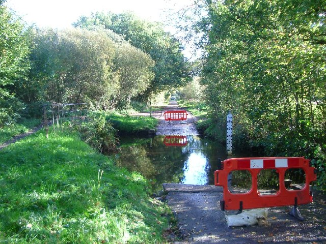
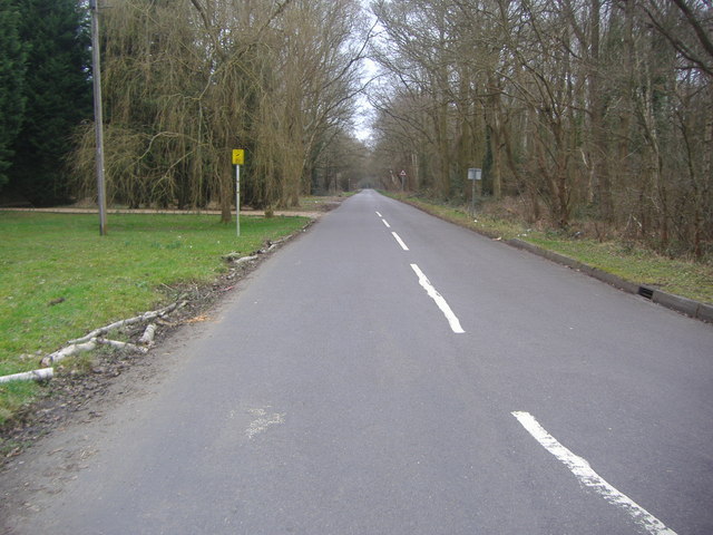
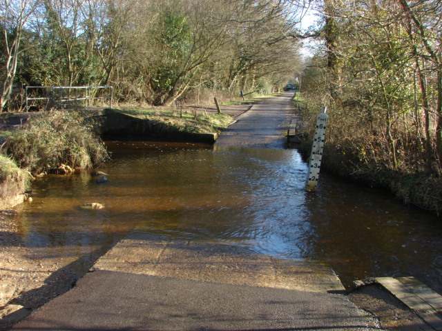
A network of well-maintained footpaths crisscrosses the common, allowing visitors to explore its beauty at their leisure. Whether it's a leisurely stroll or a more adventurous hike, the common caters to all levels of fitness and interests. Picnic areas and benches are strategically placed throughout the woodland, providing spots for visitors to rest and enjoy the peaceful surroundings.

Littlewick Common offers a welcome respite from the hustle and bustle of everyday life. Its tranquil atmosphere, beautiful woodland, and abundant wildlife make it a haven for those seeking solace in nature.

If you have any feedback on the listing, please let us know in the comments section below.

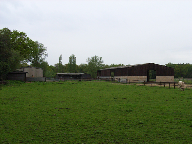
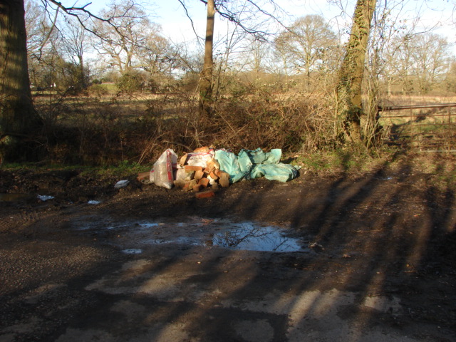
Littlewick Common Images

Images are sourced within 2km of 51.326644/-0.60086645 or Grid Reference SU9759. Thanks to Geograph Open Source API. All images are credited.

Track off Carthouse Lane A track leading south off Carthouse Lane.
Track off Carthouse Lane
A track leading south off Carthouse Lane.
Gate on Carthouse Lane A gate to the north of Carthouse Lane, leading to a field.
Gate on Carthouse Lane
A gate to the north of Carthouse Lane, leading to a field.
Carthouse Lane A lane between Chobham Road and a roundabout serving Littlewick Road, Horsell Birch and Kestrel Way.
Carthouse Lane
A lane between Chobham Road and a roundabout serving Littlewick Road, Horsell Birch and Kestrel Way.
Tenaker Plants and Gifts A garden centre on Scotts Grove Road.
Tenaker Plants and Gifts
A garden centre on Scotts Grove Road.
Ford across the Bourne in Lovelands Lane looking south-east
Ford across the Bourne in Lovelands Lane
looking south-east
The approach to Chobham along Guildford Road looking north
The approach to Chobham along Guildford Road
looking north
Houses in Castle Grove Road, Chobham looking south-east
Houses in Castle Grove Road, Chobham
looking south-east
Bullock and barns, near Coxhill Green The barns are beside The Bourne.
Bullock and barns, near Coxhill Green
The barns are beside The Bourne.
Sandpit Hall Road, Chobham East of its junction with the A3046.
Sandpit Hall Road, Chobham
East of its junction with the A3046.
Horsell Common From the northern edge of the common, on the footpath from Coxhill Green.
Horsell Common
From the northern edge of the common, on the footpath from Coxhill Green.
Sandpit Hall Road Straight road on the edge of Chobham.
Sandpit Hall Road
Straight road on the edge of Chobham.
Ford, Lovelands Lane Footbridge across the river Bourne next to the ford in Lovelands Lane
Ford, Lovelands Lane
Footbridge across the river Bourne next to the ford in Lovelands Lane
Lovelands Lane, Chobham Houses near the southern end of Lovelands Lane.
Lovelands Lane, Chobham
Houses near the southern end of Lovelands Lane.
Horsell Common Oak Trees on the northern edge of Horsell Common by the light of late winter sun.
Horsell Common
Oak Trees on the northern edge of Horsell Common by the light of late winter sun.
Flytipping, Lovelands Lane Yet another example of Man's desecration of the environment. Doesn't it just make you glad to be alive!?
Flytipping, Lovelands Lane
Yet another example of Man's desecration of the environment. Doesn't it just make you glad to be alive!?
Lovelands Farm Tree and fields at Lovelands Farm
Lovelands Farm
Tree and fields at Lovelands Farm
Fields, Scotts Grove Road View across fields to the south of Scotts Grove Road.
Fields, Scotts Grove Road
View across fields to the south of Scotts Grove Road.
Ford, Lovelands Lane Looking South along Lovelands Lane with the ford across the River Bourne in foreground.
Ford, Lovelands Lane
Looking South along Lovelands Lane with the ford across the River Bourne in foreground.
Show me another place!

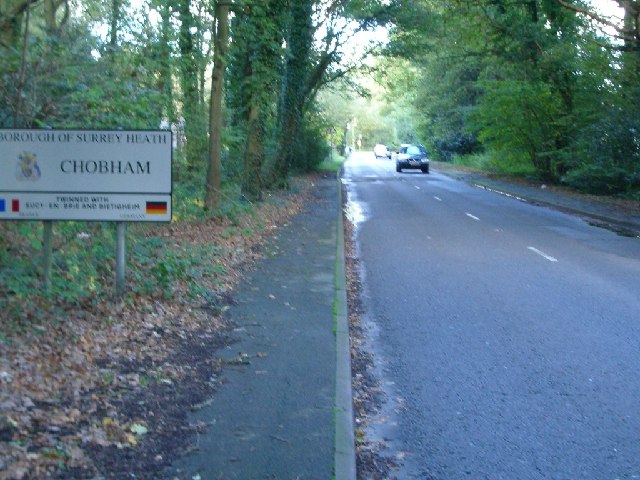
Littlewick Common is located at Grid Ref: SU9759 (Lat: 51.326644, Lng: -0.60086645)

Administrative County: Surrey

District: Woking

Police Authority: Surrey

What 3 Words

///posed.flash.fruit. Near Knaphill, Surrey

Related Wikis

Mizens Railway

Mizens Railway is a 7¼ inch gauge miniature railway located in a 10-acre site near Woking in Surrey, England. The railway comprises three routes, the...

St Andrew's Church, Goldsworth Park

St. Andrew's Church is the parish church of Goldsworth Park, a district of Woking, Surrey, England. The church paid for and sponsors the secular local...

Inkerman Barracks

Inkerman Barracks was a military establishment on Raglan Terrace, Knaphill, Surrey, England. == History == The facilities on the 65-acre site were originally...

Knaphill

Knaphill is a village in Surrey, England, between Woking to the east and Farnborough to the west; to the south and north on the A322 – its western border...

The Winston Churchill School, Woking

The Winston Churchill School is a comprehensive, secondary school in Woking, England. The school was established in 1967. It is near Knaphill, Bisley,...

Milford Green and Coxhill Green

Milford Green and Coxhill Green is a 15-hectare (37-acre) nature reserve south-east of Chobham in Surrey. It is owned by Surrey County Council and managed...

Woking Crematorium

Woking Crematorium is a crematorium in Woking, a large town in the west of Surrey, England. Established in 1878, it was the first custom-built crematorium...

Brookwood Hospital

Brookwood Hospital at Knaphill (near Woking) in Surrey, was established in 1867 by Surrey Quarter Sessions as the second County Asylum, the first being...

Nearby Amenities

Located within 500m of 51.326644,-0.60086645
Noexit: yes
Lat/Long: 51.3225796/-0.6009879
Turning Circle
Lat/Long: 51.3250441/-0.6003059
Telephone
Booth: KX100
Covered: booth
Last Check: 2018-07-21
Operator: BT
Payment Coins: yes
Payment Credit Cards: yes
Payment Debit Cards: yes
Lat/Long: 51.3227312/-0.5979152
Crossing
Crossing: traffic_signals
Crossing Ref: pelican
Kerb: lowered
Sloped Curb: yes
Lat/Long: 51.3229688/-0.5981287
Crossing
Crossing: unmarked
Kerb: lowered
Sloped Curb: yes
Lat/Long: 51.3250246/-0.599314
Bus Stop
Jasmine Close
Naptan AtcoCode: 40004403143C
Naptan Bearing: SW
Naptan BusStopType: CUS
Naptan CommonName: Jasmine Close
Naptan Indicator: adj
Naptan Landmark: Jasmine Close
Naptan NaptanCode: surgpjgd
Naptan Street: Kirkland Avenue
Naptan Verified: no
Physically Present: no
Public Transport: platform
Source: naptan_import
Lat/Long: 51.3232944/-0.6017836
Bus Stop
Knapwood House
Naptan AtcoCode: 40004404095A
Naptan Bearing: E
Naptan CommonName: Knapwood House
Naptan Indicator: adj
Naptan Landmark: Knapwood House
Naptan NaptanCode: surgdpdg
Naptan PlusbusZoneRef: WOKING
Naptan Street: Littlewick Road
Naptan Verified: no
Public Transport: platform
Source: naptan_import
Lat/Long: 51.3249367/-0.6042671
Bus Stop
Knapwood House
Naptan AtcoCode: 40004404095B
Naptan Bearing: W
Naptan CommonName: Knapwood House
Naptan Indicator: Opp
Naptan Landmark: Knapwood House
Naptan NaptanCode: surgdpdj
Naptan PlusbusZoneRef: WOKING
Naptan Street: Littlewick Road
Naptan Verified: no
Public Transport: platform
Source: naptan_import
Lat/Long: 51.3247655/-0.6044334
Bus Stop
Littlewick Common
Naptan AtcoCode: 40004404096A
Naptan Bearing: E
Naptan CommonName: Littlewick Common
Naptan Indicator: adj
Naptan Landmark: Littlewick Common
Naptan NaptanCode: surgdpdm
Naptan PlusbusZoneRef: WOKING
Naptan Street: Littlewick Road
Naptan Verified: no
Public Transport: platform
Source: naptan_import
Lat/Long: 51.3260669/-0.5989183
Bus Stop
Littlewick Common
Naptan AtcoCode: 40004404096B
Naptan Bearing: W
Naptan CommonName: Littlewick Common
Naptan Indicator: Opp
Naptan Landmark: Littlewick Common
Naptan NaptanCode: surgdpdp
Naptan PlusbusZoneRef: WOKING
Naptan Street: Littlewick Road
Naptan Verified: no
Public Transport: platform
Source: naptan_import
Lat/Long: 51.325953/-0.5989409
Bus Stop
Jasmine Close
Naptan AtcoCode: 40004404143A
Naptan Bearing: NE
Naptan CommonName: Jasmine Close
Naptan Indicator: Opp
Naptan Landmark: Jasmine Close
Naptan NaptanCode: surgdwdp
Naptan PlusbusZoneRef: WOKING
Naptan Street: Kirkland Avenue
Naptan Verified: no
Public Transport: platform
Source: naptan_import
Lat/Long: 51.3233803/-0.6018937
Crossing
Crossing: unmarked
Kerb: lowered
Sloped Curb: yes
Lat/Long: 51.3235269/-0.6009041
Man Made: survey_point
Lat/Long: 51.3262733/-0.5991932
Crossing
Crossing: unmarked
Kerb: lowered
Sloped Curb: yes
Lat/Long: 51.3226378/-0.603553
Crossing
Crossing: unmarked
Kerb: lowered
Sloped Curb: yes
Lat/Long: 51.3235665/-0.5996142
Crossing
Crossing: unmarked
Kerb: lowered
Sloped Curb: yes
Lat/Long: 51.3236008/-0.6012743
Crossing
Crossing: uncontrolled
Crossing Island: yes
Kerb: lowered
Sloped Curb: yes
Lat/Long: 51.3240615/-0.6058548
Crossing
Crossing: unmarked
Kerb: lowered
Sloped Curb: yes
Lat/Long: 51.3226336/-0.6030241
Crossing
Crossing: unmarked
Kerb: lowered
Sloped Curb: yes
Lat/Long: 51.3231741/-0.6019243
Crossing
Crossing: unmarked
Kerb: lowered
Sloped Curb: yes
Lat/Long: 51.3236875/-0.5970116
Crossing
Crossing: unmarked
Kerb: lowered
Sloped Curb: yes
Lat/Long: 51.3232781/-0.5983647
Barrier: bollard
Lat/Long: 51.3249366/-0.5987525
Crossing
Crossing: unmarked
Crossing Island: no
Kerb: lowered
Sloped Curb: yes
Tactile Paving: no
Lat/Long: 51.3257788/-0.6000248
Crossing
Crossing: uncontrolled
Crossing Island: yes
Kerb: lowered
Sloped Curb: yes
Lat/Long: 51.3240701/-0.6058182
Traffic Signals
Source: Surrey-Air_Survey
Traffic Signals Direction: backward
Lat/Long: 51.3229178/-0.5980461
Traffic Signals
Source: Surrey-Air_Survey
Traffic Signals Direction: forward
Lat/Long: 51.3230059/-0.5981896
Animal Boarding
The Mink Farm
Animal Boarding: dog;cat
Lat/Long: 51.3294566/-0.6017929
The data included in this document is from www.openstreetmap.org. The data is made available under ODbL.

Have you been to Littlewick Common?

Leave your review of Littlewick Common below (or comments, questions and feedback).