Eves Copse

Wood, Forest in Surrey Waverley

England

Eves Copse

Toll House, Chiddingfold What looks to be an ex-toll house. The brick fabric looks late for a toll house so may well have served the Petworth Turnpike Trust in its dying years. It would have replaced a Toll House SSE on the North side of the ford/bridge at Northbridge.

Milestone Society National ID: SY.CHI
Toll House, Chiddingfold Credit: Lionel Joseph

Eves Copse is a small woodland located in Surrey, England. It is situated near the village of Chiddingfold, approximately 10 miles south of Guildford. Spanning an area of around 20 acres, the copse is a beautiful natural retreat that offers a serene and peaceful environment for visitors.

The woodland consists mostly of deciduous trees, including oak, beech, and birch. These trees create a dense canopy that provides shade and shelter for various wildlife species that call Eves Copse home. The forest floor is covered with a thick layer of leaf litter and moss, creating a soft and cushioned walking surface.

There are several trails and footpaths that wind through the copse, allowing visitors to explore its scenic beauty. These paths offer opportunities for leisurely walks and are suitable for people of all ages and fitness levels. Along the way, visitors may encounter various woodland creatures, such as squirrels, rabbits, and a wide variety of bird species.

Eves Copse is also home to a diverse range of plant life, including wildflowers, ferns, and fungi. In the spring and summer months, the forest comes alive with vibrant colors and sweet scents as flowers bloom and birds chirp. It is a popular spot for nature enthusiasts, photographers, and those seeking a tranquil escape from the hustle and bustle of everyday life.

Overall, Eves Copse in Surrey is a picturesque woodland that offers a delightful and calming experience for visitors. Its natural beauty, diverse wildlife, and peaceful ambiance make it a hidden gem for nature lovers and those seeking a brief respite in the heart of Surrey.

If you have any feedback on the listing, please let us know in the comments section below.

Eves Copse Images

Images are sourced within 2km of 51.117206/-0.61117324 or Grid Reference SU9736. Thanks to Geograph Open Source API. All images are credited.

Toll House, Chiddingfold What looks to be an ex-toll house. The brick fabric looks late for a toll house so may well have served the Petworth Turnpike Trust in its dying years. It would have replaced a Toll House SSE on the North side of the ford/bridge at Northbridge.

Milestone Society National ID: SY.CHI
Toll House, Chiddingfold
What looks to be an ex-toll house. The brick fabric looks late for a toll house so may well have served the Petworth Turnpike Trust in its dying years. It would have replaced a Toll House SSE on the North side of the ford/bridge at Northbridge. Milestone Society National ID: SY.CHI
Ridgley Road at the junction of Coxcomb Lane
Shops on The Green, Chiddingfold
Shops on The Green, Chiddingfold A very small Boots, one of the few large chains who kept their village shops as well.
Shops on The Green, Chiddingfold
A very small Boots, one of the few large chains who kept their village shops as well.
House on The Green, Chiddingfold
Phillips of Wormley
Phillips of Wormley
The Winterton Arms, Chiddingfold
Houses on Petworth Road, Chiddingfold
Petworth Road, Chiddingfold
Old house on Petworth Road, Chiddingfold
Entering Chiddingfold, A283 Chiddingfold is a village and civil parish in the heart of The Weald in the Waverley district of Surrey. It lies on the A283 between Milford and Petworth.
Wikipedia: <span class="nowrap"><a title="http://en.wikipedia.org/wiki/Chiddingfold" rel="nofollow ugc noopener" href="http://en.wikipedia.org/wiki/Chiddingfold">Link</a><img style="margin-left:2px;" alt="External link" title="External link - shift click to open in new window" src="https://s1.geograph.org.uk/img/external.png" width="10" height="10"/></span>
Entering Chiddingfold, A283
Chiddingfold is a village and civil parish in the heart of The Weald in the Waverley district of Surrey. It lies on the A283 between Milford and Petworth. Wikipedia: LinkExternal link
A283, Chiddingfold The A283 runs 37 miles from Milford near Guildford south to Shoreham-on-Sea across rural Surrey and West Sussex.
<span class="nowrap"><a title="https://www.sabre-roads.org.uk/wiki/index.php?title=A283" rel="nofollow ugc noopener" href="https://www.sabre-roads.org.uk/wiki/index.php?title=A283">Link</a><img style="margin-left:2px;" alt="External link" title="External link - shift click to open in new window" src="https://s1.geograph.org.uk/img/external.png" width="10" height="10"/></span>
A283, Chiddingfold
The A283 runs 37 miles from Milford near Guildford south to Shoreham-on-Sea across rural Surrey and West Sussex. LinkExternal link
The Swan Inn
The Swan Inn
Church of St Mary Chiddingfold is a village and civil parish in the heart of The Weald in the Waverley district of Surrey. It lies on the A283 between Milford and Petworth.
Wikipedia: <span class="nowrap"><a title="http://en.wikipedia.org/wiki/Chiddingfold" rel="nofollow ugc noopener" href="http://en.wikipedia.org/wiki/Chiddingfold">Link</a><img style="margin-left:2px;" alt="External link" title="External link - shift click to open in new window" src="https://s1.geograph.org.uk/img/external.png" width="10" height="10"/></span>
Church of St Mary
Chiddingfold is a village and civil parish in the heart of The Weald in the Waverley district of Surrey. It lies on the A283 between Milford and Petworth. Wikipedia: LinkExternal link
A283 at The Winterton Arms The A283 runs 37 miles from Milford near Guildford south to Shoreham-on-Sea across rural Surrey and West Sussex.
<span class="nowrap"><a title="https://www.sabre-roads.org.uk/wiki/index.php?title=A283" rel="nofollow ugc noopener" href="https://www.sabre-roads.org.uk/wiki/index.php?title=A283">Link</a><img style="margin-left:2px;" alt="External link" title="External link - shift click to open in new window" src="https://s1.geograph.org.uk/img/external.png" width="10" height="10"/></span>
A283 at The Winterton Arms
The A283 runs 37 miles from Milford near Guildford south to Shoreham-on-Sea across rural Surrey and West Sussex. LinkExternal link
Hambledon - National Trust cottages The National Trust were left a number (13 I believe) of cottages in and around the village of Hambledon by local generous benefactors. Most of these cottages are now let out by the Trust on long-term leases and cannot be visited by the public - such as the one on the right in this image. However, one cottage "Oakhurst Cottage" can be viewed by prior arrangement (see <span class="nowrap"><a title="https://www.nationaltrust.org.uk/oakhurst-cottage" rel="nofollow ugc noopener" href="https://www.nationaltrust.org.uk/oakhurst-cottage">Link</a><img style="margin-left:2px;" alt="External link" title="External link - shift click to open in new window" src="https://s1.geograph.org.uk/img/external.png" width="10" height="10"/></span> ) - and this can be seen on the left here - and here <a href="https://www.geograph.org.uk/photo/5783968">SU9637 : Oakhurst Cottage, Hambledon</a>
Hambledon - National Trust cottages
The National Trust were left a number (13 I believe) of cottages in and around the village of Hambledon by local generous benefactors. Most of these cottages are now let out by the Trust on long-term leases and cannot be visited by the public - such as the one on the right in this image. However, one cottage "Oakhurst Cottage" can be viewed by prior arrangement (see LinkExternal link ) - and this can be seen on the left here - and here SU9637 : Oakhurst Cottage, Hambledon
Show me another place!

Eves Copse is located at Grid Ref: SU9736 (Lat: 51.117206, Lng: -0.61117324)

Administrative County: Surrey

District: Waverley

Police Authority: Surrey

What 3 Words

///jigsaw.nightlife.fastening. Near Chiddingfold, Surrey

Related Wikis

St Teresa of Avila Church, Chiddingfold

St Teresa of Avila Church is a Roman Catholic Parish church in Chiddingfold, Surrey. It is situated on the corner of Petworth Road and Woodside Road in...
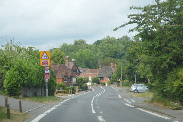
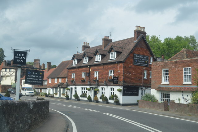
Chiddingfold

Chiddingfold is a village and civil parish in the Weald in the Waverley district of Surrey, England. It lies on the A283 road between Milford and Petworth...
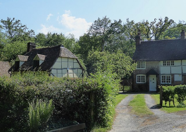
Oakhurst Cottage

Oakhurst Cottage is a tiny 16th or 17th-century cottage in Hambledon, Surrey, in the United Kingdom. It is a Grade II listed building.The cottage was given...

Pickhurst

Pickhurst is a grade II* listed house set in 130 acres (53 ha) of land near Chiddingfold, Surrey, England. == History == It was designed by the Scottish...

Tigbourne Court

Tigbourne Court is an Arts and Crafts style country house in Wormley, Surrey, England, 1 mile (1.6 km) south of Witley. It was designed by architect Edwin...

Hambledon, Surrey

Hambledon is a rural scattered village in the Waverley borough of Surrey, situated south of Guildford. It is dominated by a buffer zone of fields and woodland...

St Dominic's School

St. Dominic's School in Hambledon, Surrey, England is a co-educational day school, one of the oldest special schools in the United Kingdom. It specialises...

Witley railway station

Witley railway station is a station on the Portsmouth Direct Line in Surrey, England. It is 38 miles 36 chains (61.9 km) down the line from London Waterloo...

Related Videos

Walking to Hambledon Community Cricket Club (Surrey)

A short video walking through Hambledon Village onto Vann Lane past the Hambledon Village shop and ending at Hambledon ...

June & Robin Lovelock's visit to Vann, open for the NGS Charity on 29th March 2022

12 minute sequence of photos, the first 2 minutes of which are a summary. The pictures show our visit to Vann, in Hambledon, ...

1 Mill Lane, Chiddingfold

Tucked away down a quite no through road in Chiddingfold sits this charming 2 bedroom cottage with bonus loft room requiring ...

The Historical English Village Of Chiddingfold, Surrey.

A Wander around the beautiful Village of Chiddingfold, a perfect example of an ideal English Country Village. Subscribe to my ...

Nearby Amenities

Located within 500m of 51.117206,-0.61117324
Stonehurst
Building: yes
Source: npe
Lat/Long: 51.1200203/-0.6101604
Post Box
Operator: Royal Mail
Post Box Type: lamp
Ref: GU8 121
Royal Cypher: EIIR
Royal Cypher Wikidata: Q33102113
Lat/Long: 51.1131032/-0.6130336
The data included in this document is from www.openstreetmap.org. The data is made available under ODbL.

Have you been to Eves Copse?

Leave your review of Eves Copse below (or comments, questions and feedback).