Hardwick Wood

Wood, Forest in Rutland

England

Hardwick Wood

Hedge enclosed minor road at Pickworth Triangulation Pillar Looking north-eastward.
Hedge enclosed minor road at Pickworth Triangulation Pillar Credit: Peter Wood

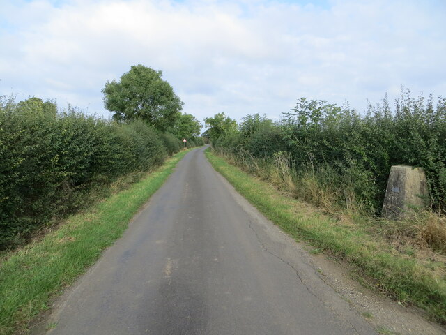
Hardwick Wood is a sprawling forest located in the county of Rutland, England. Covering an area of approximately 200 hectares, it is one of the largest woodlands in the region. The forest is situated near the village of Empingham and is easily accessible from nearby towns and cities.

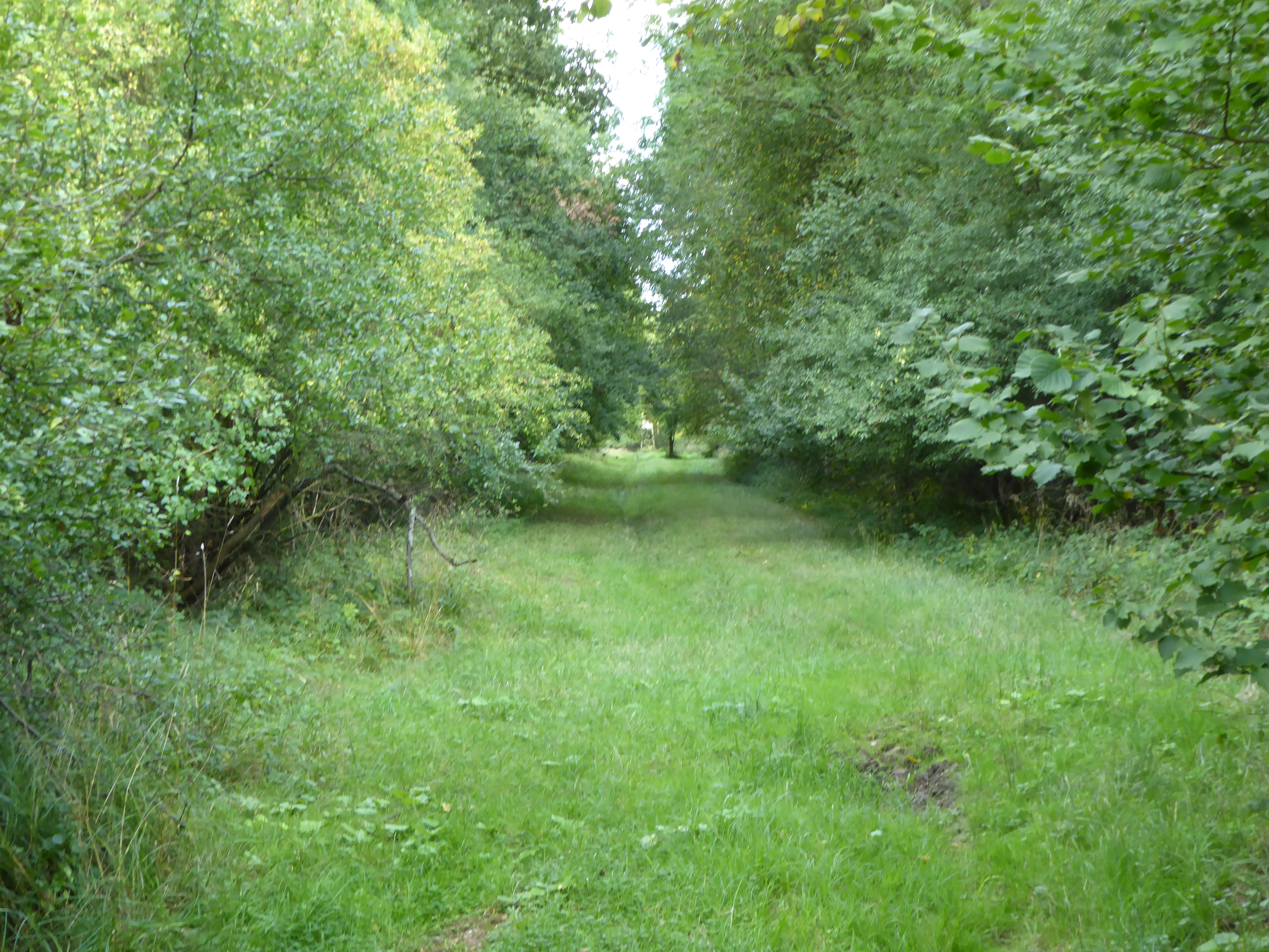
The wood is primarily composed of broadleaf trees, including oak, ash, beech, and birch, which create a diverse and vibrant ecosystem. These trees provide shelter and food for a variety of bird species, including woodpeckers, owls, and thrushes. Additionally, the forest is home to numerous mammals such as deer, foxes, and badgers, making it a popular spot for wildlife enthusiasts.

Hardwick Wood offers a range of recreational activities for visitors. There are several well-maintained walking trails that wind through the forest, providing opportunities for leisurely strolls and more challenging hikes. These paths offer breathtaking views of the surrounding countryside and allow visitors to immerse themselves in nature.

The forest also boasts a picnic area, making it an ideal destination for families and groups looking to enjoy a day out surrounded by natural beauty. Moreover, the wood is equipped with facilities such as toilets and car parks to ensure convenience for visitors.

Hardwick Wood is managed by the local authorities, who work diligently to preserve its natural beauty and protect its inhabitants. It serves as an important ecological and recreational resource for the local community and attracts visitors from both near and far who seek solace in the tranquility of a woodland setting.

If you have any feedback on the listing, please let us know in the comments section below.

Hardwick Wood Images

Images are sourced within 2km of 52.70321/-0.56808963 or Grid Reference SK9612. Thanks to Geograph Open Source API. All images are credited.

Hedge enclosed minor road at Pickworth Triangulation Pillar Looking north-eastward.
Hedge enclosed minor road at Pickworth Triangulation Pillar
Looking north-eastward.
Hedge enclosed minor road crossing Pickworth Plain Looking south-westward.
Hedge enclosed minor road crossing Pickworth Plain
Looking south-westward.
Minor road at The Lodge Looking south-westward.
Minor road at The Lodge
Looking south-westward.
Losecoat Field Looking south-eastward. Here on 12th March 1470 The Battle of Empingham (War of the Roses) took place.
Losecoat Field
Looking south-eastward. Here on 12th March 1470 The Battle of Empingham (War of the Roses) took place.
Hedge enclosed minor road heading towards the A1 Looking south-westward.
Hedge enclosed minor road heading towards the A1
Looking south-westward.
Access Drive from Woolfox Golf and Country Club Looking south-westward towards the Great North Road.
Access Drive from Woolfox Golf and Country Club
Looking south-westward towards the Great North Road.
Ordnance Survey Flush Bracket 1227 This bracket can be found on the wall of a building at Hardwick Farm.
The recorded details give a height of 89.4023 metres above sea level.
For more details see : <span class="nowrap"><a title="https://www.bench-marks.org.uk/bm1975" rel="nofollow ugc noopener" href="https://www.bench-marks.org.uk/bm1975">Link</a><img style="margin-left:2px;" alt="External link" title="External link - shift click to open in new window" src="https://s1.geograph.org.uk/img/external.png" width="10" height="10"/></span>
Ordnance Survey Flush Bracket 1227
This bracket can be found on the wall of a building at Hardwick Farm. The recorded details give a height of 89.4023 metres above sea level. For more details see : LinkExternal link
Great North Road, Woolfox
Great North Road heading to Tickencote
Great North Road heading to Tickencote Joining the main A1
Great North Road heading to Tickencote
Joining the main A1
Lose Coat Field Site of a battle in 1471. North of Stamford just next to the A1
Lose Coat Field
Site of a battle in 1471. North of Stamford just next to the A1
Hardwick Farm This farm is on the edge of RAF Woolfox Lodge and is now a golf club
Hardwick Farm
This farm is on the edge of RAF Woolfox Lodge and is now a golf club
Field Boundary on Pickworth Plain
Top Pickworth open field
Lodge Farm and fields
Old road disappearing into the Bloody Oaks
Boundary of the Bloody Oaks woods and fields
Show me another place!

Hardwick Wood is located at Grid Ref: SK9612 (Lat: 52.70321, Lng: -0.56808963)

Unitary Authority: Rutland

Police Authority: Leicestershire

What 3 Words

///thighs.lease.inflation. Near Pickworth, Rutland

Related Wikis

RAF Woolfox Lodge

Royal Air Force Woolfox Lodge, or more simply RAF Woolfox Lodge, is a former Royal Air Force station next to the A1 road in Rutland, UK. The airfield is...

Horn, Rutland

Horn is a former civil parish, now in the parish of Exton and Horn, in the county of Rutland, England. In 2001 it had a population of 9, which was included...

Bloody Oaks Quarry

Bloody Oaks Quarry is a 1.3-hectare (3.2-acre) biological Site of Special Scientific Interest north-west of Great Casterton in Rutland. It is owned and...

Clipsham Old Quarry and Pickworth Great Wood

Clipsham Old Quarry and Pickworth Great Wood is a 111.2-hectare (275-acre) biological and geological Site of Special Scientific Interest in Rutland. It...

Nearby Amenities

Located within 500m of 52.70321,-0.56808963
Hardwick Farm
Place: farm
Source: Bing
Lat/Long: 52.7010307/-0.5688627
Building: yes
Lat/Long: 52.7011279/-0.5675483
Building: yes
Lat/Long: 52.7012839/-0.5670441
Building: yes
Lat/Long: 52.7017/-0.5685568
Building: yes
Lat/Long: 52.7027922/-0.5694259
The data included in this document is from www.openstreetmap.org. The data is made available under ODbL.

Have you been to Hardwick Wood?

Leave your review of Hardwick Wood below (or comments, questions and feedback).