Ashton Gate

Settlement in Somerset

England

Ashton Gate

Open at last, but with lights Gaol Ferry Bridge was many months under repair (and much needed too!) but is now open once more. A thorough examination, restoration and repainting was carried out, but the bridge still requires some temporary lights.
Open at last, but with lights Credit: Neil Owen

Ashton Gate is a small village located in Somerset, England. Situated on the outskirts of the city of Bristol, it is a picturesque and historic area that boasts a rich heritage and natural beauty.

The village is known for its charming cottages and traditional architecture, which date back to the 17th and 18th centuries. Its idyllic setting offers stunning views of the surrounding countryside, with rolling hills and lush green fields. The nearby Ashton Court Estate provides ample opportunities for outdoor activities, including walking, cycling, and picnicking.

One of the main attractions in Ashton Gate is the Ashton Gate Stadium, home to Bristol City Football Club. With a seating capacity of over 27,000, it is one of the largest stadiums in the region and hosts various football matches and events throughout the year. The stadium has undergone extensive renovations in recent years, further enhancing its facilities and reputation.

The village also benefits from excellent transport links, with easy access to the M5 motorway and Bristol Temple Meads railway station. This makes it a convenient location for both residents and visitors to explore the wider region.

In terms of amenities, Ashton Gate offers a range of local shops, restaurants, and pubs, providing residents with all the necessary amenities for everyday living. The village also has a primary school, making it an attractive place for families.

Overall, Ashton Gate is a charming village that combines natural beauty, historic architecture, and modern amenities. It offers a peaceful and idyllic setting while still being conveniently located near the bustling city of Bristol.

If you have any feedback on the listing, please let us know in the comments section below.
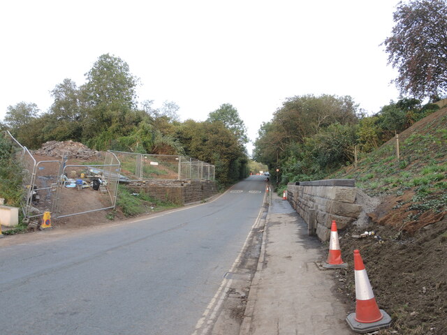
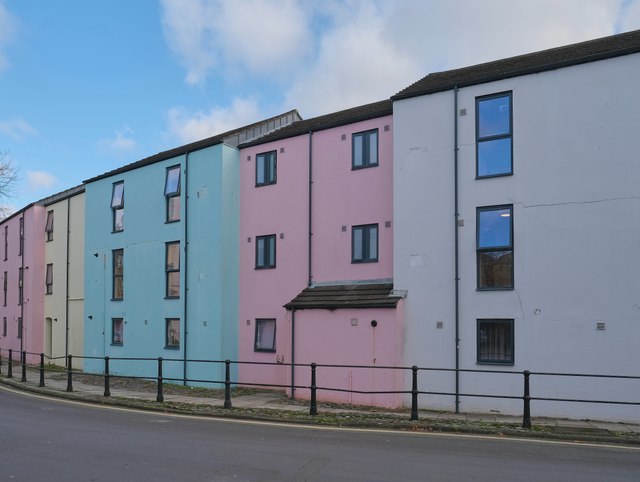
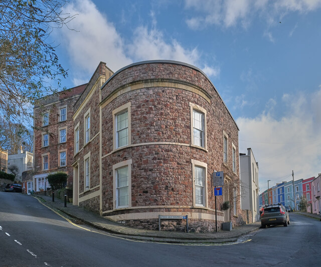
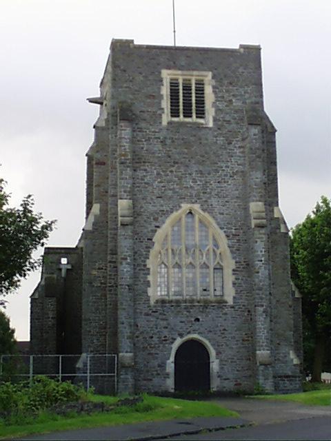
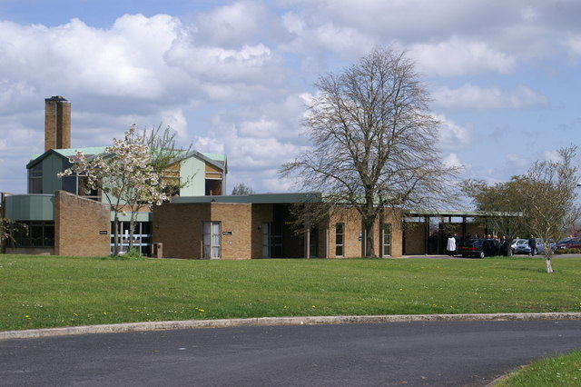
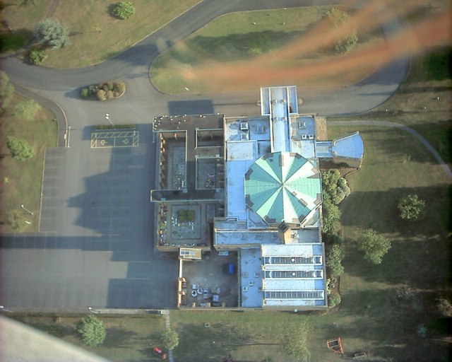
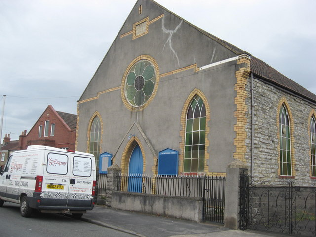
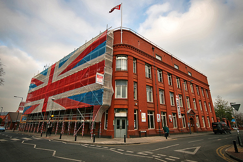
Ashton Gate Images

Images are sourced within 2km of 51.440123/-2.6165507 or Grid Reference ST5771. Thanks to Geograph Open Source API. All images are credited.

Open at last, but with lights Gaol Ferry Bridge was many months under repair (and much needed too!) but is now open once more. A thorough examination, restoration and repainting was carried out, but the bridge still requires some temporary lights.
Open at last, but with lights
Gaol Ferry Bridge was many months under repair (and much needed too!) but is now open once more. A thorough examination, restoration and repainting was carried out, but the bridge still requires some temporary lights.
Worth the wait, worth the money? Gaol Ferry Bridge has reopened after quite a time. It was closed to allow engineers to really examine it thoroughly, and unspurprisingly discovered more problems than were originally budgetted for. But after a lengthy wait the bridge is now back in service - much to the relief of businesses close by.
Worth the wait, worth the money?
Gaol Ferry Bridge has reopened after quite a time. It was closed to allow engineers to really examine it thoroughly, and unspurprisingly discovered more problems than were originally budgetted for. But after a lengthy wait the bridge is now back in service - much to the relief of businesses close by.
Rowell's work Gaol FerryBridge is a steel rope suspension bridge over the New Cut, opened in 1935. Following a major restoration (claimed to have cost the council some £1.5 million) to replace rotten timbers, rusted lattice structure and frayed ropes; a fresh coat of paint topped it all off. Here are some steel connectors, marked by Rowell of London. Note the extra wrapping. See <a href="https://www.geograph.org.uk/photo/7687912">ST5872 : Scottish steel in Bristol</a> for another piece of the bridge from elsewhere.

David Rowell began as a fencing firm in Westminster in 1855 but soon branched out into significant works for bridges and steel frames. The firm built bridges from 1903 to 1951, before the firm folded in 1970.
Rowell's work
Gaol FerryBridge is a steel rope suspension bridge over the New Cut, opened in 1935. Following a major restoration (claimed to have cost the council some £1.5 million) to replace rotten timbers, rusted lattice structure and frayed ropes; a fresh coat of paint topped it all off. Here are some steel connectors, marked by Rowell of London. Note the extra wrapping. See ST5872 : Scottish steel in Bristol for another piece of the bridge from elsewhere. David Rowell began as a fencing firm in Westminster in 1855 but soon branched out into significant works for bridges and steel frames. The firm built bridges from 1903 to 1951, before the firm folded in 1970.
Scottish steel in Bristol A plate on Gaol Ferry Bridge is all the way from Scotland. See <a href="https://www.geograph.org.uk/photo/7687909">ST5872 : Rowell's work</a> for some London steel close by.
Scottish steel in Bristol
A plate on Gaol Ferry Bridge is all the way from Scotland. See ST5872 : Rowell's work for some London steel close by.
A bridge gone There used to be a railway line over South Liberty Lane, but no more. It used to carry the Portishead West Loop - a connection from the Avon Gorge to the mainline tracks to Weston - but that section had closed some time previously.
A bridge gone
There used to be a railway line over South Liberty Lane, but no more. It used to carry the Portishead West Loop - a connection from the Avon Gorge to the mainline tracks to Weston - but that section had closed some time previously.
Catch a crab? Poor old Neptune, his trident is now adorned with some form of vegetation - possibly plastic. Perhaps the same person also left a sticker on his arm.
Catch a crab?
Poor old Neptune, his trident is now adorned with some form of vegetation - possibly plastic. Perhaps the same person also left a sticker on his arm.
A pick of provisions Bristol's centre reinforces the claim that the city is a foodie destination. All manner of street food flavours are available in the pedestrianised area. The pigeons know that too.
A pick of provisions
Bristol's centre reinforces the claim that the city is a foodie destination. All manner of street food flavours are available in the pedestrianised area. The pigeons know that too.
Newly opened French restaurant Clifton, Bristol
Newly opened French restaurant
Clifton, Bristol
Pastel Sinclair House, Clifton Road: student accommodation at Manor Hall.

The provision of housing for Bristol's burgeoning university population is extensive and this Hall is part of the West Residential Village which accounts for around 3,000 students in total.
Pastel
Sinclair House, Clifton Road: student accommodation at Manor Hall. The provision of housing for Bristol's burgeoning university population is extensive and this Hall is part of the West Residential Village which accounts for around 3,000 students in total.
On the corner Ambra Vale South, Bristol
On the corner
Ambra Vale South, Bristol
Bedminster Down, Bristol, St Oswald's Church
South Bristol Crematorium
South Bristol Crematorium A view from above.
South Bristol Crematorium
A view from above.
Manor Woods Valley A public park, home to the delightfully named Malago stream.
Manor Woods Valley
A public park, home to the delightfully named Malago stream.
The Malago A small stream in Manor Woods Valley, which I suspect here functions also as a storm drain.
The Malago
A small stream in Manor Woods Valley, which I suspect here functions also as a storm drain.
Cover on The Malago A significantly large piece of civil engineering, here covers a storm drain where it exits underground, presumably it acts as a filter to remove trees etc in times of flood.
Cover on The Malago
A significantly large piece of civil engineering, here covers a storm drain where it exits underground, presumably it acts as a filter to remove trees etc in times of flood.
Woodland or River? It's Your Choice The walkers in Manor Woods Valley are here offered a choice.
Woodland or River? It's Your Choice
The walkers in Manor Woods Valley are here offered a choice.
Zion Methodist Church, Bishopsworth Road
Show me another place!

Ashton Gate is located at Grid Ref: ST5771 (Lat: 51.440123, Lng: -2.6165507)

Unitary Authority: Bristol

Police Authority: Avon and Somerset

What 3 Words

///wipes.serves.abode. Near Bristol

Related Wikis

Ashton Gate, Bristol

Ashton Gate is a suburb of Bristol, United Kingdom, in the Southville ward of Bristol City Council. A toll house at the western end of North Street still...

Ashton Gate (stadium)

Ashton Gate is a multi-use stadium in Ashton Gate, Bristol, England, and is the home of Bristol City football club and the Bristol Bears rugby union team...

Tobacco Factory

The Tobacco Factory is the last remaining part of the old W. D. & H. O. Wills tobacco factory site on Raleigh Road, Southville, Bristol. It was saved from...

Tobacco Factory Theatre

Tobacco Factory Theatres is located on the first floor of the Tobacco Factory building on the corner of North Street and Raleigh Road, Southville in Bristol...

Show of Strength Theatre Company

Show of Strength Theatre Company is a Bristol-based theatre company which has produced new and forgotten works since 1986 in a range of venues in Bristol...

The Chessels

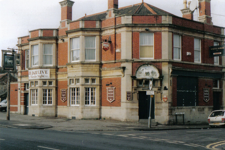
The Chessels is an area of Bedminster, Bristol that runs from the midsection of Luckwell Rd to the former White Horse pub on West Street. Chessel Street...

HMS Flying Fox (shore establishment)

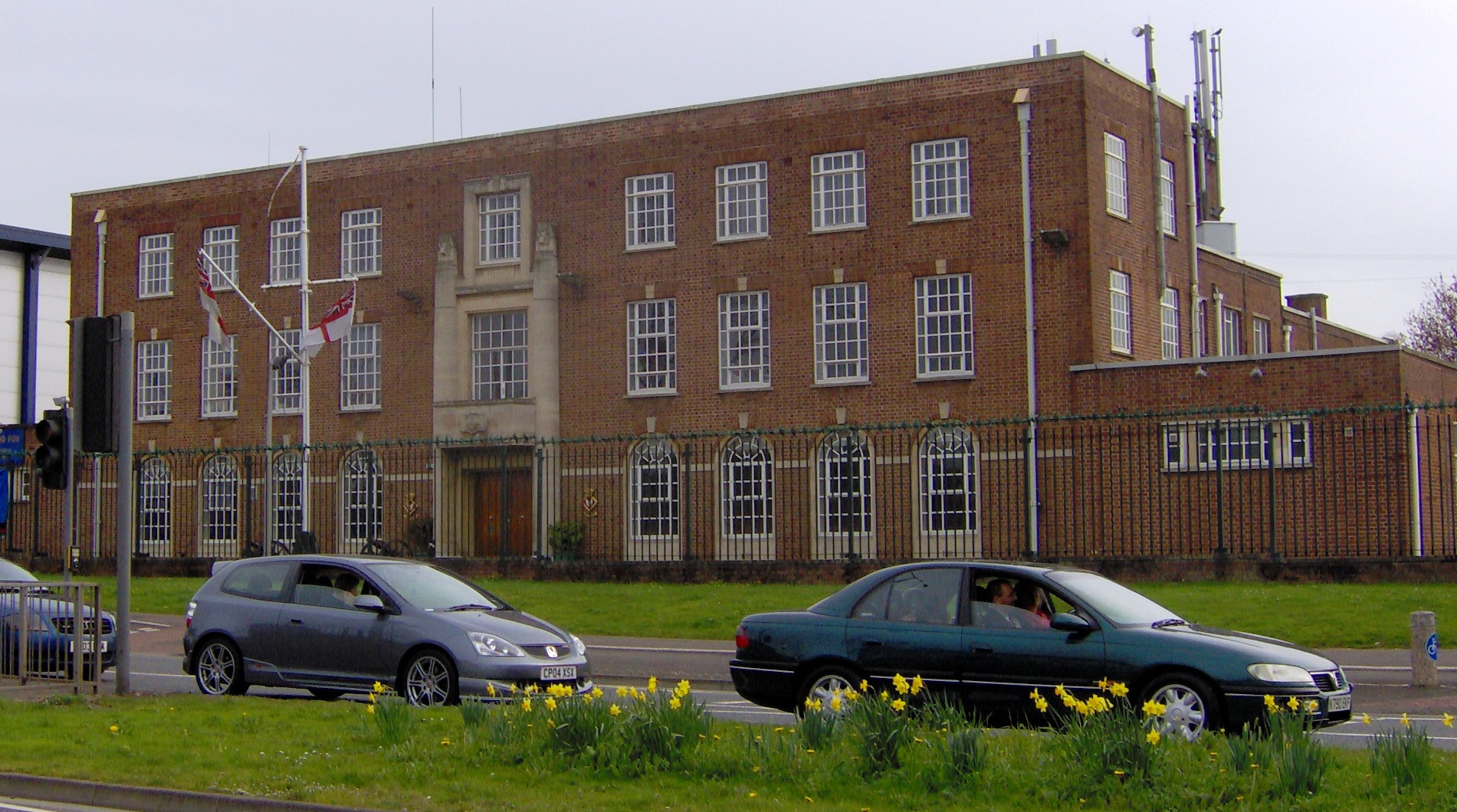
HMS Flying Fox is a Royal Naval Reserve unit located in Bristol, England. Training over 100 reservists on Thursday evenings in Bristol, Flying Fox serves...

Ashton Gate railway station

Ashton Gate railway station was a railway station serving the Ashton Gate area of Bristol, England, which included Ashton Gate football ground, the home...

Nearby Amenities

Located within 500m of 51.440123,-2.6165507
Crossing
Crossing: unmarked
Crossing Island: yes
Tactile Paving: yes
Lat/Long: 51.4429641/-2.617337
Post Box
Post Box Type: pillar
Ref: BS3 55D
Royal Cypher: GR
Royal Cypher Wikidata: Q33102273
Lat/Long: 51.439439/-2.6160833
Turning Circle
Lat/Long: 51.4359879/-2.6160665
Bicycle Parking
Bicycle Parking: stands
Capacity: 6
Covered: no
Mapillary: 975852343231296
Survey Date: 2021-03-20
Lat/Long: 51.4402619/-2.6102254
Post Box
Collection Times: Mo-Fr 09:00; Sa 07:00
Post Box Type: pillar
Ref: BS3 44
Royal Cypher: EIIR
Lat/Long: 51.4402076/-2.6100452
Bicycle Parking
Bicycle Parking: stands
Capacity: 8
Mapillary: 294411975682186
Survey Date: 2019-05-19
Lat/Long: 51.4420937/-2.6133232
Bicycle Parking
Bicycle Parking: stands
Capacity: 10
Mapillary: 195650322401433
Survey Date: 2021-03-27
Lat/Long: 51.4420489/-2.6134413
Bus Stop
Greenway Bush Lane
Bench: yes
Bin: no
Mapillary: 756208198373970
Naptan AtcoCode: 0100053339
Naptan Bearing: W
Naptan CommonName: Greenway Bush Lane
Naptan Crossing: Raleigh Road
Naptan Landmark: St Francis' Church
Naptan NaptanCode: bstdgdp
Naptan PlusbusZoneRef: BRSTLTM
Naptan Street: North Street
Passenger Information Display: yes
Public Transport: platform
Shelter: yes
Source: naptan_import
Survey Date: 2021-03-27
Lat/Long: 51.442356/-2.6141342
Bus Stop
Smyth Road
Bus: yes
Naptan AtcoCode: 0100BRA10015
Naptan Bearing: NW
Naptan CommonName: Smyth Road
Naptan Crossing: Smyth Road
Naptan NaptanCode: bstatwt
Naptan PlusbusZoneRef: BRSTLTM
Naptan Street: Winterstoke Road
Naptan Verified: no
Public Transport: platform
Shelter: yes
Source: naptan_import
Lat/Long: 51.4369765/-2.6208062
Bus Stop
Smyth Road
Bench: yes
Bin: yes
Bus: yes
Mapillary: 170029828267383
Naptan AtcoCode: 0100BRA10016
Naptan Bearing: SE
Naptan CommonName: Smyth Road
Naptan Crossing: Smyth Road
Naptan NaptanCode: bstawap
Naptan PlusbusZoneRef: BRSTLTM
Naptan Street: Winterstoke Road
Naptan Verified: no
Public Transport: platform
Shelter: yes
Source: naptan_import
Survey Date: 2021-03-20
Lat/Long: 51.4370476/-2.6205982
Bus Stop
Frayne Road
Bench: no
Bin: no
Mapillary: 1393554931021901
Naptan AtcoCode: 0100BRA10021
Naptan Bearing: SW
Naptan CommonName: Frayne Road
Naptan Crossing: North Street
Naptan NaptanCode: bstdaga
Naptan PlusbusZoneRef: BRSTLTM
Naptan Street: Ashton Road
Public Transport: platform
Shelter: no
Source: naptan_import
Survey Date: 2021-03-27
Lat/Long: 51.4427373/-2.6175306
Bus Stop
Frayne Road
Naptan AtcoCode: 0100BRA10022
Naptan Bearing: E
Naptan CommonName: Frayne Road
Naptan Crossing: Ashton Gate Terrace
Naptan NaptanCode: bstdamd
Naptan PlusbusZoneRef: BRSTLTM
Naptan Street: North Street
Naptan Verified: no
Source: naptan_import
Lat/Long: 51.4430892/-2.6162414
Bus Stop
Greenway Bush Lane
Bench: yes
Bin: no
Mapillary: 1207034419716962
Naptan AtcoCode: 0100BRA10023
Naptan Bearing: SE
Naptan CommonName: Greenway Bush Lane
Naptan Crossing: Greenway Bush Lane
Naptan Landmark: St Francis' Church
Naptan NaptanCode: bstdgdj
Naptan PlusbusZoneRef: BRSTLTM
Naptan Street: North Street
Naptan Verified: no
Public Transport: platform
Shelter: yes
Source: naptan_import
Survey Date: 2019-05-19
Tactile Paving: yes
Lat/Long: 51.4425834/-2.6143417
Bus Stop
Raleigh Road
Naptan AtcoCode: 0100BRA10024
Naptan Bearing: SW
Naptan CommonName: Raleigh Road
Naptan Crossing: North Street
Naptan Landmark: Amerind Grove Nursing Home
Naptan NaptanCode: bstdgpd
Naptan PlusbusZoneRef: BRSTLTM
Naptan Street: Raleigh Road
Naptan Verified: no
Source: naptan_import
Lat/Long: 51.4422835/-2.6131866
Bus Stop
Raleigh Road
Naptan AtcoCode: 0100BRA10025
Naptan Bearing: NE
Naptan CommonName: Raleigh Road
Naptan Crossing: North Street
Naptan Landmark: Amerind Grove Nursing Home
Naptan NaptanCode: bstdgtm
Naptan PlusbusZoneRef: BRSTLTM
Naptan Street: Raleigh Road
Naptan Verified: no
Source: naptan_import
Lat/Long: 51.4428005/-2.6125757
Bus Stop
Greville Road
Bench: yes
Bin: yes
Lit: yes
Mapillary: dQIO9FEethk77ACPt5P46J
Naptan AtcoCode: 0100BRA10055
Naptan Bearing: E
Naptan CommonName: Greville Road
Naptan Crossing: Luckwell Road
Naptan Landmark: Hen & Chicken
Naptan NaptanCode: bstdjpg
Naptan PlusbusZoneRef: BRSTLTM
Naptan Street: North Street
Naptan Verified: no
Passenger Information Display: yes
Public Transport: platform
Shelter: yes
Source: naptan_import
Survey Date: 2021-03-27
Tactile Paving: yes
Lat/Long: 51.4403893/-2.6101769
Bus Stop
Durnford Street
Bench: yes
Bin: yes
Mapillary: 1673748303013482
Naptan AtcoCode: 0100BRA10059
Naptan Bearing: NW
Naptan CommonName: Durnford Street
Naptan Crossing: Raleigh Road
Naptan Landmark: Whitemead House
Naptan NaptanCode: bstdagj
Naptan PlusbusZoneRef: BRSTLTM
Naptan Street: Duckmoor Road
Passenger Information Display: yes
Public Transport: platform
Shelter: yes
Source: naptan_import
Survey Date: 2021-03-27
Lat/Long: 51.4405174/-2.6171014
Bus Stop
Breach Road
Bench: no
Bin: yes
Bus: yes
Mapillary: 543456493314962
Naptan AtcoCode: 0100BRA16901
Naptan Bearing: N
Naptan CommonName: Breach Road
Naptan Crossing: Breach Road
Naptan NaptanCode: bstpamp
Naptan PlusbusZoneRef: BRSTLTM
Naptan Street: Luckwell Road
Naptan Verified: no
Public Transport: platform
Shelter: no
Source: naptan_import
Survey Date: 2019-05-19
Lat/Long: 51.4373399/-2.6141911
Bus Stop
Breach Road
Bench: no
Bin: no
Mapillary: 807653486522976
Naptan AtcoCode: 0100BRA16902
Naptan Bearing: S
Naptan CommonName: Breach Road
Naptan Crossing: Breach Road
Naptan NaptanCode: bstpamt
Naptan PlusbusZoneRef: BRSTLTM
Naptan Street: Luckwell Road
Naptan Verified: no
Public Transport: platform
Shelter: no
Source: naptan_import
Survey Date: 2019-05-19
Lat/Long: 51.4376808/-2.6143396
Bus Stop
Bath Street
Bench: yes
Bin: no
Mapillary: 299675018482657
Naptan AtcoCode: 0100BRA16903
Naptan Bearing: NE
Naptan CommonName: Bath Street
Naptan Crossing: Bath Street
Naptan NaptanCode: bstpamw
Naptan PlusbusZoneRef: BRSTLTM
Naptan Street: Ashton Road
Public Transport: platform
Shelter: yes
Source: naptan_import
Survey Date: 2021-03-27
Lat/Long: 51.4419788/-2.6191938
Bus Stop
Greville Road
Bench: no
Bin: no
Naptan AtcoCode: 0100BRZ00698
Naptan Bearing: N
Naptan CommonName: Greville Road
Naptan Crossing: Balfour Road
Naptan Landmark: Hen and Chicken
Naptan NaptanCode: bstdjmd
Naptan PlusbusZoneRef: BRSTLTM
Naptan Street: North Street
Naptan Verified: no
Shelter: yes
Source: naptan_import
Lat/Long: 51.4404986/-2.6108518
Bus Stop
Durnford Street
Naptan AtcoCode: 0100BRZ00699
Naptan Bearing: SE
Naptan CommonName: Durnford Street
Naptan Crossing: Durnford Street
Naptan NaptanCode: bstdadg
Naptan PlusbusZoneRef: BRSTLTM
Naptan Street: Duckmoor Road
Shelter: no
Source: naptan_import
Lat/Long: 51.4412734/-2.6181977
Traffic Signals
Lat/Long: 51.4394494/-2.6235518
Crossing
Crossing: unmarked
Crossing Island: yes
Crossing Markings: no
Tactile Paving: yes
Lat/Long: 51.4408897/-2.6223646
Crossing
Button Operated: yes
Crossing: traffic_signals
Crossing Markings: dots
Crossing Ref: toucan
Tactile Paving: yes
Traffic Signals Sound: no
Lat/Long: 51.4398726/-2.6236057
Crossing
Crossing: uncontrolled
Crossing Ref: belisha_beacon
Lat/Long: 51.4418122/-2.6194836
Turning Circle
Lat/Long: 51.4410845/-2.6169535
Bicycle Parking
Bicycle Parking: stands
Capacity: 4
Lat/Long: 51.4422279/-2.6135888
Give Way
Direction: backward
Lat/Long: 51.4369923/-2.6178692
Give Way
Direction: backward
Lat/Long: 51.4399523/-2.6113056
Barrier: bollard
Bollard: removable
Lat/Long: 51.4411488/-2.620308
Entrance: main
Lat/Long: 51.4392356/-2.6202007
Mini Roundabout
Direction: clockwise
Lat/Long: 51.4404424/-2.610565
Crossing
Crossing: zebra
Crossing Island: yes
Crossing Markings: zebra
Crossing Ref: zebra
Lat/Long: 51.4405814/-2.610843
Crossing
Crossing: uncontrolled
Crossing Ref: zebra
Lat/Long: 51.4422254/-2.613683
Noexit: yes
Lat/Long: 51.4442853/-2.6165165
Crossing
Crossing: uncontrolled
Crossing Island: yes
Lat/Long: 51.4369765/-2.6134719
Give Way
Direction: forward
Lat/Long: 51.4392102/-2.612159
Turning Circle
Lat/Long: 51.437267/-2.6155274
Turning Circle
Lat/Long: 51.4376886/-2.6164927
Theatre
The Comedy Box
Lat/Long: 51.4407182/-2.610869
Telephone
Booth: KX100
Covered: booth
Lat/Long: 51.4415963/-2.612542
Post Box
Post Box Type: pillar
Ref: BS3 1062
Royal Cypher: EIIR
Royal Cypher Wikidata: Q33102113
Lat/Long: 51.4417234/-2.6127171
Car Sharing
City Car Club
Lat/Long: 51.4411532/-2.6116013
Barrier: block
Bicycle: yes
Foot: yes
Lat/Long: 51.4408706/-2.6227525
Barrier: block
Bicycle: yes
Foot: yes
Lat/Long: 51.4408988/-2.6228182
Barrier: block
Bicycle: yes
Foot: yes
Lat/Long: 51.440908/-2.6227228
Barrier: block
Bicycle: yes
Foot: yes
Lat/Long: 51.440914/-2.6226713
Post Box
Collection Times: Mo-Fr 17:00; Sa 12:30
Post Box Type: pillar
Ref: BS3 61D
Royal Cypher: EIIR
Royal Cypher Wikidata: Q33102113
Lat/Long: 51.4430881/-2.6165938
Gorilla
Artwork Type: sculpture
Tourism: artwork
Lat/Long: 51.4403143/-2.6103547
Post Box
Collection Times: Mo-Fr 09:00; Sa 07:00
Post Box Type: pillar
Ref: BS3 60D
Royal Cypher: GVIR
Royal Cypher Wikidata: Q33102169
Lat/Long: 51.441564/-2.6199937
Man Made: surveillance
Surveillance Type: camera
Lat/Long: 51.4418094/-2.6127655
Bicycle Parking
Bicycle Parking: stands
Capacity: 6
Mapillary: 744597882847777
Survey Date: 2019-05-19
Lat/Long: 51.4418909/-2.6129906
Assisi Room
Entrance: yes
Lat/Long: 51.4422062/-2.6152188
Franciscan Hall
Entrance: yes
Lat/Long: 51.4421197/-2.6153256
Post Box
Operator: Royal Mail
Operator Wikidata: Q638098
Post Box Type: pillar
Ref: BS3 59D
Royal Cypher: EIIR
Royal Cypher Wikidata: Q33102113
Lat/Long: 51.4396271/-2.6234768
Bicycle Parking
Bicycle Parking: stands
Capacity: 6
Covered: no
Mapillary: 291744422611414
Survey Date: 2021-03-27
Lat/Long: 51.4430018/-2.617432
Leisure: playground
Lat/Long: 51.4362144/-2.6196112
Telephone
Booth: KX100
Covered: booth
Mapillary: 941740576368698
Survey Date: 2021-03-20
Lat/Long: 51.4372145/-2.6206827
Post Box
Post Box Type: wall
Ref: BS3 54
Royal Cypher: GVIR
Royal Cypher Wikidata: Q33102169
Lat/Long: 51.4372334/-2.6126986
Post Box
Post Box Type: pillar
Ref: BS3 1045D
Royal Cypher: GVIR
Royal Cypher Wikidata: Q33102169
Lat/Long: 51.4388434/-2.6101353
Bench
Backrest: yes
Lat/Long: 51.4402908/-2.6102683
Ashton Gate
Is In: Bristol
Place: suburb
Wikidata: Q4533434
Wikipedia: en:Ashton Gate, Bristol
Lat/Long: 51.4399319/-2.6186526
Crossing
Crossing: uncontrolled
Crossing Ref: zebra
Lat/Long: 51.4373789/-2.6204552
Crossing
Crossing: uncontrolled
Crossing Ref: zebra
Lat/Long: 51.4375073/-2.6201919
Crossing
Crossing: uncontrolled
Crossing Ref: zebra
Lat/Long: 51.4379231/-2.6208636
Crossing
Crossing: uncontrolled
Crossing Ref: zebra
Lat/Long: 51.4382138/-2.6203044
Bicycle Parking
FIXME: check
Access: permissive
Bicycle Parking: stands
Capacity: 50
Covered: no
Description: uncovered stands for Ashton Gate stadiumenter through South stand car park. There is a fixed track pump available. The area is stewarded and has a high foot fall on match days
Lat/Long: 51.4391841/-2.6199905
Bicycle Parking
Bicycle Parking: stands
Capacity: 6
Covered: no
Mapillary: 753474615362274
Survey Date: 2019-05-19
Lat/Long: 51.4427036/-2.615144
Grit Bin
Lat/Long: 51.4431186/-2.6173876
Marketplace
Tobacco Factory Market
Opening Hours: Su 10:00-14:30
Lat/Long: 51.4426584/-2.6134949
North Street Bedminster Southville
Information: map
Tourism: information
Type: Legible City
Lat/Long: 51.4421142/-2.6133651
Grit Bin
Lat/Long: 51.443063/-2.6122054
Crossing
Button Operated: yes
Crossing: traffic_signals
Crossing Markings: dots
Crossing Ref: toucan
Tactile Paving: yes
Traffic Signals Sound: no
Lat/Long: 51.4399534/-2.6236746
Bench
Backrest: yes
Lat/Long: 51.442433/-2.6193186
Bench
Backrest: yes
Lat/Long: 51.4426838/-2.6192408
Bench
Lat/Long: 51.4421689/-2.6191382
Bench
Backrest: yes
Lat/Long: 51.442301/-2.619273
Bench
Backrest: yes
Lat/Long: 51.442356/-2.6193267
Bench
Backrest: yes
Lat/Long: 51.4412576/-2.6215636
Bench
Backrest: yes
Lat/Long: 51.4414482/-2.6210835
Bench
Backrest: yes
Lat/Long: 51.4416757/-2.6204371
Bicycle Parking
Bicycle Parking: stands
Capacity: 6
Covered: no
Fee: no
Lat/Long: 51.4411596/-2.6118111
Bicycle Parking
Bicycle Parking: stands
Capacity: 2
Mapillary: 763349374355245
Survey Date: 2019-05-19
Lat/Long: 51.441733/-2.6127378
Ashton Gate Triangle Community Notices
Board Type: notice
Information: board
Tourism: information
Lat/Long: 51.44323/-2.6171057
Information: guidepost
Tourism: information
Lat/Long: 51.4431449/-2.6172338
Crossing
Crossing: unmarked
Crossing Island: yes
Tactile Paving: yes
Lat/Long: 51.4429434/-2.6173108
Crossing
Crossing: unmarked
Crossing Island: no
Tactile Paving: yes
Lat/Long: 51.4430686/-2.6173031
Grit Bin
Lat/Long: 51.4427466/-2.6158807
Traffic Calming: choker
Lat/Long: 51.4378289/-2.6130303
Waste Basket
Lat/Long: 51.4368434/-2.6198798
Waste Basket
Lat/Long: 51.4370683/-2.6206107
Bar
Sports Bar & Pizzeria
Lat/Long: 51.439155/-2.6208521
Barrier: bollard
Lat/Long: 51.4377371/-2.6213484
Crossing
Crossing: unmarked
Crossing Island: no
Crossing Markings: no
Tactile Paving: yes
Lat/Long: 51.4378482/-2.621107
Crossing
Crossing: unmarked
Crossing Island: no
Crossing Markings: no
Tactile Paving: yes
Lat/Long: 51.4377908/-2.6212366
Barrier: bollard
Lat/Long: 51.4377987/-2.621707
Barrier: bollard
Lat/Long: 51.4384392/-2.622545
Barrier: bollard
Lat/Long: 51.4384719/-2.622504
Dreams
Brand: Dreams
Brand Wikidata: Q5306688
Shop: bed
Lat/Long: 51.4388849/-2.6216555
Traffic Signals
Traffic Signals: crossing
Lat/Long: 51.4399562/-2.6237516
Power: substation
Lat/Long: 51.4389535/-2.6150338
Waste Basket
Lat/Long: 51.4406886/-2.6109217
Waste Basket
Lat/Long: 51.4402832/-2.6107541
Bristol South Car & Commercial
Addr City: Bristol
Addr Postcode: BS3 1LL
Shop: car_repair
Lat/Long: 51.4408277/-2.6102547
Waste Basket
Lat/Long: 51.4367511/-2.6127324
Atm
PayPoint
Level: 0
Location: indoor
Lat/Long: 51.441807/-2.6126817
Artwork Subject: Sea Gull
Artwork Type: mural
Tourism: artwork
Lat/Long: 51.4431497/-2.6165052
Power: substation
Lat/Long: 51.443312/-2.6137899
Barrier: bollard
Lat/Long: 51.4394885/-2.609415
Addr Housename: The Cigar Factory
Building: yes
Fixme: approximate / new construction?
Lat/Long: 51.4424335/-2.6127103
Restaurant
Pony Bistro North St.
Addr City: Bristol
Addr Housenumber: 291
Addr Postcode: BS3 1JP
Addr Street: North Street
Addr Suburb: Bedminster
Source Addr: FHRS Open Data
Lat/Long: 51.4425957/-2.6153389
Greville Smythe Park
Artwork Type: mosaic
Tourism: artwork
Lat/Long: 51.442064/-2.6195908
Greville Smythe Park
Addr Suburb: Bedminster Southville
Information: guidepost
Tourism: information
Type: Legible City
Lat/Long: 51.4419687/-2.6196116
Greville Smythe Park
Information: board
Tourism: information
Lat/Long: 51.4418776/-2.6195828
Waste Basket
Lat/Long: 51.4417685/-2.6194547
NHS Covid19 Mass Vaccination Centre
Healthcare: vaccination_centre
Note: precise location in building required
Start Date: 11/01/2021
Vaccination: covid19
Lat/Long: 51.4391789/-2.6209341
Give Way
Direction: backward
Lat/Long: 51.4406275/-2.6110595
Give Way
Direction: backward
Lat/Long: 51.4389914/-2.6156521
Give Way
Direction: forward
Lat/Long: 51.4390045/-2.61549
Give Way
Direction: forward
Lat/Long: 51.4366699/-2.6204343
Give Way
Direction: forward
Lat/Long: 51.4381196/-2.6175202
Give Way
Direction: forward
Lat/Long: 51.4372196/-2.6192126
Street Lamp
Ref: 18
Lat/Long: 51.4373338/-2.6189324
Street Lamp
Ref: 16
Lat/Long: 51.4376803/-2.6182088
Man Made: utility_pole
Utility: telecom
Lat/Long: 51.4378809/-2.6178085
Street Lamp
Ref: 14
Lat/Long: 51.438054/-2.6174498
Give Way
Direction: forward
Lat/Long: 51.436672/-2.6164469
Give Way
Direction: forward
Lat/Long: 51.4367473/-2.6165003
Street Lamp
Lat/Long: 51.4371415/-2.6186112
Street Lamp
Ref: 17
Lat/Long: 51.4376004/-2.6186413
Man Made: utility_pole
Utility: telecom
Lat/Long: 51.4372809/-2.6190232
Street Lamp
Ref: 20
Lat/Long: 51.4369396/-2.6197337
Man Made: utility_pole
Utility: telecom
Lat/Long: 51.4367471/-2.6169934
Man Made: utility_pole
Utility: telecom
Lat/Long: 51.4369055/-2.6178977
Street Lamp
Ref: 2
Lat/Long: 51.4369241/-2.6179922
Man Made: utility_pole
Utility: telecom
Lat/Long: 51.4369776/-2.6183014
Man Made: utility_pole
Utility: telecom
Lat/Long: 51.4372021/-2.6194601
Street Lamp
Ref: 19
Lat/Long: 51.4371891/-2.6194467
Street Lamp
Lat/Long: 51.4369066/-2.6172996
Street Lamp
Lat/Long: 51.436652/-2.6158538
Street Lamp
Ref: 6
Lat/Long: 51.4364624/-2.6152524
Man Made: utility_pole
Utility: telecom
Lat/Long: 51.4365044/-2.6155876
Street Lamp
Ref: 4
Lat/Long: 51.436667/-2.6165693
Street Lamp
Lat/Long: 51.4369559/-2.6143853
Man Made: utility_pole
Utility: telecom
Lat/Long: 51.4369605/-2.6143766
Give Way
Direction: backward
Lat/Long: 51.43716/-2.6139142
Man Made: utility_pole
Utility: telecom
Lat/Long: 51.4367226/-2.6145523
Street Lamp
Lat/Long: 51.4366449/-2.6146911
Communication: pole
Lat/Long: 51.4389019/-2.6157063
Street Lamp
Ref: 11
Lat/Long: 51.438668/-2.6161905
Street Lamp
Ref: 12
Lat/Long: 51.4384736/-2.6165868
Street Lamp
Ref: 21
Lat/Long: 51.4368079/-2.6202574
Man Made: utility_pole
Utility: telecom
Lat/Long: 51.43772/-2.6183926
Street Lamp
Ref: 15
Lat/Long: 51.437944/-2.6179339
Man Made: utility_pole
Utility: telecom
Lat/Long: 51.4381789/-2.6174625
Street Lamp
Ref: 13
Lat/Long: 51.4382947/-2.6172178
Man Made: utility_pole
Utility: telecom
Lat/Long: 51.4385171/-2.6167645
Man Made: street_cabinet
Street Cabinet: telecom
Lat/Long: 51.4389221/-2.6159269
Communication: pole
Lat/Long: 51.4388971/-2.6159806
Man Made: street_cabinet
Ref: 35
Street Cabinet: telecom
Lat/Long: 51.4389852/-2.6157942
Street Lamp
Lat/Long: 51.4389493/-2.615872
Street Lamp
Ref: 9
Lat/Long: 51.4390559/-2.6157442
Give Way
Direction: forward
Lat/Long: 51.4399126/-2.6123503
Street Lamp
Ref: 2
Lat/Long: 51.4397063/-2.6120964
Street Lamp
Ref: 5
Lat/Long: 51.4393878/-2.6133634
Give Way
Direction: forward
Lat/Long: 51.439454/-2.6134755
Give Way
Direction: forward
Lat/Long: 51.4397585/-2.6122195
Street Lamp
Ref: 7
Lat/Long: 51.43918/-2.6143377
Street Lamp
Ref: 8
Lat/Long: 51.4390768/-2.6148359
Street Lamp
Lat/Long: 51.4389351/-2.6153892
Communication: pole
Lat/Long: 51.4400032/-2.61139
Man Made: street_cabinet
Ref: 8
Street Cabinet: telecom
Lat/Long: 51.4400206/-2.611338
Man Made: street_cabinet
Street Cabinet: telecom
Lat/Long: 51.4400455/-2.6112659
Street Lamp
Lat/Long: 51.4398421/-2.6115509
Street Lamp
Lat/Long: 51.4398521/-2.6124377
Addr City: Bristol
Addr Housenumber: 4B
Addr Street: Smyth Road
Entrance: home
Lat/Long: 51.4397867/-2.6123459
Street Lamp
Ref: 3
Lat/Long: 51.4397255/-2.6124441
Street Lamp
Ref: 4
Lat/Long: 51.4395957/-2.6129812
Man Made: utility_pole
Utility: telecom
Lat/Long: 51.4395759/-2.6129822
Communication: pole
Lat/Long: 51.4394388/-2.6136075
Street Lamp
Ref: 6
Lat/Long: 51.4393798/-2.613865
Communication: pole
Lat/Long: 51.4393063/-2.6142532
Man Made: utility_pole
Utility: telecom
Lat/Long: 51.4391123/-2.6152094
Street Lamp
Ref: 9
Lat/Long: 51.4390918/-2.6153147
Information: guidepost
Tourism: information
Lat/Long: 51.4368255/-2.6129497
Street Lamp
Ref: 12
Lat/Long: 51.4369279/-2.6128364
Communication: pole
Lat/Long: 51.4371381/-2.6127408
Communication: pole
Lat/Long: 51.4374746/-2.6125829
Street Lamp
Lat/Long: 51.4376686/-2.612485
Communication: pole
Lat/Long: 51.437921/-2.6123817
Give Way
Direction: backward
Lat/Long: 51.4380025/-2.6123311
Street Lamp
Ref: 8
Lat/Long: 51.4383691/-2.6122972
Man Made: utility_pole
Utility: telecom
Lat/Long: 51.438487/-2.6122892
Give Way
Direction: backward
Lat/Long: 51.4386361/-2.6122526
Street Lamp
Ref: 7
Lat/Long: 51.4387083/-2.6122651
Give Way
Direction: backward
Lat/Long: 51.4385387/-2.6121374
Street Lamp
Ref: 9
Lat/Long: 51.4380235/-2.6121779
Street Lamp
Ref: 11
Lat/Long: 51.4372671/-2.6125071
Man Made: utility_pole
Utility: telecom
Lat/Long: 51.436695/-2.6129946
Man Made: street_cabinet
Lat/Long: 51.4367331/-2.6130925
Street Lamp
Lat/Long: 51.4368478/-2.6133711
Man Made: utility_pole
Utility: telecom
Lat/Long: 51.4370006/-2.6136987
Waste Basket
Lat/Long: 51.4370792/-2.6138124
Street Lamp
Lat/Long: 51.4370838/-2.613816
Give Way
Direction: forward
Lat/Long: 51.4367552/-2.6128618
Give Way
Direction: backward
Lat/Long: 51.4368382/-2.6132774
Addr Housenumber: 40A
Addr Street: Luckwell Road
Entrance: home
Lat/Long: 51.4390371/-2.612249
Street Lamp
Ref: 6
Lat/Long: 51.4390158/-2.6122295
Man Made: utility_pole
Utility: telecom
Lat/Long: 51.438928/-2.6122141
Street Lamp
Ref: 2
Lat/Long: 51.4400891/-2.6111348
Street Lamp
Lat/Long: 51.4391345/-2.6122617
Street Lamp
Ref: 5
Lat/Long: 51.4393696/-2.6120532
Man Made: utility_pole
Utility: telecom
Lat/Long: 51.439501/-2.6119016
Street Lamp
Lat/Long: 51.4396218/-2.6117481
Crossing
Crossing: uncontrolled
Crossing Island: yes
Tactile Paving: yes
Lat/Long: 51.4403943/-2.6104157
Crossing
Crossing: uncontrolled
Crossing Island: yes
Mapillary: 193296492629027
Survey Date: 2021-03-27
Tactile Paving: yes
Lat/Long: 51.4403665/-2.61067
Street Lamp
Ref: 1
Lat/Long: 51.4402939/-2.6106403
Man Made: street_cabinet
Lat/Long: 51.4402555/-2.6106879
Waste Basket
Lat/Long: 51.4402459/-2.6107147
Stop
Direction: backward
Lat/Long: 51.4399111/-2.6111985
Street Lamp
Ref: 3
Lat/Long: 51.4398338/-2.6113122
Give Way
Direction: forward
Lat/Long: 51.4402788/-2.610069
Communication: pole
Lat/Long: 51.4403226/-2.6096831
Waste Basket
Lat/Long: 51.4404139/-2.6102393
Street Lamp
Ref: 19
Lat/Long: 51.4405105/-2.6105149
Street Lamp
Note: and belisha beacon
Lat/Long: 51.4406254/-2.6107965
Bicycle Parking
Bicycle Parking: stands
Capacity: 4
Covered: no
Lat/Long: 51.440714/-2.6109172
Give Way
Direction: forward
Lat/Long: 51.4407475/-2.6110337
Street Lamp
Lat/Long: 51.4407608/-2.6225745
Barrier: bollard
Lat/Long: 51.4391625/-2.6230415
Crossing
Crossing: uncontrolled
Crossing Markings: zebra
Lat/Long: 51.4393255/-2.6219816
Entrance: exit
Lat/Long: 51.4393203/-2.6198891
Ashton Gate Stadium Vaccination Centre
Healthcare Speciality: vaccination
Vaccination: covid19
Lat/Long: 51.4392653/-2.6203653
Artwork Type: statue
Mapillary: 441425657211392
Material: bronze
Memorial: statue
Survey Date: 2021-03-20
Tourism: artwork
Lat/Long: 51.4388762/-2.6210275
Crossing
Lat/Long: 51.4383235/-2.6212568
Entrance: service
Lat/Long: 51.4384907/-2.6215369
Double Exposure 3D
Artist Name: Insane 51
Artwork Type: mural
Tourism: artwork
Lat/Long: 51.4426221/-2.6175299
Fire Hydrant
Emergency: fire_hydrant
Fire Hydrant Diameter: 75
Fire Hydrant Position: lane
Fire Hydrant Type: underground
Water Source: main
Lat/Long: 51.4422751/-2.6169737
Waste Basket
Lat/Long: 51.4423071/-2.6183438
Crossing
Crossing: unmarked
Crossing Island: no
Tactile Paving: yes
Lat/Long: 51.4420988/-2.6135723
Barrier: kerb
Kerb: lowered
Tactile Paving: yes
Lat/Long: 51.4421222/-2.6136138
Barrier: kerb
Kerb: lowered
Tactile Paving: yes
Lat/Long: 51.4420751/-2.6135302
Barrier: kerb
Kerb: lowered
Tactile Paving: yes
Lat/Long: 51.4430499/-2.6173582
Barrier: kerb
Kerb: lowered
Tactile Paving: yes
Lat/Long: 51.4430878/-2.6172462
Barrier: kerb
Kerb: lowered
Tactile Paving: yes
Lat/Long: 51.4429164/-2.6172769
Barrier: kerb
Kerb: lowered
Tactile Paving: yes
Lat/Long: 51.4429992/-2.617381
Crossing
Crossing: unmarked
Crossing Island: no
Tactile Paving: yes
Lat/Long: 51.4418388/-2.6192031
Barrier: kerb
Kerb: lowered
Tactile Paving: yes
Lat/Long: 51.4418544/-2.61916
Barrier: kerb
Kerb: lowered
Tactile Paving: yes
Lat/Long: 51.441825/-2.6192473
Barrier: kerb
Kerb: lowered
Tactile Paving: yes
Lat/Long: 51.441835/-2.6195041
Barrier: kerb
Kerb: lowered
Tactile Paving: yes
Lat/Long: 51.4417893/-2.619463
Barrier: kerb
Kerb: lowered
Tactile Paving: no
Lat/Long: 51.4429808/-2.61699
Barrier: kerb
Kerb: lowered
Tactile Paving: no
Lat/Long: 51.4429936/-2.6169123
Crossing
Crossing: unmarked
Crossing Island: no
Tactile Paving: no
Lat/Long: 51.4420427/-2.6186402
Barrier: kerb
Kerb: raised
Tactile Paving: no
Lat/Long: 51.4420545/-2.6186016
Barrier: kerb
Kerb: raised
Tactile Paving: no
Lat/Long: 51.4420304/-2.6186802
Waste Basket
Lat/Long: 51.4420849/-2.6184831
Crossing
Crossing: unmarked
Crossing Island: no
Tactile Paving: no
Lat/Long: 51.4426467/-2.6176503
Barrier: kerb
Kerb: lowered
Tactile Paving: yes
Lat/Long: 51.4427472/-2.6147207
Crossing
Crossing: unmarked
Crossing Island: no
Tactile Paving: yes
Lat/Long: 51.4426674/-2.6149798
Barrier: kerb
Kerb: lowered
Tactile Paving: yes
Lat/Long: 51.4424923/-2.6140622
Barrier: kerb
Kerb: lowered
Tactile Paving: yes
Lat/Long: 51.4422499/-2.6136541
Crossing
Crossing: unmarked
Crossing Island: no
Tactile Paving: yes
Lat/Long: 51.442708/-2.61484
Fire Hydrant
Emergency: fire_hydrant
Fire Hydrant Diameter: 75
Fire Hydrant Position: lane
Fire Hydrant Type: underground
Water Source: main
Lat/Long: 51.441761/-2.614735
Barrier: kerb
Tactile Paving: yes
Lat/Long: 51.4430747/-2.6161164
Barrier: kerb
Kerb: lowered
Tactile Paving: yes
Lat/Long: 51.4422025/-2.6137101
Barrier: kerb
Kerb: lowered
Tactile Paving: yes
Lat/Long: 51.4426534/-2.6149372
Barrier: kerb
Kerb: lowered
Tactile Paving: yes
Lat/Long: 51.4425293/-2.6141423
Bar
Tobacco Factory
Addr City: Bristol
Addr Country: GB
Addr Housename: The Tobacco Factory
Addr Housenumber: 278
Addr Postcode: BS3 1TF
Addr Street: Raleigh Road
Addr Suburb: Southville
Contact Facebook: https://www.facebook.com/tobaccofactory
Entrance: yes
Fhrs Id: 312272
Internet Access: wlan
Internet Access Fee: no
Level: 0
Toilets: yes
Toilets Access: yes
Website: https://tobaccofactory.com/
Lat/Long: 51.4422254/-2.6134989
Barrier: kerb
Kerb: lowered
Tactile Paving: yes
Lat/Long: 51.4424659/-2.6140724
Barrier: kerb
Kerb: lowered
Tactile Paving: yes
Lat/Long: 51.4426845/-2.6150317
Entrance: main
Lat/Long: 51.4424566/-2.6148767
Barrier: kerb
Kerb: lowered
Tactile Paving: yes
Lat/Long: 51.4427197/-2.6146192
Theatre
Tobacco Factory Theatre
Addr City: Bristol
Addr Country: GB
Addr Housename: The Tobacco Factory
Addr Housenumber: 278
Addr Postcode: BS3 1TF
Addr Street: Raleigh Road
Addr Suburb: Southville
Entrance: yes
Level: 0
Wikidata: Q7811462
Wikipedia: en:Tobacco Factory Theatre
Lat/Long: 51.4423454/-2.6132931
Barrier: kerb
Kerb: lowered
Tactile Paving: yes
Lat/Long: 51.4426754/-2.6148668
Crossing
Crossing: unmarked
Crossing Island: no
Tactile Paving: yes
Lat/Long: 51.442735/-2.6146756
Barrier: kerb
Kerb: lowered
Tactile Paving: yes
Lat/Long: 51.4427384/-2.614815
Barrier: kerb
Tactile Paving: yes
Lat/Long: 51.4430661/-2.6160409
Restaurant
Addr City: Bristol
Addr Country: GB
Addr Housename: The Tobacco Factory
Addr Housenumber: 278
Addr Postcode: BS3 1TF
Addr Street: Raleigh Road
Addr Suburb: Southville
Entrance: yes
Level: 0
Wheelchair: limited
Wikidata: Q7811461
Lat/Long: 51.4423802/-2.6138528
Barrier: kerb
Kerb: lowered
Tactile Paving: yes
Lat/Long: 51.4425195/-2.6141915
Barrier: kerb
Kerb: lowered
Tactile Paving: no
Lat/Long: 51.4426682/-2.617619
Barrier: kerb
Kerb: lowered
Tactile Paving: no
Lat/Long: 51.4426249/-2.6176818
Bicycle Parking
Bicycle Parking: wall_loops
Capacity: 5
Lat/Long: 51.4420962/-2.6153482
Crossing
Crossing: unmarked
Crossing Island: no
Tactile Paving: no
Lat/Long: 51.4410236/-2.61795
Barrier: kerb
Kerb: lowered
Tactile Paving: no
Lat/Long: 51.4409944/-2.6178852
Barrier: kerb
Kerb: lowered
Tactile Paving: no
Lat/Long: 51.4410528/-2.6180146
Crossing
Crossing: unmarked
Crossing Island: no
Tactile Paving: no
Lat/Long: 51.4407669/-2.6187103
Barrier: kerb
Kerb: lowered
Tactile Paving: no
Lat/Long: 51.4408081/-2.6186696
Barrier: kerb
Kerb: lowered
Tactile Paving: no
Lat/Long: 51.4407506/-2.6187264
Crossing
Crossing: unmarked
Crossing Island: no
Tactile Paving: yes
Lat/Long: 51.4406187/-2.6172464
Barrier: kerb
Kerb: lowered
Tactile Paving: yes
Lat/Long: 51.440645/-2.6172844
Barrier: kerb
Kerb: lowered
Tactile Paving: yes
Lat/Long: 51.4405929/-2.617209
Bench
Backrest: yes
Lat/Long: 51.4406971/-2.6186829
Bench
Backrest: yes
Lat/Long: 51.4405201/-2.6184157
Bench
Backrest: yes
Lat/Long: 51.4406066/-2.6184868
Bench
Backrest: yes
Lat/Long: 51.4406147/-2.6185327
Barrier: lift_gate
Lat/Long: 51.4410398/-2.6222769
Entrance: main
Lat/Long: 51.4402279/-2.6235778
Entrance: service
Lat/Long: 51.440583/-2.6231298
Barrier: kerb
Kerb: lowered
Tactile Paving: yes
Lat/Long: 51.4408535/-2.6223546
Barrier: kerb
Kerb: lowered
Tactile Paving: yes
Lat/Long: 51.4409344/-2.622377
Crossing
Crossing: unmarked
Crossing Island: no
Crossing Markings: no
Tactile Paving: yes
Lat/Long: 51.440781/-2.6228039
Crossing
Crossing: unmarked
Crossing Island: no
Crossing Markings: no
Tactile Paving: yes
Lat/Long: 51.4408439/-2.6229612
Barrier: kerb
Kerb: lowered
Tactile Paving: yes
Lat/Long: 51.4408699/-2.6229442
Barrier: kerb
Kerb: lowered
Tactile Paving: yes
Lat/Long: 51.4408164/-2.6229792
Barrier: kerb
Kerb: lowered
Tactile Paving: yes
Lat/Long: 51.4408007/-2.6227799
Barrier: kerb
Kerb: lowered
Tactile Paving: yes
Lat/Long: 51.4407618/-2.6228273
Fire Hydrant
Emergency: fire_hydrant
Fire Hydrant Diameter: 3"
Fire Hydrant Position: sidewalk
Fire Hydrant Type: underground
Water Source: main
Lat/Long: 51.4417876/-2.6193843
Crossing
Crossing: unmarked
Crossing Island: no
Tactile Paving: no
Lat/Long: 51.4416117/-2.6179487
Barrier: kerb
Kerb: raised
Tactile Paving: no
Lat/Long: 51.4416306/-2.6179812
Barrier: kerb
Kerb: raised
Tactile Paving: no
Lat/Long: 51.4415931/-2.6179165
Entrance: yes
Lat/Long: 51.4419903/-2.6183881
Fire Hydrant
Emergency: fire_hydrant
Fire Hydrant Diameter: 75
Fire Hydrant Position: sidewalk
Fire Hydrant Type: underground
Water Source: main
Lat/Long: 51.4417457/-2.6180246
Barrier: lift_gate
Lat/Long: 51.4412453/-2.6185843
Fire Hydrant
Emergency: fire_hydrant
Fire Hydrant Diameter: 100
Fire Hydrant Position: lane
Fire Hydrant Type: underground
Water Source: main
Lat/Long: 51.4415736/-2.6193719
Barrier: kerb
Kerb: lowered
Tactile Paving: yes
Lat/Long: 51.4417166/-2.6195019
Barrier: kerb
Kerb: lowered
Tactile Paving: yes
Lat/Long: 51.4416851/-2.6195973
Crossing
Crossing: unmarked
Crossing Island: no
Tactile Paving: yes
Lat/Long: 51.4416996/-2.6195533
Barrier: kerb
Kerb: lowered
Tactile Paving: yes
Lat/Long: 51.4416534/-2.6193687
Barrier: kerb
Kerb: raised
Tactile Paving: no
Lat/Long: 51.441565/-2.6193618
Crossing
Crossing: unmarked
Tactile Paving: yes
Lat/Long: 51.4416081/-2.6193651
Barrier: kerb
Kerb: lowered
Tactile Paving: no
Lat/Long: 51.4411724/-2.6183108
Barrier: kerb
Kerb: lowered
Tactile Paving: no
Lat/Long: 51.4412178/-2.6184265
Crossing
Crossing: unmarked
Crossing Island: no
Tactile Paving: no
Lat/Long: 51.4411939/-2.6183657
Barrier: kerb
Kerb: lowered
Tactile Paving: no
Lat/Long: 51.4410965/-2.6178028
Crossing
Crossing: unmarked
Crossing Island: no
Tactile Paving: no
Lat/Long: 51.4410742/-2.6177573
Barrier: kerb
Kerb: lowered
Tactile Paving: no
Lat/Long: 51.4410519/-2.6177116
Crossing
Crossing: unmarked
Crossing Island: no
Tactile Paving: no
Lat/Long: 51.4408416/-2.6173371
Barrier: kerb
Kerb: lowered
Tactile Paving: no
Lat/Long: 51.4408256/-2.61731
Barrier: kerb
Kerb: lowered
Tactile Paving: no
Lat/Long: 51.4408575/-2.6173641
Fire Hydrant
Emergency: fire_hydrant
Fire Hydrant Diameter: 75
Fire Hydrant Position: lane
Fire Hydrant Type: underground
Water Source: main
Lat/Long: 51.4408261/-2.6173395
Crossing
Crossing: unmarked
Crossing Island: no
Tactile Paving: no
Lat/Long: 51.441031/-2.6154367
Barrier: kerb
Kerb: lowered
Tactile Paving: no
Lat/Long: 51.4410083/-2.615478
Barrier: kerb
Kerb: lowered
Tactile Paving: no
Lat/Long: 51.4410539/-2.6153953
Crossing
Crossing: unmarked
Crossing Island: no
Tactile Paving: no
Lat/Long: 51.4417622/-2.616573
Barrier: kerb
Kerb: raised
Tactile Paving: no
Lat/Long: 51.4417351/-2.6166166
Barrier: kerb
Kerb: raised
Tactile Paving: no
Lat/Long: 51.4417897/-2.6165289
Crossing
Crossing: unmarked
Crossing Island: no
Tactile Paving: no
Lat/Long: 51.4420945/-2.6154621
Crossing
Crossing: unmarked
Crossing Island: no
Tactile Paving: no
Lat/Long: 51.4416327/-2.6144809
Barrier: kerb
Kerb: lowered
Tactile Paving: no
Lat/Long: 51.4416106/-2.6145197
Barrier: kerb
Kerb: lowered
Tactile Paving: no
Lat/Long: 51.4416551/-2.6144415
Crossing
Crossing: unmarked
Crossing Island: no
Tactile Paving: no
Lat/Long: 51.4405548/-2.612334
Crossing
Crossing: unmarked
Crossing Island: no
Tactile Paving: no
Lat/Long: 51.4417181/-2.6140944
Barrier: kerb
Kerb: lowered
Tactile Paving: no
Lat/Long: 51.4417411/-2.6140566
Barrier: kerb
Kerb: lowered
Tactile Paving: no
Lat/Long: 51.441695/-2.6141324
Fire Hydrant
Emergency: fire_hydrant
Fire Hydrant Diameter: 3 inch
Fire Hydrant Position: lane
Fire Hydrant Type: underground
Water Source: main
Lat/Long: 51.4410374/-2.6131378
Fire Hydrant
Emergency: fire_hydrant
Fire Hydrant Diameter: 3 inch
Fire Hydrant Position: lane
Fire Hydrant Type: underground
Water Source: main
Lat/Long: 51.4416532/-2.6143565
Fire Hydrant
Emergency: fire_hydrant
Fire Hydrant Diameter: 75
Fire Hydrant Position: lane
Fire Hydrant Type: underground
Water Source: main
Lat/Long: 51.4409815/-2.6140859
Crossing
Crossing: unmarked
Crossing Island: no
Tactile Paving: no
Lat/Long: 51.4413631/-2.6146315
Barrier: kerb
Kerb: lowered
Tactile Paving: no
Lat/Long: 51.4413431/-2.614664
Barrier: kerb
Kerb: lowered
Tactile Paving: no
Lat/Long: 51.4413828/-2.6145991
Waste Basket
Lat/Long: 51.4420564/-2.6189721
Waste Basket
Lat/Long: 51.4415176/-2.6205423
Waste Basket
Lat/Long: 51.4412559/-2.6212625
Waste Basket
Lat/Long: 51.4413339/-2.6205702
Fire Hydrant
Emergency: fire_hydrant
Fire Hydrant Diameter: 100
Fire Hydrant Position: sidewalk
Fire Hydrant Type: underground
Water Source: main
Lat/Long: 51.4414053/-2.6204183
Fire Hydrant
Emergency: fire_hydrant
Fire Hydrant Diameter: 3 inch
Fire Hydrant Position: sidewalk
Fire Hydrant Type: underground
Water Source: main
Lat/Long: 51.4409782/-2.6216233
Fire Hydrant
Emergency: fire_hydrant
Fire Hydrant Diameter: 3 inch
Fire Hydrant Position: sidewalk
Fire Hydrant Type: underground
Water Source: main
Lat/Long: 51.440682/-2.6226807
Fire Hydrant
Emergency: fire_hydrant
Fire Hydrant Diameter: 75
Fire Hydrant Position: lane
Fire Hydrant Type: underground
Water Source: main
Lat/Long: 51.4426132/-2.6176456
Marker: pedestal
Utility: gas
Lat/Long: 51.4429549/-2.6171192
Crossing
Crossing: unmarked
Crossing Island: no
Tactile Paving: no
Lat/Long: 51.4409515/-2.6116557
Barrier: kerb
Kerb: lowered
Tactile Paving: no
Lat/Long: 51.4409721/-2.6116932
Barrier: kerb
Kerb: lowered
Tactile Paving: no
Lat/Long: 51.4409311/-2.6116185
Entrance: main
Lat/Long: 51.4409747/-2.6117403
The Chiropractic Centre
Addr City: Bristol
Addr Country: GB
Addr Housenumber: 217B
Addr Postcode: BS3 1JJ
Addr Street: North Street
Addr Suburb: Bedminster
Entrance: yes
Healthcare: alternative
Healthcare Speciality: chiropractic
Phone: +44 117 370 2680
Website: https://www.thechirocentre.co.uk/
Lat/Long: 51.4408698/-2.6118879
Addr City: Bristol
Addr Country: GB
Addr Housenumber: 241A
Addr Postcode: BS3 1JN
Addr Street: North Street
Addr Suburb: Bedminster
Lat/Long: 51.4413871/-2.612465
Addr City: Bristol
Addr Country: GB
Addr Housenumber: 269A
Addr Postcode: BS3 1JN
Addr Street: North Street
Addr Suburb: Bedminster
Lat/Long: 51.44191/-2.613258
Addr City: Bristol
Addr Country: GB
Addr Housenumber: 253A
Addr Postcode: BS3 1JN
Addr Street: North Street
Addr Suburb: Bedminster
Lat/Long: 51.4416229/-2.612836
Entrance: main
Lat/Long: 51.4431189/-2.6168105
Atm
Operator: NatWest
Lat/Long: 51.4422541/-2.6131956
Fire Hydrant
Emergency: fire_hydrant
Fire Hydrant Diameter: 75
Fire Hydrant Position: lane
Fire Hydrant Type: underground
Water Source: main
Lat/Long: 51.4424509/-2.6142506
Grit Bin
Lat/Long: 51.4429472/-2.6137455
Loading Dock
Lat/Long: 51.4429971/-2.6139609
Atm
Operator: NatWest
Lat/Long: 51.4420701/-2.6131657
Fire Hydrant
Emergency: fire_hydrant
Fire Hydrant Position: sidewalk
Fire Hydrant Type: underground
Water Source: main
Lat/Long: 51.4422448/-2.6136135
Fire Hydrant
Emergency: fire_hydrant
Fire Hydrant Diameter: 3 inch
Fire Hydrant Position: lane
Fire Hydrant Type: underground
Water Source: main
Lat/Long: 51.4400468/-2.6121673
Fire Hydrant
Emergency: fire_hydrant
Fire Hydrant Diameter: 100
Fire Hydrant Position: lane
Fire Hydrant Type: underground
Water Source: main
Lat/Long: 51.4406563/-2.6110938
Give Way
Direction: forward
Lat/Long: 51.4388142/-2.6226236
Bicycle Parking
Bicycle Parking: stands
Capacity: 2
Mapillary: 763349374355245
Survey Date: 2019-05-19
Lat/Long: 51.4417124/-2.612706
Bench
Backrest: yes
Lat/Long: 51.4402938/-2.6104221
Bench
Backrest: yes
Lat/Long: 51.440064/-2.6102846
Bench
Backrest: yes
Lat/Long: 51.4401264/-2.6102836
Bicycle Parking
Bicycle Parking: stands
Capacity: 2
Mapillary: 744597882847777
Survey Date: 2019-05-19
Lat/Long: 51.4418111/-2.6130299
Bicycle Parking
Bicycle Parking: stands
Capacity: 2
Mapillary: 744597882847777
Survey Date: 2019-05-19
Lat/Long: 51.4418366/-2.613064
Bicycle Parking
Bicycle Parking: stands
Capacity: 2
Mapillary: 744597882847777
Survey Date: 2019-05-19
Lat/Long: 51.4418625/-2.612942
Bicycle Parking
Bicycle Parking: stands
Capacity: 4
Mapillary: 744597882847777
Survey Date: 2019-05-19
Lat/Long: 51.4424652/-2.6140216
Bicycle Parking
Bicycle Parking: stands
Capacity: 10
Mapillary: 744597882847777
Survey Date: 2019-05-19
Lat/Long: 51.4424936/-2.6139076
Table Tennis table
Access: yes
Leisure: pitch
Lit: no
Material: concrete
Sport: table_tennis
Lat/Long: 51.4402295/-2.6103098
Crossing
Lat/Long: 51.4418047/-2.6166843
Crossing
Lat/Long: 51.4421515/-2.6161297
Communication Mobile Phone: yes
Man Made: mast
Tower Type: communication
Lat/Long: 51.4382519/-2.6189842
Trolley Bay
Lat/Long: 51.442666/-2.614097
Entrance: main
Lat/Long: 51.4426147/-2.6141833
Entrance: exit
Lat/Long: 51.4425943/-2.614207
Bicycle Parking
Bicycle Parking: rack
Capacity: 2
Covered: no
Fee: no
Lat/Long: 51.4426591/-2.6140868
Generator Method: photovoltaic
Generator Output Electricity: yes
Generator Source: solar
Generator Type: solar_photovoltaic_panel
Location: roof
Power: generator
Lat/Long: 51.4379884/-2.6141944
Direction: 120
Generator Method: photovoltaic
Generator Output Electricity: yes
Generator Solar Modules: 8
Generator Source: solar
Generator Type: solar_photovoltaic_panel
Location: roof
Power: generator
Lat/Long: 51.4368931/-2.6117486
Generator Method: photovoltaic
Generator Output Electricity: yes
Generator Source: solar
Generator Type: solar_photovoltaic_panel
Location: roof
Power: generator
Lat/Long: 51.4382067/-2.6146781
Generator Method: photovoltaic
Generator Output Electricity: yes
Generator Source: solar
Generator Type: solar_photovoltaic_panel
Location: roof
Power: generator
Lat/Long: 51.4383643/-2.6148189
Generator Method: photovoltaic
Generator Output Electricity: yes
Generator Source: solar
Generator Type: solar_photovoltaic_panel
Location: roof
Power: generator
Lat/Long: 51.4385161/-2.6155149
Generator Method: photovoltaic
Generator Output Electricity: yes
Generator Source: solar
Generator Type: solar_photovoltaic_panel
Location: roof
Power: generator
Lat/Long: 51.4396638/-2.6129051
Generator Method: photovoltaic
Generator Output Electricity: yes
Generator Source: solar
Generator Type: solar_photovoltaic_panel
Location: roof
Power: generator
Lat/Long: 51.4396814/-2.6128407
Direction: 170
Generator Method: photovoltaic
Generator Output Electricity: yes
Generator Solar Modules: 16
Generator Source: solar
Generator Type: solar_photovoltaic_panel
Location: roof
Power: generator
Lat/Long: 51.4412451/-2.6205499
Direction: 250
Generator Method: photovoltaic
Generator Output Electricity: yes
Generator Solar Modules: 10
Generator Source: solar
Generator Type: solar_photovoltaic_panel
Location: roof
Power: generator
Lat/Long: 51.4419586/-2.6186392
Direction: 140
Generator Method: photovoltaic
Generator Output Electricity: yes
Generator Solar Modules: 12
Generator Source: solar
Generator Type: solar_photovoltaic_panel
Location: roof
Power: generator
Lat/Long: 51.4417205/-2.6173672
Direction: 130
Generator Method: photovoltaic
Generator Output Electricity: yes
Generator Solar Modules: 10
Generator Source: solar
Generator Type: solar_photovoltaic_panel
Location: roof
Power: generator
Lat/Long: 51.4424466/-2.6176012
Direction: 120
Generator Method: photovoltaic
Generator Output Electricity: yes
Generator Solar Modules: 2
Generator Source: solar
Generator Type: solar_photovoltaic_panel
Location: roof
Power: generator
Lat/Long: 51.4424002/-2.615359
Direction: 120
Generator Method: photovoltaic
Generator Output Electricity: yes
Generator Solar Modules: 2
Generator Source: solar
Generator Type: solar_photovoltaic_panel
Location: roof
Power: generator
Lat/Long: 51.4423645/-2.6153886
Direction: 120
Generator Method: photovoltaic
Generator Output Electricity: yes
Generator Solar Modules: 2
Generator Source: solar
Generator Type: solar_photovoltaic_panel
Location: roof
Power: generator
Lat/Long: 51.4423291/-2.615418
Direction: 120
Generator Method: photovoltaic
Generator Output Electricity: yes
Generator Solar Modules: 2
Generator Source: solar
Generator Type: solar_photovoltaic_panel
Location: roof
Power: generator
Lat/Long: 51.4422944/-2.6154468
Direction: 120
Generator Method: photovoltaic
Generator Output Electricity: yes
Generator Solar Modules: 2
Generator Source: solar
Generator Type: solar_photovoltaic_panel
Location: roof
Power: generator
Lat/Long: 51.4422591/-2.6154762
Direction: 120
Generator Method: photovoltaic
Generator Output Electricity: yes
Generator Solar Modules: 2
Generator Source: solar
Generator Type: solar_photovoltaic_panel
Location: roof
Power: generator
Lat/Long: 51.4422242/-2.6155051
Direction: 120
Generator Method: photovoltaic
Generator Output Electricity: yes
Generator Solar Modules: 2
Generator Source: solar
Generator Type: solar_photovoltaic_panel
Location: roof
Power: generator
Lat/Long: 51.4421897/-2.6155338
Direction: 210
Generator Method: photovoltaic
Generator Output Electricity: yes
Generator Solar Modules: 2
Generator Source: solar
Generator Type: solar_photovoltaic_panel
Location: roof
Power: generator
Lat/Long: 51.4421621/-2.6156202
Direction: 210
Generator Method: photovoltaic
Generator Output Electricity: yes
Generator Solar Modules: 5
Generator Source: solar
Generator Type: solar_photovoltaic_panel
Location: roof
Power: generator
Lat/Long: 51.4424215/-2.6153122
Direction: 30
Generator Method: photovoltaic
Generator Output Electricity: yes
Generator Solar Modules: 5
Generator Source: solar
Generator Type: solar_photovoltaic_panel
Location: roof
Power: generator
Lat/Long: 51.4424523/-2.6152858
Direction: 210
Generator Method: photovoltaic
Generator Output Electricity: yes
Generator Solar Modules: 2
Generator Source: solar
Generator Type: solar_photovoltaic_panel
Location: roof
Power: generator
Lat/Long: 51.4420145/-2.6149357
Direction: 210
Generator Method: photovoltaic
Generator Output Electricity: yes
Generator Solar Modules: 4
Generator Source: solar
Generator Type: solar_photovoltaic_panel
Location: roof
Power: generator
Lat/Long: 51.4418926/-2.6154234
Direction: 210
Generator Method: photovoltaic
Generator Output Electricity: yes
Generator Solar Modules: 2
Generator Source: solar
Generator Type: solar_photovoltaic_panel
Location: roof
Power: generator
Lat/Long: 51.4419978/-2.6148832
Direction: 210
Generator Method: photovoltaic
Generator Output Electricity: yes
Generator Solar Modules: 2
Generator Source: solar
Generator Type: solar_photovoltaic_panel
Location: roof
Power: generator
Lat/Long: 51.4419815/-2.614832
Direction: 210
Generator Method: photovoltaic
Generator Output Electricity: yes
Generator Solar Modules: 2
Generator Source: solar
Generator Type: solar_photovoltaic_panel
Location: roof
Power: generator
Lat/Long: 51.4419645/-2.6147786
Direction: 210
Generator Method: photovoltaic
Generator Output Electricity: yes
Generator Solar Modules: 2
Generator Source: solar
Generator Type: solar_photovoltaic_panel
Location: roof
Power: generator
Lat/Long: 51.4419472/-2.6147242
Direction: 210
Generator Method: photovoltaic
Generator Output Electricity: yes
Generator Solar Modules: 2
Generator Source: solar
Generator Type: solar_photovoltaic_panel
Location: roof
Power: generator
Lat/Long: 51.4419296/-2.6146687
Direction: 210
Generator Method: photovoltaic
Generator Output Electricity: yes
Generator Solar Modules: 2
Generator Source: solar
Generator Type: solar_photovoltaic_panel
Location: roof
Power: generator
Lat/Long: 51.4419133/-2.6146175
Direction: 230
Generator Method: photovoltaic
Generator Output Electricity: yes
Generator Solar Modules: 5
Generator Source: solar
Generator Type: solar_photovoltaic_panel
Location: roof
Power: generator
Lat/Long: 51.4414322/-2.6148795
Direction: 230
Generator Method: photovoltaic
Generator Output Electricity: yes
Generator Solar Modules: 6
Generator Source: solar
Generator Type: solar_photovoltaic_panel
Location: roof
Power: generator
Lat/Long: 51.4412969/-2.6137268
Direction: 230
Generator Method: photovoltaic
Generator Output Electricity: yes
Generator Solar Modules: 7
Generator Source: solar
Generator Type: solar_photovoltaic_panel
Location: roof
Power: generator
Lat/Long: 51.4405495/-2.6137582
Direction: 230
Generator Method: photovoltaic
Generator Output Electricity: yes
Generator Solar Modules: 3
Generator Source: solar
Generator Type: solar_photovoltaic_panel
Location: roof
Power: generator
Lat/Long: 51.4409891/-2.6151393
Direction: 210
Generator Method: photovoltaic
Generator Output Electricity: yes
Generator Solar Modules: 40
Generator Source: solar
Generator Type: solar_photovoltaic_panel
Location: roof
Power: generator
Lat/Long: 51.442411/-2.6137937
Direction: 230
Generator Method: photovoltaic
Generator Output Electricity: yes
Generator Solar Modules: 89
Generator Source: solar
Generator Type: solar_photovoltaic_panel
Location: roof
Power: generator
Lat/Long: 51.4422859/-2.6135557
Direction: 220
Generator Method: photovoltaic
Generator Output Electricity: yes
Generator Solar Modules: 16
Generator Source: solar
Generator Type: solar_photovoltaic_panel
Location: roof
Power: generator
Lat/Long: 51.4424281/-2.6127951
Direction: 130
Generator Method: photovoltaic
Generator Output Electricity: yes
Generator Solar Modules: 4
Generator Source: solar
Generator Type: solar_photovoltaic_panel
Location: roof
Power: generator
Lat/Long: 51.4423818/-2.6127583
Direction: 220
Generator Method: photovoltaic
Generator Output Electricity: yes
Generator Solar Modules: 12
Generator Source: solar
Generator Type: solar_photovoltaic_panel
Location: roof
Power: generator
Lat/Long: 51.4425417/-2.6124938
Direction: 130
Generator Method: photovoltaic
Generator Output Electricity: yes
Generator Solar Modules: 12
Generator Source: solar
Generator Type: solar_photovoltaic_panel
Location: roof
Power: generator
Lat/Long: 51.442539/-2.6123365
Direction: 130
Generator Method: photovoltaic
Generator Output Electricity: yes
Generator Solar Modules: 12
Generator Source: solar
Generator Type: solar_photovoltaic_panel
Location: roof
Power: generator
Lat/Long: 51.4426421/-2.6124574
Direction: 130
Generator Method: photovoltaic
Generator Output Electricity: yes
Generator Solar Modules: 7
Generator Source: solar
Generator Type: solar_photovoltaic_panel
Location: roof
Power: generator
Lat/Long: 51.4424849/-2.6119373
Direction: 220
Generator Method: photovoltaic
Generator Output Electricity: yes
Generator Solar Modules: 4
Generator Source: solar
Generator Type: solar_photovoltaic_panel
Location: roof
Power: generator
Lat/Long: 51.442261/-2.6117115
Direction: 220
Generator Method: photovoltaic
Generator Output Electricity: yes
Generator Solar Modules: 15
Generator Source: solar
Generator Type: solar_photovoltaic_panel
Location: roof
Power: generator
Lat/Long: 51.4430141/-2.6126129
Direction: 220
Generator Method: photovoltaic
Generator Output Electricity: yes
Generator Solar Modules: 14
Generator Source: solar
Generator Type: solar_photovoltaic_panel
Location: roof
Power: generator
Lat/Long: 51.4433307/-2.6121104
Direction: 220
Generator Method: photovoltaic
Generator Output Electricity: yes
Generator Solar Modules: 19
Generator Source: solar
Generator Type: solar_photovoltaic_panel
Location: roof
Power: generator
Lat/Long: 51.443144/-2.612815
Direction: 220
Generator Method: photovoltaic
Generator Output Electricity: yes
Generator Solar Modules: 15
Generator Source: solar
Generator Type: solar_photovoltaic_panel
Location: roof
Power: generator
Lat/Long: 51.4433064/-2.6130725
Direction: 220
Generator Method: photovoltaic
Generator Output Electricity: yes
Generator Solar Modules: 15
Generator Source: solar
Generator Type: solar_photovoltaic_panel
Location: roof
Power: generator
Lat/Long: 51.4434397/-2.6132793
Direction: 220
Generator Method: photovoltaic
Generator Output Electricity: yes
Generator Solar Modules: 12
Generator Source: solar
Generator Type: solar_photovoltaic_panel
Location: roof
Power: generator
Lat/Long: 51.4434557/-2.6123109
Direction: 220
Generator Method: photovoltaic
Generator Output Electricity: yes
Generator Solar Modules: 20
Generator Source: solar
Generator Type: solar_photovoltaic_panel
Location: roof
Power: generator
Lat/Long: 51.4436089/-2.6120285
Direction: 220
Generator Method: photovoltaic
Generator Output Electricity: yes
Generator Solar Modules: 15
Generator Source: solar
Generator Type: solar_photovoltaic_panel
Location: roof
Power: generator
Lat/Long: 51.4435014/-2.6118545
Direction: 130
Generator Method: photovoltaic
Generator Output Electricity: yes
Generator Solar Modules: 15
Generator Source: solar
Generator Type: solar_photovoltaic_panel
Location: roof
Power: generator
Lat/Long: 51.4433345/-2.612249
Direction: 130
Generator Method: photovoltaic
Generator Output Electricity: yes
Generator Solar Modules: 15
Generator Source: solar
Generator Type: solar_photovoltaic_panel
Location: roof
Power: generator
Lat/Long: 51.4434549/-2.6124265
Direction: 130
Generator Method: photovoltaic
Generator Output Electricity: yes
Generator Solar Modules: 156
Generator Source: solar
Generator Type: solar_photovoltaic_panel
Location: roof
Power: generator
Lat/Long: 51.4428145/-2.6140498
Direction: 130
Generator Method: photovoltaic
Generator Output Electricity: yes
Generator Solar Modules: 8
Generator Source: solar
Generator Type: solar_photovoltaic_panel
Location: roof
Power: generator
Lat/Long: 51.4444611/-2.6160786
Direction: 310
Generator Method: photovoltaic
Generator Output Electricity: yes
Generator Solar Modules: 8
Generator Source: solar
Generator Type: solar_photovoltaic_panel
Location: roof
Power: generator
Lat/Long: 51.4444866/-2.6161321
Direction: 220
Generator Method: photovoltaic
Generator Output Electricity: yes
Generator Solar Modules: 12
Generator Source: solar
Generator Type: solar_photovoltaic_panel
Location: roof
Power: generator
Lat/Long: 51.4437303/-2.6173379
Direction: 130
Generator Method: photovoltaic
Generator Output Electricity: yes
Generator Solar Modules: 12
Generator Source: solar
Generator Type: solar_photovoltaic_panel
Location: roof
Power: generator
Lat/Long: 51.4432837/-2.6177328
Direction: 220
Generator Method: photovoltaic
Generator Output Electricity: yes
Generator Solar Modules: 8
Generator Source: solar
Generator Type: solar_photovoltaic_panel
Location: roof
Power: generator
Lat/Long: 51.4400735/-2.611335
Direction: 220
Generator Method: photovoltaic
Generator Output Electricity: yes
Generator Solar Modules: 8
Generator Source: solar
Generator Type: solar_photovoltaic_panel
Location: roof
Power: generator
Lat/Long: 51.440181/-2.6111378
Direction: 140
Generator Method: photovoltaic
Generator Output Electricity: yes
Generator Solar Modules: 8
Generator Source: solar
Generator Type: solar_photovoltaic_panel
Location: roof
Power: generator
Lat/Long: 51.4401123/-2.6115885
Direction: 140
Generator Method: photovoltaic
Generator Output Electricity: yes
Generator Solar Modules: 8
Generator Source: solar
Generator Type: solar_photovoltaic_panel
Location: roof
Power: generator
Lat/Long: 51.4400864/-2.611635
Direction: 140
Generator Method: photovoltaic
Generator Output Electricity: yes
Generator Solar Modules: 8
Generator Source: solar
Generator Type: solar_photovoltaic_panel
Location: roof
Power: generator
Lat/Long: 51.4401386/-2.6115412
Direction: 140
Generator Method: photovoltaic
Generator Output Electricity: yes
Generator Solar Modules: 8
Generator Source: solar
Generator Type: solar_photovoltaic_panel
Location: roof
Power: generator
Lat/Long: 51.4401656/-2.6114928
Direction: 140
Generator Method: photovoltaic
Generator Output Electricity: yes
Generator Solar Modules: 8
Generator Source: solar
Generator Type: solar_photovoltaic_panel
Location: roof
Power: generator
Lat/Long: 51.4401914/-2.6114465
Direction: 140
Generator Method: photovoltaic
Generator Output Electricity: yes
Generator Solar Modules: 8
Generator Source: solar
Generator Type: solar_photovoltaic_panel
Location: roof
Power: generator
Lat/Long: 51.4402165/-2.6114016
Direction: 140
Generator Method: photovoltaic
Generator Output Electricity: yes
Generator Solar Modules: 8
Generator Source: solar
Generator Type: solar_photovoltaic_panel
Location: roof
Power: generator
Lat/Long: 51.4402427/-2.6113544
Direction: 140
Generator Method: photovoltaic
Generator Output Electricity: yes
Generator Solar Modules: 8
Generator Source: solar
Generator Type: solar_photovoltaic_panel
Location: roof
Power: generator
Lat/Long: 51.4402672/-2.6113106
Direction: 140
Generator Method: photovoltaic
Generator Output Electricity: yes
Generator Solar Modules: 8
Generator Source: solar
Generator Type: solar_photovoltaic_panel
Location: roof
Power: generator
Lat/Long: 51.4402922/-2.6112657
Direction: 140
Generator Method: photovoltaic
Generator Output Electricity: yes
Generator Solar Modules: 8
Generator Source: solar
Generator Type: solar_photovoltaic_panel
Location: roof
Power: generator
Lat/Long: 51.440319/-2.6112177
Direction: 140
Generator Method: photovoltaic
Generator Output Electricity: yes
Generator Solar Modules: 8
Generator Source: solar
Generator Type: solar_photovoltaic_panel
Location: roof
Power: generator
Lat/Long: 51.4399933/-2.611835
Direction: 140
Generator Method: photovoltaic
Generator Output Electricity: yes
Generator Solar Modules: 8
Generator Source: solar
Generator Type: solar_photovoltaic_panel
Location: roof
Power: generator
Lat/Long: 51.4400183/-2.6117891
Direction: 140
Generator Method: photovoltaic
Generator Output Electricity: yes
Generator Solar Modules: 8
Generator Source: solar
Generator Type: solar_photovoltaic_panel
Location: roof
Power: generator
Lat/Long: 51.4400445/-2.6117413
Direction: 140
Generator Method: photovoltaic
Generator Output Electricity: yes
Generator Solar Modules: 8
Generator Source: solar
Generator Type: solar_photovoltaic_panel
Location: roof
Power: generator
Lat/Long: 51.4400683/-2.6116977
Direction: 140
Generator Method: photovoltaic
Generator Output Electricity: yes
Generator Solar Modules: 8
Generator Source: solar
Generator Type: solar_photovoltaic_panel
Location: roof
Power: generator
Lat/Long: 51.4399637/-2.6118892
Direction: 130
Generator Method: photovoltaic
Generator Output Electricity: yes
Generator Solar Modules: 12
Generator Source: solar
Generator Type: solar_photovoltaic_panel
Location: roof
Power: generator
Lat/Long: 51.4365376/-2.6133386
Direction: 190
Generator Method: photovoltaic
Generator Output Electricity: yes
Generator Solar Modules: 10
Generator Source: solar
Generator Type: solar_photovoltaic_panel
Location: roof
Power: generator
Lat/Long: 51.4365136/-2.6163323
Direction: 100
Generator Method: photovoltaic
Generator Output Electricity: yes
Generator Solar Modules: 10
Generator Source: solar
Generator Type: solar_photovoltaic_panel
Location: roof
Power: generator
Lat/Long: 51.4361198/-2.6160609
Direction: 230
Generator Method: photovoltaic
Generator Output Electricity: yes
Generator Solar Modules: 6
Generator Source: solar
Generator Type: solar_photovoltaic_panel
Location: roof
Power: generator
Lat/Long: 51.4372354/-2.6189102
Direction: 230
Generator Method: photovoltaic
Generator Output Electricity: yes
Generator Solar Modules: 6
Generator Source: solar
Generator Type: solar_photovoltaic_panel
Location: roof
Power: generator
Lat/Long: 51.4368952/-2.6196304
Direction: 140
Generator Method: photovoltaic
Generator Output Electricity: yes
Generator Solar Modules: 8
Generator Source: solar
Generator Type: solar_photovoltaic_panel
Location: roof
Power: generator
Lat/Long: 51.4369034/-2.619551
Direction: 140
Generator Method: photovoltaic
Generator Output Electricity: yes
Generator Solar Modules: 8
Generator Source: solar
Generator Type: solar_photovoltaic_panel
Location: roof
Power: generator
Lat/Long: 51.439109/-2.6167346
Direction: 230
Generator Method: photovoltaic
Generator Output Electricity: yes
Generator Solar Modules: 7
Generator Source: solar
Generator Type: solar_photovoltaic_panel
Location: roof
Power: generator
Lat/Long: 51.4390693/-2.6194173
Direction: 180
Generator Method: photovoltaic
Generator Output Electricity: yes
Generator Solar Modules: 6
Generator Source: solar
Generator Type: solar_photovoltaic_panel
Location: roof
Power: generator
Lat/Long: 51.440033/-2.616169
Direction: 270
Generator Method: photovoltaic
Generator Output Electricity: yes
Generator Solar Modules: 2
Generator Source: solar
Generator Type: solar_photovoltaic_panel
Location: roof
Power: generator
Lat/Long: 51.4400531/-2.6162133
Direction: 150
Generator Method: photovoltaic
Generator Output Electricity: yes
Generator Solar Modules: 8
Generator Source: solar
Generator Type: solar_photovoltaic_panel
Location: roof
Power: generator
Lat/Long: 51.440397/-2.6152227
Direction: 140
Generator Method: photovoltaic
Generator Output Electricity: yes
Generator Solar Modules: 12
Generator Source: solar
Generator Type: solar_photovoltaic_panel
Location: roof
Power: generator
Lat/Long: 51.440336/-2.6161027
Direction: 230
Generator Method: photovoltaic
Generator Output Electricity: yes
Generator Solar Modules: 5
Generator Source: solar
Generator Type: solar_photovoltaic_panel
Location: roof
Power: generator
Lat/Long: 51.4405675/-2.6167747
Direction: 50
Generator Method: photovoltaic
Generator Output Electricity: yes
Generator Solar Modules: 5
Generator Source: solar
Generator Type: solar_photovoltaic_panel
Location: roof
Power: generator
Lat/Long: 51.4406078/-2.6167095
Five Acre Farm Shop
Building: yes
Shop: deli
Lat/Long: 51.4423521/-2.613531
Cycleway: asl
Lat/Long: 51.4394905/-2.6235892
Mini Roundabout
Direction: clockwise
Lat/Long: 51.4385217/-2.620903
The data included in this document is from www.openstreetmap.org. The data is made available under ODbL.

Have you been to Ashton Gate?

Leave your review of Ashton Gate below (or comments, questions and feedback).