Spring Wood
Wood, Forest in Northamptonshire
England
Spring Wood

Spring Wood is a picturesque forest located in Northamptonshire, England. Covering an area of approximately 200 acres, it is a popular destination for nature enthusiasts and hikers alike. The wood is characterized by its diverse range of trees, including oak, beech, ash, and birch, creating a rich and vibrant ecosystem.
As its name suggests, Spring Wood truly comes alive during the spring season. The forest floor is adorned with a carpet of colorful wildflowers, while the branches above burst with fresh green leaves. The wood is also home to a variety of wildlife, including deer, foxes, rabbits, and numerous bird species, making it an ideal spot for birdwatching and animal spotting.
The woodland is crisscrossed by a network of well-maintained walking trails, offering visitors the opportunity to explore its beauty at their own pace. These paths wind through the trees, occasionally opening up to reveal charming clearings and small ponds. The tranquil atmosphere of Spring Wood provides a peaceful escape from the hustle and bustle of everyday life.
In addition to its natural beauty, Spring Wood also holds historical significance. It is believed to have been part of a medieval hunting forest, with remnants of ancient boundaries and ditches still visible today. These historical features add to the allure and sense of mystery that surrounds the woodland.
Overall, Spring Wood in Northamptonshire is a captivating destination that offers a tranquil retreat into nature, brimming with scenic beauty and fascinating history.
If you have any feedback on the listing, please let us know in the comments section below.
Spring Wood Images
Images are sourced within 2km of 52.481575/-0.5762535 or Grid Reference SP9688. Thanks to Geograph Open Source API. All images are credited.


Spring Wood is located at Grid Ref: SP9688 (Lat: 52.481575, Lng: -0.5762535)
Unitary Authority: North Northamptonshire
Police Authority: Northamptonshire
What 3 Words
///dunes.soccer.pavilions. Near Brigstock, Northamptonshire
Nearby Locations
Related Wikis

Banhaw, Spring and Blackthorn's Woods
Banhaw, Spring and Blackthorn's Woods is a 123.4-hectare (305-acre) biological Site of Special Scientific Interest east of Corby in Northamptonshire.These...

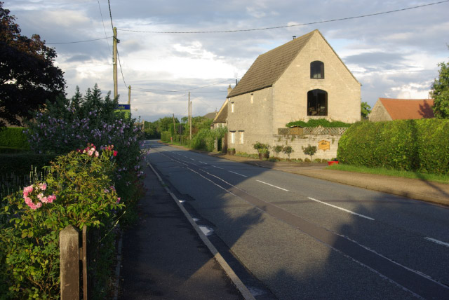
Upper Benefield
Upper Benefield is a linear village along the A427 road in the North Northamptonshire district of Northamptonshire, England. It is part of the civil parish...
Benefield Castle
Benefield Castle was sited in the village of Lower Benefield, between the towns of Corby and Oundle in Northamptonshire at grid reference SP987884. �...
Benefield
Benefield is a civil parish in North Northamptonshire, England, along the A427 road and about 6 miles (9.7 km) east of Corby and 3 miles (4.8 km) west...
Lower Benefield
Lower Benefield is a village on the A427 road in North Northamptonshire, England, near Oundle. It is part of the civil parish of Benefield. The population...
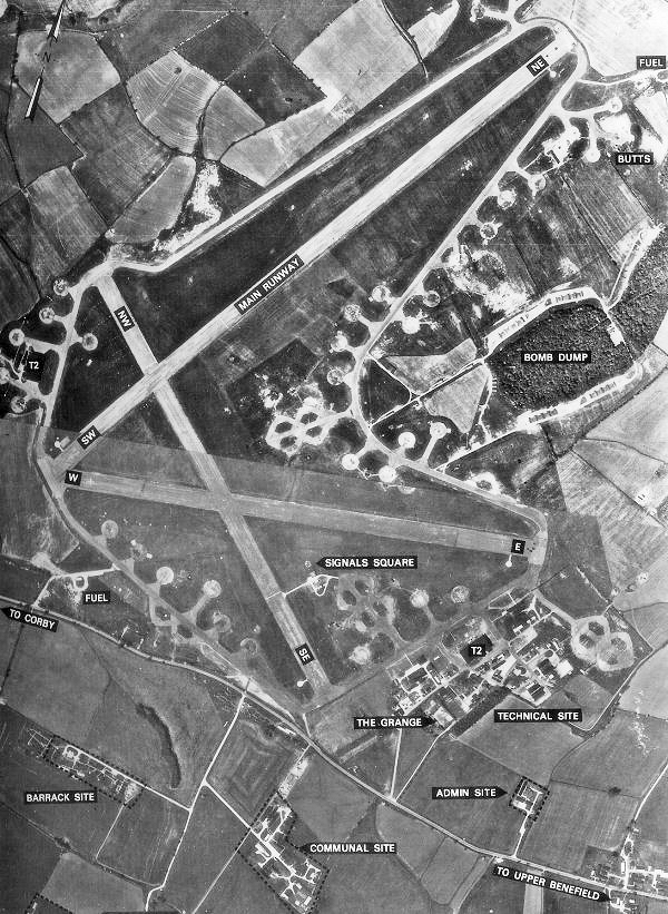
RAF Deenethorpe
Royal Air Force Deenethorpe or more simply RAF Deenethorpe is a former Royal Air Force station located 2 miles (3.2 km) east of Corby, Northamptonshire...
A427 road
The A427 road is a major road in the English Midlands. It connects the Leicestershire town of Market Harborough and the A6 with the Northamptonshire town...
Weldon Park
Weldon Park is a 51.7-hectare (128-acre) biological Site of Special Scientific Interest east of Weldon in Northamptonshire.This ancient woodland is mainly...
Nearby Amenities
Located within 500m of 52.481575,-0.5762535Have you been to Spring Wood?
Leave your review of Spring Wood below (or comments, questions and feedback).