Easter Howgate

Settlement in Midlothian

Scotland

Easter Howgate

Memorial to C.T.R. Wilson, Nobel Prize Winner See <a title="https://www.geograph.org.uk/photo/903255" href="https://www.geograph.org.uk/photo/903255">Link</a>
Memorial to C.T.R. Wilson, Nobel Prize Winner Credit: Becky Williamson

Easter Howgate is a small village located in Midlothian, Scotland. Situated about 7 miles southeast of Edinburgh, it falls within the civil parish of Fala and Soutra. With its picturesque setting and close proximity to the capital city, Easter Howgate offers residents a tranquil and scenic environment while still enjoying easy access to urban amenities.

The village is characterized by its charming traditional cottages, surrounded by rolling hills and lush green fields. It is known for its close-knit community and friendly atmosphere, making it an ideal place for families and those seeking a peaceful rural lifestyle.

Easter Howgate benefits from its strategic location near major transportation routes, such as the A68 road, which connects it to Edinburgh and the wider region. This allows residents to easily commute to the city for work or leisure activities, while also providing convenient access to shopping centers, schools, and other essential services.

Nature enthusiasts will find plenty to explore in the surrounding area, with numerous walking and cycling trails nearby. The beautiful Pentland Hills Regional Park is just a short drive away, offering stunning views and a range of outdoor activities, including hiking, horse riding, and wildlife spotting.

Overall, Easter Howgate offers a harmonious blend of rural charm and modern convenience, making it an attractive place to live for those seeking a peaceful retreat with easy access to urban amenities.

If you have any feedback on the listing, please let us know in the comments section below.

Easter Howgate Images

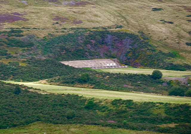
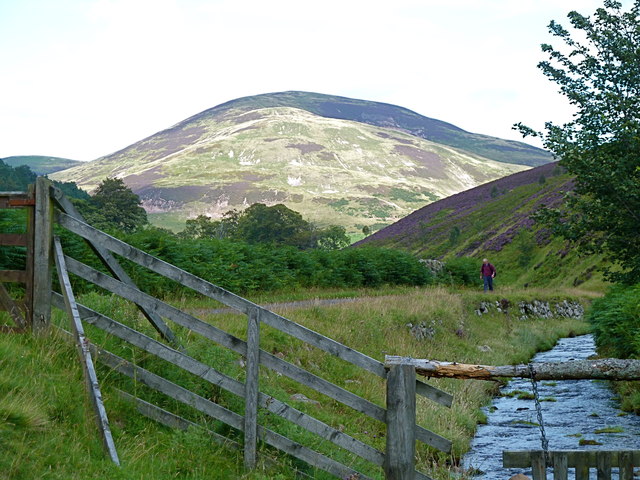
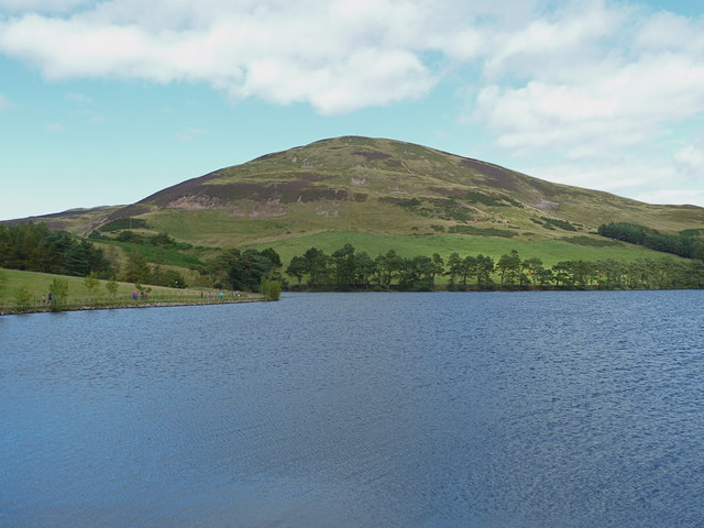
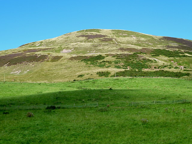
Images are sourced within 2km of 55.863721/-3.213097 or Grid Reference NT2464. Thanks to Geograph Open Source API. All images are credited.

Memorial to C.T.R. Wilson, Nobel Prize Winner See <a title="https://www.geograph.org.uk/photo/903255" href="https://www.geograph.org.uk/photo/903255">Link</a>
Memorial to C.T.R. Wilson, Nobel Prize Winner
See Link
Junction of A703 with A701
Glencorse Kirk This is the west wall of Glencorse kirk, taken from the footpath running alongside a stream.
Glencorse Kirk
This is the west wall of Glencorse kirk, taken from the footpath running alongside a stream.
Glencorse War Memorial Memorial commemorating the fallen.  Army housing in the background.
Glencorse War Memorial
Memorial commemorating the fallen. Army housing in the background.
A Stell This is a representation of a stell built by a dry stone walling group whose name now escapes me.  A stell is a shelter for animals on the hillside.  The full size version would have been bigger with a turf roof.  This one has been constructed with a stone seat for 2 legged visitors.
A Stell
This is a representation of a stell built by a dry stone walling group whose name now escapes me. A stell is a shelter for animals on the hillside. The full size version would have been bigger with a turf roof. This one has been constructed with a stone seat for 2 legged visitors.
Flotterstone Inn The Flotterstone Inn, viewed from the west.  Unfortunately I never got to sample its wares.
Flotterstone Inn
The Flotterstone Inn, viewed from the west. Unfortunately I never got to sample its wares.
Countryside Information Centre - Pentland Hills Unmanned Ranger Station with maps, local information, leaflets and toilets
Countryside Information Centre - Pentland Hills
Unmanned Ranger Station with maps, local information, leaflets and toilets
Memorial plaque to C.T.R.Wilson, physicist Born in the vicinity, at a farm near Glencorse and Easter Howgate.
Memorial plaque to C.T.R.Wilson, physicist
Born in the vicinity, at a farm near Glencorse and Easter Howgate.
Finger post at the start of several Pentland walks
Track to old filter beds plus the route to Scald Law via Turnhouse Hill - seen in the distance.
Track to old filter beds plus the route to Scald Law
via Turnhouse Hill - seen in the distance.
M.O.D. firing range on Castlelaw Hill, Pentlands Taken from the eastern slopes of Turnhouse Hill: the row of targets can be clearly seen below the dark green vegetation.
M.O.D. firing range on Castlelaw Hill, Pentlands
Taken from the eastern slopes of Turnhouse Hill: the row of targets can be clearly seen below the dark green vegetation.
Castlelaw Hill seen from Logan Burn Much of the hill is a restricted area due to regular military training by the M.O.D.
Castlelaw Hill seen from Logan Burn
Much of the hill is a restricted area due to regular military training by the M.O.D.
Glencorse and Castlelaw, Pentlands
Upper slopes of Castlelaw Hill from the south-west Height 488 metres at the summit. The surrounding land is owned by the M.O.D. whose firing ranges are to the south-east of the hillside.
Upper slopes of Castlelaw Hill from the south-west
Height 488 metres at the summit. The surrounding land is owned by the M.O.D. whose firing ranges are to the south-east of the hillside.
Lane (cul-de-sac) to Castlelaw From the A702 - Biggar/Edinburgh main road.
Lane (cul-de-sac) to Castlelaw
From the A702 - Biggar/Edinburgh main road.
Access road to military firing ranges at Castlelaw The red flag gives warning to the general public to beware of M.O.D. operations in progress: these could include ambush drills, blank firing, use of pyrotechnics, unexploded munitions and other hazards.
Access road to military firing ranges at Castlelaw
The red flag gives warning to the general public to beware of M.O.D. operations in progress: these could include ambush drills, blank firing, use of pyrotechnics, unexploded munitions and other hazards.
M.O.D. warning notice at Castlelaw, Pentlands
Unusually elaborate information board, Pentland Hills Detailed map of the Regional Park, drawer of visitor leaflets and even a contour model of the topology (in green, lower tier).
Unusually elaborate information board, Pentland Hills
Detailed map of the Regional Park, drawer of visitor leaflets and even a contour model of the topology (in green, lower tier).
Show me another place!

Easter Howgate is located at Grid Ref: NT2464 (Lat: 55.863721, Lng: -3.213097)

Unitary Authority: Midlothian

Police Authority: The Lothians and Scottish Borders

What 3 Words

///journals.spike.inhabited. Near Bilston, Midlothian

Nearby Locations

Easter Howgate

Related Wikis

Easter Howgate

Easter Howgate is a settlement in Midlothian, Scotland, UK, on the A702, two miles north of Penicuik. The Scottish Agricultural College maintains a teaching...

Royal (Dick) School of Veterinary Studies

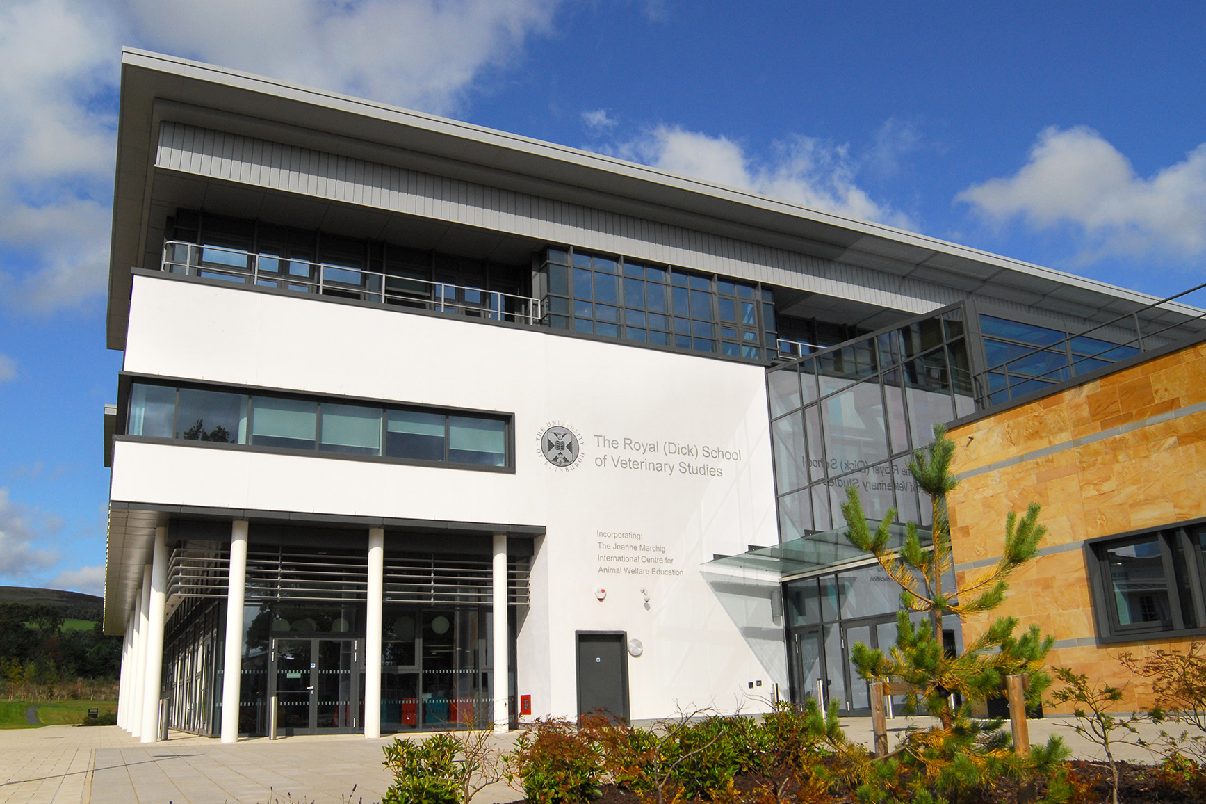
The Royal (Dick) School of Veterinary Studies, commonly referred to as the Dick Vet, is the University of Edinburgh's vet school. It is part of the College...

Roslin Institute

The Roslin Institute is an animal sciences research institute at Easter Bush, Midlothian, Scotland, part of the University of Edinburgh, and is funded...

Castle Law

Castle Law is a hill south west of Fairmilehead in the Pentland Hills in Midlothian, Scotland. It is best known for the Iron Age hill fort on its slopes...

Nearby Amenities

Located within 500m of 55.863721,-3.213097
Woodside Cottages
Place: locality
Source: OS_OpenData_StreetView
Lat/Long: 55.8626988/-3.2076787
Old Woodside Cottages
Place: locality
Source: OS_OpenData_StreetView
Lat/Long: 55.8632401/-3.2075739
Post Box
Brand: Royal Mail
Brand Wikidata: Q638098
Collection Times: Mo-Fr 14:00; Sa 08:30
Mapillary: 1033805403872183
Operator: Royal Mail
Operator Wikidata: Q638098
Post Box Mounting: telegraph_pole
Post Box Type: lamp
Ref: EH26 182
Royal Cypher: scottish_crown
Survey Date: 2021-09-16
Lat/Long: 55.8642387/-3.2133045
Easter Howgate
Place: hamlet
Wikidata: Q5329889
Lat/Long: 55.8645593/-3.2150158
Bus Stop
Fulford House
Bus: yes
Naptan AtcoCode: 6280325460
Naptan Bearing: N
Naptan CommonName: Fulford House
Naptan Indicator: at
Naptan Landmark: -
Naptan NaptanCode: 64323625
Naptan Street: A702
Operator: Stagecoach
Public Transport: platform
Ref: 6280325460
Shelter: yes
Source: NaPTAN
Lat/Long: 55.8679107/-3.2122948
Power: pole
Lat/Long: 55.8679684/-3.2128967
Power: pole
Lat/Long: 55.8607224/-3.2184872
Power: pole
Lat/Long: 55.8606838/-3.2174787
Power: pole
Lat/Long: 55.8606476/-3.2164493
Power: pole
Lat/Long: 55.8609353/-3.2152075
Power: pole
Lat/Long: 55.8617059/-3.2148366
Power: pole
Lat/Long: 55.8624379/-3.2144761
Power: pole
Lat/Long: 55.8628448/-3.2142781
Power: pole
Lat/Long: 55.8628085/-3.2152783
Power: pole
Lat/Long: 55.8632084/-3.2162035
Power: pole
Lat/Long: 55.8678059/-3.2119455
Power: pole
Lat/Long: 55.8669185/-3.2120892
Power: pole
Lat/Long: 55.8661187/-3.2122497
Power: pole
Lat/Long: 55.865637/-3.2111349
Power: pole
Lat/Long: 55.8651646/-3.2100577
Power: pole
Lat/Long: 55.8646654/-3.2089783
Power: pole
Lat/Long: 55.8641556/-3.2078677
Power: pole
Lat/Long: 55.8636504/-3.2067509
Power: pole
Lat/Long: 55.8629103/-3.2065425
Bus Stop
Fulford House
Bus: yes
Naptan AtcoCode: 6280000037
Naptan Bearing: S
Naptan CommonName: Fulford House
Naptan Indicator: opp
Naptan NaptanCode: 64323624
Naptan Street: A702
Operator: Stagecoach
Public Transport: platform
Ref: 6280000037
Shelter: yes
Source: NaPTAN
Lat/Long: 55.8679027/-3.2120873
Bus Stop
Easter Howgate Farm
Bus: yes
Naptan AtcoCode: 6280302210
Naptan Bearing: S
Naptan CommonName: Easter Howgate Farm
Naptan Indicator: opp
Naptan NaptanCode: 64323623
Naptan Street: A702
Operator: Stagecoach
Public Transport: platform
Ref: 6280302210
Shelter: yes
Source: NaPTAN
Lat/Long: 55.8633283/-3.2131293
Bus Stop
Easter Howgate Farm
Bus: yes
Naptan AtcoCode: 6280000036
Naptan Bearing: N
Naptan CommonName: Easter Howgate Farm
Naptan Indicator: at
Naptan NaptanCode: 64323598
Naptan Street: A702
Operator: Stagecoach
Public Transport: platform
Ref: 6280000036
Source: NaPTAN
Lat/Long: 55.8633104/-3.2133361
The data included in this document is from www.openstreetmap.org. The data is made available under ODbL.

Have you been to Easter Howgate?

Leave your review of Easter Howgate below (or comments, questions and feedback).