Horse Shoe Clump

Wood, Forest in Berkshire

England

Horse Shoe Clump

Dorian Drive A road leading to Green Lane off Watersplash Lane. To the left are road markings for Cheapside C of E Primary School.
Dorian Drive Credit: Oscar

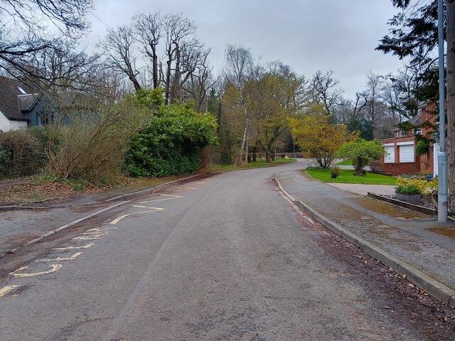
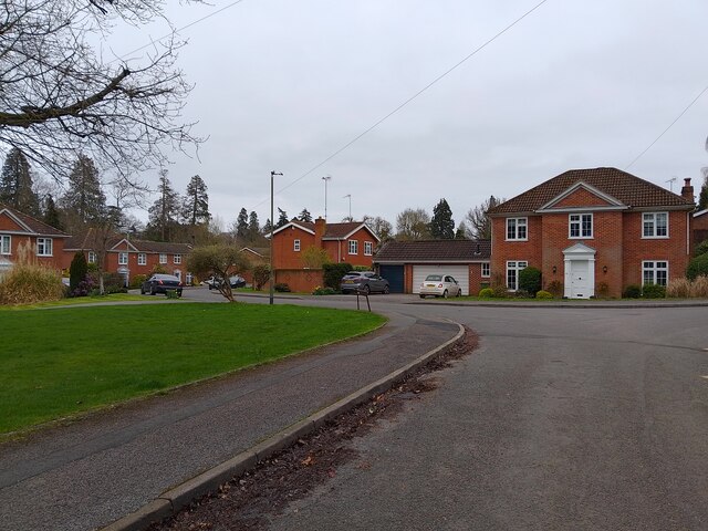
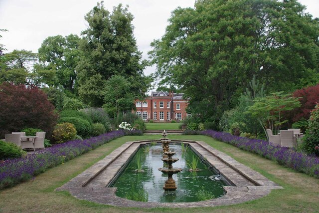
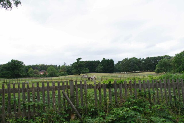
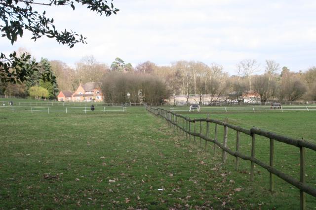
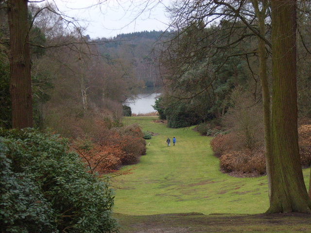
Horse Shoe Clump is a picturesque woodland area located in Berkshire, England. Situated within the larger Windsor Great Park, this charming forested area covers approximately 16 acres of land. The name "Horse Shoe Clump" is derived from the distinctive shape of the woodland, which resembles the curve of a horseshoe.

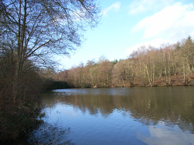
The forest is predominantly composed of a mixture of broadleaf trees, including oak, beech, and chestnut. These majestic trees create a dense canopy that provides shade and shelter for a variety of wildlife. The forest floor is covered in a carpet of lush green vegetation and dotted with wildflowers during the spring and summer months.

Horse Shoe Clump is renowned for its tranquil and serene atmosphere, attracting visitors who seek solace in nature's beauty. The sound of birdsong fills the air, with species such as woodpeckers, thrushes, and tits commonly spotted among the trees. Squirrels and rabbits can also be seen darting through the undergrowth.

The forest is crisscrossed by a network of well-maintained footpaths and trails, allowing visitors to explore its enchanting surroundings. These paths wind through the woods, offering glimpses of small streams and ponds along the way. Horse Shoe Clump is a popular spot for hiking, nature walks, and picnicking.

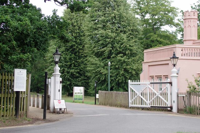
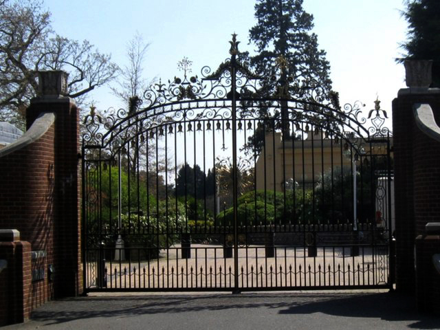
Managed by the Crown Estate, Horse Shoe Clump is a cherished natural asset within the Windsor Great Park. It provides a haven for both wildlife and visitors alike, offering a peaceful retreat from the hustle and bustle of daily life. Whether one seeks a leisurely stroll, a moment of reflection, or an opportunity to immerse in nature's embrace, Horse Shoe Clump is an idyllic destination to experience the beauty of Berkshire's woodlands.

If you have any feedback on the listing, please let us know in the comments section below.

Horse Shoe Clump Images

Images are sourced within 2km of 51.421185/-0.62336651 or Grid Reference SU9570. Thanks to Geograph Open Source API. All images are credited.

Dorian Drive A road leading to Green Lane off Watersplash Lane. To the left are road markings for Cheapside C of E Primary School.
Dorian Drive
A road leading to Green Lane off Watersplash Lane. To the left are road markings for Cheapside C of E Primary School.
Dorian Drive A road leading to Green Lane off Watersplash Lane. The houses are all in a typical Ascot style, but not particularly large.
Dorian Drive
A road leading to Green Lane off Watersplash Lane. The houses are all in a typical Ascot style, but not particularly large.
Royal Berkshire Hotel Once owned by the Spencer Family (Winston Spencer Churchill) the building was later  used as a School for the blind and since the early 1970's has been a hotel. An ideal billet for the  Ascot races or Sunningdale Golf.
Royal Berkshire Hotel
Once owned by the Spencer Family (Winston Spencer Churchill) the building was later used as a School for the blind and since the early 1970's has been a hotel. An ideal billet for the Ascot races or Sunningdale Golf.
Walled Garden for The Oaks The Oaks was the name of Charles Churchill's 1705 mansion. Now the <a href="https://www.geograph.org.uk/photo/7542840">SU9468 : Royal Berkshire Hotel</a>
Walled Garden for The Oaks
The Oaks was the name of Charles Churchill's 1705 mansion. Now the SU9468 : Royal Berkshire Hotel
Gates to a Walled Garden These days more a walled lawn than a garden. You can see a recreation of what  the eighteenth century gardens may have looked like at <a href="https://www.geograph.org.uk/photo/7542843">SU9468 : Walled Garden for The Oaks</a>
Gates to a Walled Garden
These days more a walled lawn than a garden. You can see a recreation of what the eighteenth century gardens may have looked like at SU9468 : Walled Garden for The Oaks
Sadly Not Longer a Fish Pond I am fairly sure a combination of Herons and a bloom of  blue green algae have put paid to any fish that lived in the pond of the <a href="https://www.geograph.org.uk/photo/7542840">SU9468 : Royal Berkshire Hotel</a>.
Sadly Not Longer a Fish Pond
I am fairly sure a combination of Herons and a bloom of blue green algae have put paid to any fish that lived in the pond of the SU9468 : Royal Berkshire Hotel.
The Way to Cheapside Cheap? Round here who's kidding whom? The left-hand fork leads to <a href="https://www.geograph.org.uk/photo/7542859">SU9568 : Charles III's Back Garden Gate</a>. The building at the fork is the Bluebells restaurant; sadly, I didn't get a chance to try the fayre  <span class="nowrap"><a title="https://bluebells-restaurant.co.uk" rel="nofollow ugc noopener" href="https://bluebells-restaurant.co.uk">Link</a><img style="margin-left:2px;" alt="External link" title="External link - shift click to open in new window" src="https://s1.geograph.org.uk/img/external.png" width="10" height="10"/></span>.
The Way to Cheapside
Cheap? Round here who's kidding whom? The left-hand fork leads to SU9568 : Charles III's Back Garden Gate. The building at the fork is the Bluebells restaurant; sadly, I didn't get a chance to try the fayre LinkExternal link.
Charles III's Back Garden Gate The automatic gates to the grounds of Charlie's dacha in Windsor. They are normally closed 
see <a href="https://www.geograph.org.uk/photo/6385571">SU9568 : Blacknest Gate and Lodge</a>
Charles III's Back Garden Gate
The automatic gates to the grounds of Charlie's dacha in Windsor. They are normally closed see SU9568 : Blacknest Gate and Lodge
Paddocks by the London Road I have a feeling these may be polo ponies.
Paddocks by the London Road
I have a feeling these may be polo ponies.
Old Milestone by the A329 and B383 in Sunninghill
Tittenhurst A view looking north over Titness Park.
Tittenhurst
A view looking north over Titness Park.
Cheapside
Cheapside
The western end of Virginia Water
The Polo Centre On the A329 near Blacknest
The Polo Centre
On the A329 near Blacknest
Johnson's Pond, Windsor Great Park A small waterfall connects this to Virginia Water.
Johnson's Pond, Windsor Great Park
A small waterfall connects this to Virginia Water.
The Valley Gardens, Windsor Great Park The view from a gazebo in the gardens down to Virginia Water.
The Valley Gardens, Windsor Great Park
The view from a gazebo in the gardens down to Virginia Water.
Sunninghill Road, Cheapside
Show me another place!

Horse Shoe Clump is located at Grid Ref: SU9570 (Lat: 51.421185, Lng: -0.62336651)

Unitary Authority: Windsor and Maidenhead

Police Authority: Thames Valley

What 3 Words

///spoken.notes.deaf. Near Sunningdale, Berkshire

Related Wikis

Valley Gardens

The Valley Gardens are 220 acres (0.89 km2) of woodland garden, part of the Crown Estate located near Englefield Green in the English county of Surrey...

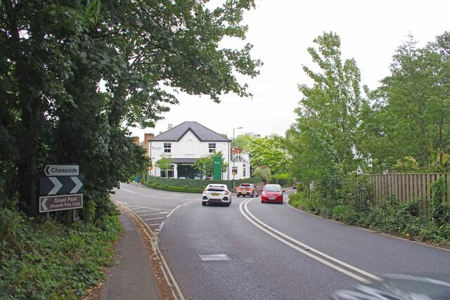
Cheapside, Berkshire

Cheapside describes a close triangle of roads in the civil parish of Sunninghill and Ascot and ecclesiastical parish of Sunninghill in the Royal Borough...

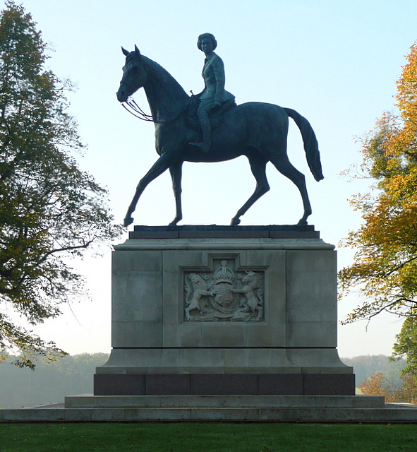
Equestrian statue of Elizabeth II, Windsor Great Park

An equestrian statue of Elizabeth II stands in Windsor Great Park near Windsor, Berkshire. The statue, designed by sculptor Philip Jackson, was commissioned...

Cumberland Lodge

Cumberland Lodge is a 17th-century Grade II listed country house in Windsor Great Park 3.5 miles south of Windsor Castle. Since 1947 it has been occupied...

Tittenhurst Park

Tittenhurst Park is a Grade II listed early Georgian country house set in 72 acres (29 hectares) off London Road at Beggar's Bush near Ascot and over...
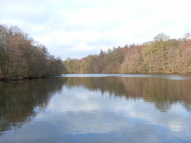
Virginia Water Lake

Virginia Water Lake lies on the southern edge of Windsor Great Park, in the borough of Runnymede in Surrey and the civil parishes of Old Windsor and Sunningdale...

IPARC

The International Pesticide Application Research Consortium (IPARC), previously the International Pesticide Application Research Centre and before that...

Silwood Park

Silwood Park is the rural campus of Imperial College London, England. It is situated near the village of Sunninghill, near Ascot in Berkshire. Since 1986...

Nearby Amenities

Located within 500m of 51.421185,-0.62336651
Norfolk Farm
Naptan AtcoCode: 036006001402
Naptan Bearing: E
Naptan BusStopType: CUS
Naptan CommonName: Norfolk Farm
Naptan Indicator: adj
Naptan Landmark: Mill Covert
Naptan NaptanCode: winadpw
Naptan Street: Norfolk Plantation
Naptan Verified: no
Source: naptan_import
Lat/Long: 51.42322/-0.61785
Long Plantation
Natural: wood
Lat/Long: 51.4183894/-0.6207161
Horse Shoe Clump
Place: locality
Lat/Long: 51.4212051/-0.6234603
Manorhill Cottages
Place: isolated_dwelling
Lat/Long: 51.4176006/-0.6254591
Norfolk Farm Cottages
Place: isolated_dwelling
Lat/Long: 51.4219196/-0.6184087
The data included in this document is from www.openstreetmap.org. The data is made available under ODbL.

Have you been to Horse Shoe Clump?

Leave your review of Horse Shoe Clump below (or comments, questions and feedback).