Lodgefield Little Copse

Wood, Forest in Sussex Chichester

England

Lodgefield Little Copse

Interior of St Laurence's Church, Lurgashall
Interior of St Laurence's Church, Lurgashall Credit: Ian Cunliffe

Lodgefield Little Copse is a charming woodland area located in Sussex, England. Spread across a modest area, the copse is known for its serene and peaceful atmosphere, making it a popular destination for nature enthusiasts and hikers alike.

The copse is primarily composed of various species of trees, including oak, beech, and birch. These trees create a dense canopy, providing shade and shelter to the diverse range of flora and fauna that call the copse their home. The forest floor is covered in a thick layer of fallen leaves and moss, adding to the natural beauty of the woodland.

Visitors to Lodgefield Little Copse can expect to encounter a variety of wildlife. The copse is known to be inhabited by a plethora of bird species, including woodpeckers, owls, and various songbirds. Additionally, small mammals such as squirrels and rabbits are often spotted scurrying around the undergrowth.

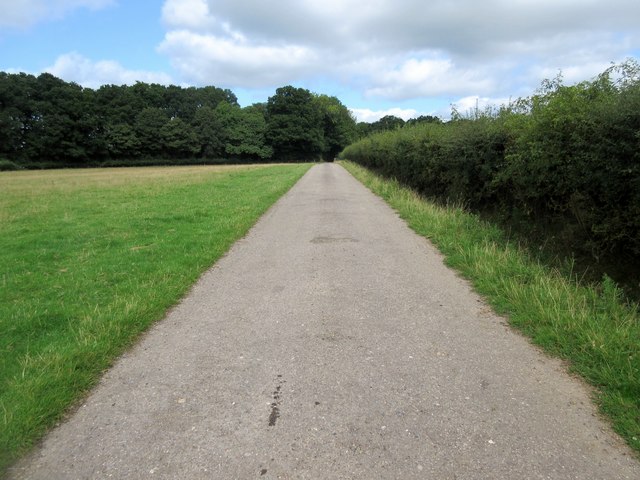
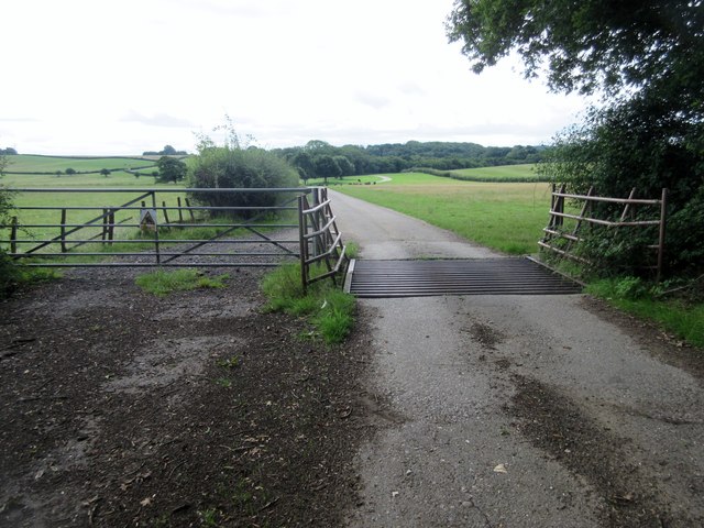
A network of well-maintained trails and footpaths wind through the copse, allowing visitors to explore the area easily. These paths lead to picturesque spots, including a small stream that flows through the copse, providing a tranquil setting for a picnic or a moment of reflection.

Lodgefield Little Copse is a haven for nature lovers, providing a peaceful retreat away from the hustle and bustle of everyday life. Its natural beauty and diverse array of wildlife make it a must-visit destination for those seeking to immerse themselves in the serenity of the Sussex countryside.

If you have any feedback on the listing, please let us know in the comments section below.

Lodgefield Little Copse Images

Images are sourced within 2km of 51.035038/-0.6362081 or Grid Reference SU9527. Thanks to Geograph Open Source API. All images are credited.

Interior of St Laurence's Church, Lurgashall
Altar cloth - St Laurence's Church, Lurgashall
Old Milestone, Northchapel On the wall of a layby, a loop off the A283, the original part of the road. The original milestone this would have been on was erected by the Petworth Turnpike Trust in the 19ᵗʰ Century.

Inscription: London / 46 / Petworth / 3

Milestone Society National ID: SX_LMP46
Old Milestone, Northchapel
On the wall of a layby, a loop off the A283, the original part of the road. The original milestone this would have been on was erected by the Petworth Turnpike Trust in the 19ᵗʰ Century. Inscription: London / 46 / Petworth / 3 Milestone Society National ID: SX_LMP46
Field by Chillinghurst Copse
Hedgerow east of lane
Gatehouse Copse Apparently named after the lodge on the other side of the road off to the right at an entrance to the walled part of the Petworth estate.
Gatehouse Copse
Apparently named after the lodge on the other side of the road off to the right at an entrance to the walled part of the Petworth estate.
Streel's Lane (1)
Streel's Lane (1)
Streel's Lane (2)
Streel's Lane (2)
Streel's Lane (3)
Streel's Lane (3)
Streel's Lane (4)
Streel's Lane (4)
Streel's Lane (5)
Streel's Lane (5)
Footpath to Ebernoe Public footpath 583.
Footpath to Ebernoe
Public footpath 583.
Estate road to Hilltop Barn  Public footpath 655.
Estate road to Hilltop Barn
Public footpath 655.
Cattle across footpath The Petworth Heard of Sussex Cattle including bull, cows and calves by public footpath 655.
Cattle across footpath
The Petworth Heard of Sussex Cattle including bull, cows and calves by public footpath 655.
Route to Chillinghurst Plantations Public footpath 655 on farm road.
Route to Chillinghurst Plantations
Public footpath 655 on farm road.
Oak trees by track Track to Benefold Copse
Oak trees by track
Track to Benefold Copse
Gate and cattle grid Beware of the bull sign on public footpath 655. The Petworth Heard of Sussex Cattle can be seen grazing in the distance.
Gate and cattle grid
Beware of the bull sign on public footpath 655. The Petworth Heard of Sussex Cattle can be seen grazing in the distance.
Grazing land For the Petworth Heard of Sussex Cattle from Stagpark Farm.
Grazing land
For the Petworth Heard of Sussex Cattle from Stagpark Farm.
Show me another place!

Lodgefield Little Copse is located at Grid Ref: SU9527 (Lat: 51.035038, Lng: -0.6362081)

Administrative County: West Sussex

District: Chichester

Police Authority: Sussex

What 3 Words

///flicked.parsnip.rosette. Near Petworth, West Sussex

Related Wikis

Ebernoe Common

Ebernoe Common is a 233.9-hectare (578-acre) biological Site of Special Scientific Interest in Ebernoe, north of Petworth in West Sussex. It is a Nature...

Ebernoe

Ebernoe is a hamlet and civil parish in the District of Chichester in West Sussex, England, and 4 miles (6 km) north of Petworth near the A283 road. The...

Ebernoe Horn Fair

Ebernoe Horn Fair is held in the small Sussex village of Ebernoe, the location of which is about five miles north of Petworth (grid reference SU975280...

Lurgashall

Lurgashall is a village and civil parish in the Chichester district of West Sussex, England, 6.5 km (4 ml) north west of Petworth, just inside the South...

Northchapel

Northchapel is a village and civil parish in Chichester District in West Sussex, England. It stands on the A283 road just south of the Surrey border, around...

Balls Cross

Balls Cross is a hamlet in Ebernoe civil parish in the Chichester District of West Sussex, England.The hamlet comprises a few houses together with a small...

Petworth (electoral division)

Petworth is an electoral division of West Sussex in the United Kingdom, and returns one member to sit on West Sussex County Council. == Extent == The division...

Pitshill

Pitshill is a Grade II* listed house built in the neoclassical style and is located within the Parish of Tillington a couple of miles west of Petworth...

Nearby Amenities

Located within 500m of 51.035038,-0.6362081
Ebernoe Turn
Naptan AtcoCode: 4400MO0177
Naptan Bearing: SE
Naptan BusStopType: CUS
Naptan CommonName: Ebernoe Turn
Naptan Indicator: opp Kentfield's Lodge
Naptan Landmark: Kentfield's Lodge
Naptan NaptanCode: wsxdjatd
Naptan Street: A283
Naptan Verified: no
Source: naptan_import
Lat/Long: 51.0359961/-0.6363637
Ebernoe Turn
Naptan AtcoCode: 4400MO0178
Naptan Bearing: NW
Naptan BusStopType: CUS
Naptan CommonName: Ebernoe Turn
Naptan Indicator: adj Kentfield's Lodge
Naptan Landmark: Streels Lane
Naptan NaptanCode: wsxdjatg
Naptan Street: A283
Naptan Verified: no
Source: naptan_import
Lat/Long: 51.0359905/-0.6366491
A283
Naptan AtcoCode: 4400MO0575
Naptan Bearing: SE
Naptan BusStopType: CUS
Naptan CommonName: A283
Naptan Indicator: HAR
Naptan Landmark: Hail & Ride
Naptan NaptanCode: wsxgdmpj
Naptan Street: A283
Naptan Verified: no
Source: naptan_import
Lat/Long: 51.0325694/-0.6324851
A283
Naptan AtcoCode: 4400MO0576
Naptan Bearing: NW
Naptan BusStopType: CUS
Naptan CommonName: A283
Naptan Indicator: HAR
Naptan Landmark: Hail & Ride
Naptan NaptanCode: wsxgdmpm
Naptan Street: A283
Naptan Verified: no
Source: naptan_import
Lat/Long: 51.0324459/-0.6326885
Give Way
Direction: backward
Lat/Long: 51.036134/-0.6365621
Post Box
Collection Plate: not visible
Collection Times: Mo-Fr 16:00; Sa 09:30
Last Checked: 2020-03-06
Operator: Royal Mail
Post Box Type: wall
Ref: GU28 35
Royal Cypher: VR
Royal Cypher Wikidata: Q33102356
Lat/Long: 51.0359204/-0.6364973
Barrier: stile
Lat/Long: 51.0368667/-0.6316422
Barrier: stile
Lat/Long: 51.0382679/-0.6334433
Power: pole
Source: Bing
Lat/Long: 51.0383614/-0.6318853
Power: pole
Source: Bing
Lat/Long: 51.0372685/-0.637813
Power: pole
Source: Bing
Lat/Long: 51.0374844/-0.6403289
The data included in this document is from www.openstreetmap.org. The data is made available under ODbL.

Have you been to Lodgefield Little Copse?

Leave your review of Lodgefield Little Copse below (or comments, questions and feedback).