Ash Copse

Wood, Forest in Sussex Chichester

England

Ash Copse

Lavington Lizard The stone lizard statue at Lavington Common.
Lavington Lizard Credit: Chris Thomas-Atkin

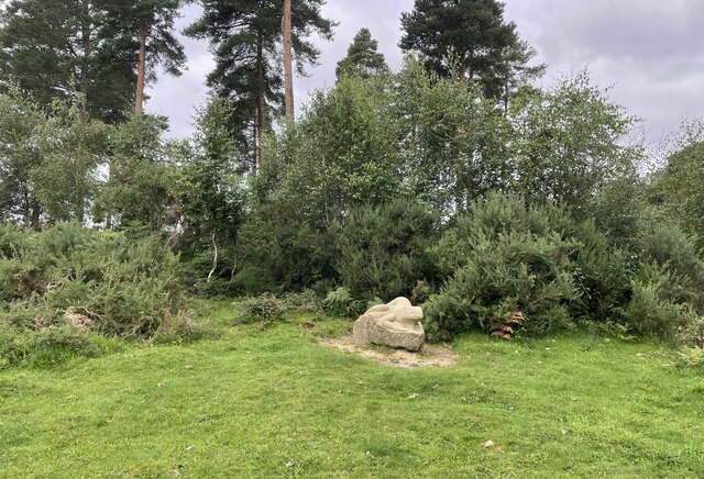
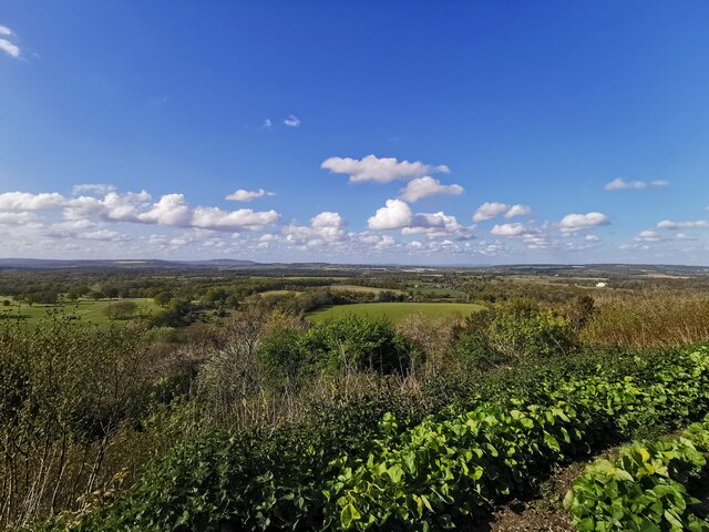
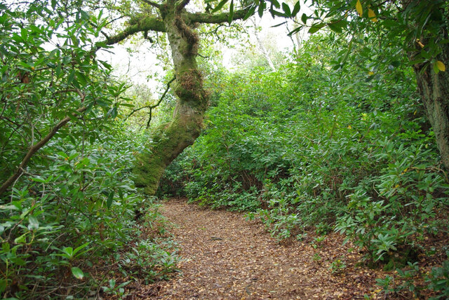
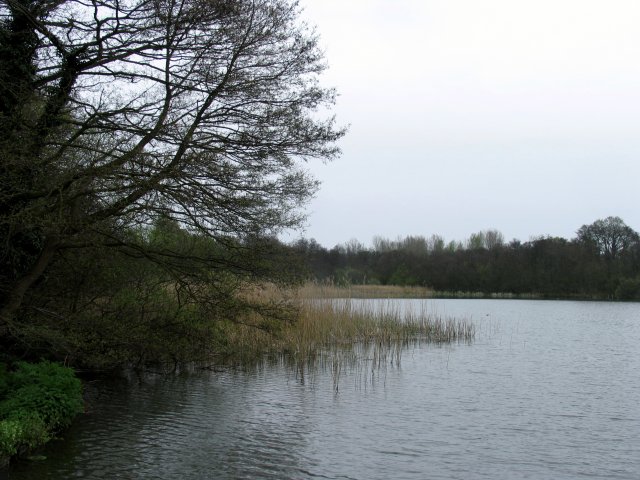
Ash Copse is a woodland area located in Sussex, England. Covering an approximate area of several acres, it is known for its dense growth of ash trees, hence the name "Ash Copse." The copse is situated within the South Downs National Park, which is renowned for its scenic landscapes and diverse wildlife.

The woodland is characterized by a mixture of mature ash trees, interspersed with other native tree species such as oak, beech, and birch. The canopy formed by these trees provides a shaded and cool environment, making it an ideal habitat for a variety of flora and fauna.

Walking through Ash Copse, visitors will be greeted by a lush undergrowth, consisting of wildflowers, ferns, and mosses. The forest floor is covered in a thick carpet of fallen leaves and decomposing plant matter, contributing to the rich and fertile soil.

The copse is home to a wide range of wildlife, including various bird species such as woodpeckers, owls, and thrushes. Mammals such as deer, foxes, and squirrels can also be spotted within the woodland.

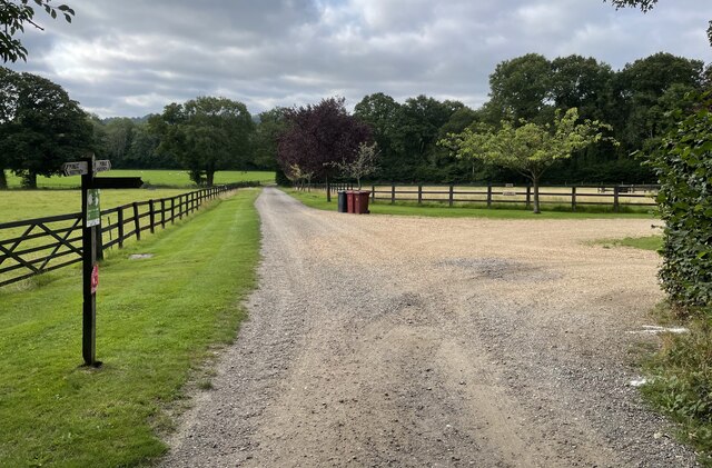
Ash Copse offers a tranquil and peaceful setting, attracting nature enthusiasts, hikers, and photographers. There are several walking trails that wind through the woodland, allowing visitors to explore its beauty and enjoy the sights and sounds of nature.

Overall, Ash Copse is a natural gem within Sussex, providing a haven for both flora and fauna, and offering a serene escape from the hustle and bustle of everyday life.

If you have any feedback on the listing, please let us know in the comments section below.

Ash Copse Images

Images are sourced within 2km of 50.946775/-0.63940437 or Grid Reference SU9517. Thanks to Geograph Open Source API. All images are credited.
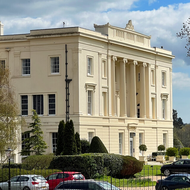
Lavington Lizard The stone lizard statue at Lavington Common.
Lavington Lizard
The stone lizard statue at Lavington Common.
Path junction A path junction near Upperbarn House. The public footpath leading off to the right passes through Brook’s Copse to join Norwood Lane.
Path junction
A path junction near Upperbarn House. The public footpath leading off to the right passes through Brook’s Copse to join Norwood Lane.
Paths near Upper Norwood On the outskirts of Upper Norwood a bridleway heads towards the farm whilst a public footpath leads off to the left towards Seaford College.
Paths near Upper Norwood
On the outskirts of Upper Norwood a bridleway heads towards the farm whilst a public footpath leads off to the left towards Seaford College.
Gateway with a view An open gate to fields beside the public footpath. The spot provides a view of the wooded flanks of the South Downs ahead.
Gateway with a view
An open gate to fields beside the public footpath. The spot provides a view of the wooded flanks of the South Downs ahead.
Seaford College Looking towards the college from Wallace Square.
Seaford College
Looking towards the college from Wallace Square.
View from Duncton Hill View Point
Burton House Originally built in 1831 as a private residence for Henry Bassett, Burton Park [House] served for many years as a girl's school - St Michael's. The mansion, like many others in West Sussex, has been converted into luxury housing. Many of the grandest rooms in the building are now incorporated into spectacular apartments - and a cluster of very attractive houses have been built to the north and east of the building. [taken from WestSussex.info]
Burton House
Originally built in 1831 as a private residence for Henry Bassett, Burton Park [House] served for many years as a girl's school - St Michael's. The mansion, like many others in West Sussex, has been converted into luxury housing. Many of the grandest rooms in the building are now incorporated into spectacular apartments - and a cluster of very attractive houses have been built to the north and east of the building. [taken from WestSussex.info]
Gnarled tree trunk There are several of these trees hereabouts, with trunks of huge girth - maybe 3-4 metres in diameter. I think they may be sweet chestnuts.
Gnarled tree trunk
There are several of these trees hereabouts, with trunks of huge girth - maybe 3-4 metres in diameter. I think they may be sweet chestnuts.
Burton House I've taken photographs of this house before - but maybe not from exactly this angle!
Burton House
I've taken photographs of this house before - but maybe not from exactly this angle!
Footbridge, Lavington Common On a National Trust circular walk.  One of two similar bridges on the walk, which follows the stream valley on the outward part. This section is mostly through an overgrown rhododendron thicket, and so of limited interest.
Footbridge, Lavington Common
On a National Trust circular walk. One of two similar bridges on the walk, which follows the stream valley on the outward part. This section is mostly through an overgrown rhododendron thicket, and so of limited interest.
Lavington Common circular walk This section is mostly through an overgrown rhododendron thicket, and so of limited interest.
Lavington Common circular walk
This section is mostly through an overgrown rhododendron thicket, and so of limited interest.
Lavington Common circular walk This section is mostly through an overgrown rhododendron thicket, and so of limited interest.
Lavington Common circular walk
This section is mostly through an overgrown rhododendron thicket, and so of limited interest.
Lavington Common circular walk This section is mostly through an overgrown rhododendron thicket, and so of limited interest.
Lavington Common circular walk
This section is mostly through an overgrown rhododendron thicket, and so of limited interest.
Public footpath 672/2, East Lavington and Duncton At the parish boundary, Duncton being the near side of the barrier.
Public footpath 672/2, East Lavington and Duncton
At the parish boundary, Duncton being the near side of the barrier.
Public footpath 672/2, Petworth After coming across Duncton Common, just into Petworth parish.
Public footpath 672/2, Petworth
After coming across Duncton Common, just into Petworth parish.
Path junction, Duncton Common Strictly speaking, in Petworth parish. Bridleway 671 goes straight on, footpath 672/2 forks left.
Path junction, Duncton Common
Strictly speaking, in Petworth parish. Bridleway 671 goes straight on, footpath 672/2 forks left.
Path, Kilsham Copse Bridleway 671, Petworth, used by the Serpent Trail.
Path, Kilsham Copse
Bridleway 671, Petworth, used by the Serpent Trail.
Private paths, Kilsham Copse Off bridleway 671, Petworth.
Private paths, Kilsham Copse
Off bridleway 671, Petworth.
Show me another place!

Ash Copse is located at Grid Ref: SU9517 (Lat: 50.946775, Lng: -0.63940437)

Administrative County: West Sussex

District: Chichester

Police Authority: Sussex

What 3 Words

///furniture.sprinter.occupiers. Near Petworth, West Sussex

Related Wikis

Duncton

Duncton is a village and civil parish in the District of Chichester in West Sussex, England. The village is in the South Downs 3 miles (5 km) south of...

Burton Park

Burton Park is a 19th-century country house in the civil parish of Duncton in West Sussex, and is situated 1/2 a mile to the east of the village of Duncton...

East Lavington

East Lavington, formerly Woolavington, is a village and civil parish in the District of Chichester in West Sussex, England. It is located six kilometres...
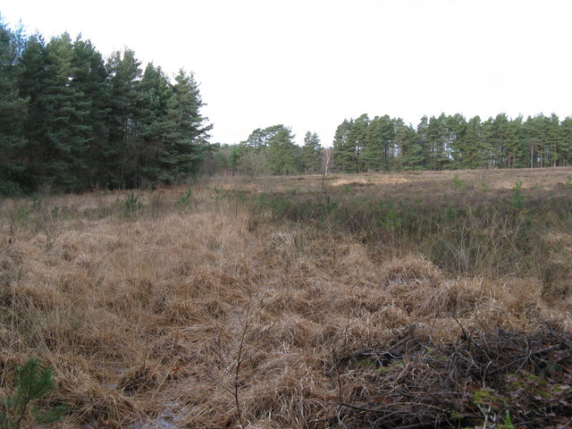
Lavington Common

Lavington Common is a 31.2-hectare (77-acre) biological Site of Special Scientific Interest south-west of Petworth in West Sussex. It is a National Trust...

Barlavington

Barlavington is a small village and civil parish in the Chichester district of West Sussex, England. The village is situated about four miles (6.4 km)...

Burton Park SSSI

Burton Park SSSI is a 57.7-hectare (143-acre) biological Site of Special Scientific Interest west of Pulborough in West Sussex. A larger area of 63 hectares...

Petworth railway station

Petworth railway station was a railway station nearly two miles (3 km) from the town of Petworth in West Sussex, England. It was located on the former...

Coultershaw Wharf and Beam Pump

Coultershaw Bridge is a rural community situated 1.5 mi (2.4 km) south of the town Petworth in West Sussex, England where the A285 road from Petworth to...

Nearby Amenities

Located within 500m of 50.946775,-0.63940437
Duncton
Is In: West Sussex, England, UK
Place: village
Source: npe
Lat/Long: 50.9467289/-0.6345459
Bus Stop
Burton Park
Bus: yes
Naptan AtcoCode: 4400MO0058
Naptan Bearing: S
Naptan CommonName: Burton Park
Naptan Indicator: Burton Park
Naptan Landmark: adj Burton Park
Naptan NaptanCode: wsxdgtgm
Naptan Street: Duncton High Street
Naptan Verified: no
Public Transport: platform
Source: naptan_import
Lat/Long: 50.9463132/-0.6344485
Bus Stop
Burton Park
Bus: yes
Naptan AtcoCode: 4400MO0059
Naptan Bearing: N
Naptan CommonName: Burton Park
Naptan Indicator: Willett Close
Naptan Landmark: adj Willett Close
Naptan NaptanCode: wsxdgtgp
Naptan Street: Duncton High Street
Naptan Verified: no
Public Transport: platform
Source: naptan_import
Lat/Long: 50.9469359/-0.6346295
Bus Stop
Seaford College
Bus: yes
Naptan AtcoCode: 4400MO0247
Naptan Bearing: N
Naptan BusStopType: CUS
Naptan CommonName: Seaford College
Naptan Indicator: adj Track to College
Naptan Landmark: Duncton
Naptan NaptanCode: wsxdjgap
Naptan Street: Seaford College
Naptan Verified: no
Public Transport: platform
Source: naptan_import
Lat/Long: 50.9436144/-0.6389972
Bus Stop
The Cricketers PH
Bus: yes
Naptan AtcoCode: 4400MO0248
Naptan Bearing: SW
Naptan BusStopType: CUS
Naptan CommonName: The Cricketers PH
Naptan Indicator: o/s pub
Naptan Landmark: Duncton High Street
Naptan NaptanCode: wsxdjgat
Naptan Street: The Cricketers PH
Naptan Verified: no
Public Transport: platform
Source: naptan_import
Lat/Long: 50.944445/-0.6354142
Barrier: stile
Lat/Long: 50.9433778/-0.634895
Barrier: stile
Lat/Long: 50.9440758/-0.635491
Barrier: kissing_gate
Lat/Long: 50.9430521/-0.6368157
Barrier: stile
Lat/Long: 50.9439583/-0.6368412
Barrier: stile
Lat/Long: 50.9468384/-0.6366507
Post Box
Collection Plate: CP7
Collection Times: Mo-Fr 16:15; Sa 10:00
Operator: Royal Mail
Post Box Type: lamp
Ref: GU28 3
Royal Cypher: EIIR
Royal Cypher Wikidata: Q33102113
Lat/Long: 50.946952/-0.6345538
Man Made: tower
Lat/Long: 50.9471692/-0.6405166
Drinking Water
Access: permissive
Bottle: yes
Drinking Water: yes
Fee: no
Man Made: water_tap
Lat/Long: 50.9492347/-0.6338834
Defibrillator
Defibrillator Location: In the bus shelter.
Emergency: defibrillator
Indoor: no
Source: survey
Survey Point: 2022-08-25
Lat/Long: 50.9469158/-0.6346135
The data included in this document is from www.openstreetmap.org. The data is made available under ODbL.

Have you been to Ash Copse?

Leave your review of Ash Copse below (or comments, questions and feedback).