South Copse

Wood, Forest in Sussex Chichester

England

South Copse

Bridleway at Selham Common Approaching the road on bridleway number 981.
Bridleway at Selham Common Credit: Chris Thomas-Atkin

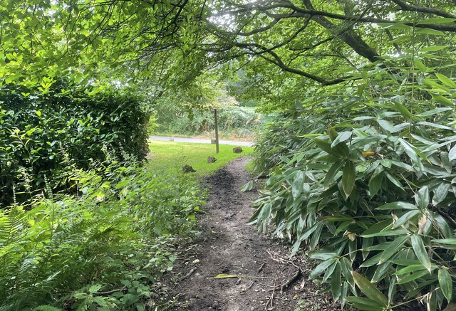
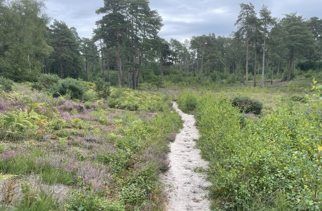
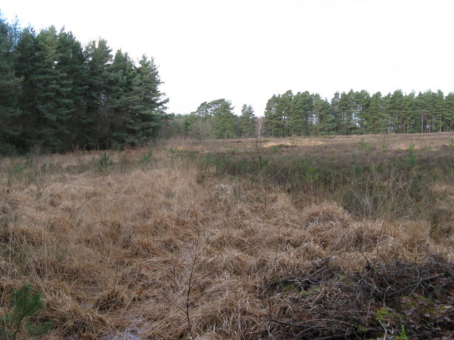
South Copse is a picturesque woodland located in the county of Sussex, England. Situated in the southern part of the region, this forested area covers a vast expanse of approximately 100 acres. The copse is characterized by its dense and diverse collection of trees, creating a lush and verdant environment.

The woodland is home to a variety of tree species, including oak, beech, birch, and pine, which contribute to the rich biodiversity of the area. The forest floor is adorned with a carpet of bluebells and wildflowers during the spring, providing a stunning display of colors.

South Copse is a haven for wildlife, serving as a sanctuary for numerous species. Birdwatchers will delight in the abundance of avian life, with sightings of woodpeckers, owls, and various songbirds being common. Additionally, the woodland is home to mammals such as deer, foxes, and rabbits, which can often be spotted amidst the trees.

The copse offers an idyllic setting for nature enthusiasts and hikers, with a network of well-maintained trails that wind through the forest. These paths allow visitors to explore the woodland at their own pace, offering opportunities for peaceful walks and birdwatching.

South Copse is a cherished natural treasure in Sussex, attracting visitors throughout the year. Its tranquil and unspoiled beauty, combined with its abundant wildlife, make it a must-visit destination for those seeking a connection with nature in the heart of the English countryside.

If you have any feedback on the listing, please let us know in the comments section below.
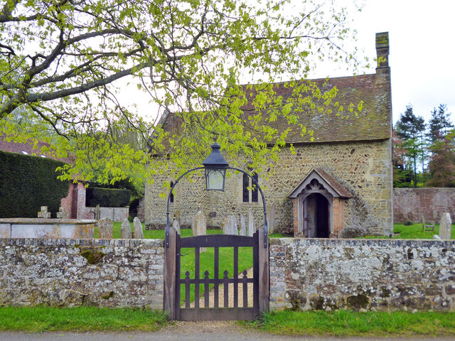
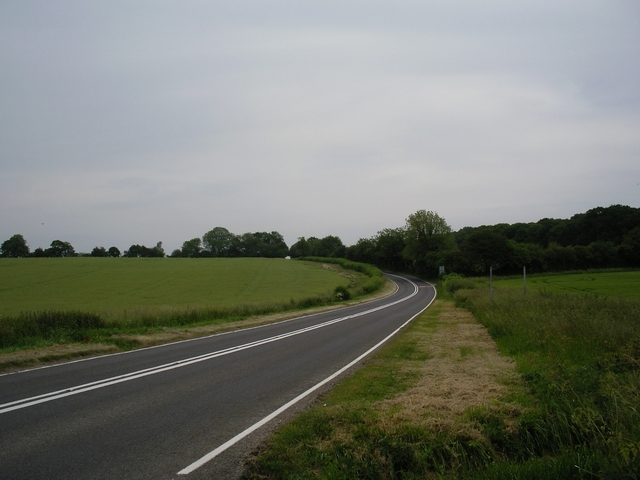
South Copse Images

Images are sourced within 2km of 50.978032/-0.65552799 or Grid Reference SU9420. Thanks to Geograph Open Source API. All images are credited.

Bridleway at Selham Common Approaching the road on bridleway number 981.
Bridleway at Selham Common
Approaching the road on bridleway number 981.
Sandy Path A Sandy path at Fir Toat.
Sandy Path
A Sandy path at Fir Toat.
Fitzlea Wood Heading through Fitzlea Wood towards Lavington Common.
Fitzlea Wood
Heading through Fitzlea Wood towards Lavington Common.
Ford at Fitzlea Wood
"Factory" near Halfway Bridge This rather unusual and functional-looking building is labelled "factory" on the map. We need a bit of local knowledge to furnish a better description. The bulk of the building is in the square to the south of the camera, so it counts as a cross-grid shot.
"Factory" near Halfway Bridge
This rather unusual and functional-looking building is labelled "factory" on the map. We need a bit of local knowledge to furnish a better description. The bulk of the building is in the square to the south of the camera, so it counts as a cross-grid shot.
Selham church St. James's is a grade I listed building, oldest parts 11th century.
Selham church
St. James's is a grade I listed building, oldest parts 11th century.
Selham church St. James's is a grade I listed building, oldest parts 11th century.
Selham church
St. James's is a grade I listed building, oldest parts 11th century.
Gate to vineyard Several field here are planted with vines.
Gate to vineyard
Several field here are planted with vines.
Brookfield Lane From the A272 towards River.
Brookfield Lane
From the A272 towards River.
The Manor of Dean A grade II*(star) listed building, 15th and  early 17th centuries.
The Manor of Dean
A grade II*(star) listed building, 15th and early 17th centuries.
The Serpent Trail on Lavington Common Raised section of path avoiding flooded track. Public footpath 672/2 on access land. The Serpent Trail is a 64 mile long distance footpath from Haslemere to Petersfield. The route is designed to join up the many heathland areas on greensand in the western Weald.
The Serpent Trail on Lavington Common
Raised section of path avoiding flooded track. Public footpath 672/2 on access land. The Serpent Trail is a 64 mile long distance footpath from Haslemere to Petersfield. The route is designed to join up the many heathland areas on greensand in the western Weald.
Path junction on The Serpent Trail, Lavington Common The Serpent Trail continues left along public footpath 672/2 whilst path 994 continues ahead to Northwood Farm. The Serpent Trail is a 64 mile long distance footpath from Haslemere to Petersfield. The route is designed to join up the many heathland areas on greensand in the western Weald.
Path junction on The Serpent Trail, Lavington Common
The Serpent Trail continues left along public footpath 672/2 whilst path 994 continues ahead to Northwood Farm. The Serpent Trail is a 64 mile long distance footpath from Haslemere to Petersfield. The route is designed to join up the many heathland areas on greensand in the western Weald.
Crumbling retaining wall by The Serpent Trail The Serpent Trail is a 64 mile long distance footpath from Haslemere to Petersfield. The route is designed to join up the many heathland areas on greensand in the western Weald.
Crumbling retaining wall by The Serpent Trail
The Serpent Trail is a 64 mile long distance footpath from Haslemere to Petersfield. The route is designed to join up the many heathland areas on greensand in the western Weald.
The Serpent Trail in Fitzlea Wood The Serpent Trail is a 64 mile long distance footpath from Haslemere to Petersfield. The route is designed to join up the many heathland areas on greensand in the western Weald.
The Serpent Trail in Fitzlea Wood
The Serpent Trail is a 64 mile long distance footpath from Haslemere to Petersfield. The route is designed to join up the many heathland areas on greensand in the western Weald.
Muddy section of The Serpent Trail  Public bridleway 1004 to Graffham Common. The Serpent Trail is a 64 mile long distance footpath from Haslemere to Petersfield. The route is designed to join up the many heathland areas on greensand in the western Weald.
Muddy section of The Serpent Trail
Public bridleway 1004 to Graffham Common. The Serpent Trail is a 64 mile long distance footpath from Haslemere to Petersfield. The route is designed to join up the many heathland areas on greensand in the western Weald.
Barn by The Serpent Trail Public bridleway 1004. The Serpent Trail is a 64 mile long distance footpath from Haslemere to Petersfield. The route is designed to join up the many heathland areas on greensand in the western Weald.
Barn by The Serpent Trail
Public bridleway 1004. The Serpent Trail is a 64 mile long distance footpath from Haslemere to Petersfield. The route is designed to join up the many heathland areas on greensand in the western Weald.
Rebuilt barn at Brookside Farm The Serpent Trail passes Brookside Farm. See previous photo <a href="https://www.geograph.org.uk/photo/1937968">SU9419 : Buildings at Brookside Farm</a>. The Serpent Trail is a 64 mile long distance footpath from Haslemere to Petersfield. The route is designed to join up the many heathland areas on greensand in the western Weald.
Rebuilt barn at Brookside Farm
The Serpent Trail passes Brookside Farm. See previous photo SU9419 : Buildings at Brookside Farm. The Serpent Trail is a 64 mile long distance footpath from Haslemere to Petersfield. The route is designed to join up the many heathland areas on greensand in the western Weald.
Felled area, Graffham Common Public bridleway 1004.
Felled area, Graffham Common
Public bridleway 1004.
Show me another place!

South Copse is located at Grid Ref: SU9420 (Lat: 50.978032, Lng: -0.65552799)

Administrative County: West Sussex

District: Chichester

Police Authority: Sussex

What 3 Words

///employers.lends.keeps. Near Petworth, West Sussex

Nearby Locations

South Copse

Related Wikis

River Lod, West Sussex

The River Lod is a short river draining about 52 km2 (20 sq mi) of north west Sussex. The main source is on the Greensand Ridge at Marley Heights near...

Selham railway station

Selham railway station served the village of Selham in the county of West Sussex in England. The station was out in mostly open fields, although a public...

Selham

Selham is a small village and former civil parish, now in the parish of Graffham, in the Chichester district of West Sussex, England. It lies south of...

Graffham Common

Graffham Common is a 38-hectare (94-acre) nature reserve between Midhurst and Petworth in West Sussex. It is owned and managed by the Sussex Wildlife...

Lavington Common

Lavington Common is a 31.2-hectare (77-acre) biological Site of Special Scientific Interest south-west of Petworth in West Sussex. It is a National Trust...

A272 road

The A272 is a road in southeast England. It follows an approximate east–west route from near Heathfield, East Sussex to the city of Winchester, Hampshire...

Tillington, West Sussex

Tillington is a village, ecclesiastical parish and civil parish in the District of Chichester in West Sussex, England, 1 mile (1.6 km) west of Petworth...

Rotherbridge

Rotherbridge is a small, rural community situated approximately 1 mile (1.6 km) south-west of Petworth in West Sussex, England. Until 1800, the road from...

Nearby Amenities

Located within 500m of 50.978032,-0.65552799
The data included in this document is from www.openstreetmap.org. The data is made available under ODbL.

Have you been to South Copse?

Leave your review of South Copse below (or comments, questions and feedback).