Killinghurst Great Copse

Wood, Forest in Surrey Waverley

England

Killinghurst Great Copse

Old Milestone, A283, Cripplecrutch Hill, Ramsnest Common The milestone, is located 270 m south of the Mulberry Inn on the North West side of the road in the bushes at the back of the verge. Parish of Chiddingfold (Waverley District).  Carved stone post, Petworth stone design, erected by the Petworth turnpike trust in the 18th century.

Inscription reads:-   HYDE PARK CORNER / 40 MILES / PETWORTH / 7 MILES / GODALMING / 8 MILES / CHIDDINGFOLD / 2 MILES

Milestone Society National ID: SY_LMP40
Old Milestone, A283, Cripplecrutch Hill, Ramsnest Common Credit: George Fitt

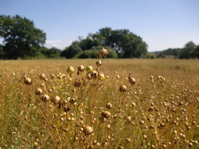
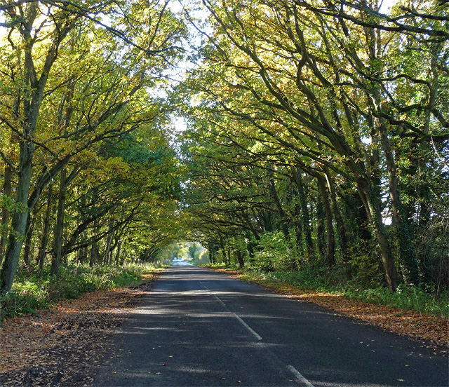
Killinghurst Great Copse is a picturesque woodland located in the county of Surrey, England. Covering an area of approximately 100 acres, it is a notable feature of the local landscape and is cherished by both residents and visitors alike.

The copse is predominantly composed of a variety of deciduous trees, including oak, beech, and birch, which create a vibrant and ever-changing canopy throughout the year. The dense foliage provides a haven for an array of wildlife, making it a popular destination for nature enthusiasts and birdwatchers. Visitors may catch glimpses of species such as deer, foxes, and a diverse range of bird species, including woodpeckers and owls.

A network of well-maintained footpaths and trails meander through the copse, inviting visitors to explore its hidden nooks and crannies. These pathways lead to tranquil spots, perfect for picnics or simply enjoying the peaceful atmosphere of this natural haven. In the springtime, the woodland floor is carpeted with bluebells, creating a truly magical sight.

Killinghurst Great Copse is also steeped in history. It has been referenced in local records dating back centuries and is believed to have been part of a medieval hunting ground. Today, remnants of old boundary walls and ditches can still be seen, adding to the copse's charm and intrigue.

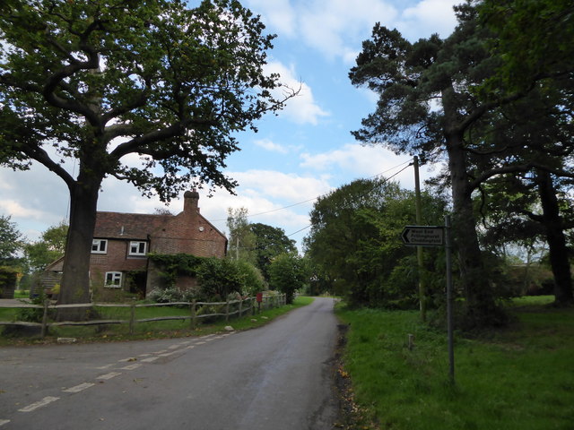
Managed by local authorities, Killinghurst Great Copse is easily accessible and offers ample parking facilities. Whether it's a leisurely walk, a family outing, or an opportunity to immerse oneself in nature, this woodland sanctuary provides a unique and enriching experience for all who visit.

If you have any feedback on the listing, please let us know in the comments section below.

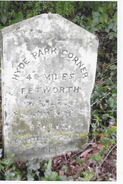
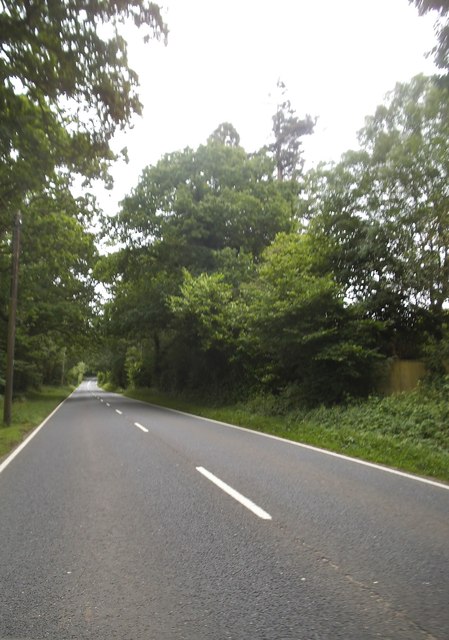
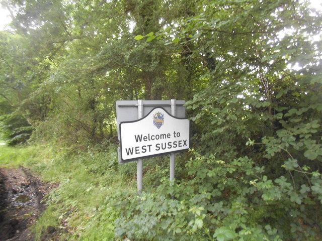
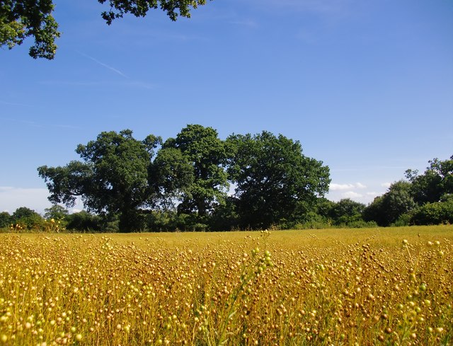
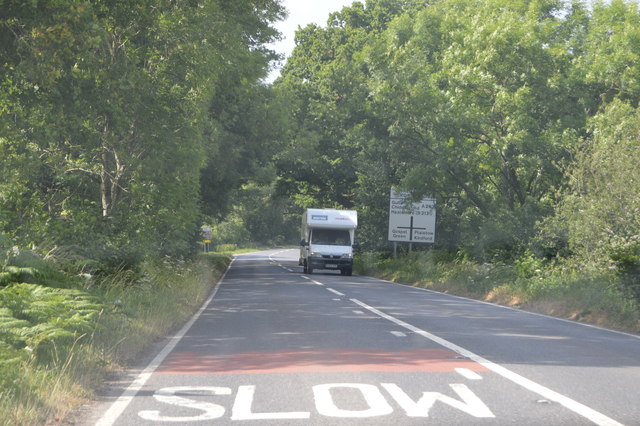
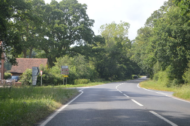
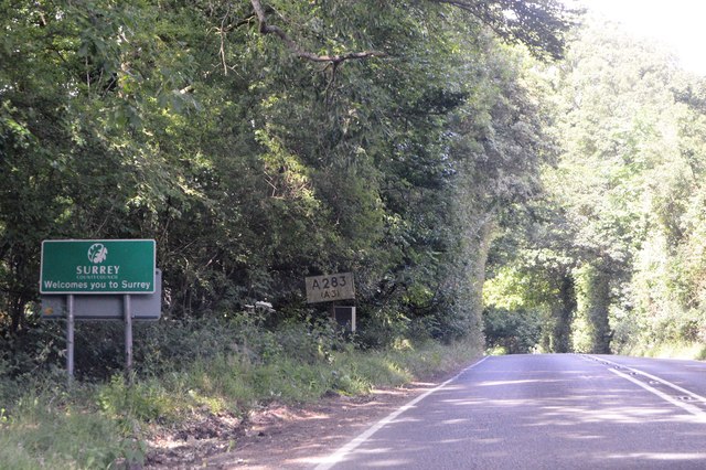
Killinghurst Great Copse Images

Images are sourced within 2km of 51.088116/-0.65903574 or Grid Reference SU9432. Thanks to Geograph Open Source API. All images are credited.

Old Milestone, A283, Cripplecrutch Hill, Ramsnest Common The milestone, is located 270 m south of the Mulberry Inn on the North West side of the road in the bushes at the back of the verge. Parish of Chiddingfold (Waverley District).  Carved stone post, Petworth stone design, erected by the Petworth turnpike trust in the 18th century.

Inscription reads:-   HYDE PARK CORNER / 40 MILES / PETWORTH / 7 MILES / GODALMING / 8 MILES / CHIDDINGFOLD / 2 MILES

Milestone Society National ID: SY_LMP40
Old Milestone, A283, Cripplecrutch Hill, Ramsnest Common
The milestone, is located 270 m south of the Mulberry Inn on the North West side of the road in the bushes at the back of the verge. Parish of Chiddingfold (Waverley District). Carved stone post, Petworth stone design, erected by the Petworth turnpike trust in the 18th century. Inscription reads:- HYDE PARK CORNER / 40 MILES / PETWORTH / 7 MILES / GODALMING / 8 MILES / CHIDDINGFOLD / 2 MILES Milestone Society National ID: SY_LMP40
Cripplecrutch Hill, Ramsnest Common
Where am I? Cripplecrutch Hill, Ramsnest Common
Where am I?
Cripplecrutch Hill, Ramsnest Common
The entrance to Ramster Garden
Petworth Road, Ramsnest Common
A field of ripe flax, near Gospel Green I don't remember having seen flax in Sussex before.   I'm more used to seeing its blue flowers in eastern England - perhaps in the old county of Huntingdonshire, or in Norfolk.  Be that as it may, acres of the ripe seed-heads were a fine sight on this sunny day in late August.
A field of ripe flax, near Gospel Green
I don't remember having seen flax in Sussex before. I'm more used to seeing its blue flowers in eastern England - perhaps in the old county of Huntingdonshire, or in Norfolk. Be that as it may, acres of the ripe seed-heads were a fine sight on this sunny day in late August.
Ripe flax Acres of ripe flax - bringing a distinctive russety colour to the August landscape.
Ripe flax
Acres of ripe flax - bringing a distinctive russety colour to the August landscape.
Exploring eastwards along the Bashire (3) Rush hour in Killinghurst
Running total: 22 B points
Exploring eastwards along the Bashire (3)
Rush hour in Killinghurst Running total: 22 B points
Exploring eastwards  along the Bashire (4) Looking west-northwest along Killinghurst Lane
Running total: 23 B points
Exploring eastwards along the Bashire (4)
Looking west-northwest along Killinghurst Lane Running total: 23 B points
Exploring eastwards along the Bashire (5) Guess where I am on the A283!
Running total: 24 B points
Exploring eastwards along the Bashire (5)
Guess where I am on the A283! Running total: 24 B points
Shillinglee Road near Fisherstreet Minor road heading for the A283 through a canopy of oaks.
Shillinglee Road near Fisherstreet
Minor road heading for the A283 through a canopy of oaks.
A283, northbound The A283 runs 37 miles from Milford near Guildford south to Shoreham-on-Sea across rural Surrey and West Sussex.
<span class="nowrap"><a title="https://www.sabre-roads.org.uk/wiki/index.php?title=A283" rel="nofollow ugc noopener" href="https://www.sabre-roads.org.uk/wiki/index.php?title=A283">Link</a><img style="margin-left:2px;" alt="External link" title="External link - shift click to open in new window" src="https://s1.geograph.org.uk/img/external.png" width="10" height="10"/></span>
A283, northbound
The A283 runs 37 miles from Milford near Guildford south to Shoreham-on-Sea across rural Surrey and West Sussex. LinkExternal link
Entering Surrey, A283 The A283 runs 37 miles from Milford near Guildford south to Shoreham-on-Sea across rural Surrey and West Sussex.
<span class="nowrap"><a title="https://www.sabre-roads.org.uk/wiki/index.php?title=A283" rel="nofollow ugc noopener" href="https://www.sabre-roads.org.uk/wiki/index.php?title=A283">Link</a><img style="margin-left:2px;" alt="External link" title="External link - shift click to open in new window" src="https://s1.geograph.org.uk/img/external.png" width="10" height="10"/></span>
Entering Surrey, A283
The A283 runs 37 miles from Milford near Guildford south to Shoreham-on-Sea across rural Surrey and West Sussex. LinkExternal link
Cripplecrutch Hill The A283 runs 37 miles from Milford near Guildford south to Shoreham-on-Sea across rural Surrey and West Sussex.
<span class="nowrap"><a title="https://www.sabre-roads.org.uk/wiki/index.php?title=A283" rel="nofollow ugc noopener" href="https://www.sabre-roads.org.uk/wiki/index.php?title=A283">Link</a><img style="margin-left:2px;" alt="External link" title="External link - shift click to open in new window" src="https://s1.geograph.org.uk/img/external.png" width="10" height="10"/></span>
Cripplecrutch Hill
The A283 runs 37 miles from Milford near Guildford south to Shoreham-on-Sea across rural Surrey and West Sussex. LinkExternal link
A283 at The Mulberry The A283 runs 37 miles from Milford near Guildford south to Shoreham-on-Sea across rural Surrey and West Sussex.
<span class="nowrap"><a title="https://www.sabre-roads.org.uk/wiki/index.php?title=A283" rel="nofollow ugc noopener" href="https://www.sabre-roads.org.uk/wiki/index.php?title=A283">Link</a><img style="margin-left:2px;" alt="External link" title="External link - shift click to open in new window" src="https://s1.geograph.org.uk/img/external.png" width="10" height="10"/></span>
A283 at The Mulberry
The A283 runs 37 miles from Milford near Guildford south to Shoreham-on-Sea across rural Surrey and West Sussex. LinkExternal link
A283, northbound The A283 runs 37 miles from Milford near Guildford south to Shoreham-on-Sea across rural Surrey and West Sussex.
<span class="nowrap"><a title="https://www.sabre-roads.org.uk/wiki/index.php?title=A283" rel="nofollow ugc noopener" href="https://www.sabre-roads.org.uk/wiki/index.php?title=A283">Link</a><img style="margin-left:2px;" alt="External link" title="External link - shift click to open in new window" src="https://s1.geograph.org.uk/img/external.png" width="10" height="10"/></span>
A283, northbound
The A283 runs 37 miles from Milford near Guildford south to Shoreham-on-Sea across rural Surrey and West Sussex. LinkExternal link
Old Milestone by the A283, Petworth Road, Chiddingfold Parish Carved stone post by the A283, in parish of CHIDDINGFOLD (WAVERLEY District), Petworth Road, Cherfold, near Golf Club, on narrow verge between road and ditch, on Northwest side of road. Petworth stone, erected by the Petworth turnpike trust in the 18th century. 

Inscription reads:-
HYDE PARK CORNER
39 MILES
PETWORTH
8 MILES
GODALMING
7 MILES
CHIDDINGFOLD
1 MILE

Milestone Society National ID: SY_LMP39.
Old Milestone by the A283, Petworth Road, Chiddingfold Parish
Carved stone post by the A283, in parish of CHIDDINGFOLD (WAVERLEY District), Petworth Road, Cherfold, near Golf Club, on narrow verge between road and ditch, on Northwest side of road. Petworth stone, erected by the Petworth turnpike trust in the 18th century. Inscription reads:- HYDE PARK CORNER 39 MILES PETWORTH 8 MILES GODALMING 7 MILES CHIDDINGFOLD 1 MILE Milestone Society National ID: SY_LMP39.
Show me another place!

Killinghurst Great Copse is located at Grid Ref: SU9432 (Lat: 51.088116, Lng: -0.65903574)

Administrative County: Surrey

District: Waverley

Police Authority: Surrey

What 3 Words

///wanting.recur.flask. Near Haslemere, Surrey

Related Wikis

Ramsnest Common

Ramsnest Common is a hamlet in the far south of the Borough of Waverley, the largest district of Surrey, England centred on the A283 1.5 miles (2.4 km...

Ramster

Ramster Garden is an open garden, near Chiddingfold, Surrey, covering over 20 acres (81,000 m2). First landscaped and laid out in the 1890s by Gauntlett...

Netherside Stream Outcrops

Netherside Stream Outcrops is a 2.9-hectare (7.2-acre) geological Site of Special Scientific Interest north-east of Haslemere in Surrey. It is a Geological...

Shillinglee

Shillinglee is an 18th-century house and estate in West Sussex, England near the Surrey border, in between the villages of Chiddingfold and Plaistow. It...

Nearby Amenities

Located within 500m of 51.088116,-0.65903574
Radgate
Building: yes
Source: npe
Lat/Long: 51.0852546/-0.6570879
The data included in this document is from www.openstreetmap.org. The data is made available under ODbL.

Have you been to Killinghurst Great Copse?

Leave your review of Killinghurst Great Copse below (or comments, questions and feedback).