Old Dale Plantation

Wood, Forest in Yorkshire

England

Old Dale Plantation

Hudson Way in Goodmanham Dale The Hudson Way runs along the former York to Hull via Market Weighton railway line between Beverley and Market Weighton.
Hudson Way in Goodmanham Dale Credit: DS Pugh

Old Dale Plantation is a picturesque woodland located in the heart of Yorkshire, England. Spanning over a vast area, this enchanting forest is known for its rich history and natural beauty. The plantation dates back several centuries and has been carefully preserved to retain its traditional charm.

Nestled amidst rolling hills and meandering streams, Old Dale Plantation boasts a diverse range of flora and fauna. The woodland is predominantly composed of towering oak and beech trees, offering a serene and tranquil atmosphere for visitors to explore. The forest floor is adorned with a carpet of wildflowers during spring, creating a vibrant and colorful landscape.

The plantation is home to a variety of wildlife, making it a haven for nature enthusiasts. Birdwatchers can spot a plethora of species, including woodpeckers, owls, and thrushes, while small mammals like hedgehogs and squirrels can be glimpsed scurrying through the undergrowth. It is not uncommon to spot deer grazing in the meadows or catch a glimpse of a fox darting between the trees.

The plantation also holds historical significance, with remnants of an ancient settlement still visible within its boundaries. Visitors can uncover traces of old stone walls and foundations, providing a glimpse into the past. These archaeological remains offer a fascinating insight into the lives of the people who once inhabited the area.

Old Dale Plantation is a beloved destination for hikers, nature lovers, and history enthusiasts alike. Its timeless beauty and captivating history make it a must-visit location in Yorkshire, offering a peaceful retreat from the hustle and bustle of everyday life.

If you have any feedback on the listing, please let us know in the comments section below.

Old Dale Plantation Images

Images are sourced within 2km of 53.885404/-0.57270093 or Grid Reference SE9344. Thanks to Geograph Open Source API. All images are credited.

Hudson Way in Goodmanham Dale The Hudson Way runs along the former York to Hull via Market Weighton railway line between Beverley and Market Weighton.
Hudson Way in Goodmanham Dale
The Hudson Way runs along the former York to Hull via Market Weighton railway line between Beverley and Market Weighton.
Hudson Way near Southwold Farm The Hudson Way runs along the former York to Hull via Market Weighton railway line between Beverley and Market Weighton.
Hudson Way near Southwold Farm
The Hudson Way runs along the former York to Hull via Market Weighton railway line between Beverley and Market Weighton.
Fields near Walk House Farm Viewed from the Hudson Way.
Fields near Walk House Farm
Viewed from the Hudson Way.
Viaduct above Spring Road The Hudson Way crossing Spring Road.
Viaduct above Spring Road
The Hudson Way crossing Spring Road.
Approaching Kiplingcotes Station The Hudson Way runs along the former York to Hull via Market Weighton railway line between Beverley and Market Weighton.
Approaching Kiplingcotes Station
The Hudson Way runs along the former York to Hull via Market Weighton railway line between Beverley and Market Weighton.
Signal box and car park The disused signalbox at Kiplingcotes Station on the Hudson Way.
Signal box and car park
The disused signalbox at Kiplingcotes Station on the Hudson Way.
Kiplingcotes Station The railway station on the former York to Beverley railway line.
Kiplingcotes Station
The railway station on the former York to Beverley railway line.
Farm track leading to Spring Road Looking along a farm track from where the Hudson Way crosses the track.
Farm track leading to Spring Road
Looking along a farm track from where the Hudson Way crosses the track.
Fields south of Spring Road Looking towards Spring Road from the Hudson Way.
Fields south of Spring Road
Looking towards Spring Road from the Hudson Way.
Seat on the Hudson Way A bench looking north towards Spring Road from the former railway embankment.
Seat on the Hudson Way
A bench looking north towards Spring Road from the former railway embankment.
Chalk Bridge over the Hudson Way The Hudson Way runs along the former York to Hull via Market Weighton railway line between Beverley and Market Weighton.
Chalk Bridge over the Hudson Way
The Hudson Way runs along the former York to Hull via Market Weighton railway line between Beverley and Market Weighton.
Track near Wold Farm A farm track from Wold Farm heading towards the road viewed from the crossing over the Hudson Way.
Track near Wold Farm
A farm track from Wold Farm heading towards the road viewed from the crossing over the Hudson Way.
Michael's Bridge over the Hudson Way The Hudson Way runs along the former York to Hull via Market Weighton railway line between Beverley and Market Weighton.
Michael's Bridge over the Hudson Way
The Hudson Way runs along the former York to Hull via Market Weighton railway line between Beverley and Market Weighton.
Hudson Way near Wold Farm The Hudson Way runs along the former York to Hull via Market Weighton railway line between Beverley and Market Weighton.
Hudson Way near Wold Farm
The Hudson Way runs along the former York to Hull via Market Weighton railway line between Beverley and Market Weighton.
Railway path near Wold Farm The Hudson Way runs along the former York to Hull via Market Weighton railway line between Beverley and Market Weighton.
Railway path near Wold Farm
The Hudson Way runs along the former York to Hull via Market Weighton railway line between Beverley and Market Weighton.
Field near Wold Farm Compare with <a href="https://www.geograph.org.uk/photo/6522733">SE9542 : Barley beside the rail trail</a> three years on.
Field near Wold Farm
Compare with SE9542 : Barley beside the rail trail three years on.
Hudson Way near Gardham The Hudson Way runs along the former York to Hull via Market Weighton railway line between Beverley and Market Weighton.
Hudson Way near Gardham
The Hudson Way runs along the former York to Hull via Market Weighton railway line between Beverley and Market Weighton.
Road near Sir John's Plantation National Cycle Network route 66 runs along here.
Road near Sir John's Plantation
National Cycle Network route 66 runs along here.
Show me another place!

Old Dale Plantation is located at Grid Ref: SE9344 (Lat: 53.885404, Lng: -0.57270093)

Division: East Riding

Unitary Authority: East Riding of Yorkshire

Police Authority: Humberside

What 3 Words

///tentacles.varieties.unfilled. Near Etton, East Yorkshire

Related Wikis

Kiplingcotes railway station

Kiplingcotes railway station was a minor railway station on the York–Beverley line, in the East Riding of Yorkshire, England. It opened on 1 May 1865 and...

Dalton Holme

Dalton Holme a civil parish in the East Riding of Yorkshire in England. It is situated 5 miles (8 km) to the north-west from the market town of Beverley...

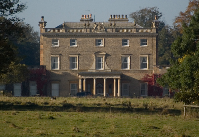
Dalton Hall, East Riding of Yorkshire

Dalton Hall is a grade II* listed Georgian country house in Dalton Holme, East Riding of Yorkshire, England. It is constructed of grey brick with stone...

Kiplingcotes

Kiplingcotes is a hamlet in the East Riding of Yorkshire, England. It is situated approximately 3.5 miles (6 km) north-east of the market town of Market...

Nearby Amenities

Located within 500m of 53.885404,-0.57270093
The data included in this document is from www.openstreetmap.org. The data is made available under ODbL.

Have you been to Old Dale Plantation?

Leave your review of Old Dale Plantation below (or comments, questions and feedback).