Bushycommon Wood

Wood, Forest in Bedfordshire

England

Bushycommon Wood

The A5 Watling Street, Sheeplane
The A5 Watling Street, Sheeplane Credit: David Howard

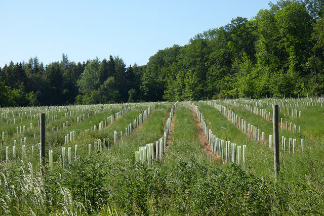
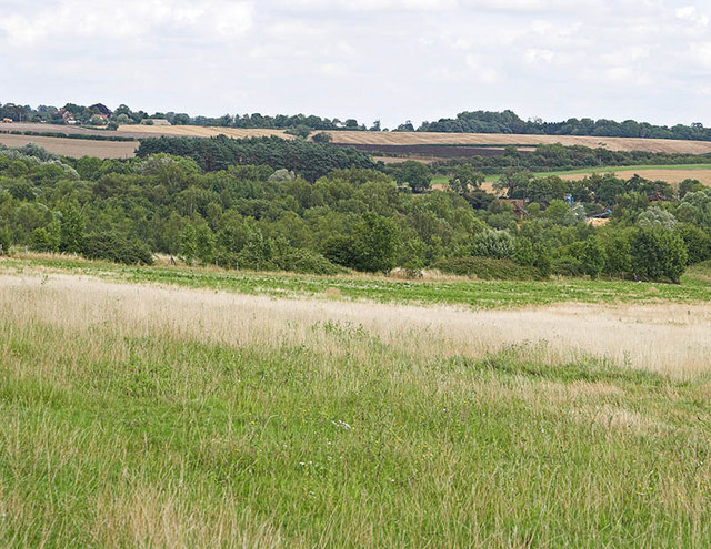
Bushycommon Wood is a picturesque woodland located in the county of Bedfordshire, England. Covering an area of approximately 100 acres, it is a cherished natural treasure for locals and visitors alike. The wood is situated near the village of Bushycommon and is easily accessible by foot or bicycle.

The woodland boasts a diverse range of tree species, including oak, beech, ash, and birch. The dense canopy created by these trees provides ample shade and a cool atmosphere, making it a popular spot for nature enthusiasts and families looking to escape the hustle and bustle of urban life.

Walking through Bushycommon Wood, visitors will be greeted by a carpet of vibrant wildflowers, adding a splash of color to the tranquil surroundings. The woodland is also home to a rich variety of wildlife, including deer, foxes, badgers, and a multitude of bird species. Birdwatchers can catch glimpses of woodpeckers, owls, and songbirds, making it a haven for birdwatching enthusiasts.

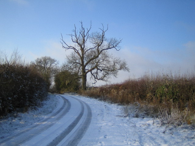
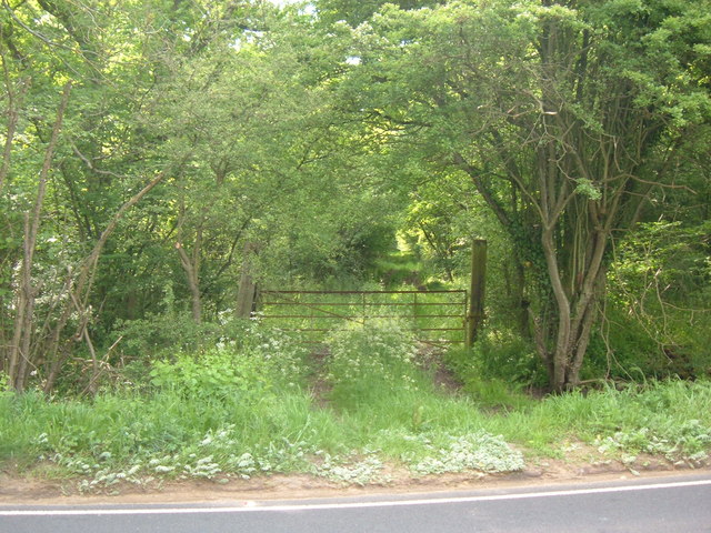
The wood features well-maintained footpaths that wind their way through the trees, allowing visitors to explore its natural beauty. There are also picnic areas and benches scattered throughout the wood, providing ample opportunities to rest and enjoy a packed lunch.

Bushycommon Wood holds great historical significance as well. It was once part of a larger forest that covered much of the surrounding area, and remnants of ancient trees can still be found within its boundaries.

Overall, Bushycommon Wood is a delightful destination for nature lovers, offering a serene and idyllic setting to explore and appreciate the wonders of the natural world.

If you have any feedback on the listing, please let us know in the comments section below.

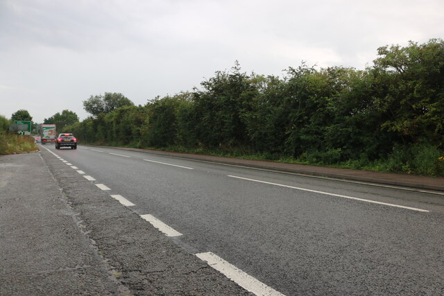
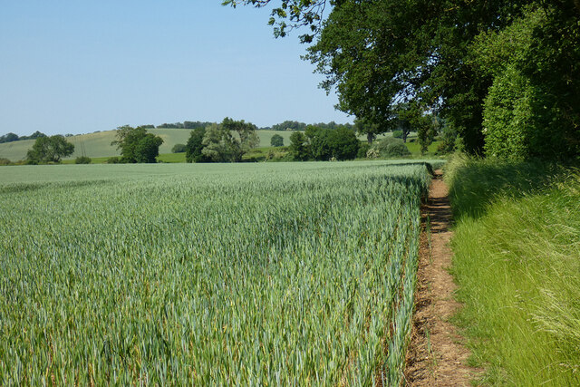
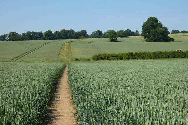
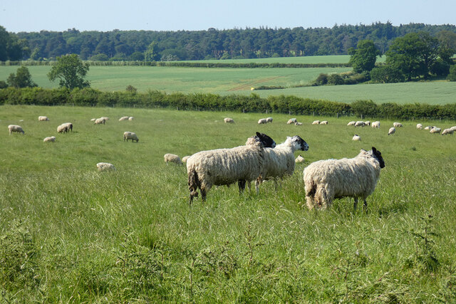
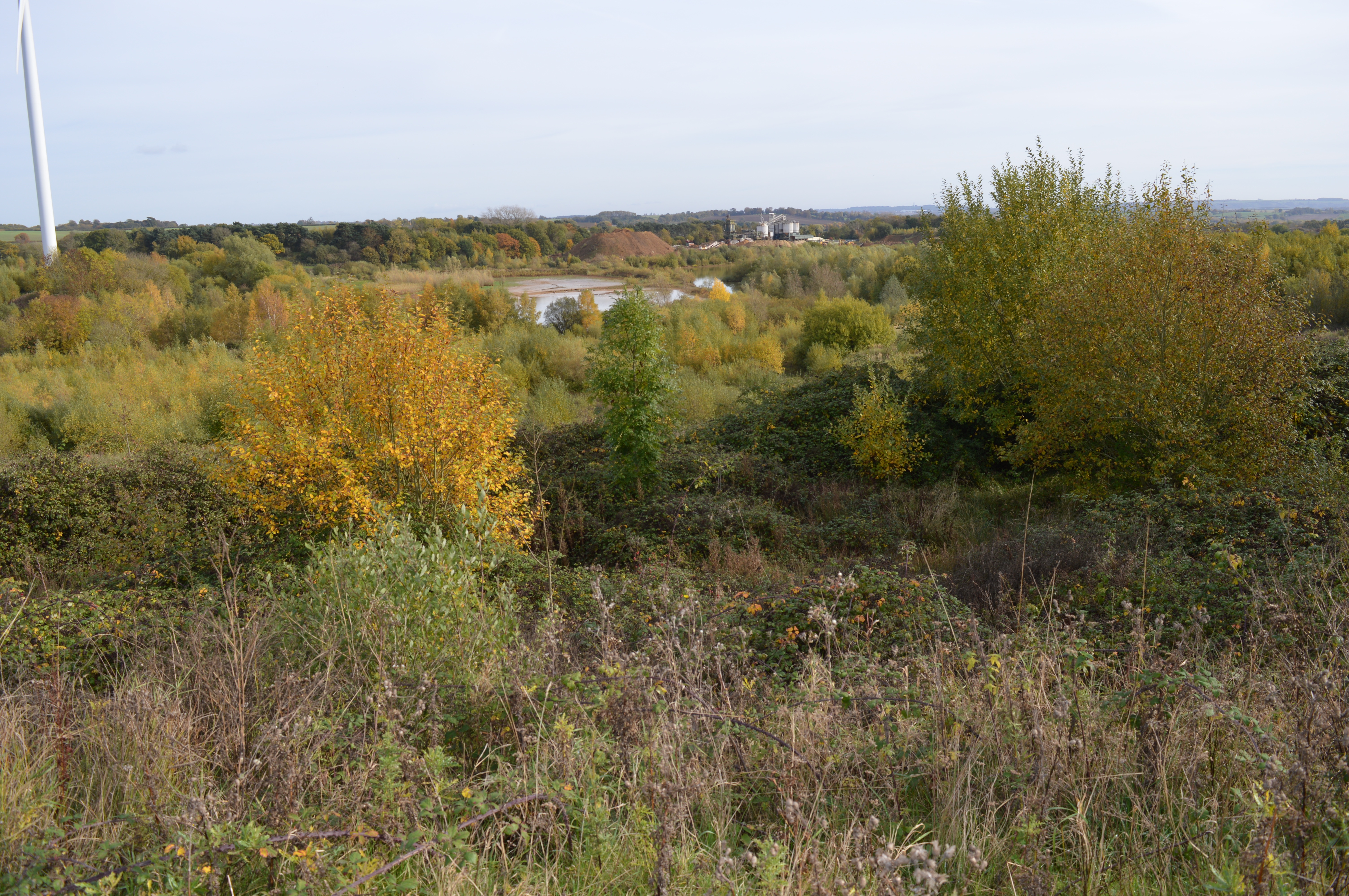
Bushycommon Wood Images

Images are sourced within 2km of 51.964636/-0.6347419 or Grid Reference SP9330. Thanks to Geograph Open Source API. All images are credited.

The A5 Watling Street, Sheeplane
Farmland, Potsgrove A bridleway through oats climbs towards the B5704.
Farmland, Potsgrove
A bridleway through oats climbs towards the B5704.
Farmland, Potsgrove A footpath through wheat, like most in the area, has been well reinstated.
Farmland, Potsgrove
A footpath through wheat, like most in the area, has been well reinstated.
Farmland, Woburn A footpath to the north of Potsgrove follows the field's edge.
Farmland, Woburn
A footpath to the north of Potsgrove follows the field's edge.
Farmland, Woburn A footpath through wheat to the south of the village.
Farmland, Woburn
A footpath through wheat to the south of the village.
Pasture, Potsgrove Sheep grazing in a field to the east of Sheep Lane.
Pasture, Potsgrove
Sheep grazing in a field to the east of Sheep Lane.
Woodland, Little Brickhill A replanted area in the south of Buttermilk Wood.
Woodland, Little Brickhill
A replanted area in the south of Buttermilk Wood.
Watling Street, Sheeplane
Leighton Buzzard: Double Arches quarry Sand despatching silos at the Double Arches quarry site on Eastern Way, managed by WBB Minerals.
Leighton Buzzard: Double Arches quarry
Sand despatching silos at the Double Arches quarry site on Eastern Way, managed by WBB Minerals.
Heath and Reach: Near Overendgreen Farm The lane between Heath and Reach and Overendgreen Farm viewed looking westwards with a light covering of snow on the ground.
Heath and Reach: Near Overendgreen Farm
The lane between Heath and Reach and Overendgreen Farm viewed looking westwards with a light covering of snow on the ground.
Abandoned Gravel and Sand Pits Abandoned Gravel and Sand Pit workings almost fill this grid square.Some have now been recovered as grass land, as seen here.
Abandoned Gravel and Sand Pits
Abandoned Gravel and Sand Pit workings almost fill this grid square.Some have now been recovered as grass land, as seen here.
Fields bordering the A5 Though bordering the extremely busy A5 Watling Street, these fields look peaceful and rural. This view is in the general direction of the village of Heath & Reach.
Fields bordering the A5
Though bordering the extremely busy A5 Watling Street, these fields look peaceful and rural. This view is in the general direction of the village of Heath & Reach.
Little wood across the A5 I managed to find a moment when lorries and cars weren't thundering past to take this snap of a little wood by the side of the A5 near Heath & Reach.
Little wood across the A5
I managed to find a moment when lorries and cars weren't thundering past to take this snap of a little wood by the side of the A5 near Heath & Reach.
Watling Street Tree This tree has attained goodly proportions despite being in close proximity to the very busy A5 Watling Street, part of which can be seen on the right.
Watling Street Tree
This tree has attained goodly proportions despite being in close proximity to the very busy A5 Watling Street, part of which can be seen on the right.
Verge, hedge and tree This photograph was taken across the carriageway of the A5 looking at the opposite verge with the hedge and a particularly fine tree towering behind it.
Verge, hedge and tree
This photograph was taken across the carriageway of the A5 looking at the opposite verge with the hedge and a particularly fine tree towering behind it.
A5 near the Brickhills Unlovely but a major feature of the square, the A5 Watling Street is seen here heading northwestwards. The green sign just visible ahead indicates the slip-road to access Little Brickhill which used to be on the old A5 but is now bypassed. For another exciting shot of tarmac a couple of hundred metres away in the adjacent square, see <a href="https://www.geograph.org.uk/photo/367475">SP9230 : A5 looking southeast</a>
A5 near the Brickhills
Unlovely but a major feature of the square, the A5 Watling Street is seen here heading northwestwards. The green sign just visible ahead indicates the slip-road to access Little Brickhill which used to be on the old A5 but is now bypassed. For another exciting shot of tarmac a couple of hundred metres away in the adjacent square, see SP9230 : A5 looking southeast
A5 looking southeast A snap taken during a moment's respite from the thundering traffic that normally charges past this point on the busy A5. Taken a couple of hundred yards southeast of <a href="https://www.geograph.org.uk/photo/367469">SP9231 : A5 near the Brickhills</a> but in a different gridsquare.
A5 looking southeast
A snap taken during a moment's respite from the thundering traffic that normally charges past this point on the busy A5. Taken a couple of hundred yards southeast of SP9231 : A5 near the Brickhills but in a different gridsquare.
Show me another place!

Bushycommon Wood is located at Grid Ref: SP9330 (Lat: 51.964636, Lng: -0.6347419)

Unitary Authority: Central Bedfordshire

Police Authority: Bedfordshire

What 3 Words

///texts.proud.depth. Near Potsgrove, Bedfordshire

Nearby Locations

Sheeplane Bushycommon Wood

Related Wikis

King's Wood, Heath and Reach

King's Wood is an area of ancient woodland in the parish of Heath and Reach in Bedfordshire, England. The wood lies north of the village of Heath and...

Double Arches Pit

Double Arches Pit (formerly known as New Trees Pit) was a sand quarry near the village and civil parish of Heath and Reach, Bedfordshire, England. It is...

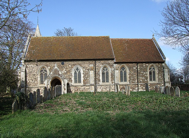
St Mary's Church, Potsgrove

St Mary's Church is a redundant Anglican church in the village of Potsgrove, Bedfordshire. England. It is recorded in the National Heritage List for England...

Kings and Bakers Woods and Heaths

Kings and Bakers Woods and Heaths is a 212.8-hectare (526-acre) Site of Special Scientific Interest (SSSI) between Heath and Reach in Bedfordshire and...

Potsgrove

Potsgrove is a small village and civil parish located in the Central Bedfordshire district of Bedfordshire, England. The parish includes the hamlet of...

Woburn Cottage Hospital

Woburn Cottage Hospital was a hospital in Woburn, Bedfordshire, England. == History == Mary, the Duchess of Bedford (1865–1937) developed an interest in...

Church of St Peter & All Saints, Battlesden

Church of St Peter & All Saints is a Grade I listed church in Battlesden, Bedfordshire, England. It became a listed building on 23 January 1961. ��2...

Stockgrove Country Park

Stockgrove Country Park is located in England on the Bedfordshire/Buckinghamshire border in the parish of Heath and Reach. Stockgrove Park's 80 acres is...

Nearby Amenities

Located within 500m of 51.964636,-0.6347419
Post Box
Collection Times: Mo-Fr 16:00; Sa 10:30
Operator: Royal Mail
Ref: LU7 98
Source: survey
Lat/Long: 51.9609895/-0.6380939
Sandhouse
Place: hamlet
Lat/Long: 51.9605642/-0.6377961
Direction: 135
Generator Method: photovoltaic
Generator Output Electricity: yes
Generator Solar Modules: 12
Generator Source: solar
Generator Type: solar_photovoltaic_panel
Location: roof
Power: generator
Lat/Long: 51.9613682/-0.6389556
The data included in this document is from www.openstreetmap.org. The data is made available under ODbL.

Have you been to Bushycommon Wood?

Leave your review of Bushycommon Wood below (or comments, questions and feedback).