Hollybush Plantation

Wood, Forest in Yorkshire

England

Hollybush Plantation

Wrangman  Dale  Road  (Track) Alongside Wrangmandale Wold Farm. The route of both the Yorkshire Wolds Way and the High Hunsley Circuit going north over Newbold Wold. the threatening sky gave us sunshine and showers, what joy!!
Wrangman Dale Road (Track) Credit: Martin Dawes

Hollybush Plantation is a picturesque woodland located in Yorkshire, England. Situated in the heart of the county, this plantation encompasses an area of lush greenery and dense forestry. Covering a vast expanse, it offers a serene escape from the hustle and bustle of city life.

The plantation, as the name suggests, is renowned for its abundance of holly bushes. These evergreen shrubs provide a stunning display of vibrant red berries, particularly during the winter months, creating a magical atmosphere. The holly bushes also serve as a natural habitat for a variety of bird species, including thrushes and blackbirds, making it a favorite spot for birdwatchers.

The woodland is characterized by its diverse range of tree species, including oak, beech, and ash. Towering trees provide shelter for various wildlife, such as squirrels, foxes, and deer, which can often be spotted roaming freely in the area. The forest floor is adorned with an array of wildflowers, adding bursts of color to the natural landscape.

Hollybush Plantation offers an idyllic setting for nature enthusiasts and outdoor adventurers alike. There are several walking trails that meander through the woodland, allowing visitors to explore its beauty at their own pace. These trails provide an opportunity to immerse oneself in the tranquility of the surroundings, while also enjoying the stunning vistas that unfold along the way.

Whether it's a leisurely stroll, a picnic amongst nature, or a wildlife-spotting expedition, Hollybush Plantation is a captivating destination that showcases the breathtaking beauty of Yorkshire's woodlands.

If you have any feedback on the listing, please let us know in the comments section below.

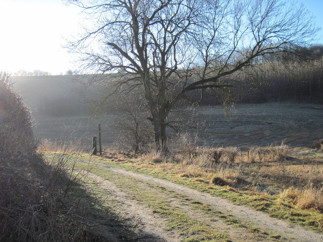
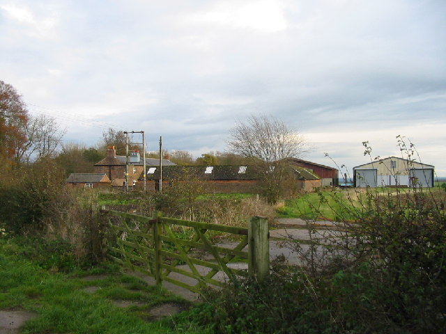
Hollybush Plantation Images

Images are sourced within 2km of 53.829405/-0.57498514 or Grid Reference SE9337. Thanks to Geograph Open Source API. All images are credited.

Wrangman  Dale  Road  (Track) Alongside Wrangmandale Wold Farm. The route of both the Yorkshire Wolds Way and the High Hunsley Circuit going north over Newbold Wold. the threatening sky gave us sunshine and showers, what joy!!
Wrangman Dale Road (Track)
Alongside Wrangmandale Wold Farm. The route of both the Yorkshire Wolds Way and the High Hunsley Circuit going north over Newbold Wold. the threatening sky gave us sunshine and showers, what joy!!
Junction  of  track  and  country  road Wrangman Dale Road (Track) meets Beverley Road. Beverley to the left
Junction of track and country road
Wrangman Dale Road (Track) meets Beverley Road. Beverley to the left
Checkpoint  on  Rudolph's  Romp  at  Wrangmandale  Wold  farm The yearly challenge walk attracted over 250 walkers/runners
Checkpoint on Rudolph's Romp at Wrangmandale Wold farm
The yearly challenge walk attracted over 250 walkers/runners
New  Marker  on  the  Yorkshire  Wolds  Way Footpath going right is to North Newbold.
New Marker on the Yorkshire Wolds Way
Footpath going right is to North Newbold.
Bridleway  to  Newbold  Lodge There are not many features on the open high wolds, so this track going to Newbald Lodge, a large farming complex, surrounded by a windbreak of trees is going to be the main one.
Bridleway to Newbold Lodge
There are not many features on the open high wolds, so this track going to Newbald Lodge, a large farming complex, surrounded by a windbreak of trees is going to be the main one.
Farm  Road  into  Newbald  Lodge
Farm Road into Newbald Lodge
Lane  toward  North  Newbald
Lane toward North Newbald
Over  field  to  Burton  Rakes  Farm It was early afternoon but the drizzle and mist had turned to rain
Over field to Burton Rakes Farm
It was early afternoon but the drizzle and mist had turned to rain
Gate across the Wolds Way Easily sidestepped.
Gate across the Wolds Way
Easily sidestepped.
The Wolds Way through Swin Dale The low winter afternoon sun reaches only the northern side of the dale.
The Wolds Way through Swin Dale
The low winter afternoon sun reaches only the northern side of the dale.
Pond in Swin Dale This high up the dale surface water is rare,
Pond in Swin Dale
This high up the dale surface water is rare,
The upper part of Swin Dale Near its head Swin Dale divides into three. Here two parts can be seen - straight ahead and right at the fingerpost. The third part is off to the left of the camera.
The upper part of Swin Dale
Near its head Swin Dale divides into three. Here two parts can be seen - straight ahead and right at the fingerpost. The third part is off to the left of the camera.
Swin  Dale  Frost  and  Sun The low January sun has not reached the south side of the dale which rises through the trees to Whin Hill, hence the grass is still white over.
Swin Dale Frost and Sun
The low January sun has not reached the south side of the dale which rises through the trees to Whin Hill, hence the grass is still white over.
Yorkshire  Wolds  Way  at  the  western  end  of  Swin  Dale
Yorkshire Wolds Way at the western end of Swin Dale
Sun  on  a  frosty  scene Track at the western end of Swin Dale
Sun on a frosty scene
Track at the western end of Swin Dale
Track  out  of  Swin  Dale  to  Beverley  Road Part of the Yorkshire Wolds Way and the High Hunsley Circuit, both long distance walks.
Track out of Swin Dale to Beverley Road
Part of the Yorkshire Wolds Way and the High Hunsley Circuit, both long distance walks.
To  The  Grange  off  Beverley  Road Still called Mount Pleasant Farm on the O/S map
To The Grange off Beverley Road
Still called Mount Pleasant Farm on the O/S map
Beverley  Road  from  North  Newbald A minor road at this point in a wold valley
Beverley Road from North Newbald
A minor road at this point in a wold valley
Show me another place!

Hollybush Plantation is located at Grid Ref: SE9337 (Lat: 53.829405, Lng: -0.57498514)

Division: East Riding

Unitary Authority: East Riding of Yorkshire

Police Authority: Humberside

What 3 Words

///contour.delays.divides. Near North Newbald, East Yorkshire

Nearby Locations

Hollybush Plantation

Related Wikis

Beverley Rural District

Beverley was a rural district in the East Riding of Yorkshire, England from 1894 to 1974.The district surrounded but did not include Beverley, which formed...

High Gardham

High Gardham is a small hamlet in the East Riding of Yorkshire, England. It is situated approximately 5.5 miles (9 km) west of Beverley town centre and...

North Newbald

North Newbald is a village and former civil parish, now in the parish of Newbald, in the East Riding of Yorkshire, England. The village is situated approximately...

High Hunsley

High Hunsley is a small hamlet in the East Riding of Yorkshire, England. It is situated in the Yorkshire Wolds approximately 6 miles (10 km) south-west...

Nearby Amenities

Located within 500m of 53.829405,-0.57498514
The data included in this document is from www.openstreetmap.org. The data is made available under ODbL.

Have you been to Hollybush Plantation?

Leave your review of Hollybush Plantation below (or comments, questions and feedback).