Bird's Holt

Wood, Forest in Lincolnshire North Kesteven

England

Bird's Holt

Birchwood Leisure Centre Leisure centre in the heart of Lincolns biggest housing estate.
Birchwood Leisure Centre Credit: Matthew Smith

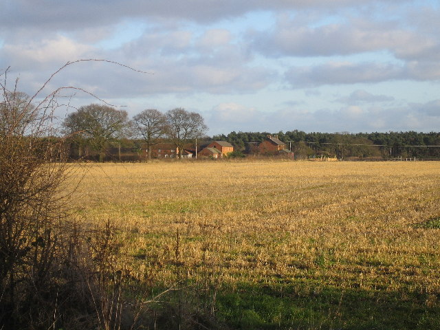
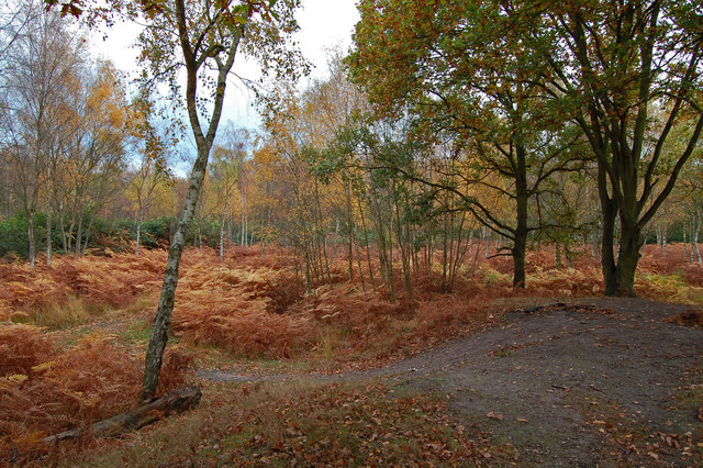
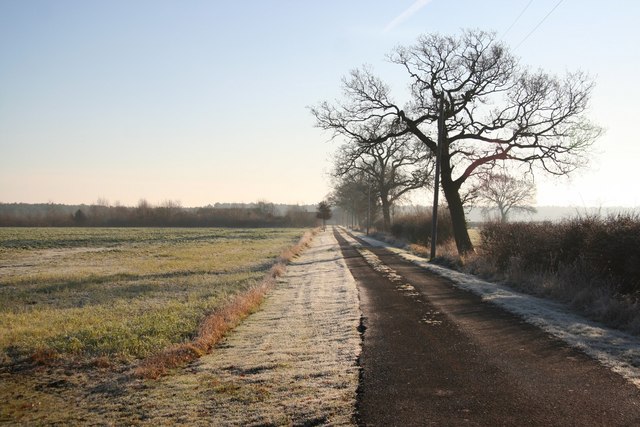
Bird's Holt is a small village located in the county of Lincolnshire, England. Situated in the heart of the beautiful countryside, the village is known for its dense woodlands and lush forests, earning it the nickname "Wood" or "Forest". It is located approximately 10 miles south of the city of Lincoln.

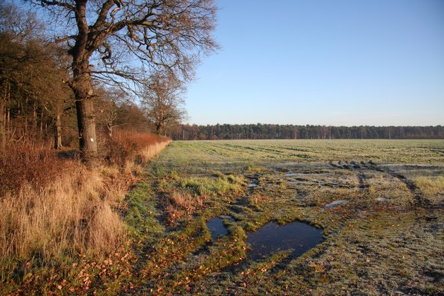
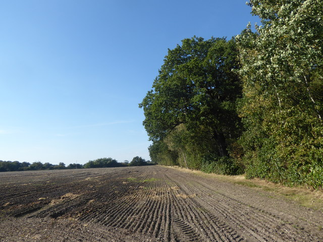
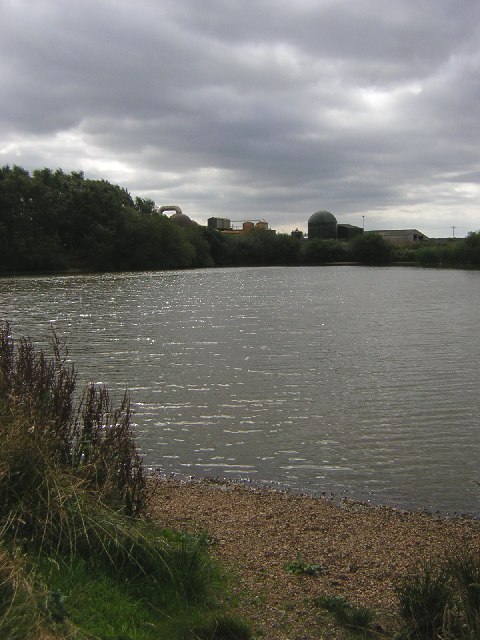
The village is characterized by its picturesque surroundings, with rolling hills and open fields providing a stunning backdrop for residents and visitors alike. The woodlands surrounding Bird's Holt are home to a diverse range of plant and animal species, making it a popular destination for nature enthusiasts and bird watchers.

Despite its small size, Bird's Holt boasts a tight-knit community that takes pride in preserving its natural beauty. The village is known for its traditional charm, with many of its houses and buildings retaining their original features.

There are limited amenities within the village itself, with a small shop and a pub being the main focal points for locals. However, the nearby city of Lincoln offers a wider range of services and amenities, including shopping centers, restaurants, and entertainment venues.

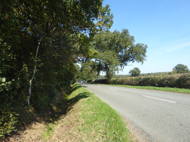
Bird's Holt is well-connected to the surrounding areas by road, with easy access to the A15 and A46 highways. This makes it an ideal location for those seeking a peaceful rural lifestyle while still being within reach of larger towns and cities.

Overall, Bird's Holt in Lincolnshire is a tranquil village surrounded by stunning woodlands and forests, providing a haven for nature lovers and offering a tight-knit community for its residents.

If you have any feedback on the listing, please let us know in the comments section below.
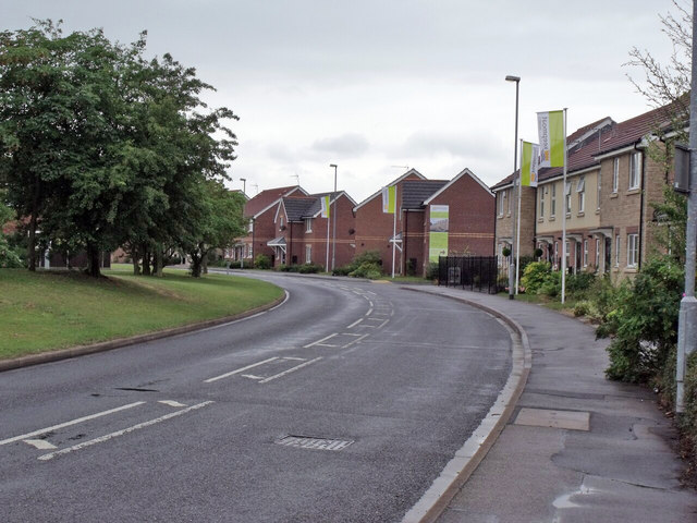
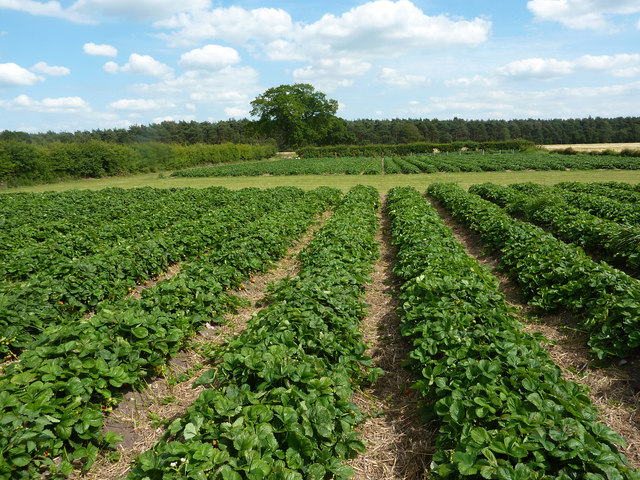
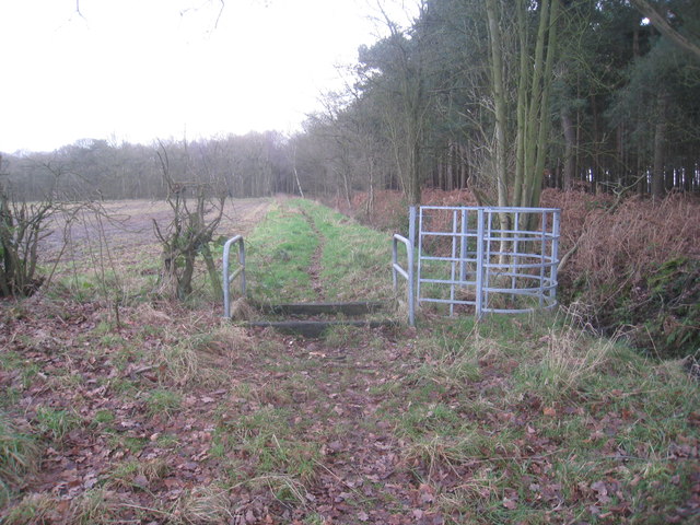
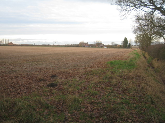
Bird's Holt Images

Images are sourced within 2km of 53.229278/-0.6207865 or Grid Reference SK9271. Thanks to Geograph Open Source API. All images are credited.

Birchwood Leisure Centre Leisure centre in the heart of Lincolns biggest housing estate.
Birchwood Leisure Centre
Leisure centre in the heart of Lincolns biggest housing estate.
Blackmoor Farm Blackmoor Farm near Skellingthorpe, looking south east from the corner of Gilberts plot.
Blackmoor Farm
Blackmoor Farm near Skellingthorpe, looking south east from the corner of Gilberts plot.
New housing on Epsom Drive More new homes being built on Epsom Drive, Birchwood
New housing on Epsom Drive
More new homes being built on Epsom Drive, Birchwood
An Enticing Path Hospital Plantation, adjacent to Birchwood Nature Park
An Enticing Path
Hospital Plantation, adjacent to Birchwood Nature Park
Hospital Plantation Autumn colours in this wood adjacent to Birchwood Nature Reserve
Hospital Plantation
Autumn colours in this wood adjacent to Birchwood Nature Reserve
Lane to Blackmoor Farm Lane from Jerusalem Road to Blackmoor Farm on a frosty December morning
Lane to Blackmoor Farm
Lane from Jerusalem Road to Blackmoor Farm on a frosty December morning
Blackmoor farmland Farmland at Blackmoor Farm near Jerusalem
Blackmoor farmland
Farmland at Blackmoor Farm near Jerusalem
Birchwood Co-op Shopping development on the Birchwood
Birchwood Co-op
Shopping development on the Birchwood
Birchwood shopping Shopping development at Birchwood
Birchwood shopping
Shopping development at Birchwood
View from Black Lane On the right is the woodland known as Gilbert's Plot.
View from Black Lane
On the right is the woodland known as Gilbert's Plot.
Looking along Black Lane On the left is the woodland known as Gilbert's Plot.
Looking along Black Lane
On the left is the woodland known as Gilbert's Plot.
Memorial to RAF Skellingthorpe The memorial reads thus: To the Memory of the air crews and ground staff who gave their life while serving with No. 50 Squadron and No. 61, 5 Group Bomber Command The Royal Air Force 2nd World War 1939 - 1945.
Skellingthorpe was a bomber airfield within 5 Group, which opened in late 1941. It eventually had the Class "A" intersecting three runways, the main being 1650 yards with two subsidiaries at 1400 yards. There were three hangars, two T2s and a B1. On 26th November 1941, 50 Squadron arrived with their Hampdens from Swinderby, whilst the runways there were re-laid.
<a title="https://www.geograph.org.uk/article/Royal-Air-Force-Stations-in-Lincolnshire" href="https://www.geograph.org.uk/article/Royal-Air-Force-Stations-in-Lincolnshire">Link</a>
Memorial to RAF Skellingthorpe
The memorial reads thus: To the Memory of the air crews and ground staff who gave their life while serving with No. 50 Squadron and No. 61, 5 Group Bomber Command The Royal Air Force 2nd World War 1939 - 1945. Skellingthorpe was a bomber airfield within 5 Group, which opened in late 1941. It eventually had the Class "A" intersecting three runways, the main being 1650 yards with two subsidiaries at 1400 yards. There were three hangars, two T2s and a B1. On 26th November 1941, 50 Squadron arrived with their Hampdens from Swinderby, whilst the runways there were re-laid. Link
Woodfield Avenue, Birchwood New Houses
Woodfield Avenue, Birchwood
New Houses
Strawberry fields Rows of strawberries at Blackmoor Farm
Strawberry fields
Rows of strawberries at Blackmoor Farm
Pick your own PYO strawberries at Blackmoor Farm
Pick your own
PYO strawberries at Blackmoor Farm
Ss Luke & Martin church, Birchwood Designed by Robert Read of Grantham, 1976.
Ss Luke & Martin church, Birchwood
Designed by Robert Read of Grantham, 1976.
The bridleway to Whisby Road Given that there is a gap left for horse-riders the gate seems rather superfluous.
The bridleway to Whisby Road
Given that there is a gap left for horse-riders the gate seems rather superfluous.
View towards Monson Farm Taken from the bridleway between Jerusalem Road and Whisby Road.
View towards Monson Farm
Taken from the bridleway between Jerusalem Road and Whisby Road.
Show me another place!

Bird's Holt is located at Grid Ref: SK9271 (Lat: 53.229278, Lng: -0.6207865)

Administrative County: Lincolnshire

District: North Kesteven

Police Authority: Lincolnshire

What 3 Words

///successes.gobbles.using. Near Skellingthorpe, Lincolnshire

Nearby Locations

Bird's Holt Skellingthorpe

Related Wikis

Jerusalem, Lincolnshire

Jerusalem is a small ribbon development in the North Kesteven district of Lincolnshire, England. It conjoined to the south of Skellingthorpe, and is part...

Skellingthorpe railway station (Lancashire, Derbyshire and East Coast Railway)

Skellingthorpe (Lancashire, Derbyshire and East Coast Railway) railway station is one of two former railway stations in Skellingthorpe, Lincolnshire, England...

Skellingthorpe

Skellingthorpe is a village and civil parish in the North Kesteven district of Lincolnshire, England. The population of the village at the 2011 census...
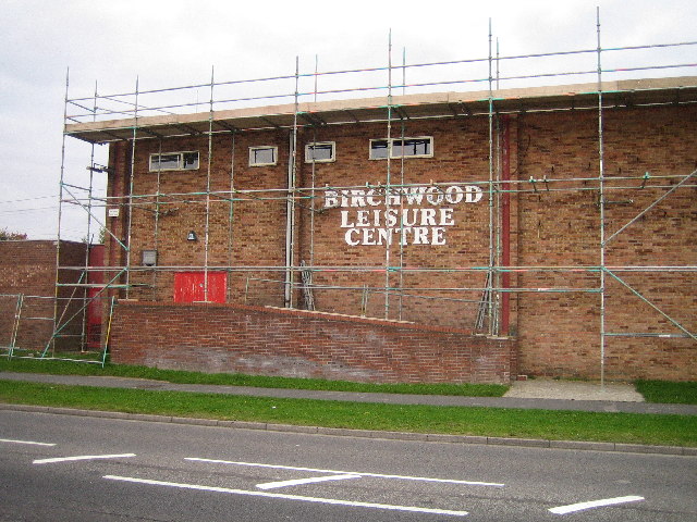
Birchwood, Lincoln

Birchwood is a district and suburb of Lincoln in Lincolnshire, England. The district population in the 2021 Census was 8,932. It is located midway between...

Nearby Amenities

Located within 500m of 53.229278,-0.6207865
Barrier: bollard
Lat/Long: 53.2325767/-0.6213913
Barrier: bollard
Lat/Long: 53.2325441/-0.6219085
Queensway
Naptan AtcoCode: 270000014199
Naptan Bearing: SW
Naptan BusStopType: CUS
Naptan CommonName: Queensway
Naptan Indicator: adj
Naptan Landmark: Queensway
Naptan NaptanCode: linjpdmt
Naptan Street: Jerusalem Road
Naptan Verified: no
Source: naptan_import
Lat/Long: 53.2307534/-0.6245754
Queensway
Naptan AtcoCode: 270000014200
Naptan Bearing: NE
Naptan BusStopType: CUS
Naptan CommonName: Queensway
Naptan Indicator: opp
Naptan Landmark: Queensway
Naptan NaptanCode: linjpdmw
Naptan Street: Jerusalem Road
Naptan Verified: no
Source: naptan_import
Lat/Long: 53.2308357/-0.6246926
Bus Stop
Jerusalem Road
Naptan AtcoCode: 270000014202
Naptan Bearing: SE
Naptan CommonName: Jerusalem Road
Naptan Indicator: opp
Naptan Landmark: Number 14
Naptan NaptanCode: linjpdpa
Naptan Street: Jerusalem Road
Naptan Verified: no
Source: naptan_import
Lat/Long: 53.2277393/-0.6266944
Bus Stop
Jerusalem Road
Naptan AtcoCode: 270000014203
Naptan Bearing: NW
Naptan CommonName: Jerusalem Road
Naptan Indicator: o/s
Naptan Landmark: Number 14
Naptan NaptanCode: linjpdpd
Naptan Street: Jerusalem Road
Naptan Verified: no
Source: naptan_import
Lat/Long: 53.2276778/-0.6268162
Bus Stop
Wiseholme Road
Naptan AtcoCode: 2700LSGN4072
Naptan Bearing: N
Naptan CommonName: Wiseholme Road
Naptan Indicator: adj
Naptan Landmark: Wiseholme Road
Naptan NaptanCode: lindjadw
Naptan Street: Gardenfield
Naptan Verified: no
Source: naptan_import
Lat/Long: 53.2279141/-0.6145387
Bus Stop
Old Chapel Road
Naptan AtcoCode: 2700LSJR2827
Naptan Bearing: SW
Naptan CommonName: Old Chapel Road
Naptan Indicator: o/s
Naptan Landmark: Old Chapel Road
Naptan NaptanCode: linatwaj
Naptan Street: Jerusalem Road
Naptan Verified: no
Source: naptan_import
Lat/Long: 53.2332742/-0.6202244
Bus Stop
Old Chapel Road
Naptan AtcoCode: 2700LSJR2828
Naptan Bearing: N
Naptan CommonName: Old Chapel Road
Naptan Indicator: adj
Naptan Landmark: Old Chapel Road
Naptan NaptanCode: linatwam
Naptan Street: Jerusalem Road
Naptan Verified: no
Source: naptan_import
Lat/Long: 53.2336422/-0.6201676
Bus Stop
Swallow Avenue
Naptan AtcoCode: 2700LSSA2830
Naptan Bearing: NW
Naptan CommonName: Swallow Avenue
Naptan Indicator: adj
Naptan Landmark: The Holt Primary School
Naptan NaptanCode: linatwap
Naptan Street: Swallow Avenue
Naptan Verified: no
Source: naptan_import
Lat/Long: 53.2314901/-0.6225467
Bus Stop
Swallow Avenue
Naptan AtcoCode: 2700LSSA2831
Naptan Bearing: E
Naptan CommonName: Swallow Avenue
Naptan Indicator: opp
Naptan Landmark: The Holt Primary School
Naptan NaptanCode: linatwaw
Naptan Street: Swallow Avenue
Naptan Verified: no
Source: naptan_import
Lat/Long: 53.2314644/-0.6218601
Bus Stop
Mallard Close
Naptan AtcoCode: 2700LSSA2844
Naptan Bearing: W
Naptan CommonName: Mallard Close
Naptan Indicator: adj
Naptan Landmark: Mallard Close
Naptan NaptanCode: linatwgm
Naptan Street: Swallow Avenue
Naptan Verified: no
Source: naptan_import
Lat/Long: 53.2311319/-0.6193554
Bus Stop
Mallard Close
Naptan AtcoCode: 2700LSSA2849
Naptan Bearing: E
Naptan CommonName: Mallard Close
Naptan Indicator: opp
Naptan Landmark: Mallard Close
Naptan NaptanCode: linatwjd
Naptan Street: Swallow Avenue
Naptan Verified: no
Source: naptan_import
Lat/Long: 53.2312989/-0.6188796
Bus Stop
Lapwing Close
Naptan AtcoCode: 2700LSSA2852
Naptan Bearing: NW
Naptan CommonName: Lapwing Close
Naptan Indicator: opp
Naptan Landmark: Lapwing Close
Naptan NaptanCode: linatwjm
Naptan Street: Swallow Avenue
Naptan Verified: no
Source: naptan_import
Lat/Long: 53.2305139/-0.6164356
Bus Stop
Lapwing Close
Naptan AtcoCode: 2700LSSA2856
Naptan Bearing: SE
Naptan CommonName: Lapwing Close
Naptan Indicator: adj
Naptan Landmark: Lapwing Close
Naptan NaptanCode: linatwjw
Naptan Street: Swallow Avenue
Naptan Verified: no
Source: naptan_import
Lat/Long: 53.2304574/-0.6158863
Bus Stop
Coopers Holt Close
Naptan AtcoCode: 2700LSSA2860
Naptan Bearing: N
Naptan CommonName: Coopers Holt Close
Naptan Indicator: adj
Naptan Landmark: Coopers Holt Close
Naptan NaptanCode: linatwmd
Naptan Street: Swallow Avenue
Naptan Verified: no
Source: naptan_import
Lat/Long: 53.2291987/-0.6153885
Ele: 10.711792
Lat/Long: 53.2334978/-0.6182077
Turning Circle
Lat/Long: 53.2317167/-0.6154695
Turning Circle
Lat/Long: 53.2327281/-0.6166925
Turning Circle
Lat/Long: 53.2301659/-0.6192869
Turning Circle
Lat/Long: 53.2300827/-0.6189111
Turning Circle
Lat/Long: 53.2292083/-0.6163363
Turning Circle
Lat/Long: 53.2306405/-0.6179574
Jerusalem
Place: hamlet
Source: Bing
Wikidata: Q6185057
Wikipedia: en:Jerusalem, Lincolnshire
Lat/Long: 53.2285359/-0.6270955
Willow Glade
Description: Woodland play area
Leisure: playground
Lat/Long: 53.2321022/-0.6251042
Generator Method: photovoltaic
Generator Output Electricity: yes
Generator Source: solar
Generator Type: solar_photovoltaic_panel
Location: roof
Power: generator
Lat/Long: 53.2289198/-0.6161595
Generator Method: photovoltaic
Generator Output Electricity: yes
Generator Source: solar
Generator Type: solar_photovoltaic_panel
Location: roof
Power: generator
Lat/Long: 53.2291655/-0.6166638
Generator Method: photovoltaic
Generator Output Electricity: yes
Generator Source: solar
Generator Type: solar_photovoltaic_panel
Location: roof
Power: generator
Lat/Long: 53.2294465/-0.6162588
Generator Method: photovoltaic
Generator Output Electricity: yes
Generator Source: solar
Generator Type: solar_photovoltaic_panel
Location: roof
Power: generator
Lat/Long: 53.2302685/-0.615379
Generator Method: photovoltaic
Generator Output Electricity: yes
Generator Source: solar
Generator Type: solar_photovoltaic_panel
Location: roof
Power: generator
Lat/Long: 53.2307646/-0.6144697
Generator Method: photovoltaic
Generator Output Electricity: yes
Generator Source: solar
Generator Type: solar_photovoltaic_panel
Location: roof
Power: generator
Lat/Long: 53.2314406/-0.6166209
Generator Method: photovoltaic
Generator Output Electricity: yes
Generator Source: solar
Generator Type: solar_photovoltaic_panel
Location: roof
Power: generator
Lat/Long: 53.2307952/-0.6164304
Generator Method: photovoltaic
Generator Output Electricity: yes
Generator Source: solar
Generator Type: solar_photovoltaic_panel
Location: roof
Power: generator
Lat/Long: 53.2305784/-0.6168274
Generator Method: photovoltaic
Generator Output Electricity: yes
Generator Source: solar
Generator Type: solar_photovoltaic_panel
Location: roof
Power: generator
Lat/Long: 53.2301834/-0.6170956
Generator Method: photovoltaic
Generator Output Electricity: yes
Generator Source: solar
Generator Type: solar_photovoltaic_panel
Location: roof
Power: generator
Lat/Long: 53.2304952/-0.6200595
Generator Method: photovoltaic
Generator Output Electricity: yes
Generator Source: solar
Generator Type: solar_photovoltaic_panel
Location: roof
Power: generator
Lat/Long: 53.2305257/-0.6195176
Generator Method: photovoltaic
Generator Output Electricity: yes
Generator Source: solar
Generator Type: solar_photovoltaic_panel
Location: roof
Power: generator
Lat/Long: 53.2308886/-0.6196839
Generator Method: photovoltaic
Generator Output Electricity: yes
Generator Source: solar
Generator Type: solar_photovoltaic_panel
Location: roof
Power: generator
Lat/Long: 53.2309464/-0.6191582
Generator Method: photovoltaic
Generator Output Electricity: yes
Generator Source: solar
Generator Type: solar_photovoltaic_panel
Location: roof
Power: generator
Lat/Long: 53.2300954/-0.6234685
Generator Method: photovoltaic
Generator Output Electricity: yes
Generator Source: solar
Generator Type: solar_photovoltaic_panel
Location: roof
Power: generator
Lat/Long: 53.2316191/-0.6193862
Generator Method: photovoltaic
Generator Output Electricity: yes
Generator Source: solar
Generator Type: solar_photovoltaic_panel
Location: roof
Power: generator
Lat/Long: 53.2316609/-0.6199388
Generator Method: photovoltaic
Generator Output Electricity: yes
Generator Source: solar
Generator Type: solar_photovoltaic_panel
Location: roof
Power: generator
Lat/Long: 53.2314586/-0.6185038
Generator Method: photovoltaic
Generator Output Electricity: yes
Generator Source: solar
Generator Type: solar_photovoltaic_panel
Location: roof
Power: generator
Lat/Long: 53.2314794/-0.6182946
Generator Method: photovoltaic
Generator Output Electricity: yes
Generator Source: solar
Generator Type: solar_photovoltaic_panel
Location: roof
Power: generator
Lat/Long: 53.2310203/-0.6168488
Generator Method: photovoltaic
Generator Output Electricity: yes
Generator Source: solar
Generator Type: solar_photovoltaic_panel
Location: roof
Power: generator
Lat/Long: 53.2313157/-0.6232566
Generator Method: photovoltaic
Generator Output Electricity: yes
Generator Source: solar
Generator Type: solar_photovoltaic_panel
Location: roof
Power: generator
Lat/Long: 53.2312836/-0.623321
Generator Method: photovoltaic
Generator Output Electricity: yes
Generator Source: solar
Generator Type: solar_photovoltaic_panel
Location: roof
Power: generator
Lat/Long: 53.231131/-0.6235866
Generator Method: photovoltaic
Generator Output Electricity: yes
Generator Source: solar
Generator Type: solar_photovoltaic_panel
Location: roof
Power: generator
Lat/Long: 53.2310829/-0.6236751
Generator Method: photovoltaic
Generator Output Electricity: yes
Generator Source: solar
Generator Type: solar_photovoltaic_panel
Location: roof
Power: generator
Lat/Long: 53.2309625/-0.6239004
Generator Method: photovoltaic
Generator Output Electricity: yes
Generator Source: solar
Generator Type: solar_photovoltaic_panel
Location: roof
Power: generator
Lat/Long: 53.2308966/-0.624005
Generator Method: photovoltaic
Generator Output Electricity: yes
Generator Source: solar
Generator Type: solar_photovoltaic_panel
Location: roof
Power: generator
Lat/Long: 53.2297791/-0.6267462
Generator Method: photovoltaic
Generator Output Electricity: yes
Generator Source: solar
Generator Type: solar_photovoltaic_panel
Location: roof
Power: generator
Lat/Long: 53.2300184/-0.6271754
Generator Method: photovoltaic
Generator Output Electricity: yes
Generator Source: solar
Generator Type: solar_photovoltaic_panel
Location: roof
Power: generator
Lat/Long: 53.2332052/-0.621469
Generator Method: photovoltaic
Generator Output Electricity: yes
Generator Source: solar
Generator Type: solar_photovoltaic_panel
Location: roof
Power: generator
Lat/Long: 53.2332832/-0.6181629
Generator Method: photovoltaic
Generator Output Electricity: yes
Generator Source: solar
Generator Type: solar_photovoltaic_panel
Location: roof
Power: generator
Lat/Long: 53.2333034/-0.618082
Generator Method: photovoltaic
Generator Output Electricity: yes
Generator Source: solar
Generator Type: solar_photovoltaic_panel
Location: roof
Power: generator
Lat/Long: 53.2335655/-0.6186772
Generator Method: photovoltaic
Generator Output Electricity: yes
Generator Source: solar
Generator Type: solar_photovoltaic_panel
Location: roof
Power: generator
Lat/Long: 53.2271936/-0.6265719
Generator Method: photovoltaic
Generator Output Electricity: yes
Generator Source: solar
Generator Type: solar_photovoltaic_panel
Location: roof
Power: generator
Lat/Long: 53.2271342/-0.6265022
Generator Method: photovoltaic
Generator Output Electricity: yes
Generator Source: solar
Generator Type: solar_photovoltaic_panel
Location: roof
Power: generator
Lat/Long: 53.2267304/-0.6261052
Noexit: yes
Lat/Long: 53.2289267/-0.6153984
Noexit: yes
Lat/Long: 53.2288236/-0.6155338
Noexit: yes
Lat/Long: 53.2287816/-0.6157311
Noexit: yes
Lat/Long: 53.2287545/-0.6159742
Noexit: yes
Lat/Long: 53.2286494/-0.6160267
Noexit: yes
Lat/Long: 53.2285646/-0.6161232
Noexit: yes
Lat/Long: 53.2284717/-0.6164997
Noexit: yes
Lat/Long: 53.228568/-0.6166513
Noexit: yes
Lat/Long: 53.2284818/-0.6165855
Noexit: yes
Lat/Long: 53.2286999/-0.616525
Noexit: yes
Lat/Long: 53.2287646/-0.616825
Noexit: yes
Lat/Long: 53.2288949/-0.6168823
Noexit: yes
Lat/Long: 53.2289829/-0.6170036
Noexit: yes
Lat/Long: 53.22907/-0.6171273
Noexit: yes
Lat/Long: 53.2291765/-0.6172082
Noexit: yes
Lat/Long: 53.2291754/-0.6174672
Noexit: yes
Lat/Long: 53.2290671/-0.6177267
Noexit: yes
Lat/Long: 53.2288975/-0.6175976
Noexit: yes
Lat/Long: 53.2287169/-0.6173301
Noexit: yes
Lat/Long: 53.2286263/-0.6172436
Noexit: yes
Lat/Long: 53.2286505/-0.6170463
Noexit: yes
Lat/Long: 53.228548/-0.6169288
Noexit: yes
Lat/Long: 53.2284049/-0.6168492
Noexit: yes
Lat/Long: 53.2283136/-0.6167573
Noexit: yes
Lat/Long: 53.2282993/-0.6166925
Noexit: yes
Lat/Long: 53.2281717/-0.6165734
Noexit: yes
Lat/Long: 53.2280998/-0.6165151
Noexit: yes
Lat/Long: 53.2279379/-0.6163039
Noexit: yes
Lat/Long: 53.2280915/-0.6162213
Noexit: yes
Lat/Long: 53.2281262/-0.6161696
Noexit: yes
Lat/Long: 53.2282835/-0.615841
Noexit: yes
Lat/Long: 53.2283691/-0.6157478
Noexit: yes
Lat/Long: 53.2267777/-0.6146999
Noexit: yes
Lat/Long: 53.2277841/-0.6137129
Give Way
Direction: backward
Lat/Long: 53.2275998/-0.6138828
Give Way
Direction: backward
Lat/Long: 53.2281955/-0.6146789
Give Way
Direction: forward
Lat/Long: 53.2286787/-0.6143525
Noexit: yes
Lat/Long: 53.2280298/-0.613644
Noexit: yes
Lat/Long: 53.2281002/-0.6142619
Noexit: yes
Lat/Long: 53.2281519/-0.6142086
Noexit: yes
Lat/Long: 53.2282968/-0.6142306
Noexit: yes
Lat/Long: 53.2284688/-0.6141591
Noexit: yes
Lat/Long: 53.2286991/-0.6135769
Noexit: yes
Lat/Long: 53.2284897/-0.6134666
Noexit: yes
Lat/Long: 53.2286686/-0.6139368
Noexit: yes
Lat/Long: 53.2300307/-0.6135074
Noexit: yes
Lat/Long: 53.2300598/-0.6136161
Noexit: yes
Lat/Long: 53.2299198/-0.613793
Noexit: yes
Lat/Long: 53.2297998/-0.6139041
Noexit: yes
Lat/Long: 53.2268516/-0.6148371
Noexit: yes
Lat/Long: 53.2269631/-0.6149121
Noexit: yes
Lat/Long: 53.2271352/-0.6147874
Noexit: yes
Lat/Long: 53.2272508/-0.6147101
Noexit: yes
Lat/Long: 53.2273547/-0.6146539
Noexit: yes
Lat/Long: 53.2274033/-0.6144706
Noexit: yes
Lat/Long: 53.2275003/-0.6144004
Noexit: yes
Lat/Long: 53.2273862/-0.6149596
Noexit: yes
Lat/Long: 53.2273514/-0.6151801
Noexit: yes
Lat/Long: 53.2275291/-0.6148903
Noexit: yes
Lat/Long: 53.2277287/-0.6148975
Noexit: yes
Lat/Long: 53.2278156/-0.6147388
Noexit: yes
Lat/Long: 53.227908/-0.6147206
Noexit: yes
Lat/Long: 53.2279853/-0.6146844
Noexit: yes
Lat/Long: 53.2280168/-0.6145973
Noexit: yes
Lat/Long: 53.2278562/-0.6155951
Noexit: yes
Lat/Long: 53.2280192/-0.6153346
Noexit: yes
Lat/Long: 53.2281635/-0.6151092
Noexit: yes
Lat/Long: 53.2282584/-0.6152033
Noexit: yes
Lat/Long: 53.2282425/-0.6149673
Noexit: yes
Lat/Long: 53.2288029/-0.6176352
Give Way
Direction: backward
Lat/Long: 53.2307907/-0.6168007
Give Way
Direction: backward
Lat/Long: 53.2310255/-0.6199373
Noexit: yes
Lat/Long: 53.2308426/-0.6164816
Noexit: yes
Lat/Long: 53.2307734/-0.6163432
Noexit: yes
Lat/Long: 53.2301953/-0.6158939
Noexit: yes
Lat/Long: 53.2303012/-0.6160822
Noexit: yes
Lat/Long: 53.2303461/-0.6163548
Noexit: yes
Lat/Long: 53.2303434/-0.6161543
Noexit: yes
Lat/Long: 53.2304085/-0.6164665
Noexit: yes
Lat/Long: 53.2305051/-0.6165533
Noexit: yes
Lat/Long: 53.2305912/-0.616665
Noexit: yes
Lat/Long: 53.2306406/-0.6166885
Noexit: yes
Lat/Long: 53.2306602/-0.6167955
Noexit: yes
Lat/Long: 53.2303837/-0.6157462
Noexit: yes
Lat/Long: 53.2304091/-0.6155643
Noexit: yes
Lat/Long: 53.2302054/-0.6154763
Give Way
Direction: backward
Lat/Long: 53.2312135/-0.6188267
Noexit: yes
Lat/Long: 53.2300768/-0.6179408
Noexit: yes
Lat/Long: 53.2301692/-0.6178502
Noexit: yes
Lat/Long: 53.2302465/-0.6177606
Noexit: yes
Lat/Long: 53.2303207/-0.6176812
Noexit: yes
Lat/Long: 53.2303539/-0.6175061
Noexit: yes
Lat/Long: 53.2303781/-0.6174072
Noexit: yes
Lat/Long: 53.2305075/-0.6174998
Noexit: yes
Lat/Long: 53.2300963/-0.6181587
Noexit: yes
Lat/Long: 53.2301395/-0.6183577
Noexit: yes
Lat/Long: 53.2301329/-0.6185628
Noexit: yes
Lat/Long: 53.2300606/-0.6172725
Noexit: yes
Lat/Long: 53.2301462/-0.6171657
Noexit: yes
Lat/Long: 53.2302573/-0.617097
Noexit: yes
Lat/Long: 53.2303524/-0.6169889
Noexit: yes
Lat/Long: 53.2304497/-0.6169156
Noexit: yes
Lat/Long: 53.2306157/-0.6174183
Noexit: yes
Lat/Long: 53.230792/-0.6170741
Noexit: yes
Lat/Long: 53.2309076/-0.6166414
Noexit: yes
Lat/Long: 53.2309703/-0.6168475
Give Way
Direction: backward
Lat/Long: 53.2310483/-0.6171058
Noexit: yes
Lat/Long: 53.230865/-0.6172207
Noexit: yes
Lat/Long: 53.2309364/-0.6173622
Noexit: yes
Lat/Long: 53.2310116/-0.6161929
Noexit: yes
Lat/Long: 53.2310993/-0.6161364
Noexit: yes
Lat/Long: 53.2311803/-0.6160628
Noexit: yes
Lat/Long: 53.231277/-0.6160289
Noexit: yes
Lat/Long: 53.2313503/-0.6159522
Noexit: yes
Lat/Long: 53.2314463/-0.6158787
Noexit: yes
Lat/Long: 53.231514/-0.6157324
Noexit: yes
Lat/Long: 53.2313221/-0.615441
Noexit: yes
Lat/Long: 53.2312194/-0.6155267
Noexit: yes
Lat/Long: 53.2311094/-0.6155839
Noexit: yes
Lat/Long: 53.2310132/-0.6156711
Noexit: yes
Lat/Long: 53.2309078/-0.6157565
Noexit: yes
Lat/Long: 53.2308277/-0.6158777
Noexit: yes
Lat/Long: 53.2307264/-0.6160026
Noexit: yes
Lat/Long: 53.2305551/-0.6158199
Noexit: yes
Lat/Long: 53.2304554/-0.618186
Noexit: yes
Lat/Long: 53.2305155/-0.6183331
Noexit: yes
Lat/Long: 53.2305399/-0.6185044
Noexit: yes
Lat/Long: 53.2306498/-0.6186624
Noexit: yes
Lat/Long: 53.2306815/-0.6187754
Noexit: yes
Lat/Long: 53.2307907/-0.6188323
Noexit: yes
Lat/Long: 53.2310199/-0.6190408
Noexit: yes
Lat/Long: 53.2311088/-0.6189775
Noexit: yes
Lat/Long: 53.2309827/-0.6185319
Noexit: yes
Lat/Long: 53.2308723/-0.6184027
Noexit: yes
Lat/Long: 53.230834/-0.6182344
Noexit: yes
Lat/Long: 53.2308113/-0.6180871
Noexit: yes
Lat/Long: 53.2307842/-0.617948
Noexit: yes
Lat/Long: 53.2304427/-0.6180237
Noexit: yes
Lat/Long: 53.2311455/-0.6184162
Noexit: yes
Lat/Long: 53.2311555/-0.618333
Noexit: yes
Lat/Long: 53.231165/-0.6181478
Noexit: yes
Lat/Long: 53.2311344/-0.617968
Noexit: yes
Lat/Long: 53.2311153/-0.6177817
Noexit: yes
Lat/Long: 53.2312135/-0.6184751
Noexit: yes
Lat/Long: 53.230988/-0.6192253
Noexit: yes
Lat/Long: 53.2309691/-0.6194072
Noexit: yes
Lat/Long: 53.2309452/-0.6195887
Noexit: yes
Lat/Long: 53.2312609/-0.6196663
Noexit: yes
Lat/Long: 53.2312922/-0.6194692
Noexit: yes
Lat/Long: 53.2313216/-0.6192839
Noexit: yes
Lat/Long: 53.2313735/-0.619106
Noexit: yes
Lat/Long: 53.231403/-0.6189272
Noexit: yes
Lat/Long: 53.2313919/-0.6187405
Noexit: yes
Lat/Long: 53.2314703/-0.6185517
Noexit: yes
Lat/Long: 53.2314765/-0.6183742
Noexit: yes
Lat/Long: 53.2314376/-0.6177745
Noexit: yes
Lat/Long: 53.2313963/-0.6175974
Noexit: yes
Lat/Long: 53.2313516/-0.6174346
Noexit: yes
Lat/Long: 53.2313032/-0.6172672
Noexit: yes
Lat/Long: 53.2314474/-0.6170963
Noexit: yes
Lat/Long: 53.2315481/-0.6169668
Noexit: yes
Lat/Long: 53.2316521/-0.6169697
Noexit: yes
Lat/Long: 53.231765/-0.616905
Noexit: yes
Lat/Long: 53.2318656/-0.6168692
Noexit: yes
Lat/Long: 53.2320713/-0.6168572
Noexit: yes
Lat/Long: 53.2319384/-0.6163779
Noexit: yes
Lat/Long: 53.231845/-0.6164757
Noexit: yes
Lat/Long: 53.2317339/-0.6165184
Noexit: yes
Lat/Long: 53.231619/-0.6165858
Noexit: yes
Lat/Long: 53.2314956/-0.61654
Noexit: yes
Lat/Long: 53.2314632/-0.6167107
Noexit: yes
Lat/Long: 53.231337/-0.6166972
Noexit: yes
Lat/Long: 53.2312432/-0.6167384
Noexit: yes
Lat/Long: 53.2306282/-0.6152443
Noexit: yes
Lat/Long: 53.2307078/-0.615211
Noexit: yes
Lat/Long: 53.2307578/-0.6150879
Noexit: yes
Lat/Long: 53.230805/-0.6149708
Noexit: yes
Lat/Long: 53.2308424/-0.6148995
Noexit: yes
Lat/Long: 53.2306287/-0.6150039
Noexit: yes
Lat/Long: 53.2305475/-0.6148314
Noexit: yes
Lat/Long: 53.2304685/-0.6147523
Noexit: yes
Lat/Long: 53.2306248/-0.6146579
Noexit: yes
Lat/Long: 53.2307244/-0.6147113
Noexit: yes
Lat/Long: 53.2308014/-0.6146451
Noexit: yes
Lat/Long: 53.2309499/-0.6148116
Noexit: yes
Lat/Long: 53.2310284/-0.614724
Noexit: yes
Lat/Long: 53.2309316/-0.6141799
Noexit: yes
Lat/Long: 53.2309858/-0.6143692
Noexit: yes
Lat/Long: 53.2310384/-0.614426
Noexit: yes
Lat/Long: 53.2311165/-0.6146091
Noexit: yes
Lat/Long: 53.2301341/-0.615074
Noexit: yes
Lat/Long: 53.2300155/-0.6152277
Noexit: yes
Lat/Long: 53.229941/-0.6154085
Noexit: yes
Lat/Long: 53.2298333/-0.6157342
Noexit: yes
Lat/Long: 53.2297485/-0.6152969
Noexit: yes
Lat/Long: 53.229658/-0.615175
Noexit: yes
Lat/Long: 53.2294111/-0.6151067
Noexit: yes
Lat/Long: 53.2292749/-0.6150502
Noexit: yes
Lat/Long: 53.2291828/-0.6150577
Noexit: yes
Lat/Long: 53.2290682/-0.6149655
Noexit: yes
Lat/Long: 53.2289577/-0.6148299
Noexit: yes
Lat/Long: 53.2293273/-0.6154778
Noexit: yes
Lat/Long: 53.2294461/-0.6155452
Noexit: yes
Lat/Long: 53.2295637/-0.6155867
Noexit: yes
Lat/Long: 53.2297242/-0.6156091
Noexit: yes
Lat/Long: 53.2291579/-0.6145605
Noexit: yes
Lat/Long: 53.2294091/-0.614432
Noexit: yes
Lat/Long: 53.2294146/-0.6145873
Noexit: yes
Lat/Long: 53.2296355/-0.6146804
Noexit: yes
Lat/Long: 53.2295298/-0.6144977
Noexit: yes
Lat/Long: 53.2294201/-0.6141587
Noexit: yes
Lat/Long: 53.2299217/-0.614379
Noexit: yes
Lat/Long: 53.2297708/-0.6146155
Noexit: yes
Lat/Long: 53.230134/-0.614528
Noexit: yes
Lat/Long: 53.2300716/-0.6141311
Noexit: yes
Lat/Long: 53.230326/-0.6135869
Noexit: yes
Lat/Long: 53.2291631/-0.613917
Noexit: yes
Lat/Long: 53.2290768/-0.6138989
Noexit: yes
Lat/Long: 53.2288402/-0.6143477
Noexit: yes
Lat/Long: 53.2286831/-0.6147082
Noexit: yes
Lat/Long: 53.2287557/-0.6148624
Noexit: yes
Lat/Long: 53.228755/-0.6150026
Noexit: yes
Lat/Long: 53.2301307/-0.6139051
Noexit: yes
Lat/Long: 53.2308034/-0.6138872
Noexit: yes
Lat/Long: 53.2312882/-0.6144123
Noexit: yes
Lat/Long: 53.2313717/-0.614296
Noexit: yes
Lat/Long: 53.2311801/-0.6141502
Noexit: yes
Lat/Long: 53.2312957/-0.6140767
Noexit: yes
Lat/Long: 53.2296369/-0.6133128
Noexit: yes
Lat/Long: 53.2292498/-0.6132946
Noexit: yes
Lat/Long: 53.2293809/-0.613457
Noexit: yes
Lat/Long: 53.2294083/-0.6136104
Noexit: yes
Lat/Long: 53.2264484/-0.626041
Noexit: yes
Lat/Long: 53.2265429/-0.6259355
Noexit: yes
Lat/Long: 53.2267653/-0.6259437
Noexit: yes
Lat/Long: 53.226698/-0.6259473
Noexit: yes
Lat/Long: 53.2269134/-0.6259243
Noexit: yes
Lat/Long: 53.2269761/-0.626262
Noexit: yes
Lat/Long: 53.2271025/-0.6264006
Noexit: yes
Lat/Long: 53.2271985/-0.6263676
Noexit: yes
Lat/Long: 53.2272805/-0.626501
Noexit: yes
Lat/Long: 53.2273816/-0.6265113
Noexit: yes
Lat/Long: 53.2274299/-0.6265704
Give Way
Direction: forward
Lat/Long: 53.2295869/-0.6267835
Noexit: yes
Lat/Long: 53.2275525/-0.6267326
Noexit: yes
Lat/Long: 53.227494/-0.6266601
Noexit: yes
Lat/Long: 53.227551/-0.6268357
Traffic Calming: yes
Lat/Long: 53.2261034/-0.6257502
Noexit: yes
Lat/Long: 53.2277456/-0.6269535
Noexit: yes
Lat/Long: 53.2277332/-0.6272352
Noexit: yes
Lat/Long: 53.2278189/-0.6273586
Noexit: yes
Lat/Long: 53.2278679/-0.62731
Noexit: yes
Lat/Long: 53.2281276/-0.6275088
Noexit: yes
Lat/Long: 53.2282102/-0.6276436
Noexit: yes
Lat/Long: 53.2282154/-0.6277971
Noexit: yes
Lat/Long: 53.2270243/-0.6260029
Noexit: yes
Lat/Long: 53.2269879/-0.6259646
Noexit: yes
Lat/Long: 53.2305575/-0.6242308
Noexit: yes
Lat/Long: 53.230372/-0.6240288
Noexit: yes
Lat/Long: 53.2303966/-0.6238851
Noexit: yes
Lat/Long: 53.2303278/-0.6236619
Noexit: yes
Lat/Long: 53.2302991/-0.6236082
Give Way
Direction: backward
Lat/Long: 53.2304231/-0.6235212
Noexit: yes
Lat/Long: 53.2302223/-0.6234534
Noexit: yes
Lat/Long: 53.2301792/-0.6233864
Noexit: yes
Lat/Long: 53.2301208/-0.6232878
Noexit: yes
Lat/Long: 53.2300665/-0.6232002
Noexit: yes
Lat/Long: 53.2299951/-0.6230564
Noexit: yes
Lat/Long: 53.2299638/-0.622346
Noexit: yes
Lat/Long: 53.2300183/-0.62228
Noexit: yes
Lat/Long: 53.2300963/-0.6221293
Noexit: yes
Lat/Long: 53.2301462/-0.6220503
Noexit: yes
Lat/Long: 53.2301957/-0.6219596
Noexit: yes
Lat/Long: 53.2302152/-0.6219105
Noexit: yes
Lat/Long: 53.2302825/-0.6218078
Noexit: yes
Lat/Long: 53.230277/-0.6217317
Noexit: yes
Lat/Long: 53.2303483/-0.621685
Noexit: yes
Lat/Long: 53.2304003/-0.6215962
Noexit: yes
Lat/Long: 53.2304364/-0.621479
Noexit: yes
Lat/Long: 53.2304695/-0.6214648
Noexit: yes
Lat/Long: 53.2305775/-0.6217599
Noexit: yes
Lat/Long: 53.2305509/-0.621802
Noexit: yes
Lat/Long: 53.2305038/-0.6218864
Noexit: yes
Lat/Long: 53.2304681/-0.6219548
Noexit: yes
Lat/Long: 53.230411/-0.6220844
Noexit: yes
Lat/Long: 53.2303871/-0.6221164
Noexit: yes
Lat/Long: 53.2303359/-0.6222057
Noexit: yes
Lat/Long: 53.2302996/-0.6222945
Noexit: yes
Lat/Long: 53.2302322/-0.6224258
Noexit: yes
Lat/Long: 53.2301896/-0.6225231
Noexit: yes
Lat/Long: 53.2306497/-0.6216643
Noexit: yes
Lat/Long: 53.23067/-0.6216307
Noexit: yes
Lat/Long: 53.2307021/-0.6233398
Noexit: yes
Lat/Long: 53.2305686/-0.6234704
Noexit: yes
Lat/Long: 53.2307313/-0.6232602
Noexit: yes
Lat/Long: 53.2308406/-0.623079
Noexit: yes
Lat/Long: 53.2308419/-0.6229762
Noexit: yes
Lat/Long: 53.2309721/-0.6228185
Noexit: yes
Lat/Long: 53.2309947/-0.6227688
Noexit: yes
Lat/Long: 53.2309447/-0.622553
Noexit: yes
Lat/Long: 53.2308308/-0.622626
Noexit: yes
Lat/Long: 53.2307338/-0.622815
Noexit: yes
Lat/Long: 53.2307021/-0.6228731
Noexit: yes
Lat/Long: 53.2306096/-0.6230366
Noexit: yes
Lat/Long: 53.2305755/-0.6230812
Noexit: yes
Lat/Long: 53.2304584/-0.6232945
Noexit: yes
Lat/Long: 53.2302349/-0.6230464
Noexit: yes
Lat/Long: 53.2301856/-0.6228747
Noexit: yes
Lat/Long: 53.2328662/-0.6216777
Noexit: yes
Lat/Long: 53.2328983/-0.6214364
Noexit: yes
Lat/Long: 53.2335002/-0.6219283
Noexit: yes
Lat/Long: 53.2272118/-0.6163742
Crossing
Lat/Long: 53.2272529/-0.615991
Noexit: yes
Lat/Long: 53.2273113/-0.6153741
Noexit: yes
Lat/Long: 53.2272541/-0.6155429
The data included in this document is from www.openstreetmap.org. The data is made available under ODbL.

Have you been to Bird's Holt?

Leave your review of Bird's Holt below (or comments, questions and feedback).