Brickkiln Plantation

Wood, Forest in Lincolnshire South Kesteven

England

Brickkiln Plantation

Kelham Road, Great Gonerby From Gonerby Road
Kelham Road, Great Gonerby Credit: David Howard

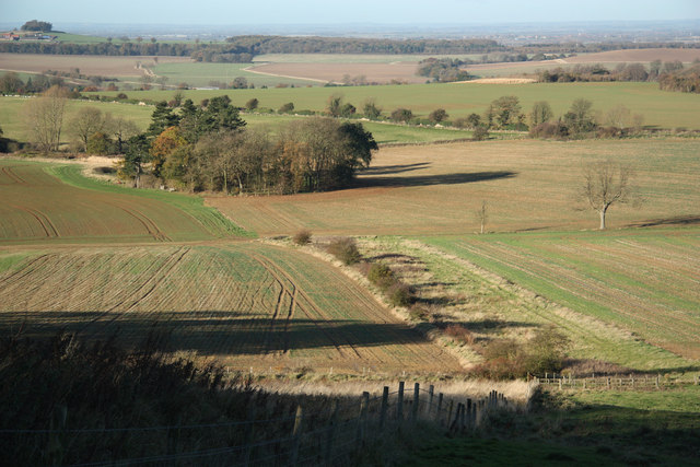
Brickkiln Plantation is a picturesque woodland located in Lincolnshire, England. Covering an area of approximately 100 acres, it is a haven for nature enthusiasts and offers a tranquil escape from the hustle and bustle of everyday life.

The plantation is predominantly made up of mature trees, including oak, beech, and birch, creating a dense and verdant forest. The tall, majestic trees provide a canopy that offers shade and shelter to a diverse range of flora and fauna.

Walking through Brickkiln Plantation, visitors will find themselves surrounded by a carpet of wildflowers, such as bluebells, primroses, and foxgloves, which add bursts of vibrant color to the forest floor. The air is filled with the sweet fragrance of the flowers, creating a sensory delight for those exploring the area.

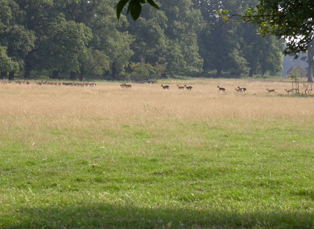
The woodland is home to a variety of wildlife, including deer, squirrels, and a myriad of bird species. Birdwatchers can spot woodpeckers, owls, and various songbirds throughout the year. With luck and patience, visitors may also catch a glimpse of elusive creatures such as badgers or foxes.

Brickkiln Plantation offers several well-maintained walking trails, allowing visitors to immerse themselves in the natural beauty of the surroundings. These paths wind through the forest, offering different levels of difficulty and showcasing various aspects of the woodland.

Nature lovers, hikers, and photographers alike will be captivated by the serenity and charm of Brickkiln Plantation. Its untouched beauty and rich biodiversity make it a must-visit destination for anyone seeking a peaceful retreat in the heart of Lincolnshire's countryside.

If you have any feedback on the listing, please let us know in the comments section below.

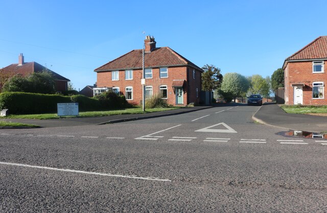
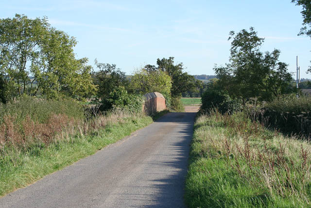
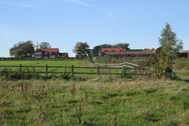
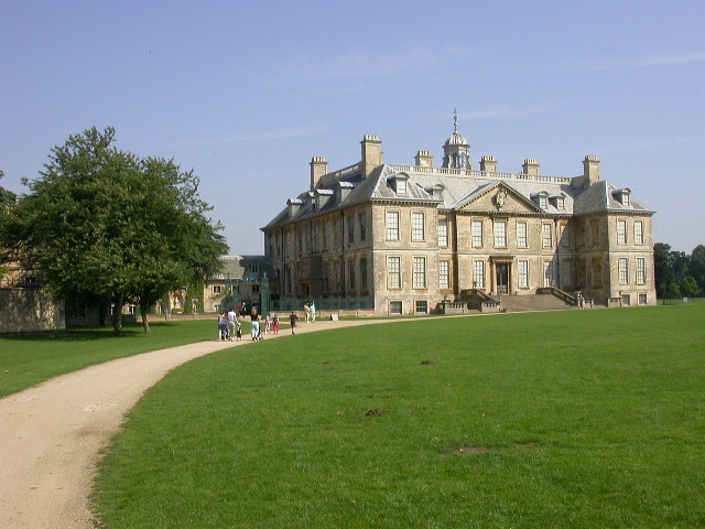
Brickkiln Plantation Images

Images are sourced within 2km of 52.935853/-0.63489476 or Grid Reference SK9138. Thanks to Geograph Open Source API. All images are credited.

Kelham Road, Great Gonerby From Gonerby Road
Kelham Road, Great Gonerby
From Gonerby Road
Gonnerby Grange Bridge, Peascliffe Lane The London to Edinburgh high speed rail link passes under this bridge in a deep cutting.
Gonnerby Grange Bridge, Peascliffe Lane
The London to Edinburgh high speed rail link passes under this bridge in a deep cutting.
Gonerby Grange near Belton A large farm complex on Peascliffe Lane.
Gonerby Grange near Belton
A large farm complex on Peascliffe Lane.
Belton House Restoration country house with magnificent interiors, gardens and park.
Belton House
Restoration country house with magnificent interiors, gardens and park.
Front of Belton House Shows the sweep of part of the unusually large carriage circle.
Front of Belton House
Shows the sweep of part of the unusually large carriage circle.
Boathouse Pond Surrounded by Arboreta. Photo taken from the Dam.
Boathouse Pond
Surrounded by Arboreta. Photo taken from the Dam.
Boathouse Can be seen across the pond.  The style is Swiss Chalet with decorative outer walls.  Scaffolding is there while it's being made safe for the public.
Boathouse
Can be seen across the pond. The style is Swiss Chalet with decorative outer walls. Scaffolding is there while it's being made safe for the public.
Fallow Herd Deer Park at Belton
Fallow Herd
Deer Park at Belton
Large flat topped hill north of Great Gonerby
Stevenson Avenue, Gonerby Hill Foot, Grantham In the Thatcher era there was a building boom in Grantham supposedly to house all the London commuters that had discovered the benefits of living in a Lincolnshire town only 76 minutes from King's Cross. Gonerby Hill Foot, not surprisingly at the bottom of Gonerby Hill, is mainly 70s and 80s housing.
Stevenson Avenue, Gonerby Hill Foot, Grantham
In the Thatcher era there was a building boom in Grantham supposedly to house all the London commuters that had discovered the benefits of living in a Lincolnshire town only 76 minutes from King's Cross. Gonerby Hill Foot, not surprisingly at the bottom of Gonerby Hill, is mainly 70s and 80s housing.
Long Street, Great Gonerby There are many small village houses on Long Street with modern infil development. The large stone house is Manor Farm, (now on Lord Drive), with modern executive housing surrounding it.
Long Street, Great Gonerby
There are many small village houses on Long Street with modern infil development. The large stone house is Manor Farm, (now on Lord Drive), with modern executive housing surrounding it.
St.John's church, Manthorpe, Lincs. In the pretty stone estate village of Manthorpe on the outskirts of Grantham, built 1847-8 by G.G.Place of Nottingham in a Early English gothic revival manner.
St.John's church, Manthorpe, Lincs.
In the pretty stone estate village of Manthorpe on the outskirts of Grantham, built 1847-8 by G.G.Place of Nottingham in a Early English gothic revival manner.
Low Road. Manthorpe
Low Road. Manthorpe
Belton Forge
Belton Forge
Belton Village
Belton Village
Almshouses Jacobean style estate almshouses in Belton village of 1827
Almshouses
Jacobean style estate almshouses in Belton village of 1827
Belton Estate village houses A house of two halves, but all of 1839 - the left half has a date in the gable of 1470 and a bay window from the Chantry House in Grantham, the right half is dated 1839
Belton Estate village houses
A house of two halves, but all of 1839 - the left half has a date in the gable of 1470 and a bay window from the Chantry House in Grantham, the right half is dated 1839
Belton village estate cottage Attaractive estate cottage in Belton village
Belton village estate cottage
Attaractive estate cottage in Belton village
Show me another place!

Brickkiln Plantation is located at Grid Ref: SK9138 (Lat: 52.935853, Lng: -0.63489476)

Administrative County: Lincolnshire

District: South Kesteven

Police Authority: Lincolnshire

What 3 Words

///jiffy.coconut.resembles. Near Great Gonerby, Lincolnshire

Nearby Locations

Brickkiln Plantation

Related Wikis

Belton and Manthorpe

Belton and Manthorpe is a civil parish in the South Kesteven district of Lincolnshire, England, consisting of Belton and Manthorpe, just north of Grantham...

Manthorpe, Grantham

Manthorpe is a village in the South Kesteven district of Lincolnshire, England. It is on the northern edge of the town of Grantham and on the Grantham...

Murder of Julie Pacey

The murder of Julie Pacey (1955/1956 – 26 September 1994) was a mysterious, and still unsolved, murder of a mother in her own home in Grantham, England...
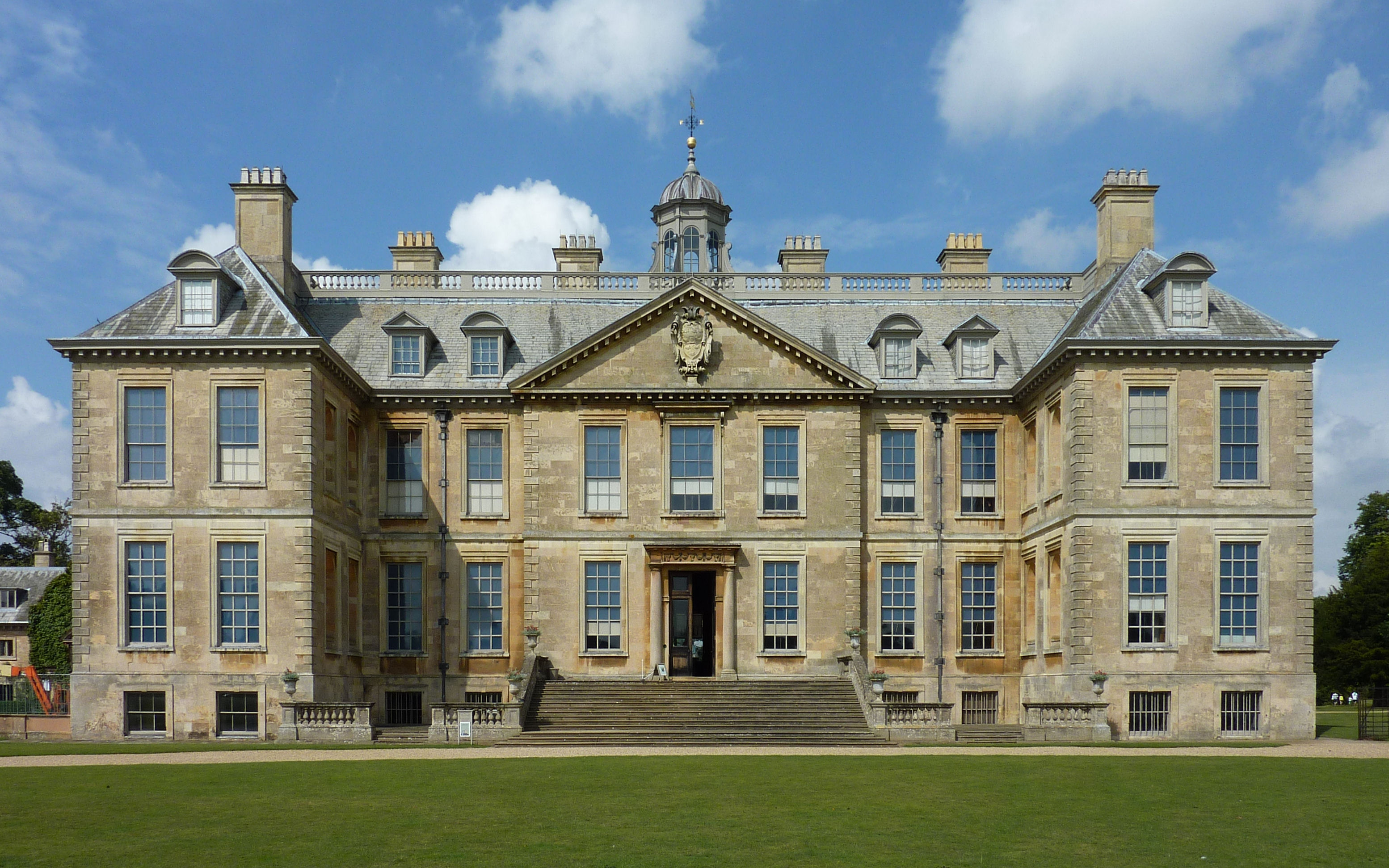
Belton House

Belton House is a Grade I listed country house in the parish of Belton near Grantham in Lincolnshire, England, built between 1685 and 1687 by Sir John...

Central Technology and Sports College

Central Technology & Sports College was a secondary school in the north of Grantham in Lincolnshire, England. It became part of The Priory Ruskin Academy...

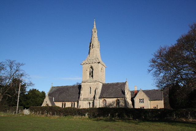
St Peter and St Paul's Church, Belton

The Church of St Peter and St Paul, Belton, South Kesteven, Lincolnshire is a functioning parish church and a Grade I listed building. Since the 17th century...

Oak Bank School

Oak Bank School is a co-educational special school with academy status located in Leighton Buzzard, Bedfordshire, England. The school accepts pupils from...

Belton, South Kesteven

Belton is a village in the civil parish of Belton and Manthorpe, in the South Kesteven district of Lincolnshire, England. It is situated on the A607 road...

Nearby Amenities

Located within 500m of 52.935853,-0.63489476
Power: tower
Source: Bing
Lat/Long: 52.9317334/-0.6320872
Power: tower
Source: Bing
Lat/Long: 52.9347724/-0.639421
Power: tower
Source: Bing
Lat/Long: 52.9332939/-0.635853
Building: yes
Lat/Long: 52.9332424/-0.6290583
Location Transition: yes
Material: wood
Power: pole
Lat/Long: 52.9363906/-0.6312614
Material: wood
Power: pole
Lat/Long: 52.9319984/-0.6346532
Material: wood
Power: pole
Lat/Long: 52.9353908/-0.6304683
Material: wood
Power: pole
Lat/Long: 52.9346491/-0.6310204
Material: wood
Power: pole
Lat/Long: 52.9326494/-0.6337552
Material: wood
Power: pole
Lat/Long: 52.9333144/-0.6328382
Material: wood
Power: pole
Lat/Long: 52.9359444/-0.6309136
Material: wood
Power: pole
Lat/Long: 52.9339958/-0.6319017
Power: pole
Lat/Long: 52.9373156/-0.6408864
Power: pole
Lat/Long: 52.9372166/-0.6398269
Power: pole
Lat/Long: 52.9371053/-0.6386501
The data included in this document is from www.openstreetmap.org. The data is made available under ODbL.

Have you been to Brickkiln Plantation?

Leave your review of Brickkiln Plantation below (or comments, questions and feedback).