Baxter's Copse

Wood, Forest in Sussex Chichester

England

Baxter's Copse

West Lodge West Lodge at an entrance to Seaford College.
West Lodge Credit: Chris Thomas-Atkin

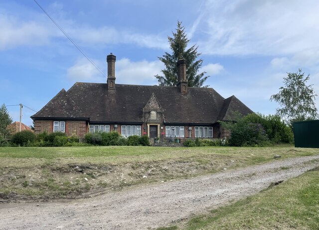
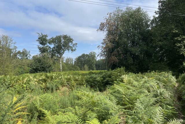
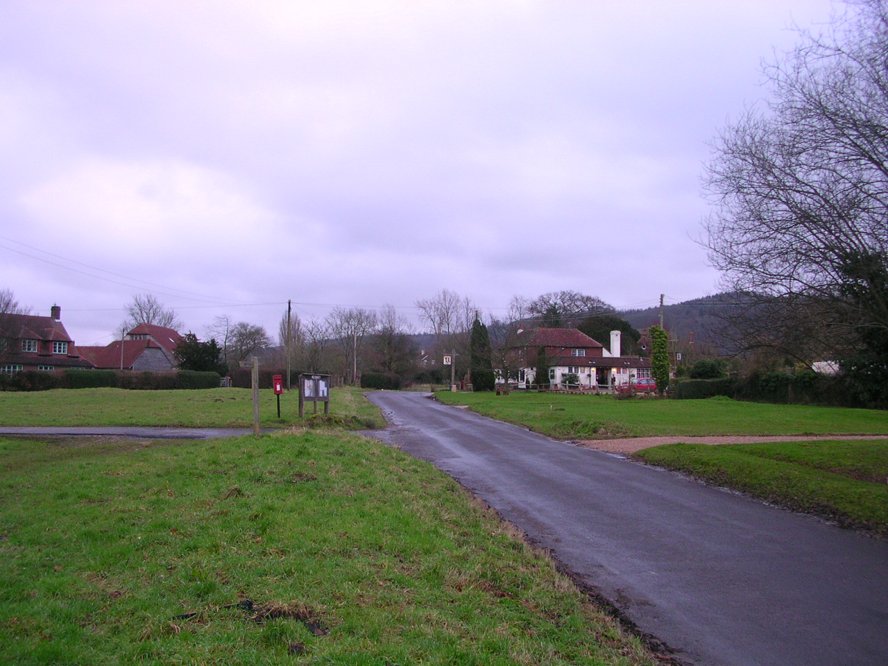
Baxter's Copse, located in Sussex, England, is a picturesque woodland area known for its natural beauty and serene atmosphere. Spanning over a vast area, it is considered one of the most enchanting forests in the region.

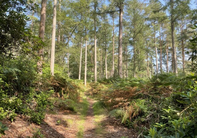
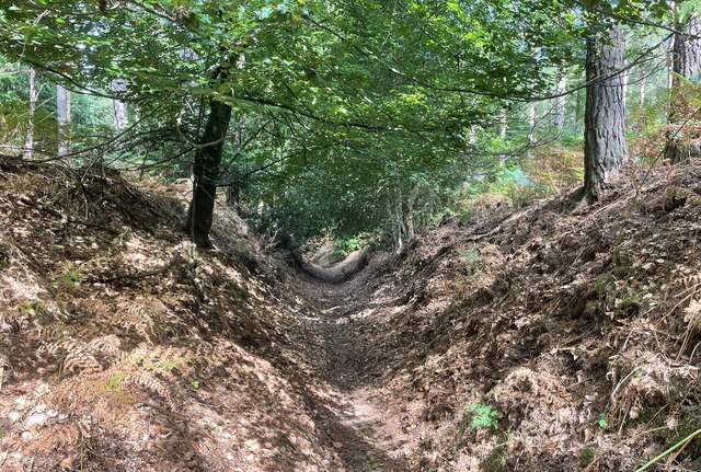
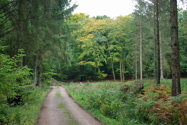
The copse is primarily composed of native deciduous trees, including oak, beech, and birch, which create a dense canopy that filters sunlight, casting dappled shadows on the forest floor. The diverse vegetation in Baxter's Copse provides a habitat for a wide range of wildlife, including foxes, deer, and various bird species.

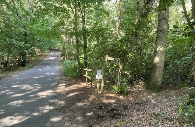
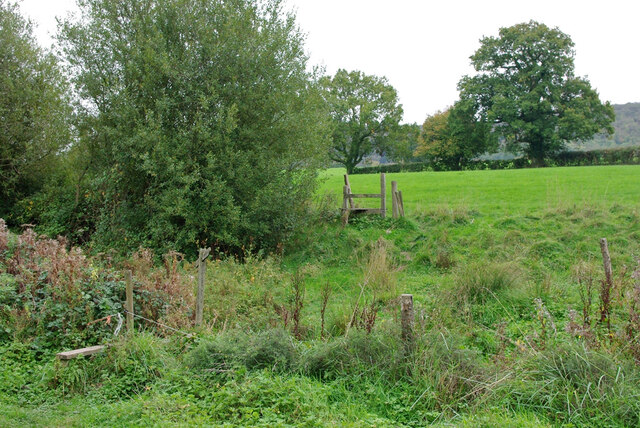
Traversing the woodland, visitors can follow a network of well-maintained footpaths that wind their way through the copse, allowing for leisurely walks and exploration of the area's natural wonders. The paths are often lined with wildflowers, enhancing the enchanting atmosphere and providing a burst of color during spring and summer months.

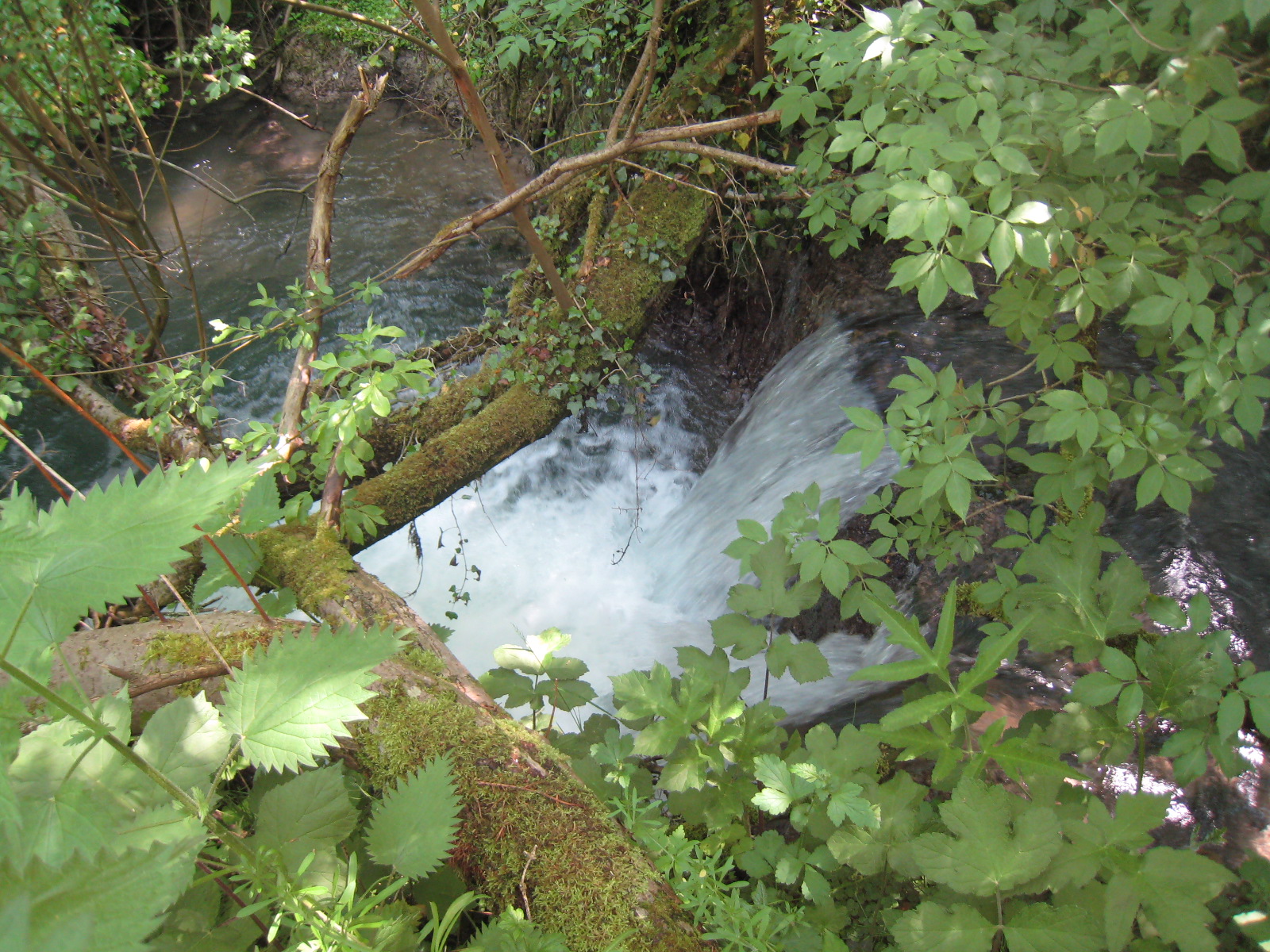
Baxter's Copse is also home to a small stream that meanders through the woodland, adding to the tranquil ambiance and creating a peaceful soundtrack of babbling water. This stream serves as a watering hole for animals and attracts an array of insects and amphibians.

Nature enthusiasts and photographers are particularly drawn to Baxter's Copse due to its stunning vistas and the opportunity to capture the beauty of the changing seasons. The copse is especially renowned for its vibrant autumn foliage, which transforms the woodland into a kaleidoscope of oranges, reds, and yellows.

With its serene ambiance, diverse flora and fauna, and breathtaking scenery, Baxter's Copse is a true gem of Sussex and a haven for those seeking a peaceful escape in nature.

If you have any feedback on the listing, please let us know in the comments section below.

Baxter's Copse Images

Images are sourced within 2km of 50.950816/-0.69967768 or Grid Reference SU9117. Thanks to Geograph Open Source API. All images are credited.

West Lodge West Lodge at an entrance to Seaford College.
West Lodge
West Lodge at an entrance to Seaford College.
The Parish Church of St Giles The church is a Grade II listed building. See <span class="nowrap"><a title="https://historicengland.org.uk/listing/the-list/list-entry/1276882" rel="nofollow ugc noopener" href="https://historicengland.org.uk/listing/the-list/list-entry/1276882">Link</a><img style="margin-left:2px;" alt="External link" title="External link - shift click to open in new window" src="https://s1.geograph.org.uk/img/external.png" width="10" height="10"/></span>
The Parish Church of St Giles
The church is a Grade II listed building. See LinkExternal link
Homes of Rest The almshouses in Graffham are a Grade II listed building. See <span class="nowrap"><a title="https://historicengland.org.uk/listing/the-list/list-entry/1396449" rel="nofollow ugc noopener" href="https://historicengland.org.uk/listing/the-list/list-entry/1396449">Link</a><img style="margin-left:2px;" alt="External link" title="External link - shift click to open in new window" src="https://s1.geograph.org.uk/img/external.png" width="10" height="10"/></span>
Homes of Rest
The almshouses in Graffham are a Grade II listed building. See LinkExternal link
Leaving Homeball Wood The stile ahead leads to fields beside Homeball Wood near to Graffham.
Leaving Homeball Wood
The stile ahead leads to fields beside Homeball Wood near to Graffham.
Bridleway at Birch Copse The bridleway leaves the roadside at Birch Copse and heads northwards to meet up with the Serpent Trail.
Bridleway at Birch Copse
The bridleway leaves the roadside at Birch Copse and heads northwards to meet up with the Serpent Trail.
Birch Copse Passing through Birch Copse on the bridleway heading northwards to join with the Serpent Trail.
Birch Copse
Passing through Birch Copse on the bridleway heading northwards to join with the Serpent Trail.
Sunken Path The way ahead is between steep banks at this point.
Sunken Path
The way ahead is between steep banks at this point.
Ferns near Graffham Court The Serpent Trail makes it way through a sea of ferns at this open space near Graffham Court.
Ferns near Graffham Court
The Serpent Trail makes it way through a sea of ferns at this open space near Graffham Court.
Graffham School Next to the church, built in 1854 to designs of the  noted architect GE Street.
Graffham School
Next to the church, built in 1854 to designs of the noted architect GE Street.
Oak in field, Graffham
Public footpath 958, Graffham Towards Woodcote, Marsh Farm is visible ahead.
Public footpath 958, Graffham
Towards Woodcote, Marsh Farm is visible ahead.
Dead oak in field, Graffham
Stiles on footpath 958, Graffham From Woodcote towards Graffham.
Stiles on footpath 958, Graffham
From Woodcote towards Graffham.
A lot of weedkilling, Heyshott Looking along the route of footpath 953, Heyshott.
A lot of weedkilling, Heyshott
Looking along the route of footpath 953, Heyshott.
Site of Beech Barn, Heyshott There was once also a small pond here.
Site of Beech Barn, Heyshott
There was once also a small pond here.
Public footpath 957, Heyshott From Heyshott towards Woodcote.
Public footpath 957, Heyshott
From Heyshott towards Woodcote.
Shooting tower at edge of woodland On a deer route.
Shooting tower at edge of woodland
On a deer route.
Woodland track Also public footpath 957, Graffham, towards Woodcote.
Woodland track
Also public footpath 957, Graffham, towards Woodcote.
Show me another place!

Baxter's Copse is located at Grid Ref: SU9117 (Lat: 50.950816, Lng: -0.69967768)

Administrative County: West Sussex

District: Chichester

Police Authority: Sussex

What 3 Words

///desktops.informs.muddle. Near Midhurst, West Sussex

Related Wikis

Sussex Downs AONB

Sussex Downs Area of Outstanding Natural Beauty in England was designated in 1966. The designation was revoked in March 2010, together with the neighbouring...

Graffham

Graffham is a village, Anglican parish and civil parish in West Sussex, England, situated on the northern escarpment of the South Downs within the South...

Heyshott

Heyshott is a village, Anglican parish and civil parish in the Chichester district of West Sussex, England. It is approximately three miles south of Midhurst...

Ambersham Common

Ambersham Common is a 141.6-hectare (350-acre) biological Site of Special Scientific Interest south-east of Midhurst in West Sussex. It is a Nature Conservation...

Heyshott Down

Heyshott Down is a 42.6-hectare (105-acre) biological Site of Special Scientific Interest south of Midhurst in West Sussex. It is a Nature Conservation...

Graffham Common

Graffham Common is a 38-hectare (94-acre) nature reserve between Midhurst and Petworth in West Sussex. It is owned and managed by the Sussex Wildlife...

South Ambersham

South Ambersham is a hamlet and former civil parish, now in the parish of Graffham, in the Chichester district of West Sussex, England. It lies 0.7 miles...

Cocking Foundry

Cocking Foundry (also known as Chorley Iron Foundry) is an abandoned iron foundry in the South Downs of England. It was situated to the north of the village...

Nearby Amenities

Located within 500m of 50.950816,-0.69967768
BAXTERSCOPSE1
Disused: yes
Man Made: petroleum_well
Ref GB Decc: L99/02-1
Source: DECC
Lat/Long: 50.9526389/-0.6974444
Barrier: stile
Lat/Long: 50.9485732/-0.7022044
Barrier: stile
Lat/Long: 50.9476891/-0.7007661
Barrier: stile
Lat/Long: 50.9471312/-0.6972977
Barrier: stile
Lat/Long: 50.9506174/-0.6943048
The data included in this document is from www.openstreetmap.org. The data is made available under ODbL.

Have you been to Baxter's Copse?

Leave your review of Baxter's Copse below (or comments, questions and feedback).