Hurthill Copse

Wood, Forest in Surrey Waverley

England

Hurthill Copse

Devil's Punch Bowl
Devil's Punch Bowl Credit: Oscar Taylor

Hurthill Copse is a picturesque woodland located in the county of Surrey, England. Nestled in the tranquil countryside, this copse is a haven for nature enthusiasts and offers a serene retreat from the hustle and bustle of urban life.

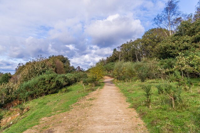
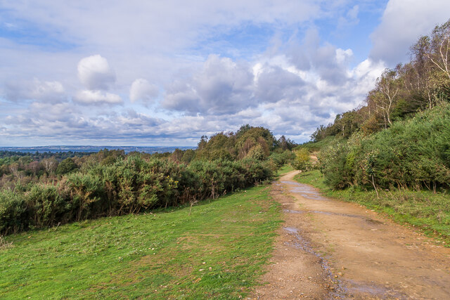
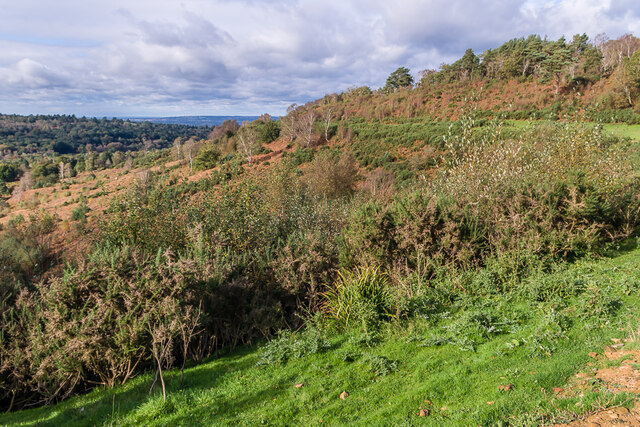
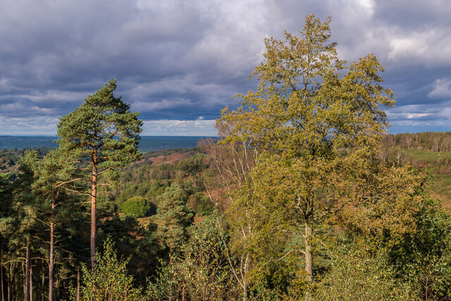
Covering an area of approximately 100 acres, Hurthill Copse boasts a diverse range of tree species, including oak, beech, and birch. The woodland floor is adorned with a rich carpet of bluebells during the spring months, creating a stunning display of vibrant colors. The tall, majestic trees provide a canopy that creates a cool and shady atmosphere, making it an ideal place for leisurely walks and picnics on hot summer days.

The copse is also home to a variety of wildlife, including deer, foxes, and a myriad of bird species. It provides a habitat for numerous insects and small mammals, making it a popular spot for nature lovers and photographers alike. Birdwatchers will be delighted to spot species such as woodpeckers, robins, and blue tits flitting among the branches.

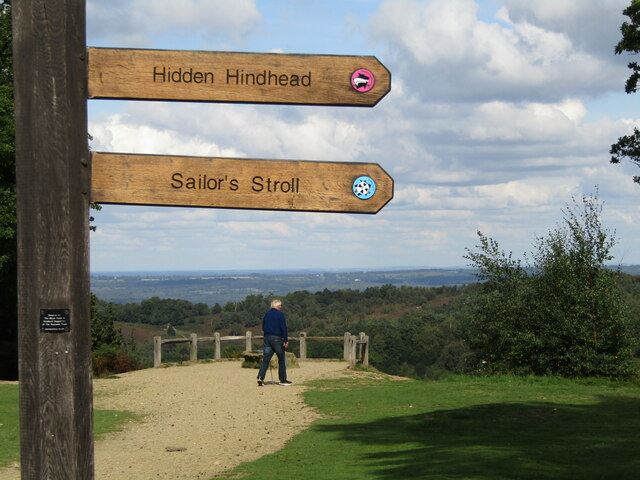
With its well-maintained paths and clear signposts, Hurthill Copse is easily accessible to visitors of all ages and abilities. It is a perfect location for family outings, dog walking, or simply immersing oneself in the tranquility of nature. The copse is open year-round and can be enjoyed during all seasons, each offering its own unique charm.

Hurthill Copse is a true gem in the heart of Surrey, providing a peaceful and idyllic setting for those seeking solace in nature's embrace.

If you have any feedback on the listing, please let us know in the comments section below.

Hurthill Copse Images

Images are sourced within 2km of 51.116071/-0.70013127 or Grid Reference SU9136. Thanks to Geograph Open Source API. All images are credited.

Devil's Punch Bowl
Devil's Punch Bowl
Renovations underway at The Wheatsheaf
Celtic cross Celtic cross on the summit of Gibbet Hill, erected in 1851 by Sir William Erle near the site of the gallows which were used to hang three sailors who in 1786  had murdered another while he was on his way to Portsmouth.  Grade II listed  - see <span class="nowrap"><a title="www.historicengland.org.uk/listing/the-list/list-entry/1260847" rel="nofollow ugc noopener" href="http://www.historicengland.org.uk/listing/the-list/list-entry/1260847">Link</a><img style="margin-left:2px;" alt="External link" title="External link - shift click to open in new window" src="https://s1.geograph.org.uk/img/external.png" width="10" height="10"/></span>.
Celtic cross
Celtic cross on the summit of Gibbet Hill, erected in 1851 by Sir William Erle near the site of the gallows which were used to hang three sailors who in 1786 had murdered another while he was on his way to Portsmouth. Grade II listed - see LinkExternal link.
Gibbet Hill Trig point on the summit of Gibbet Hill, with the North Downs in the centre background and Leith Hill to their right.  Although not apparent in this photo, very clear conditions on this occasion meant that the City of London skyscrapers could be seen through the Wey Gap, left of centre, a distance of almost 40 miles.
Gibbet Hill
Trig point on the summit of Gibbet Hill, with the North Downs in the centre background and Leith Hill to their right. Although not apparent in this photo, very clear conditions on this occasion meant that the City of London skyscrapers could be seen through the Wey Gap, left of centre, a distance of almost 40 miles.
Byway, Devil's Punchbowl Byway above the Devil's Punch Bowl, giving an alternative route for traffic prohibited from using the A3 Hindhead Tunnel.
Byway, Devil's Punchbowl
Byway above the Devil's Punch Bowl, giving an alternative route for traffic prohibited from using the A3 Hindhead Tunnel.
Old A3, Devil's Punch Bowl Part of the route of the former A3 above the Devil's Punch Bowl, restored to nature following the opening of the Hindhead Tunnel in 2011.
Old A3, Devil's Punch Bowl
Part of the route of the former A3 above the Devil's Punch Bowl, restored to nature following the opening of the Hindhead Tunnel in 2011.
Devil's Punch Bowl Looking along the rim of the Devil's Punch Bowl, with part of the route of the former A3 in the background, restored to nature following the opening of the Hindhead Tunnel in 2011.
Devil's Punch Bowl
Looking along the rim of the Devil's Punch Bowl, with part of the route of the former A3 in the background, restored to nature following the opening of the Hindhead Tunnel in 2011.
Devil's Punch Bowl Looking across the Devil's Punch Bowl.
Devil's Punch Bowl
Looking across the Devil's Punch Bowl.
Devil's Punch Bowl - Viewpoint New wooden signposts for "Hidden Hindhead" and the "Sailor's Stroll" at the head of this large natural amphitheatre by Hindhead.
Devil's Punch Bowl - Viewpoint
New wooden signposts for "Hidden Hindhead" and the "Sailor's Stroll" at the head of this large natural amphitheatre by Hindhead.
Hindhead - Former A3 Gorse-lined footpath offering panoramic views westwards over the Devil's Punch Bowl.
Hindhead - Former A3
Gorse-lined footpath offering panoramic views westwards over the Devil's Punch Bowl.
Hindhead - Former A3 Gorse-lined footpath offering panoramic views westwards over the Devil's Punch Bowl.
Hindhead - Former A3
Gorse-lined footpath offering panoramic views westwards over the Devil's Punch Bowl.
Old Milestone on Gibbet Hill, Haslemere parish Carved stone post by the UC road (was A3), in parish of HASLEMERE (WAVERLEY District), Byway 500 near Gibbet Hill, gravel road beside restricted road, on West side of road. Guildford facets, erected by the Kingston & Sheetbridge, 2nd District turnpike trust in the 19th century. 

Inscription reads:-
: GODALMING / 7 MILES : : PORTSMOUTH / 30 : : HYDE PARK CORNER / 39 : : LIPHOOK / 5 MILES :
Carved benchmark on right side. 

Milestone Society National ID: SY_LP39.
Old Milestone on Gibbet Hill, Haslemere parish
Carved stone post by the UC road (was A3), in parish of HASLEMERE (WAVERLEY District), Byway 500 near Gibbet Hill, gravel road beside restricted road, on West side of road. Guildford facets, erected by the Kingston & Sheetbridge, 2nd District turnpike trust in the 19th century. Inscription reads:- : GODALMING / 7 MILES : : PORTSMOUTH / 30 : : HYDE PARK CORNER / 39 : : LIPHOOK / 5 MILES : Carved benchmark on right side. Milestone Society National ID: SY_LP39.
Dogs on a Lead A new sign on a post in the Devil's Punchbowl implores dog owners to keep their pets on a lead during March - September to protect ground nesting birds.
<span class="nowrap"><a title="www.nationaltrust.org.uk/visit/surrey/hindhead-commons-and-the-devils-punch-bowl" rel="nofollow ugc noopener" href="http://www.nationaltrust.org.uk/visit/surrey/hindhead-commons-and-the-devils-punch-bowl">Link</a><img style="margin-left:2px;" alt="External link" title="External link - shift click to open in new window" src="https://s1.geograph.org.uk/img/external.png" width="10" height="10"/></span>
Dogs on a Lead
A new sign on a post in the Devil's Punchbowl implores dog owners to keep their pets on a lead during March - September to protect ground nesting birds. LinkExternal link
Devil's Punchbowl - Heathland Heathland path passing birch, bracken and gorse on a Punchbowl hillside.
<span class="nowrap"><a title="www.nationaltrust.org.uk/visit/surrey/hindhead-commons-and-the-devils-punch-bowl" rel="nofollow ugc noopener" href="http://www.nationaltrust.org.uk/visit/surrey/hindhead-commons-and-the-devils-punch-bowl">Link</a><img style="margin-left:2px;" alt="External link" title="External link - shift click to open in new window" src="https://s1.geograph.org.uk/img/external.png" width="10" height="10"/></span>
Devil's Punchbowl - Heathland
Heathland path passing birch, bracken and gorse on a Punchbowl hillside. LinkExternal link
Devil's Punchbowl - Mud A very wet February 2024 in Surrey has resulted in heathland paths being under water in places which would normally be dry.
 <span class="nowrap"><a title="www.nationaltrust.org.uk/visit/surrey/hindhead-commons-and-the-devils-punch-bowl" rel="nofollow ugc noopener" href="http://www.nationaltrust.org.uk/visit/surrey/hindhead-commons-and-the-devils-punch-bowl">Link</a><img style="margin-left:2px;" alt="External link" title="External link - shift click to open in new window" src="https://s1.geograph.org.uk/img/external.png" width="10" height="10"/></span>
Devil's Punchbowl - Mud
A very wet February 2024 in Surrey has resulted in heathland paths being under water in places which would normally be dry. LinkExternal link
Devil's Punchbowl - Public Bridleway Sign advising "No unauthorised motor vehicles" heading north away from the Punchbowl.
<span class="nowrap"><a title="www.nationaltrust.org.uk/visit/surrey/hindhead-commons-and-the-devils-punch-bowl" rel="nofollow ugc noopener" href="http://www.nationaltrust.org.uk/visit/surrey/hindhead-commons-and-the-devils-punch-bowl">Link</a><img style="margin-left:2px;" alt="External link" title="External link - shift click to open in new window" src="https://s1.geograph.org.uk/img/external.png" width="10" height="10"/></span>
Devil's Punchbowl - Public Bridleway
Sign advising "No unauthorised motor vehicles" heading north away from the Punchbowl. LinkExternal link
Hindhead - Punch Bowl Lane Crossing of a bridleway with a byway. Off road bikes are often seen and heard here in this heathland environment.
<span class="nowrap"><a title="www.nationaltrust.org.uk/visit/surrey/hindhead-commons-and-the-devils-punch-bowl" rel="nofollow ugc noopener" href="http://www.nationaltrust.org.uk/visit/surrey/hindhead-commons-and-the-devils-punch-bowl">Link</a><img style="margin-left:2px;" alt="External link" title="External link - shift click to open in new window" src="https://s1.geograph.org.uk/img/external.png" width="10" height="10"/></span>
Hindhead - Punch Bowl Lane
Crossing of a bridleway with a byway. Off road bikes are often seen and heard here in this heathland environment. LinkExternal link
Show me another place!

Hurthill Copse is located at Grid Ref: SU9136 (Lat: 51.116071, Lng: -0.70013127)

Administrative County: Surrey

District: Waverley

Police Authority: Surrey

What 3 Words

///vegetable.snuggle.coaching. Near Hindhead, Surrey

Nearby Locations

The Roughs Hurthill Copse

Related Wikis

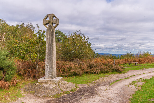
Gibbet Hill, Hindhead

Gibbet Hill, at Hindhead, Surrey, is the apex of the scarp surrounding the Devil's Punch Bowl, not far from the A3 London to Portsmouth road in England...

All Saints' Church, Grayswood

All Saints' Church is an active parish church in the village of Grayswood, Surrey, England. The church stands in the centre of the village and was built...

Wispers School

Wispers School was a British independent boarding school for girls aged between 11 and 18 which was founded in 1947 and which closed in 2008 after 61 years...
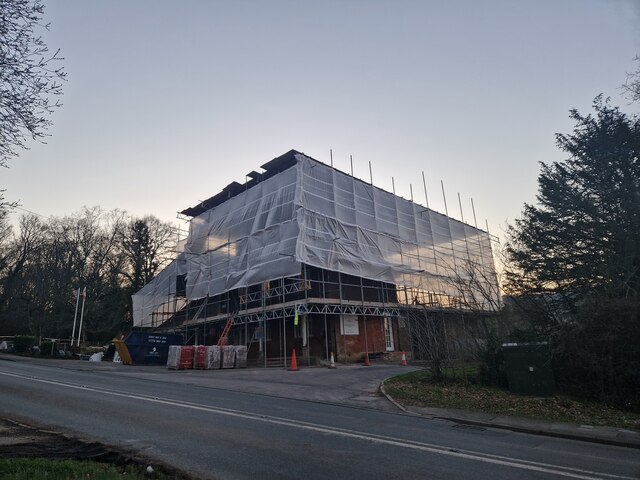
Oak Hall, Haslemere

Oak Hall at Haslemere, Surrey, England is a Grade II listed country house. As of 2013 it houses Oak Hall Country Club, part of the Wispers Park retirement...

Nearby Amenities

Located within 500m of 51.116071,-0.70013127
Hurt Hill
Natural: peak
Lat/Long: 51.114637/-0.7063613
Temple of the Four Winds
Description: The base of an old hunting lodge.
Historic: ruins
Tourism: viewpoint
Lat/Long: 51.1147425/-0.7067708
Hurthill Copse
Natural: wood
Source: npe
Lat/Long: 51.1142917/-0.6991927
High Button
Place: locality
Source: npe
Lat/Long: 51.1182267/-0.7049726
Bench
Backrest: no
Lat/Long: 51.1147791/-0.7067774
The data included in this document is from www.openstreetmap.org. The data is made available under ODbL.

Have you been to Hurthill Copse?

Leave your review of Hurthill Copse below (or comments, questions and feedback).