Alder Wood

Wood, Forest in Sussex Chichester

England

Alder Wood

Old Milestone by A286, Kingsley Green The Milestone is located near the junction with Square Drive on a narrow verge on the East of the road.  Parish of Fernhurst (Chichester District). Carved stone post, Chichester stone design, erected by the Chichester, Dell Quay & Fernhurst turnpike trust in the 19th Century.   

Inscription reads:-  
TO / LONDON / 43 MILES / TO / CHICHESTER / 18 MILES 

Milestone Society National ID: SX_CCMD18
Old Milestone by A286, Kingsley Green Credit: JR Dowding

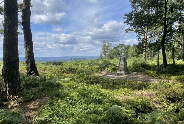
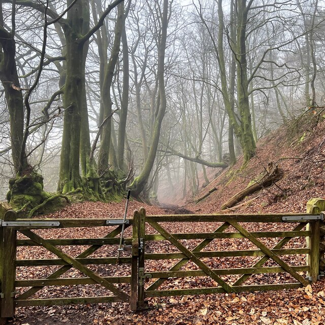
Alder Wood is a picturesque forest located in Sussex, England. Spanning an area of approximately 50 acres, this woodland is known for its dense growth of alder trees, which give the forest its name. It is a popular destination for both locals and tourists who seek solace in nature and enjoy outdoor activities.

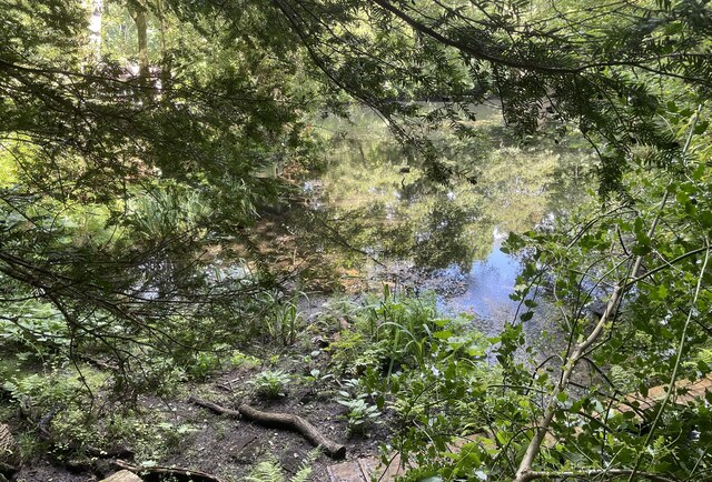
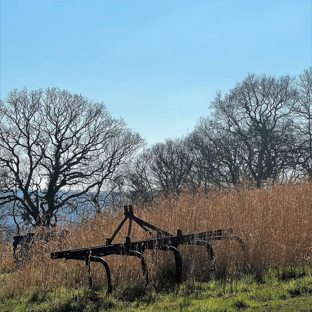
The forest is characterized by its rich biodiversity, with a variety of flora and fauna thriving within its boundaries. The alder trees dominate the landscape, creating a canopy that provides shade and shelter for a diverse range of plant species such as bluebells, wood sorrel, and ferns. This abundance of vegetation attracts a wide array of wildlife, including deer, foxes, badgers, and numerous bird species.

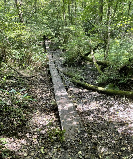
Alder Wood offers an extensive network of walking trails, enabling visitors to explore the forest and enjoy its natural beauty. These trails are well-maintained and suitable for all skill levels, accommodating both casual walkers and avid hikers. The forest is also a popular spot for picnics, with designated picnic areas and benches scattered throughout.

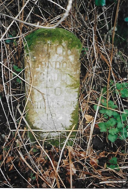
For those interested in history, Alder Wood has a fascinating past. It was once part of a larger estate and has remnants of old stone walls and structures that date back centuries. Visitors can catch glimpses of the forest's historical significance as they wander through its enchanting pathways.

Overall, Alder Wood in Sussex is a captivating destination that offers a serene escape from the bustling city life. With its stunning landscape, diverse wildlife, and historical charm, it continues to attract nature enthusiasts and history aficionados alike.

If you have any feedback on the listing, please let us know in the comments section below.

Alder Wood Images

Images are sourced within 2km of 51.070565/-0.70470345 or Grid Reference SU9030. Thanks to Geograph Open Source API. All images are credited.

Old Milestone by A286, Kingsley Green The Milestone is located near the junction with Square Drive on a narrow verge on the East of the road.  Parish of Fernhurst (Chichester District). Carved stone post, Chichester stone design, erected by the Chichester, Dell Quay & Fernhurst turnpike trust in the 19th Century.   

Inscription reads:-  
TO / LONDON / 43 MILES / TO / CHICHESTER / 18 MILES 

Milestone Society National ID: SX_CCMD18
Old Milestone by A286, Kingsley Green
The Milestone is located near the junction with Square Drive on a narrow verge on the East of the road.  Parish of Fernhurst (Chichester District). Carved stone post, Chichester stone design, erected by the Chichester, Dell Quay & Fernhurst turnpike trust in the 19th Century.   Inscription reads:- TO / LONDON / 43 MILES / TO / CHICHESTER / 18 MILES Milestone Society National ID: SX_CCMD18
Pond beside Green Lane Beyond the pond lies the county border and the edge of the South Downs National Park.
Pond beside Green Lane
Beyond the pond lies the county border and the edge of the South Downs National Park.
Valewood Farmhouse The farmhouse is a Grade II* (star) listed building. See <span class="nowrap"><a title="https://historicengland.org.uk/listing/the-list/list-entry/1354733" rel="nofollow ugc noopener" href="https://historicengland.org.uk/listing/the-list/list-entry/1354733">Link</a><img style="margin-left:2px;" alt="External link" title="External link - shift click to open in new window" src="https://s1.geograph.org.uk/img/external.png" width="10" height="10"/></span>
Valewood Farmhouse
The farmhouse is a Grade II* (star) listed building. See LinkExternal link
Gated Track On the Sussex Border Path in Chase Wood heading for Blackdown.
Gated Track
On the Sussex Border Path in Chase Wood heading for Blackdown.
Walking the planks The public footpath crosses a wet area near Lake House on a boardwalk.
Walking the planks
The public footpath crosses a wet area near Lake House on a boardwalk.
Path junction One of the many path options on Blackdown.
Path junction
One of the many path options on Blackdown.
Old Boundary Marker on Museum Hill, Haslemere Manor Boundary Marker in the rockery at the entrance to Museum Court, on the east side of Museum Hill. Haslemere parish. Inscribed 2 on the front and B H on the top. In 1814 the boundaries of the Old Manor of Haslemere were perambulated by the Leet Jury and surveyed by J. Perry. 31 Marker stones were set up, each one foot square and 3 ft 6 ins tall, marked B.H. on the top and numbered on outer face. 9 of these remain.

Milestone Society National ID: SY_HAS02em
Old Boundary Marker on Museum Hill, Haslemere
Manor Boundary Marker in the rockery at the entrance to Museum Court, on the east side of Museum Hill. Haslemere parish. Inscribed 2 on the front and B H on the top. In 1814 the boundaries of the Old Manor of Haslemere were perambulated by the Leet Jury and surveyed by J. Perry. 31 Marker stones were set up, each one foot square and 3 ft 6 ins tall, marked B.H. on the top and numbered on outer face. 9 of these remain. Milestone Society National ID: SY_HAS02em
Pond near the Pen-y-Bos Track The curious Welsh-sounding name "Pen-y-Bos" apparently comes from the Brythonic language spoken by the ancient Britons, which was obviously related to Welsh. (cf Pen-y-ghent in Yorkshire)
Pond near the Pen-y-Bos Track
The curious Welsh-sounding name "Pen-y-Bos" apparently comes from the Brythonic language spoken by the ancient Britons, which was obviously related to Welsh. (cf Pen-y-ghent in Yorkshire)
View SW from the Pen-y-Bos Track Something was burning down in the valley - hence the smoke. The curious Welsh-sounding name "Pen-y-Bos" apparently comes from the Brythonic language spoken by the ancient Britons, which was obviously related to Welsh. (cf Pen-y-ghent in Yorkshire)
View SW from the Pen-y-Bos Track
Something was burning down in the valley - hence the smoke. The curious Welsh-sounding name "Pen-y-Bos" apparently comes from the Brythonic language spoken by the ancient Britons, which was obviously related to Welsh. (cf Pen-y-ghent in Yorkshire)
This year's creature is..... .... a bird. In previous years the High Street has seen cows, pigs and hares.
This year's creature is.....
.... a bird. In previous years the High Street has seen cows, pigs and hares.
Haslemere Remembrance Sunday 2023
Black Down Trig Point A return visit to the trig point which marks the highest point in Sussex. For more details see <a href="https://www.geograph.org.uk/photo/6117646">SU9129 : Highest point in Sussex</a>
Black Down Trig Point
A return visit to the trig point which marks the highest point in Sussex. For more details see SU9129 : Highest point in Sussex
Reeth near Black Down The property known as Reeth viewed from the passing footpath.
Reeth near Black Down
The property known as Reeth viewed from the passing footpath.
Reeth Copse Heading towards Fernhurst through Reeth Copse.
Reeth Copse
Heading towards Fernhurst through Reeth Copse.
Bridleway on the east side of Black Down
View SSW from the Serpent Trail
Wooded slope on the east side of Black Down
Abandoned equipment north of Sopers Barn Farm
Show me another place!

Alder Wood is located at Grid Ref: SU9030 (Lat: 51.070565, Lng: -0.70470345)

Administrative County: West Sussex

District: Chichester

Police Authority: Sussex

What 3 Words

///upper.practical.birds. Near Haslemere, Surrey

Related Wikis

Haste Hill

Haste Hill is a hill near Haslemere, Surrey in England which was probably the original settlement of the town of Haslemere. It was used as the site of...

Blackdown, West Sussex

Blackdown, or Black Down, summit elevation 279.7 metres (918 ft) AMSL, is the highest point in both the historic county of Sussex and the South Downs National...

Haslemere Town Hall

Haslemere Town Hall is a municipal building in the High Street, Haslemere, Surrey, England. The structure, which serves as the meeting place of Haslemere...

The Curry Club

The Curry Club was founded by Pat Chapman in 1982, to further the understanding and appreciation of the cuisines of the Indian subcontinent. In 2007 it...

Haslemere Educational Museum

Haslemere Educational Museum was founded in 1888 by the eminent surgeon Sir Jonathan Hutchinson to display his growing collection of natural history specimens...

Haslemere

The town of Haslemere () and the villages of Shottermill and Grayswood are in south west Surrey, England, around 38 mi (62 km) south west of London. Together...

Haslemere railway station

Haslemere railway station is on the Portsmouth Direct Line, serving the town of Haslemere, Surrey, England. It is 42 miles 79 chains (69.2 km) down the...

Iberia Flight 062

Iberia Flight 062 was a twin-engined Sud Aviation Caravelle registered EC-BDD operating a scheduled flight from Málaga Airport, Spain, to London Heathrow...

Nearby Amenities

Located within 500m of 51.070565,-0.70470345
Valewood Park
Place: locality
Lat/Long: 51.0738/-0.708656
The data included in this document is from www.openstreetmap.org. The data is made available under ODbL.

Have you been to Alder Wood?

Leave your review of Alder Wood below (or comments, questions and feedback).