Keffold's Copse

Wood, Forest in Surrey Waverley

England

Keffold's Copse

New build in Haslemere (II) Church Meadows
New build in Haslemere (II) Credit: Basher Eyre

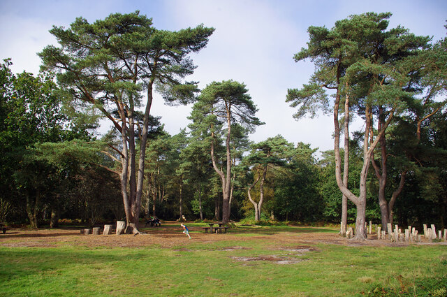
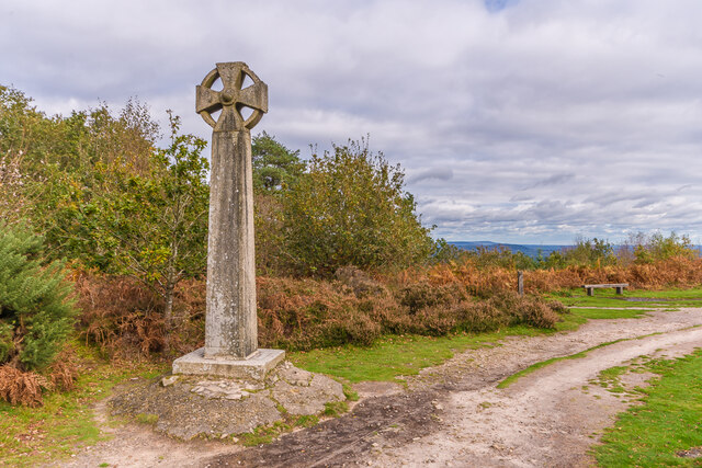
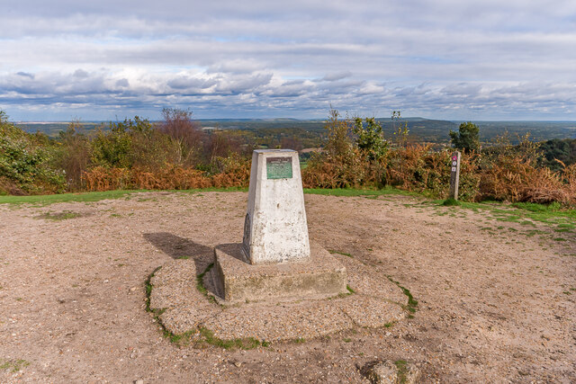
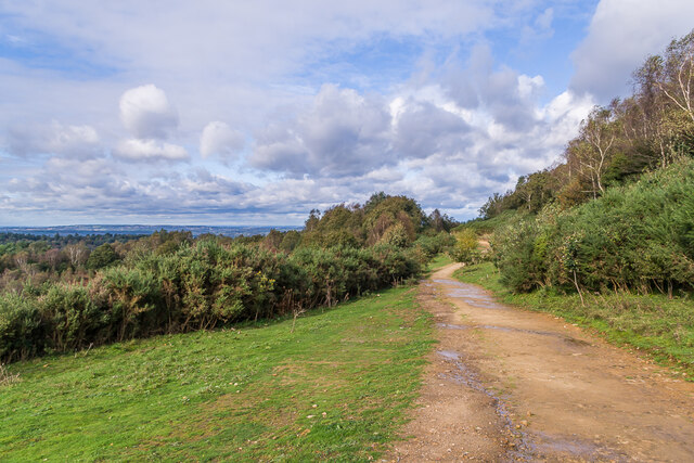
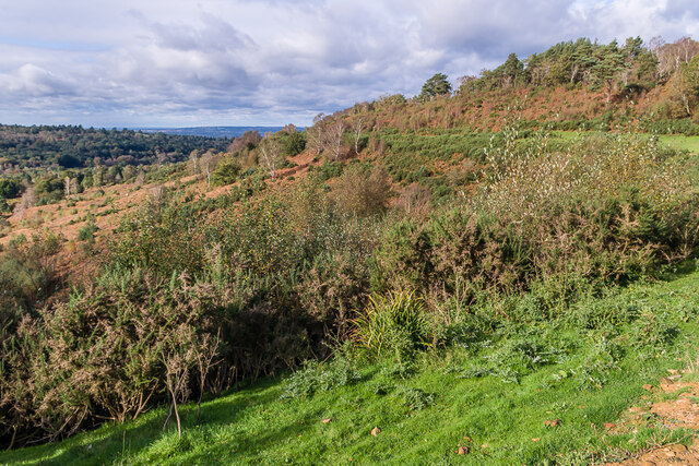
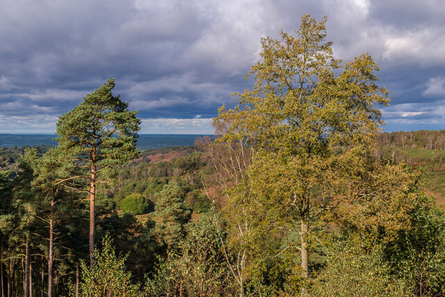
Keffold's Copse is a picturesque woodland located in Surrey, England. Covering an area of approximately 10 acres, it is a popular destination for nature lovers and outdoor enthusiasts. The copse is situated on the outskirts of a small village, surrounded by rolling hills and meadows.

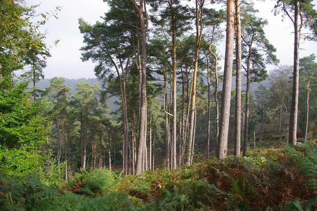
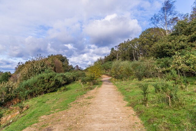
The woodland is predominantly made up of broadleaf trees, including oak, beech, and ash, creating a rich and diverse ecosystem. The dense canopy provides shade and shelter for a variety of wildlife, such as birds, squirrels, and deer. Wildflowers and ferns carpet the forest floor, adding to its natural beauty.

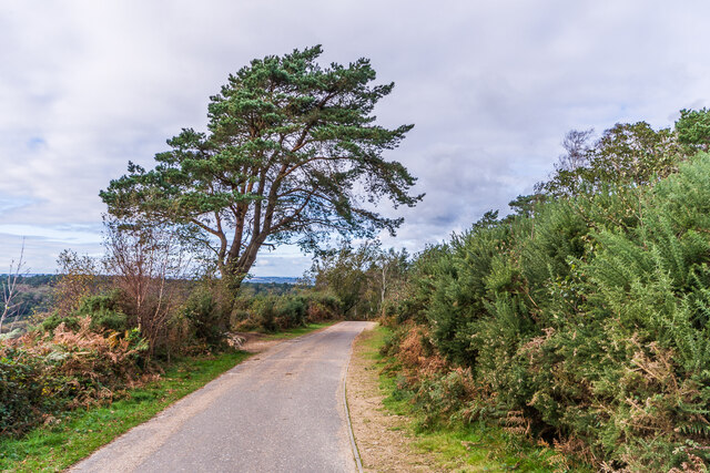
A network of well-maintained footpaths winds through the copse, offering visitors the opportunity to explore and immerse themselves in the tranquil surroundings. These paths lead to several clearings and glades, providing perfect spots for picnics or simply taking a moment to appreciate the peacefulness of the area.

Keffold's Copse is also home to several ancient trees, some of which are estimated to be over 200 years old. These majestic giants stand tall, their gnarled trunks and twisted branches adding a sense of history and wisdom to the woodland.

The copse is a designated Site of Special Scientific Interest (SSSI), recognizing its importance for wildlife conservation. As a result, it is carefully managed to preserve its natural features and protect the delicate balance of its ecosystem.

Whether you are seeking a quiet retreat, a chance to connect with nature, or simply a place for a leisurely stroll, Keffold's Copse offers a serene and enchanting experience for visitors of all ages.

If you have any feedback on the listing, please let us know in the comments section below.

Keffold's Copse Images

Images are sourced within 2km of 51.108593/-0.70454079 or Grid Reference SU9035. Thanks to Geograph Open Source API. All images are credited.

New build in Haslemere (II) Church Meadows
New build in Haslemere (II)
Church Meadows
Road closure in Church Lane
No mow May, June (and July) My neighbour in Parsons Green, a keen gardener, says all the seeds have blown into her garden and created "weeds"- which as we know means a plant we don't want on our patch!
No mow May, June (and July)
My neighbour in Parsons Green, a keen gardener, says all the seeds have blown into her garden and created "weeds"- which as we know means a plant we don't want on our patch!
MORE water repairs in Chatsworth Avenue Haslemere has a very high water table but...  very low water pressure
MORE water repairs in Chatsworth Avenue
Haslemere has a very high water table but... very low water pressure
Renovations underway at The Wheatsheaf
Hindhead Common Pine trees and a clearing near the visitor centre at the Devil's Punch Bowl.
Hindhead Common
Pine trees and a clearing near the visitor centre at the Devil's Punch Bowl.
Devil's Punch Bowl Looking down into the natural bowl.
Devil's Punch Bowl
Looking down into the natural bowl.
Flush bracket S1535 On the trig point on Gibbet Hill (272m). See <a href="https://www.geograph.org.uk/photo/6696717">SU8935 : Gibbet Hill</a>.
Flush bracket S1535
On the trig point on Gibbet Hill (272m). See SU8935 : Gibbet Hill.
Marker stone, Stoatley Hollow A concrete marker, presumably indicating a buried cable. Almost identical to <a href="https://www.geograph.org.uk/photo/6436763">SU8933 : Mid Southern Utility Company marker in Weydown Road</a>.
Marker stone, Stoatley Hollow
A concrete marker, presumably indicating a buried cable. Almost identical to SU8933 : Mid Southern Utility Company marker in Weydown Road.
Celtic cross Celtic cross on the summit of Gibbet Hill, erected in 1851 by Sir William Erle near the site of the gallows which were used to hang three sailors who in 1786  had murdered another while he was on his way to Portsmouth.  Grade II listed  - see <span class="nowrap"><a title="www.historicengland.org.uk/listing/the-list/list-entry/1260847" rel="nofollow ugc noopener" href="http://www.historicengland.org.uk/listing/the-list/list-entry/1260847">Link</a><img style="margin-left:2px;" alt="External link" title="External link - shift click to open in new window" src="https://s1.geograph.org.uk/img/external.png" width="10" height="10"/></span>.
Celtic cross
Celtic cross on the summit of Gibbet Hill, erected in 1851 by Sir William Erle near the site of the gallows which were used to hang three sailors who in 1786 had murdered another while he was on his way to Portsmouth. Grade II listed - see LinkExternal link.
Gibbet Hill Trig point on the summit of Gibbet Hill, with the North Downs in the centre background and Leith Hill to their right.  Although not apparent in this photo, very clear conditions on this occasion meant that the City of London skyscrapers could be seen through the Wey Gap, left of centre, a distance of almost 40 miles.
Gibbet Hill
Trig point on the summit of Gibbet Hill, with the North Downs in the centre background and Leith Hill to their right. Although not apparent in this photo, very clear conditions on this occasion meant that the City of London skyscrapers could be seen through the Wey Gap, left of centre, a distance of almost 40 miles.
Byway, Devil's Punchbowl Byway above the Devil's Punch Bowl, giving an alternative route for traffic prohibited from using the A3 Hindhead Tunnel.
Byway, Devil's Punchbowl
Byway above the Devil's Punch Bowl, giving an alternative route for traffic prohibited from using the A3 Hindhead Tunnel.
Old A3, Devil's Punch Bowl Part of the route of the former A3 above the Devil's Punch Bowl, restored to nature following the opening of the Hindhead Tunnel in 2011.
Old A3, Devil's Punch Bowl
Part of the route of the former A3 above the Devil's Punch Bowl, restored to nature following the opening of the Hindhead Tunnel in 2011.
Devil's Punch Bowl Looking along the rim of the Devil's Punch Bowl, with part of the route of the former A3 in the background, restored to nature following the opening of the Hindhead Tunnel in 2011.
Devil's Punch Bowl
Looking along the rim of the Devil's Punch Bowl, with part of the route of the former A3 in the background, restored to nature following the opening of the Hindhead Tunnel in 2011.
Devil's Punch Bowl Looking across the Devil's Punch Bowl.
Devil's Punch Bowl
Looking across the Devil's Punch Bowl.
Dawn breaks at the old BMW Garage in London Road This month has been mostly pleasant, weather wise. The hot spell promised for early September never materialised. Mostly it was warm and still. Towards the end of the month we caught the tail end of Hurricane Ian. The official Met Office summary is here <span class="nowrap"><a title="https://www.metoffice.gov.uk/binaries/content/assets/metofficegovuk/pdf/weather/learn-about/uk-past-events/summaries/uk_monthly_climate_summary_202209.pdf" rel="nofollow ugc noopener" href="https://www.metoffice.gov.uk/binaries/content/assets/metofficegovuk/pdf/weather/learn-about/uk-past-events/summaries/uk_monthly_climate_summary_202209.pdf">Link</a><img style="margin-left:2px;" alt="External link" title="External link - shift click to open in new window" src="https://s1.geograph.org.uk/img/external.png" width="10" height="10"/></span>
Dawn breaks at the old BMW Garage in London Road
This month has been mostly pleasant, weather wise. The hot spell promised for early September never materialised. Mostly it was warm and still. Towards the end of the month we caught the tail end of Hurricane Ian. The official Met Office summary is here LinkExternal link
Devil's Punch Bowl - Viewpoint New wooden signposts for "Hidden Hindhead" and the "Sailor's Stroll" at the head of this large natural amphitheatre by Hindhead.
Devil's Punch Bowl - Viewpoint
New wooden signposts for "Hidden Hindhead" and the "Sailor's Stroll" at the head of this large natural amphitheatre by Hindhead.
Show me another place!

Keffold's Copse is located at Grid Ref: SU9035 (Lat: 51.108593, Lng: -0.70454079)

Administrative County: Surrey

District: Waverley

Police Authority: Surrey

What 3 Words

///eyebrows.fiery.butternut. Near Haslemere, Surrey

Nearby Locations

Keffold's Copse

Related Wikis

Oak Hall, Haslemere

Oak Hall at Haslemere, Surrey, England is a Grade II listed country house. As of 2013 it houses Oak Hall Country Club, part of the Wispers Park retirement...

All Saints' Church, Grayswood

All Saints' Church is an active parish church in the village of Grayswood, Surrey, England. The church stands in the centre of the village and was built...

Gibbet Hill, Hindhead

Gibbet Hill, at Hindhead, Surrey, is the apex of the scarp surrounding the Devil's Punch Bowl, not far from the A3 London to Portsmouth road in England...

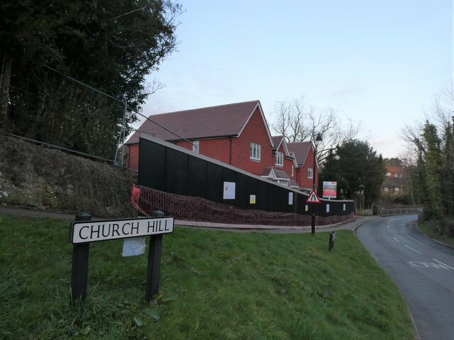
Church Hill House, Haslemere

Church Hill House is a grade II* listed house in Tanners Lane, Haslemere, Surrey. Parts of the walls are grade II listed as well as the adjoining Church...
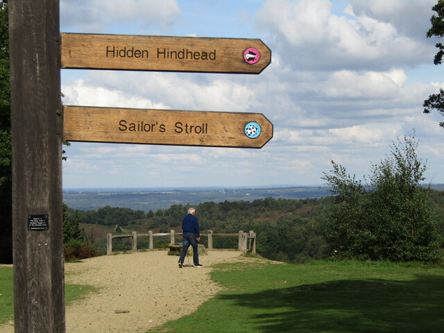
Serpent Trail

The Serpent Trail is a 64-mile (103 km) long distance footpath. It runs from Haslemere to Petersfield, which are 11 miles apart in a straight line, by...

Devil's Punch Bowl

The Devil's Punch Bowl is a 282.2-hectare (697-acre) visitor attraction and biological Site of Special Scientific Interest situated just to the east of...
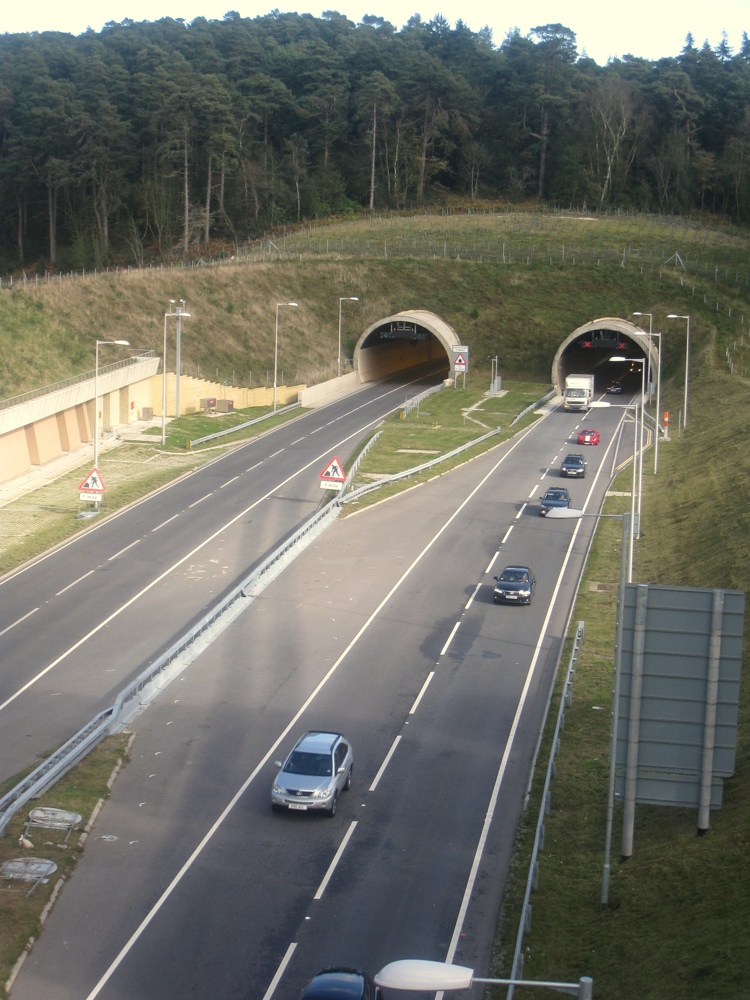
Hindhead Tunnel

The Hindhead Tunnel, opened in 2011, is part of the 4-mile (6.4 km) dual-carriageway that replaced one of the last remaining stretches of single-carriageway...
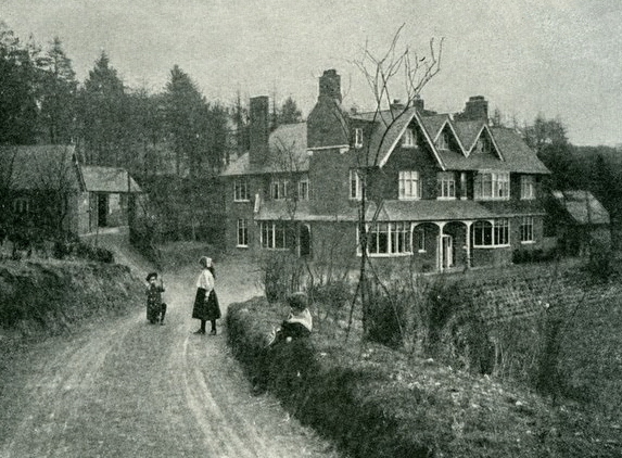
Undershaw

Undershaw is a former residence of the author Sir Arthur Conan Doyle, the creator of Sherlock Holmes. The house was built for Doyle at his order to accommodate...

Nearby Amenities

Located within 500m of 51.108593,-0.70454079
Inval
Alt Name: Invall
Note: The National Trust spells it Inval, but OS OpenData StreetView spells it Invall.
Place: locality
Lat/Long: 51.1098/-0.708738
Tourism: viewpoint
Lat/Long: 51.1121/-0.706945
Barrier: stile
Lat/Long: 51.1058473/-0.7000469
Keffold's Copse
Natural: wood
Source: os_street_view
Lat/Long: 51.1068804/-0.7047703
Tuder's Copse
Natural: wood
Source: os_street_view
Lat/Long: 51.107756/-0.6976194
Bench
Lat/Long: 51.1120803/-0.706969
The data included in this document is from www.openstreetmap.org. The data is made available under ODbL.

Have you been to Keffold's Copse?

Leave your review of Keffold's Copse below (or comments, questions and feedback).