Seven Acre Covert

Wood, Forest in Buckinghamshire

England

Seven Acre Covert

Clifton Reynes: Petsoe Manor Farm
Clifton Reynes: Petsoe Manor Farm Credit: Michael Garlick

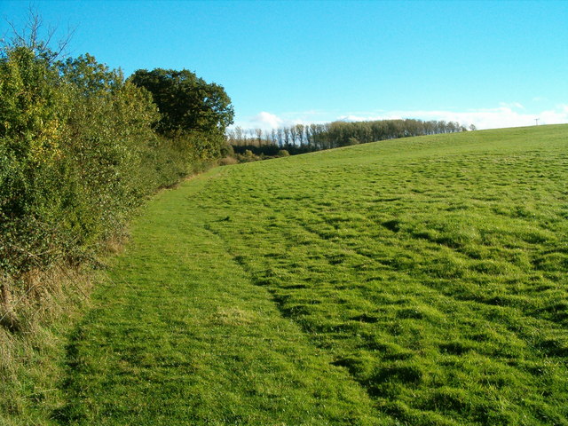
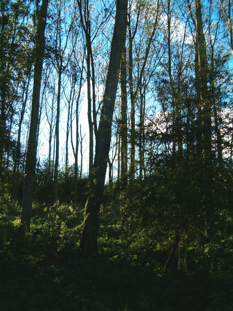
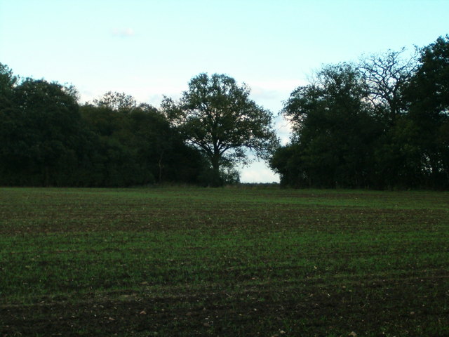
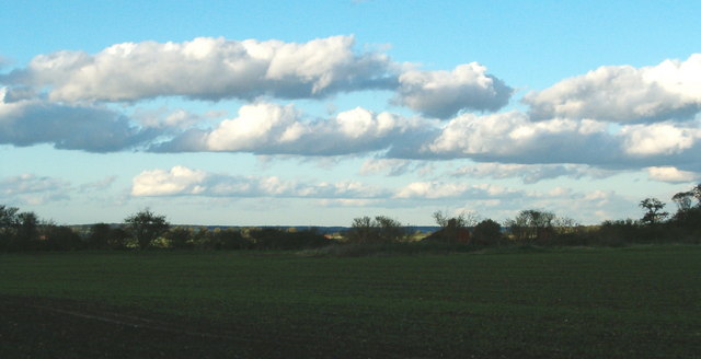
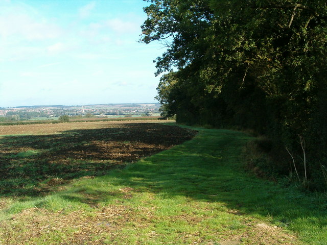
Seven Acre Covert is a picturesque woodland area located in Buckinghamshire, England. Covering an area of approximately seven acres, this tranquil woodland is a hidden gem nestled within the beautiful countryside of the region. The covert is a mix of ancient and secondary woodland, boasting a diverse range of tree species including oak, beech, birch, and conifers.

The woodland floor is adorned with a rich carpet of wildflowers and a variety of ferns, adding to the natural beauty of the area. The dense canopy of trees provides a haven for a wide array of wildlife, making it a popular spot for nature enthusiasts and birdwatchers.

Visitors to Seven Acre Covert can enjoy peaceful walks along well-maintained paths, immersing themselves in the serenity of nature. The woodland offers a sense of tranquility, making it an ideal place for relaxation, meditation, or simply escaping the hustle and bustle of everyday life.

Managed by local conservation groups, the woodland is carefully maintained to preserve its natural beauty and promote biodiversity. Efforts are made to protect and enhance the habitat for a multitude of species, such as deer, foxes, badgers, and a variety of bird species.

Seven Acre Covert is easily accessible and provides ample parking facilities, making it a popular destination for both locals and tourists. Whether it's a leisurely stroll, wildlife spotting, or simply enjoying the peaceful surroundings, Seven Acre Covert offers a delightful woodland experience in the heart of Buckinghamshire.

If you have any feedback on the listing, please let us know in the comments section below.

Seven Acre Covert Images

Images are sourced within 2km of 52.124649/-0.6801665 or Grid Reference SP9048. Thanks to Geograph Open Source API. All images are credited.

Clifton Reynes: Petsoe Manor Farm
Emberton: Wheat field and wind farm
Emberton: Track to Grange Farm
Chicheley: Barley field
Chicheley: Wheat field
Chicheley: Track to Grange Farm
Road to Petsoe Manor Farm By-road running east from near Emberton
Road to Petsoe Manor Farm
By-road running east from near Emberton
Over the Hedgerow A farmhouse just off the A422, east of Chicheley.
Over the Hedgerow
A farmhouse just off the A422, east of Chicheley.
Countryside Path Looking up the hill towards Seven Acre Covert.
Countryside Path
Looking up the hill towards Seven Acre Covert.
Seven Acre Covert The tall slim trees that make up Seven Acre Covert.
Seven Acre Covert
The tall slim trees that make up Seven Acre Covert.
Farmland Track The farm track heads north, but the public footpath, markered by the post on the right, heads west across the field.
Farmland Track
The farm track heads north, but the public footpath, markered by the post on the right, heads west across the field.
Between the Woods Looking across the field towards a gap between two small woods.
Between the Woods
Looking across the field towards a gap between two small woods.
Farmland and Woods This grid square is a patchwork of farm fields and small woods.
Farmland and Woods
This grid square is a patchwork of farm fields and small woods.
Cotton Wool Clouds The clouds sweep over the fields on a warm and breezy autumn day.
Cotton Wool Clouds
The clouds sweep over the fields on a warm and breezy autumn day.
Along the Hedgerow Arriving on the scene to take this photograph, a family of partridges were flushed from the hedgerow and went flapping across the field.
Along the Hedgerow
Arriving on the scene to take this photograph, a family of partridges were flushed from the hedgerow and went flapping across the field.
Skyline with Trees The regimented young crop grows in the field, overseen by a row of trees on the skyline.
Skyline with Trees
The regimented young crop grows in the field, overseen by a row of trees on the skyline.
Reach up to the Sky A single tree stands proud in the hedgerow.
Reach up to the Sky
A single tree stands proud in the hedgerow.
Petsoe Manor Farm The Farmhouse at Petsoe Manor Farm.
Petsoe Manor Farm
The Farmhouse at Petsoe Manor Farm.
Show me another place!

Seven Acre Covert is located at Grid Ref: SP9048 (Lat: 52.124649, Lng: -0.6801665)

Unitary Authority: Milton Keynes

Police Authority: Thames Valley

What 3 Words

///pouch.tapes.charts. Near Sherington, Buckinghamshire

Nearby Locations

Emberton Seven Acre Covert

Related Wikis

Hollington Wood

Hollington Wood is a small patch of ancient woodland about a mile south-east of the village of Emberton near Olney in the City of Milton Keynes, Buckinghamshire...

Petsoe End

Petsoe End is a hamlet in Emberton civil parish, in the City of Milton Keynes, Buckinghamshire, England. The name Petsoe is used frequently in the local...

Milton Keynes wind farm

Milton Keynes wind farm is located 2 miles east of Emberton in the City of Milton Keynes, Buckinghamshire, UK. It was developed by Your Energy and is...

Emberton

Emberton is a village and civil parish in the unitary authority area of the City of Milton Keynes, in Buckinghamshire, England. The village is near the...

Chicheley Hall

Chicheley Hall, Chicheley, Buckinghamshire, England is a country house built in the first quarter of the 18th century. The client was Sir John Chester...

Chicheley War Memorial

Chicheley War Memorial is located in Hall Lane, Chicheley, Buckinghamshire, England. It is a grade II listed building with Historic England. It was designed...

Chicheley

Chicheley is a village and civil parish in the unitary authority area of the City of Milton Keynes, Buckinghamshire, England. The village is about 2.5...

Sherington

Sherington is a village and civil parish in the unitary authority area of the City of Milton Keynes, Buckinghamshire, England. It is located 2 miles (3...

Nearby Amenities

Located within 500m of 52.124649,-0.6801665
Wood Farm
Landuse: farm
Note Retag: CS #48756035
Source: OS_OpenData_StreetView
Lat/Long: 52.1268745/-0.6857688
Brand: National Grid
Brand Wikidata: Q1465461
Operator: National Grid Electricity Distribution
Operator Old: Western Power Distribution
Operator Wikidata: Q7988183
Owner: National Grid Electricity Distribution (East Midlands) Plc
Owner Wikidata: Q114348127
Power: pole
Ref: 94ZUFA67
Source: wpd_open_data
Lat/Long: 52.1274914/-0.6842101
Brand: National Grid
Brand Wikidata: Q1465461
Operator: National Grid Electricity Distribution
Operator Old: Western Power Distribution
Operator Wikidata: Q7988183
Owner: National Grid Electricity Distribution (East Midlands) Plc
Owner Wikidata: Q114348127
Power: pole
Ref: 94ZUFA66
Source: wpd_open_data
Lat/Long: 52.1264837/-0.68362
Brand: National Grid
Brand Wikidata: Q1465461
Operator: National Grid Electricity Distribution
Operator Old: Western Power Distribution
Operator Wikidata: Q7988183
Owner: National Grid Electricity Distribution (East Midlands) Plc
Owner Wikidata: Q114348127
Power: pole
Ref: 94ZUFA65
Source: wpd_open_data
Lat/Long: 52.1252783/-0.6828904
Brand: National Grid
Brand Wikidata: Q1465461
Operator: National Grid Electricity Distribution
Operator Old: Western Power Distribution
Operator Wikidata: Q7988183
Owner: National Grid Electricity Distribution (East Midlands) Plc
Owner Wikidata: Q114348127
Power: pole
Ref: 94ZUFA62
Source: wpd_open_data
Lat/Long: 52.1218333/-0.6808627
Brand: National Grid
Brand Wikidata: Q1465461
Operator: National Grid Electricity Distribution
Operator Old: Western Power Distribution
Operator Wikidata: Q7988183
Owner: National Grid Electricity Distribution (East Midlands) Plc
Owner Wikidata: Q114348127
Power: pole
Ref: 94ZUFA63
Source: wpd_open_data
Lat/Long: 52.1229679/-0.6815439
Brand: National Grid
Brand Wikidata: Q1465461
Operator: National Grid Electricity Distribution
Operator Old: Western Power Distribution
Operator Wikidata: Q7988183
Owner: National Grid Electricity Distribution (East Midlands) Plc
Owner Wikidata: Q114348127
Power: pole
Ref: 94ZUFA64
Source: wpd_open_data
Lat/Long: 52.1241233/-0.6822574
Brand: National Grid
Brand Wikidata: Q1465461
Operator: National Grid Electricity Distribution
Operator Old: Western Power Distribution
Operator Wikidata: Q7988183
Owner: National Grid Electricity Distribution (East Midlands) Plc
Owner Wikidata: Q114348127
Power: pole
Ref: 94ZUFA61
Source: wpd_open_data
Lat/Long: 52.1211474/-0.6807587
Direction: 190
Generator Method: photovoltaic
Generator Output Electricity: yes
Generator Solar Modules: 12
Generator Source: solar
Generator Type: solar_photovoltaic_panel
Location: roof
Power: generator
Lat/Long: 52.1266569/-0.6866225
The data included in this document is from www.openstreetmap.org. The data is made available under ODbL.

Have you been to Seven Acre Covert?

Leave your review of Seven Acre Covert below (or comments, questions and feedback).