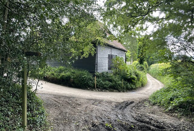
Ash Reeds Copse

Wood, Forest in Sussex Chichester

England

Ash Reeds Copse

The Parish Church of St Margaret The church is a Grade II listed building. See <span class="nowrap"><a title="https://historicengland.org.uk/listing/the-list/list-entry/1025991" rel="nofollow ugc noopener" href="https://historicengland.org.uk/listing/the-list/list-entry/1025991">Link</a><img style="margin-left:2px;" alt="External link" title="External link - shift click to open in new window" src="https://s1.geograph.org.uk/img/external.png" width="10" height="10"/></span>
The Parish Church of St Margaret Credit: Chris Thomas-Atkin

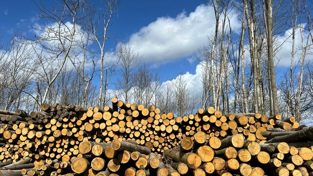
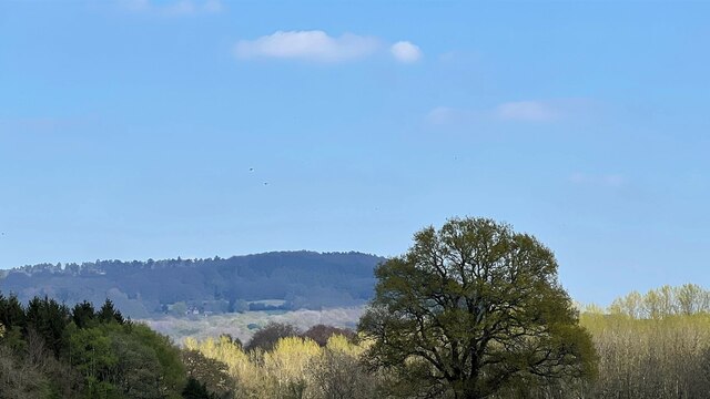
Ash Reeds Copse is a picturesque woodland located in Sussex, England. Spread across a vast expanse of approximately 100 acres, this copse is a haven for nature enthusiasts and those seeking tranquility amidst the beauty of the outdoors.

The copse is predominantly inhabited by ash trees, which give it its name. These majestic trees stand tall, their branches reaching towards the sky, creating a dense canopy that provides shade and shelter to the myriad of wildlife that call this place home. The forest floor is adorned with a carpet of verdant moss and wildflowers, adding to the enchanting atmosphere.

As one wanders through the copse, they are treated to a symphony of natural sounds. The songs of various bird species, including thrushes, warblers, and woodpeckers, fill the air, creating a delightful melody. Squirrels scurry amongst the branches, their playful antics adding to the charm of the place.

Ash Reeds Copse is also home to a diverse range of wildlife. Deer can often be spotted grazing in the early morning or evening hours, while foxes and badgers make their homes in the nooks and crannies of the woodland. In springtime, the copse comes alive with the chirping of frogs and the croaking of toads as they gather in the nearby ponds to breed.

Visitors to Ash Reeds Copse are encouraged to explore the numerous walking trails that wind through the woodland, allowing for an immersive experience in nature. The copse offers a peaceful retreat from the hustle and bustle of everyday life, providing an opportunity to reconnect with the natural world and appreciate the wonders it has to offer.

If you have any feedback on the listing, please let us know in the comments section below.

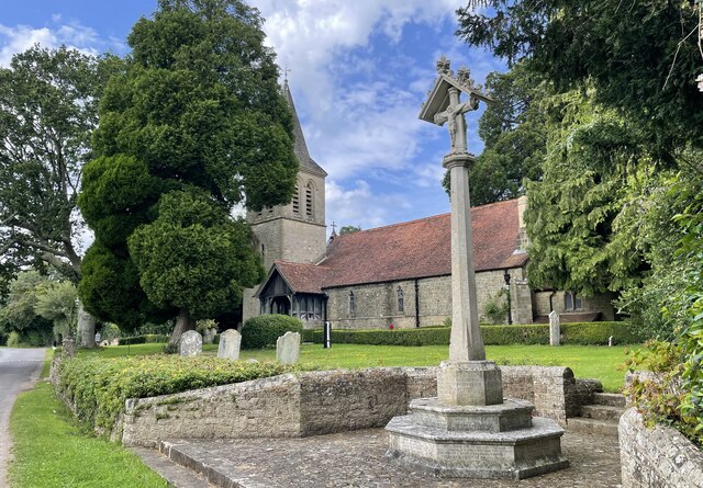
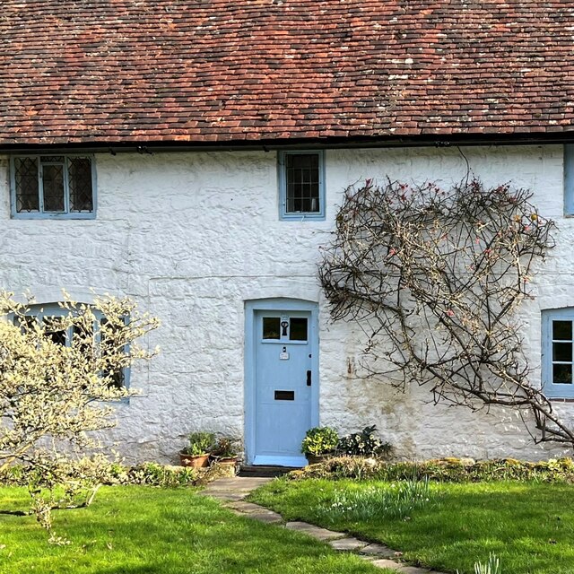
Ash Reeds Copse Images

Images are sourced within 2km of 51.0343/-0.71875016 or Grid Reference SU8926. Thanks to Geograph Open Source API. All images are credited.

The Parish Church of St Margaret The church is a Grade II listed building. See <span class="nowrap"><a title="https://historicengland.org.uk/listing/the-list/list-entry/1025991" rel="nofollow ugc noopener" href="https://historicengland.org.uk/listing/the-list/list-entry/1025991">Link</a><img style="margin-left:2px;" alt="External link" title="External link - shift click to open in new window" src="https://s1.geograph.org.uk/img/external.png" width="10" height="10"/></span>
The Parish Church of St Margaret
The church is a Grade II listed building. See LinkExternal link
White Cottage According to the map "White Cottage" is the name of the cottage - not merely a description!
White Cottage
According to the map "White Cottage" is the name of the cottage - not merely a description!
Houses adjacent to Crossfield car park
Logs near the Serpent Trail It didn't occur to me when I took the photo, but this composition now says "Ukrainian flag" to me.
Logs near the Serpent Trail
It didn't occur to me when I took the photo, but this composition now says "Ukrainian flag" to me.
View east across the land north of Madam's Farm The mast of the Midhurst Transmitting Station is visible about a third of the way across.
View east across the land north of Madam's Farm
The mast of the Midhurst Transmitting Station is visible about a third of the way across.
View NE towards Black Down
Barn on Whites Lane
Barn on Whites Lane
Large house SE of Upper Lodge This was the clearest shot I could get. The map labels this plot as "Yew Tree Cottage", but I'm a bit doubtful about that. It doesn't sound right for a property of this size.
Large house SE of Upper Lodge
This was the clearest shot I could get. The map labels this plot as "Yew Tree Cottage", but I'm a bit doubtful about that. It doesn't sound right for a property of this size.
Twilight in Old Glebe This year I am going to try and take a photo on all the days that end in 1. As well as this I shall say how many photos the site (and I) have bagged in 2023. For example, early on January 2nd I used the advanced search facility to discover that so far the site has 200 images for 2023 and I have 5. This I shall record from now on in the picture description.
Twilight in Old Glebe
This year I am going to try and take a photo on all the days that end in 1. As well as this I shall say how many photos the site (and I) have bagged in 2023. For example, early on January 2nd I used the advanced search facility to discover that so far the site has 200 images for 2023 and I have 5. This I shall record from now on in the picture description.
Twilight in Fernhurst Cemetery (1) This year 238,705 photos have been uploaded to the site; of which 4,651 (1.95%) are mine
Twilight in Fernhurst Cemetery (1)
This year 238,705 photos have been uploaded to the site; of which 4,651 (1.95%) are mine
Twilight in Fernhurst Cemetery (2)
Twilight in Fernhurst Cemetery (3) The CWGC grave of Brigadier Charles George Cuningham Balfour Davey <span class="nowrap"><a title="https://generals.dk/general/Balfour-Davey/Charles_George_Cuningham/Great_Britain.html" rel="nofollow ugc noopener" href="https://generals.dk/general/Balfour-Davey/Charles_George_Cuningham/Great_Britain.html">Link</a><img style="margin-left:2px;" alt="External link" title="External link - shift click to open in new window" src="https://s1.geograph.org.uk/img/external.png" width="10" height="10"/></span> His service record is here <span class="nowrap"><a title="https://www.cwgc.org/find-records/find-war-dead/casualty-details/2723274/charles-george-cunningham-balfour-davey/" rel="nofollow ugc noopener" href="https://www.cwgc.org/find-records/find-war-dead/casualty-details/2723274/charles-george-cunningham-balfour-davey/">Link</a><img style="margin-left:2px;" alt="External link" title="External link - shift click to open in new window" src="https://s1.geograph.org.uk/img/external.png" width="10" height="10"/></span>
Twilight in Fernhurst Cemetery (3)
The CWGC grave of Brigadier Charles George Cuningham Balfour Davey LinkExternal link His service record is here LinkExternal link
Twilight in Fernhurst Cemetery (4)
Twilight in Fernhurst Cemetery (5) The CWGC grave of Fernhurst native Gunner Sydney Chandler <span class="nowrap"><a title="https://www.cwgc.org/find-records/find-war-dead/casualty-details/402611/sidney-chandler/" rel="nofollow ugc noopener" href="https://www.cwgc.org/find-records/find-war-dead/casualty-details/402611/sidney-chandler/">Link</a><img style="margin-left:2px;" alt="External link" title="External link - shift click to open in new window" src="https://s1.geograph.org.uk/img/external.png" width="10" height="10"/></span>
Twilight in Fernhurst Cemetery (5)
The CWGC grave of Fernhurst native Gunner Sydney Chandler LinkExternal link
Twilight in Fernhurst Cemetery (6)
Twilight in Fernhurst Cemetery (7) The CWGC grave of Private C Roe <span class="nowrap"><a title="https://www.cwgc.org/find-records/find-war-dead/casualty-details/402614/c-roe/" rel="nofollow ugc noopener" href="https://www.cwgc.org/find-records/find-war-dead/casualty-details/402614/c-roe/">Link</a><img style="margin-left:2px;" alt="External link" title="External link - shift click to open in new window" src="https://s1.geograph.org.uk/img/external.png" width="10" height="10"/></span>
Twilight in Fernhurst Cemetery (7)
The CWGC grave of Private C Roe LinkExternal link
Twilight in Fernhurst Cemetery (8)
Approaching Tanyard Cottage On the public footpath at the point where it turns right at Tanyard Cottage towards Fernhurst.
Approaching Tanyard Cottage
On the public footpath at the point where it turns right at Tanyard Cottage towards Fernhurst.
Show me another place!

Ash Reeds Copse is located at Grid Ref: SU8926 (Lat: 51.0343, Lng: -0.71875016)

Administrative County: West Sussex

District: Chichester

Police Authority: Sussex

What 3 Words

///poems.effort.bluff. Near Fernhurst, West Sussex

Related Wikis

Cooksbridge Meadow

Cooksbridge Meadow is a 9-hectare (22-acre) nature reserve south of Fernhurst in Sussex. It is managed by the Sussex Wildlife Trust.Most of this site...

Fernhurst

Fernhurst is a village and civil parish in the Chichester District of West Sussex, England, on the A286 Milford, Surrey, to Chichester road, 3 miles (4...

Northpark Copse to Snapelands Copse

Northpark Copse to Snapelands Copse is a 101.4-hectare (251-acre) biological Site of Special Scientific Interest north of Midhurst in West Sussex.This...

North Ambersham

North Ambersham was a tithing in the Chichester district of West Sussex, England. Until 1844 North Ambersham was a detached part of Hampshire and was...

Perry Copse Outcrop

Perry Copse Outcrop is a 0.2-hectare (0.49-acre) geological Site of Special Scientific Interest in Fernhurst in West Sussex. It is a Geological Conservation...

Midhurst transmitting station

The Midhurst transmitting station is a facility for both analogue and digital VHF/FM radio and UHF television transmission, 3.1 miles (5.0 km) northeast...

Iberia Flight 062

Iberia Flight 062 was a twin-engined Sud Aviation Caravelle registered EC-BDD operating a scheduled flight from Málaga Airport, Spain, to London Heathrow...

Western Weald

The western Weald is an area of undulating countryside in Hampshire and West Sussex containing a mixture of woodland and heathland areas. It lies to the...

Nearby Amenities

Located within 500m of 51.0343,-0.71875016
Pub
Kings Arms
Addr Postcode: GU27 3HA
Addr Street: Midhurst Road
Fhrs Id: 569659
Wikidata: Q26637519
Lat/Long: 51.03503/-0.7251785
Barrier: stile
Lat/Long: 51.0353325/-0.7126445
Barrier: stile
Lat/Long: 51.0353162/-0.7122896
Barrier: stile
Lat/Long: 51.0353744/-0.7135584
Power: pole
Lat/Long: 51.0334028/-0.7120219
Power: pole
Lat/Long: 51.0349259/-0.7139424
Power: pole
Lat/Long: 51.0357709/-0.7150179
Power: pole
Lat/Long: 51.0365535/-0.7159782
Power: pole
Lat/Long: 51.0369144/-0.7181239
Restaurant
Banyan
Addr City: Haslemere
Addr Country: GB
Addr Hamlet: Fernhurst
Addr Postcode: GU27 3HA
Addr Street: Midhurst Road
Cuisine: indian
Fhrs Authority: Chichester
Fhrs Id: 590848
Fhrs Local Authority Id: 13/00146/FOOD
Website: https://www.banyanrestaurant.co.uk/
Lat/Long: 51.0350355/-0.7249072
The data included in this document is from www.openstreetmap.org. The data is made available under ODbL.

Have you been to Ash Reeds Copse?

Leave your review of Ash Reeds Copse below (or comments, questions and feedback).