Cocked Hat Plantation
Wood, Forest in Lincolnshire North Kesteven
England
Cocked Hat Plantation

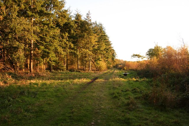
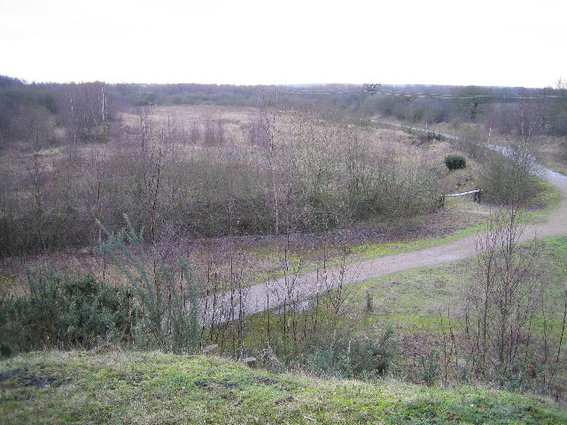
Cocked Hat Plantation, located in Lincolnshire, is a picturesque woodland area known for its natural beauty and rich history. Situated within the larger Lincolnshire Forest, this plantation covers a vast area and offers a variety of flora and fauna for visitors to explore.
The woodland is named after a distinctive oak tree that stands at the entrance and resembles a cocked hat, adding to the charm and uniqueness of the plantation. The area is known for its dense woodlands, with towering trees providing a shady and serene atmosphere. The diverse range of tree species includes oak, beech, birch, and pine, creating a vibrant and colorful landscape throughout the year.
The plantation is a haven for wildlife, with numerous species calling it home. It is not uncommon to spot squirrels scurrying up the trees or hear the melodic songs of various bird species. Additionally, the woodland is home to a variety of insects and small mammals, adding to the ecological diversity of the area.
For nature enthusiasts and hikers, Cocked Hat Plantation offers a network of well-maintained trails that wind through the woodland, allowing visitors to immerse themselves in the tranquility of the surroundings. These trails range in difficulty and length, catering to both casual strollers and avid hikers.
Due to its idyllic setting, Cocked Hat Plantation attracts visitors throughout the year, with each season offering a unique experience. Whether it's the vibrant colors of autumn, the fresh blooms of spring, or the peaceful snowy landscapes of winter, this woodland is a must-visit destination for any nature lover.
If you have any feedback on the listing, please let us know in the comments section below.
Cocked Hat Plantation Images
Images are sourced within 2km of 53.180614/-0.6702929 or Grid Reference SK8865. Thanks to Geograph Open Source API. All images are credited.


Cocked Hat Plantation is located at Grid Ref: SK8865 (Lat: 53.180614, Lng: -0.6702929)
Administrative County: Lincolnshire
District: North Kesteven
Police Authority: Lincolnshire
What 3 Words
///magazines.prouder.fruit. Near Bassingham, Lincolnshire
Nearby Locations
Related Wikis
Tunman Wood
Tunman Wood is a local nature reserve with an area of over 53 ha (130 acres) located near Eagle Barnsdale, Lincolnshire. It is an area of ancient woodland...

Eagle Barnsdale
Eagle Barnsdale is a village in the North Kesteven district of Lincolnshire, England. The population can be found included in the civil parish of Eagle...

Thorpe-on-the-Hill railway station
Thorpe on the Hill railway station was a station serving the village of Thorpe-on-the-Hill, Lincolnshire, England. == Opening == It was opened as Thorpe...
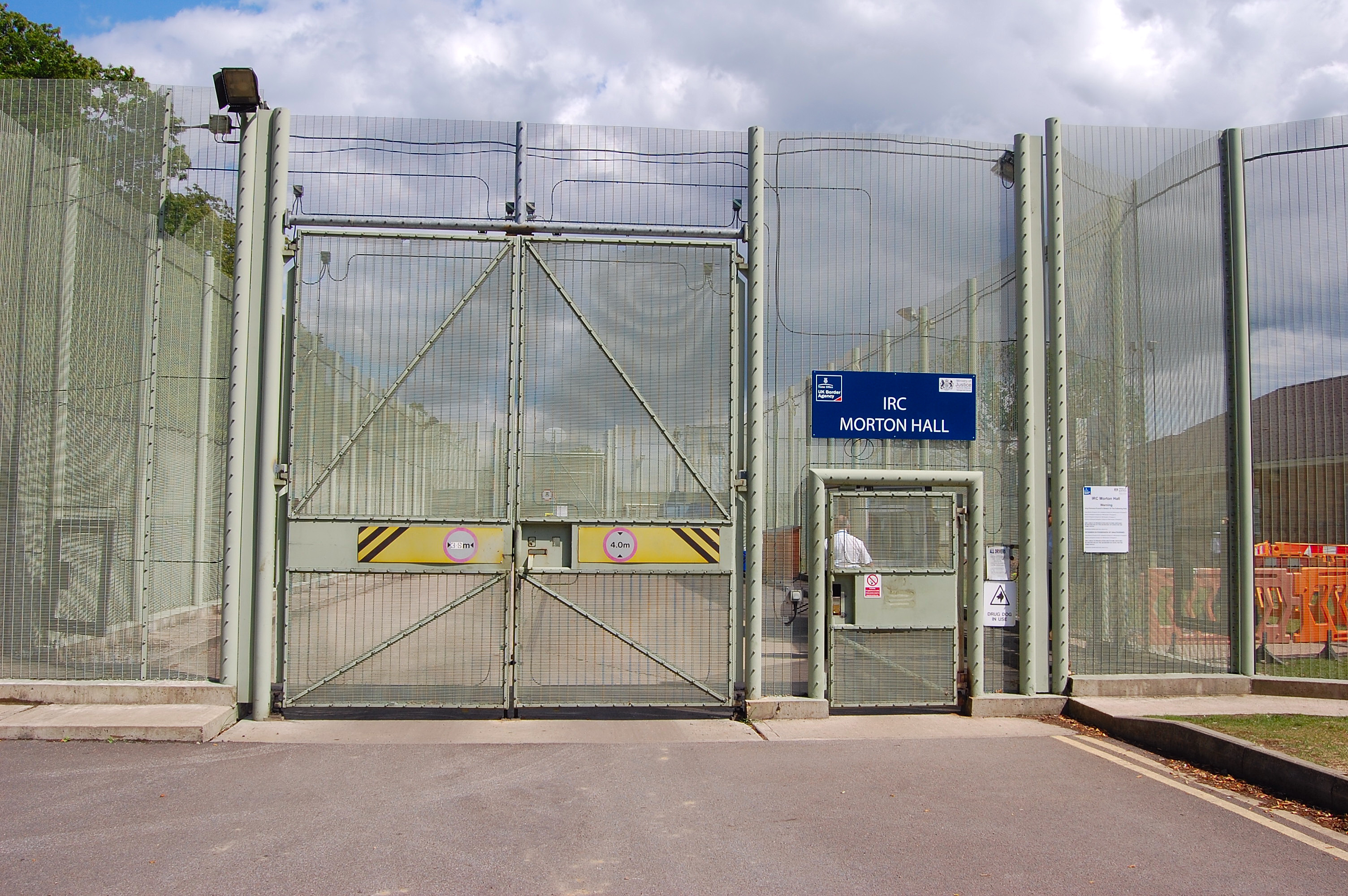
HM Prison Morton Hall
HM Prison Morton Hall is a Category C men's prison, located in the village of Morton Hall (near Lincoln) in Lincolnshire, England. The centre is operated...
Thorpe on the Hill, Lincolnshire
Thorpe on the Hill is a small village and civil parish in North Kesteven, Lincolnshire, England. == Location == It is situated less than 1 mile (1.6 km...

Morton Hall
Morton Hall is a small village in the civil parish of Swinderby , in the North Kesteven district of Lincolnshire, England. It is situated 8 miles (13 km...
Eagle, Lincolnshire
Eagle is a village in the North Kesteven district of Lincolnshire, England. It is situated 7 miles (11 km) south-west from Lincoln and 2 miles (3.2 km...
Whisby
Whisby is a hamlet in the civil parish of Doddington and Whisby, in the North Kesteven district of Lincolnshire, England. It is situated 5 miles (8.0 km...
Nearby Amenities
Located within 500m of 53.180614,-0.6702929Have you been to Cocked Hat Plantation?
Leave your review of Cocked Hat Plantation below (or comments, questions and feedback).