Blackthorn Covert

Wood, Forest in Rutland

England

Blackthorn Covert

Prepared field near Barrow Some of the installations of the former RAF Cottesmore can be seen in the distance.
Prepared field near Barrow Credit: Jonathan Thacker

Blackthorn Covert is a stunning woodland area located in Rutland, England. Covering an expansive area, this woodland is known for its dense blackthorn bushes, which give it its name. The covert is situated in a picturesque location, surrounded by rolling hills and scattered with a variety of tree species, including oak, beech, and birch.

This woodland is a haven for wildlife enthusiasts, as it provides a diverse range of habitats for numerous species. The dense undergrowth and thicket of blackthorn bushes create a perfect environment for nesting birds, such as nightingales and warblers. Visitors can enjoy the melodious songs of these birds as they explore the woodland.

Additionally, Blackthorn Covert is home to a wide array of flora and fauna. Wildflowers, including bluebells and primroses, adorn the forest floor during spring, creating a vibrant and colorful display. Various mammals, such as badgers, foxes, and deer, can also be spotted within the covert, making it an ideal destination for wildlife spotting.

The woodland offers several walking trails, allowing visitors to immerse themselves in its natural beauty and tranquility. These well-maintained paths wind through the trees, offering glimpses of the surrounding countryside and providing opportunities to appreciate the diverse ecosystem.

Blackthorn Covert is a truly enchanting destination for nature lovers and offers a peaceful retreat from the hustle and bustle of everyday life. With its stunning scenery, abundant wildlife, and well-marked trails, it is a must-visit location for those seeking to connect with nature in Rutland.

If you have any feedback on the listing, please let us know in the comments section below.

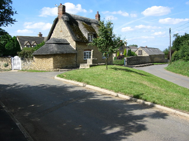
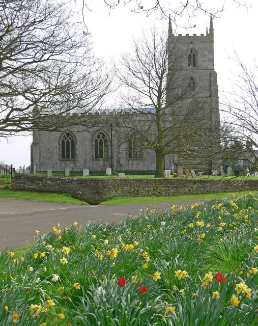
Blackthorn Covert Images

Images are sourced within 2km of 52.720259/-0.68480971 or Grid Reference SK8814. Thanks to Geograph Open Source API. All images are credited.

Prepared field near Barrow Some of the installations of the former RAF Cottesmore can be seen in the distance.
Prepared field near Barrow
Some of the installations of the former RAF Cottesmore can be seen in the distance.
Rocks by Rail Museum, Cottesmore Two now preserved locomotives manufactured by Andrew Barclay Sons & Co.
Rocks by Rail Museum, Cottesmore
Two now preserved locomotives manufactured by Andrew Barclay Sons & Co.
Cottesmore Bridge A road bridge over the brook.
Cottesmore Bridge
A road bridge over the brook.
Unnamed brook Despite searching the map over several squares, I’m unable to find a name for this stretch of water.
Unnamed brook
Despite searching the map over several squares, I’m unable to find a name for this stretch of water.
Route of former ironstone railway A line here linked the quarries south of Cottesmore with the main line near Ashwell.
Route of former ironstone railway
A line here linked the quarries south of Cottesmore with the main line near Ashwell.
Agricultural waste Cottesmore in the distance.
Agricultural waste
Cottesmore in the distance.
Tree on the corner
Tree on the corner
St. Nicholas, Cottesmore Grade II Listed

The current church mostly dates from the 13th and 14th centuries, and is built of stone from Clipsham, which is nearby. The tower dates to the 14th century. In the northern wall some 12th-century stonework can be seen.


<span class="nowrap"><a title="https://en.wikipedia.org/wiki/St_Nicholas%27_Church,_Cottesmore" rel="nofollow ugc noopener" href="https://en.wikipedia.org/wiki/St_Nicholas%27_Church,_Cottesmore">Link</a><img style="margin-left:2px;" alt="External link" title="External link - shift click to open in new window" src="https://s1.geograph.org.uk/img/external.png" width="10" height="10"/></span>
St. Nicholas, Cottesmore
Grade II Listed The current church mostly dates from the 13th and 14th centuries, and is built of stone from Clipsham, which is nearby. The tower dates to the 14th century. In the northern wall some 12th-century stonework can be seen. LinkExternal link
Cottage at the end of the Leas
Cottesmore The pub sign by the bus stop is for the pub on this side of the B668 road (<a href="https://www.geograph.org.uk/photo/6901001">SK9013 : The famous sun</a>).
Cottesmore
The pub sign by the bus stop is for the pub on this side of the B668 road (SK9013 : The famous sun).
The Leas A short curved road parallel to the village main street.
The Leas
A short curved road parallel to the village main street.
The Village Shop and Church, what more does a Village need?
The Village
Shop and Church, what more does a Village need?
Cottages under the trees A grade II building of 1775 - see <span class="nowrap"><a title="https://historicengland.org.uk/listing/the-list/list-entry/1177099" rel="nofollow ugc noopener" href="https://historicengland.org.uk/listing/the-list/list-entry/1177099">Link</a><img style="margin-left:2px;" alt="External link" title="External link - shift click to open in new window" src="https://s1.geograph.org.uk/img/external.png" width="10" height="10"/></span>
Cottages under the trees
A grade II building of 1775 - see LinkExternal link
Fishing pond near Market Overton
Commonwealth war graves, Cottesmore Mainly of Canadian and Australian servicemen.
Commonwealth war graves, Cottesmore
Mainly of Canadian and Australian servicemen.
Fishing pond near Market Overton
Grass field and strawstacks
Show me another place!

Blackthorn Covert is located at Grid Ref: SK8814 (Lat: 52.720259, Lng: -0.68480971)

Unitary Authority: Rutland

Police Authority: Leicestershire

What 3 Words

///conceals.writers.arose. Near Cottesmore, Rutland

Nearby Locations

Blackthorn Covert

Related Wikis

Rutland Railway Museum

Rutland Railway Museum, now trading as Rocks by Rail: The Living Ironstone Museum, is a heritage railway on part of a former Midland Railway mineral branch...

Barrow, Rutland

Barrow is a village and civil parish in the county of Rutland in the East Midlands of England. It is located about five miles (8 km) north-east of Oakham...

St Nicholas' Church, Cottesmore

St Nicholas' Church is a church in Cottesmore, Rutland. It is a Grade II* listed building.The Cottesmore Benefice is part of the North Rutland Churches...

Cottesmore Amateurs F.C.

Cottesmore AFC (formerly known as Cottesmore Amateurs FC) is a football club based in Cottesmore, Rutland, England. They are currently members of the Leicestershire...

Market Overton

Market Overton is a village on the northern edge of the county of Rutland in the East Midlands of England. The population of the civil parish (including...

Cottesmore, Rutland

Cottesmore (often pronounced Cotts'more) is a village and civil parish in the north of the county of Rutland in the East Midlands of England. In terms...

Church of St Peter and St Paul, Market Overton

The Church of St Peter and St Paul is the Church of England parish church in Market Overton, Rutland. The church is part of the Oakham team ministry....

Teigh

Teigh is a village and civil parish in the county of Rutland in the East Midlands of England. The population of the village was 48 in the 2001 census....

Nearby Amenities

Located within 500m of 52.720259,-0.68480971
Power: pole
Lat/Long: 52.7242868/-0.6868936
Power: pole
Lat/Long: 52.7233973/-0.6868735
Power: pole
Lat/Long: 52.7222943/-0.6867877
Power: pole
Lat/Long: 52.7213496/-0.6867059
Power: pole
Lat/Long: 52.7206916/-0.6866696
Power: pole
Lat/Long: 52.7191466/-0.6865758
Power: pole
Lat/Long: 52.7183619/-0.6865141
Power: pole
Lat/Long: 52.7167737/-0.6863987
Power: pole
Lat/Long: 52.7161157/-0.6863397
The data included in this document is from www.openstreetmap.org. The data is made available under ODbL.

Have you been to Blackthorn Covert?

Leave your review of Blackthorn Covert below (or comments, questions and feedback).