Punters Copse

Wood, Forest in Sussex Chichester

England

Punters Copse

Forge Cottage
Forge Cottage Credit: Ian Cunliffe

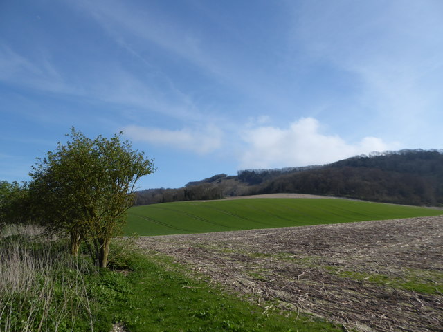
Punters Copse is a small woodland area located in the county of Sussex, England. Situated in the heart of the South Downs National Park, it covers an area of approximately 10 acres. The copse is characterized by a mixture of broadleaf trees, including oak, beech, and chestnut, providing a picturesque and serene environment for visitors.

The woodland is known for its diverse flora and fauna, with a rich variety of plants, flowers, and wildlife. Bluebells carpet the forest floor in the spring, creating a stunning display of vibrant colors. Punters Copse is also home to many species of birds, including woodpeckers, owls, and warblers, making it a popular spot for birdwatching enthusiasts.

The copse offers several walking trails, allowing visitors to explore the woodland and take in the natural beauty of the surroundings. The paths wind their way through the trees, providing a peaceful and tranquil atmosphere. There are also designated picnic areas where visitors can relax and enjoy a meal amidst the beauty of nature.

Punters Copse is easily accessible, with parking available nearby. The woodland is open to the public year-round, and there is no entrance fee. It is a perfect destination for nature lovers, hikers, and families looking to escape the hustle and bustle of city life and immerse themselves in the peacefulness of the countryside.

Overall, Punters Copse offers a wonderful opportunity to experience the beauty of a Sussex woodland, with its picturesque scenery, diverse wildlife, and tranquil atmosphere.

If you have any feedback on the listing, please let us know in the comments section below.

Punters Copse Images

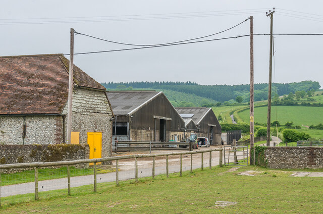
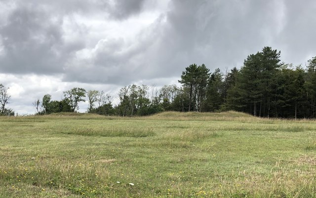
Images are sourced within 2km of 50.937106/-0.73605346 or Grid Reference SU8816. Thanks to Geograph Open Source API. All images are credited.

Forge Cottage
Forge Cottage
View west towards Cocking Down The track heading up the hillside on the other side of the valley is the South Downs Way - aka Middlefield Lane.
View west towards Cocking Down
The track heading up the hillside on the other side of the valley is the South Downs Way - aka Middlefield Lane.
Dog's mercury on the north slopes of Heyshott Down Dog's mercury is completely dominant hereabouts. It is an indicator of ancient woodland.
Dog's mercury on the north slopes of Heyshott Down
Dog's mercury is completely dominant hereabouts. It is an indicator of ancient woodland.
Old Milestone by the A286, Milestone Garage, Cocking Parish Carved stone post by the A286, in parish of COCKING (CHICHESTER District), Milestone Garage, edge of forecourt at corner of canopy, on East side of road. Erected by the Chichester, Dell Quay & Fernhurst turnpike trust in the 19th century. An earlier photograph can be found here <a title="https://www.geograph.org.uk/photo/6044222" href="https://www.geograph.org.uk/photo/6044222">Link</a>.

Inscription reads:- : TO / CHICHESTER / 9 MILES / - / LONDON / 52 / - :

Milestone Society National ID: SX_CCMD09.
Old Milestone by the A286, Milestone Garage, Cocking Parish
Carved stone post by the A286, in parish of COCKING (CHICHESTER District), Milestone Garage, edge of forecourt at corner of canopy, on East side of road. Erected by the Chichester, Dell Quay & Fernhurst turnpike trust in the 19th century. An earlier photograph can be found here Link. Inscription reads:- : TO / CHICHESTER / 9 MILES / - / LONDON / 52 / - : Milestone Society National ID: SX_CCMD09.
Hillbarn Lane Lane on Manorfarm Down used by the South Downs Way.
Hillbarn Lane
Lane on Manorfarm Down used by the South Downs Way.
Hillbarn Lane Lane on Manorfarm Down used by the South Downs Way.
Hillbarn Lane
Lane on Manorfarm Down used by the South Downs Way.
Manor Farm Farm off Hillbarn Lane.
Manor Farm
Farm off Hillbarn Lane.
Crossing the A286 The South Downs Way crossing the A286.
Crossing the A286
The South Downs Way crossing the A286.
Cocking Hill Farm Farm on Hillbarn Lane.
Cocking Hill Farm
Farm on Hillbarn Lane.
Bench Mark on the side of Cadence Cafe CUT MARK: BARN COCKINGHILL FM NW ANG (ODN 106.980m, AGL 0.1m)
Bench Mark on the side of Cadence Cafe
CUT MARK: BARN COCKINGHILL FM NW ANG (ODN 106.980m, AGL 0.1m)
Searching southwards down the Bashire (17) Farmland on the edge of Gadd's Bottom
Searching southwards down the Bashire (17)
Farmland on the edge of Gadd's Bottom
Searching southwards down the Bashire (18) A peaceful scene in Eastdean Wood
Searching southwards down the Bashire (18)
A peaceful scene in Eastdean Wood
Kink in the South Downs Way At this point the OS Map shows that the route of the South Downs Way turns left through the gate. It then heads north for a short distance before resuming its easterly direction.  However, the route ahead provides a short cycle route to seemingly avoid having to use the gate, but is probably used by all users of the trail.
Kink in the South Downs Way
At this point the OS Map shows that the route of the South Downs Way turns left through the gate. It then heads north for a short distance before resuming its easterly direction. However, the route ahead provides a short cycle route to seemingly avoid having to use the gate, but is probably used by all users of the trail.
Tumuli on the South Downs Viewed from the South Downs Way near Combe Bottom.
Tumuli on the South Downs
Viewed from the South Downs Way near Combe Bottom.
Cross Dyke on the South Downs Viewed from the South Downs Way near Combe Bottom.
Cross Dyke on the South Downs
Viewed from the South Downs Way near Combe Bottom.
Logs and storage tanks at Manor Farm
House at Manor Farm
House at Manor Farm
Broad Walk in Charlton Forest
Show me another place!

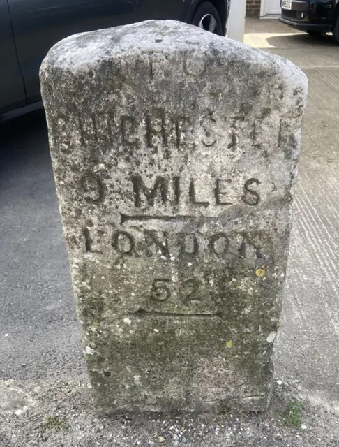
Punters Copse is located at Grid Ref: SU8816 (Lat: 50.937106, Lng: -0.73605346)

Administrative County: West Sussex

District: Chichester

Police Authority: Sussex

What 3 Words

///eternally.relax.tone. Near Midhurst, West Sussex

Related Wikis

Heyshott Down

Heyshott Down is a 42.6-hectare (105-acre) biological Site of Special Scientific Interest south of Midhurst in West Sussex. It is a Nature Conservation...
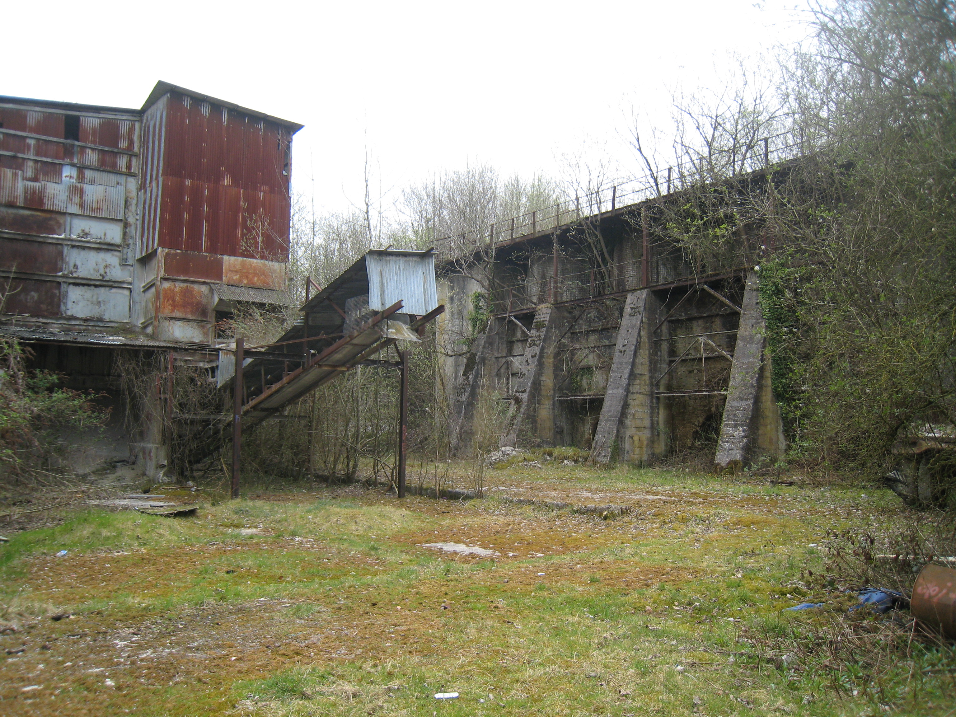
Cocking Lime Works

Cocking Lime Works and its associated chalk quarry are abandoned industrial sites in the South Downs of England. They are to the south of the village of...

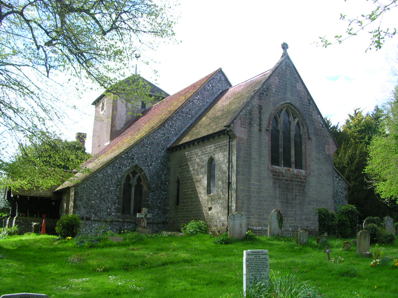
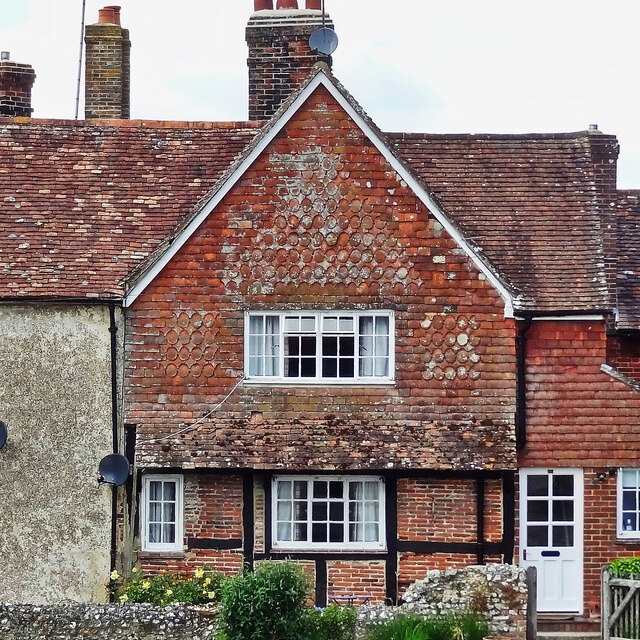
St Catherine of Siena Church, Cocking

St Catherine of Siena Church is an Anglican parish church in Cocking, a village in the district of Chichester, one of seven local government districts...

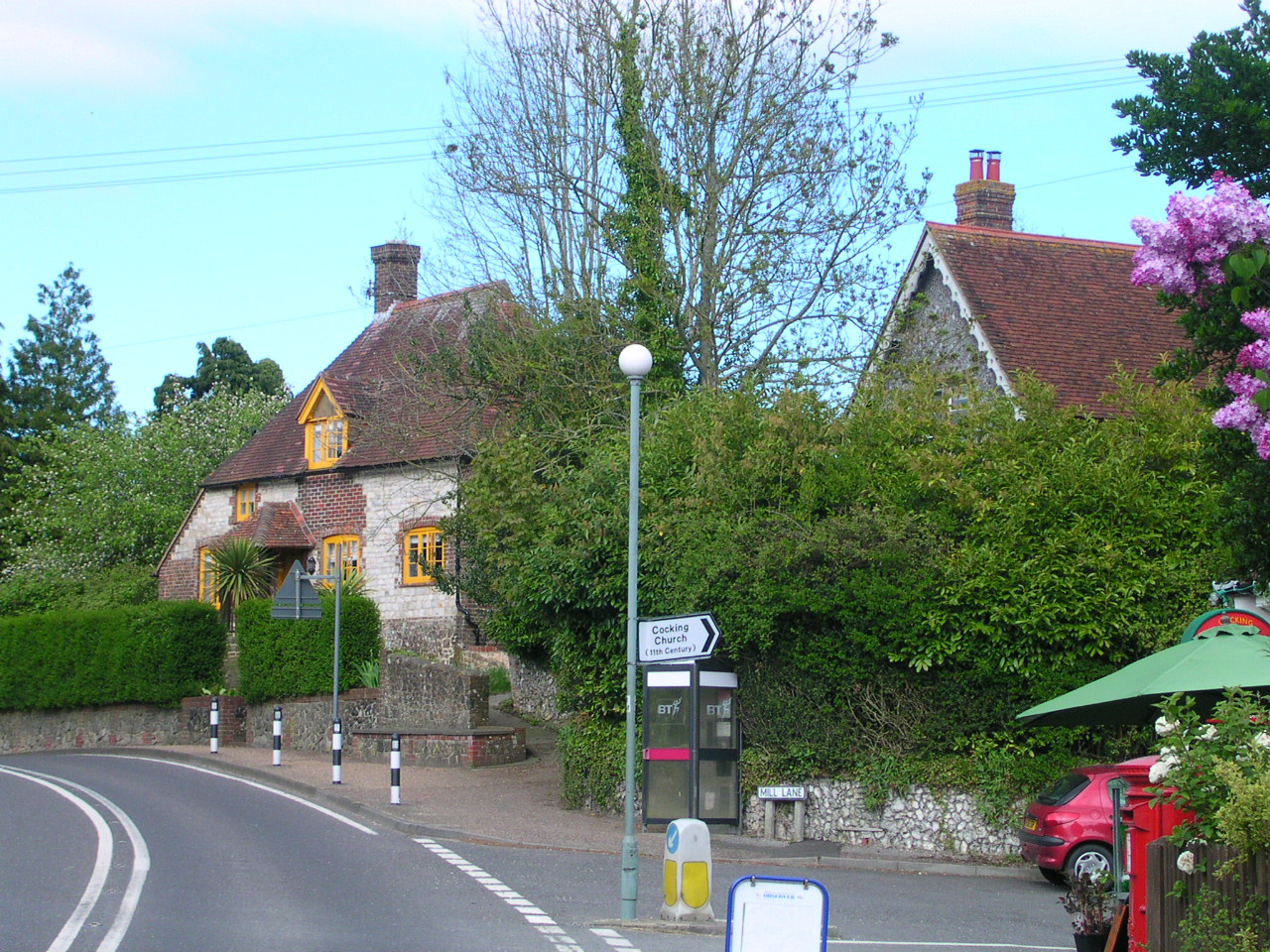
Cocking, West Sussex

Cocking is a village, parish and civil parish in the Chichester district of West Sussex, England. The village is about three miles (5 km) south of Midhurst...

Nearby Amenities

Located within 500m of 50.937106,-0.73605346
Information: guidepost
Tourism: information
Lat/Long: 50.9406506/-0.737076
The data included in this document is from www.openstreetmap.org. The data is made available under ODbL.

Have you been to Punters Copse?

Leave your review of Punters Copse below (or comments, questions and feedback).