Fenton Boundary Plantation

Wood, Forest in Lincolnshire South Kesteven

England

Fenton Boundary Plantation

Stubble field and Stanger's Plantation
Stubble field and Stanger's Plantation Credit: Jonathan Thacker

Fenton Boundary Plantation, located in Lincolnshire, England, is a serene woodland area known for its natural beauty and rich biodiversity. The plantation covers an extensive area, comprising of thick woods and dense forests. It is a popular destination for nature lovers, hikers, and wildlife enthusiasts.

The plantation is home to a diverse range of flora and fauna, including various species of trees such as oak, beech, and birch. The lush greenery and towering trees create a picturesque landscape, providing a peaceful and calming environment for visitors.

Fenton Boundary Plantation is also known for its abundance of wildlife. The woodland provides a habitat for numerous species, including deer, foxes, badgers, and a wide variety of bird species. Birdwatchers flock to the plantation to catch a glimpse of rare and migratory birds that pass through the area.

The plantation offers a network of well-maintained trails and paths, allowing visitors to explore the woods and forest at their own pace. The trails provide opportunities for walking, jogging, and cycling, making it an ideal destination for outdoor activities and exercise.

In addition to its natural beauty, Fenton Boundary Plantation has historical significance. The area has traces of ancient settlements and archaeological sites, adding an intriguing element to the plantation's allure.

Overall, Fenton Boundary Plantation in Lincolnshire is a captivating destination that offers a blend of natural beauty, wildlife, and historical significance, making it a must-visit location for both locals and tourists seeking a tranquil escape into nature.

If you have any feedback on the listing, please let us know in the comments section below.

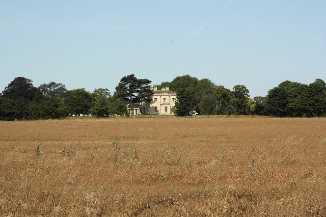
Fenton Boundary Plantation Images

Images are sourced within 2km of 53.041068/-0.68983419 or Grid Reference SK8750. Thanks to Geograph Open Source API. All images are credited.

Stubble field and Stanger's Plantation
Saint Martins Church, Stubton The present Anglican parish church is dedicated to St. Martin and dates back to at least the 15th Century.
Saint Martins Church, Stubton
The present Anglican parish church is dedicated to St. Martin and dates back to at least the 15th Century.
St.Martin's church, Stubton, Lincs.
Stubber Hill Plantation, Stubton.
Gorse Lane Gorse Lane leads to the former RAF Fulbeck a couple of squares to the north.
Gorse Lane
Gorse Lane leads to the former RAF Fulbeck a couple of squares to the north.
Footpath to Claypole Track from Stubton to Claypole
Footpath to Claypole
Track from Stubton to Claypole
Footpath to Stubton Gorse
Public footpath near Stubton This farm road goes to a private airstrip running left to right on the horizon. The footpath goes to Fenton.
Public footpath near Stubton
This farm road goes to a private airstrip running left to right on the horizon. The footpath goes to Fenton.
Lake at Gorse Lodge, near Stubton Gorse Lodge is actually in <a href="https://www.geograph.org.uk/gridref/SK8849">SK8849</a> but the majority of this lake, the field beyond and the woodland, Stubton Gorse are in the featured square. There is a clay pigeon shooting ground here.
Lake at Gorse Lodge, near Stubton
Gorse Lodge is actually in SK8849 but the majority of this lake, the field beyond and the woodland, Stubton Gorse are in the featured square. There is a clay pigeon shooting ground here.
Ploughed field at Gorse Lodge
Footpath Stubton to Claypole?
Stubton Hall Stubton Hall from Brandon Road, former school, now a wedding venue <span class="nowrap"><a title="http://www.stubtonhall.co.uk/" rel="nofollow ugc noopener" href="http://www.stubtonhall.co.uk/">Link</a><img style="margin-left:2px;" alt="External link" title="External link - shift click to open in new window" src="https://s1.geograph.org.uk/img/external.png" width="10" height="10"/></span>
Stubton Hall
Stubton Hall from Brandon Road, former school, now a wedding venue LinkExternal link
Brandon Road View towards Stubton Hall on Brandon Road
Brandon Road
View towards Stubton Hall on Brandon Road
Stubton Hall Country House built 1813-14 by Sir Jeffry Wyatville, later enhanced as a private school, now an hotel <span class="nowrap"><a title="http://www.stubtonhall.co.uk/" rel="nofollow ugc noopener" href="http://www.stubtonhall.co.uk/">Link</a><img style="margin-left:2px;" alt="External link" title="External link - shift click to open in new window" src="https://s1.geograph.org.uk/img/external.png" width="10" height="10"/></span>
Stubton Hall
Country House built 1813-14 by Sir Jeffry Wyatville, later enhanced as a private school, now an hotel LinkExternal link
Entrance to Stubton Hill Farm
Footpath to Stubton Gorse
Track to Stubton Gorse
View towards Stubton Gorse
Show me another place!

Fenton Boundary Plantation is located at Grid Ref: SK8750 (Lat: 53.041068, Lng: -0.68983419)

Administrative County: Lincolnshire

District: South Kesteven

Police Authority: Lincolnshire

What 3 Words

///twists.undertook.truckload. Near Claypole, Lincolnshire

Nearby Locations

Fenton Boundary Plantation

Related Wikis

Fenton, South Kesteven

Fenton is a village in the South Kesteven district of Lincolnshire, England. It is situated 14 miles (23 km) south-west from the city and county town of...

Stubton

Stubton is a small village and civil parish in the South Kesteven district of Lincolnshire, England. The population of the civil parish (including Fenton...
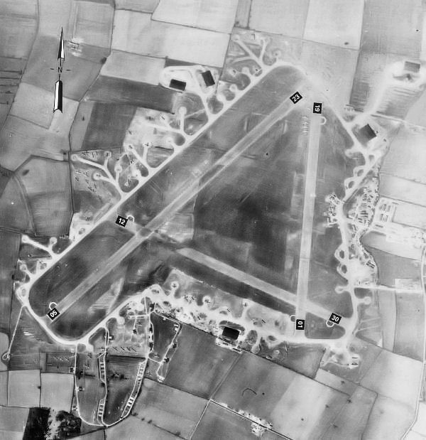
RAF Fulbeck

Royal Air Force Fulbeck or more simply RAF Fulbeck is a former Royal Air Force station located 6.3 miles (10.1 km) east of Newark-on-Trent, Nottinghamshire...

Claypole railway station

Claypole railway station was a station in Claypole, Lincolnshire that was in operation from 1852 to 1957. == History == The station was opened by the Great...

Nearby Amenities

Located within 500m of 53.041068,-0.68983419
Stubton Hill
Natural: peak
Lat/Long: 53.0402584/-0.6948853
The data included in this document is from www.openstreetmap.org. The data is made available under ODbL.

Have you been to Fenton Boundary Plantation?

Leave your review of Fenton Boundary Plantation below (or comments, questions and feedback).