Adderstone Wood

Wood, Forest in Yorkshire Ryedale

England

Adderstone Wood

Staindale Beck A quiet dale just outside the eastern edge of Dalby Forest Park with a wooded beck of crystal clear waters with small trout on one of the National Trust's working farms.

The name Stain Dale comes from the Norse and means a 'stony valley' probably because of the rock formations higher up the valley at the Bridestones.
Staindale Beck Credit: Mick Garratt

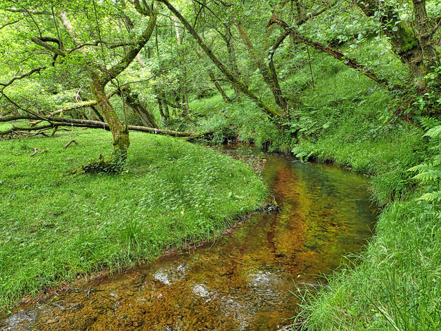
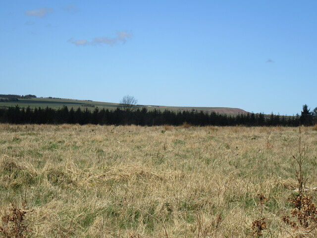
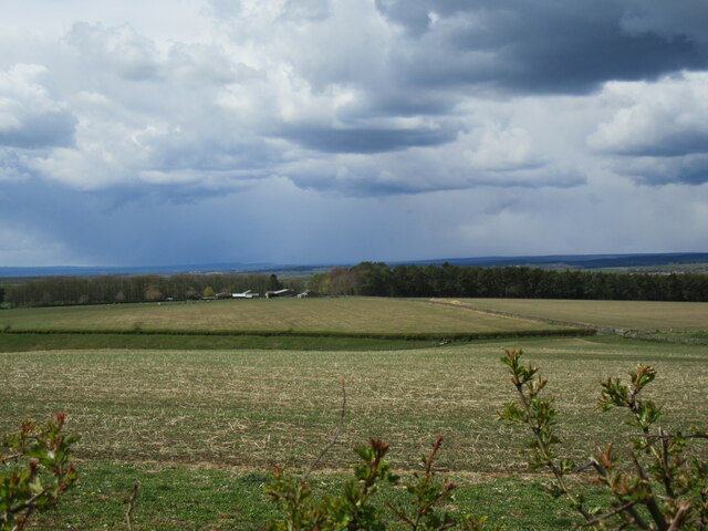
Adderstone Wood is a sprawling forest located in the county of Yorkshire, England. Covering a vast area, the wood is a captivating example of natural beauty and tranquility. Nestled amidst the rolling hills and picturesque landscapes, this woodland is a haven for nature enthusiasts and those seeking solace in the great outdoors.

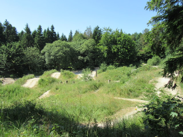
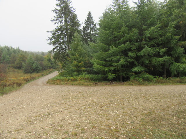
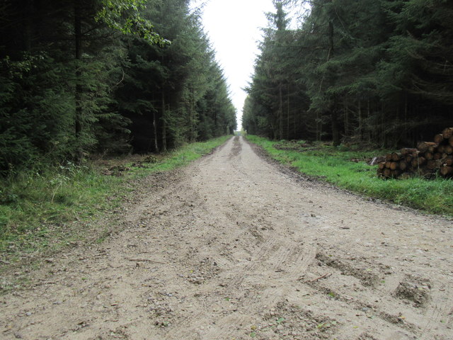
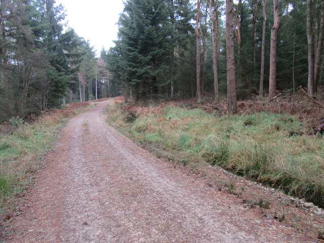
The wood is primarily composed of deciduous trees, such as oak, beech, and birch, which provide a stunning display of colors throughout the changing seasons. The dense foliage creates a sense of seclusion, allowing visitors to immerse themselves in the peaceful ambience. A network of well-maintained paths winds through the wood, offering visitors an opportunity to explore its depths and discover its hidden treasures.

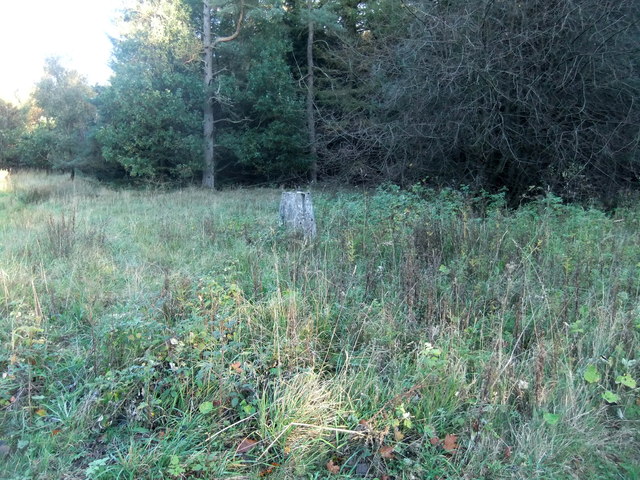
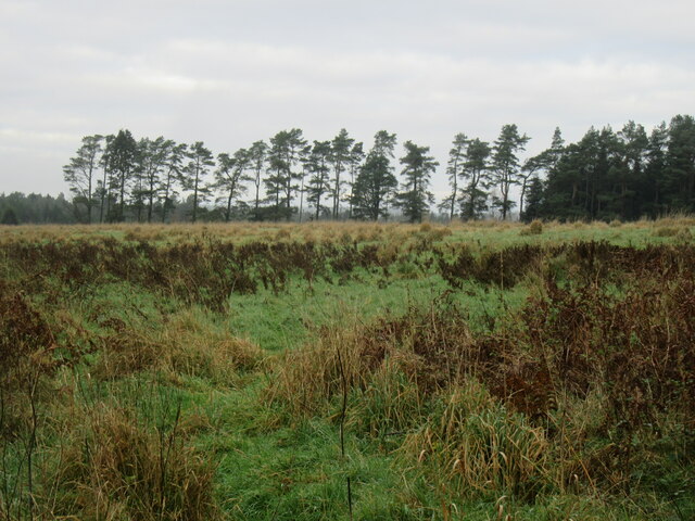
The biodiversity within Adderstone Wood is remarkable, with a wide variety of flora and fauna calling it home. Wildflowers carpet the forest floor, showcasing vibrant hues and enticing a plethora of insects and small animals. Birdsong fills the air as numerous avian species flit between the branches, including woodpeckers, nuthatches, and robins.

The wood is not only a sanctuary for wildlife but also a recreational space for humans. Visitors can engage in activities such as walking, jogging, or cycling along the designated trails. Picnic areas are scattered throughout the wood, providing the perfect spot for a leisurely lunch amidst the serenity of nature.

Whether it be a leisurely stroll, a moment of quiet reflection, or an opportunity to connect with the natural world, Adderstone Wood offers an enchanting escape from the hustle and bustle of everyday life. Its timeless beauty and diverse ecosystem make it an essential destination for anyone seeking to immerse themselves in the wonders of nature.

If you have any feedback on the listing, please let us know in the comments section below.

Adderstone Wood Images

Images are sourced within 2km of 54.301063/-0.65244248 or Grid Reference SE8790. Thanks to Geograph Open Source API. All images are credited.

Staindale Beck A quiet dale just outside the eastern edge of Dalby Forest Park with a wooded beck of crystal clear waters with small trout on one of the National Trust's working farms.

The name Stain Dale comes from the Norse and means a 'stony valley' probably because of the rock formations higher up the valley at the Bridestones.
Staindale Beck
A quiet dale just outside the eastern edge of Dalby Forest Park with a wooded beck of crystal clear waters with small trout on one of the National Trust's working farms. The name Stain Dale comes from the Norse and means a 'stony valley' probably because of the rock formations higher up the valley at the Bridestones.
Dixon's Hollow Mountain bike course in Dalby Forest.
Dixon's Hollow
Mountain bike course in Dalby Forest.
Newclose Rigg junction The ditch to the centre of the photo claimed two cars on the night stage of the Trackrod Rally a week earlier, although they did manage to continue.
Newclose Rigg junction
The ditch to the centre of the photo claimed two cars on the night stage of the Trackrod Rally a week earlier, although they did manage to continue.
Red Dyke Trig Pillar
Track in Dalby Forest Looking SE.
Track in Dalby Forest
Looking SE.
Peathead Rigg Looking north.
Peathead Rigg
Looking north.
Newclose Rigg Looking east.
Newclose Rigg
Looking east.
Log pile in Dalby Forest Four loaded timber trucks were seen in Dalby Forest today.
Log pile in Dalby Forest
Four loaded timber trucks were seen in Dalby Forest today.
Newclose Rigg view Looking north from Newclose Rigg towards Whinny Nab.
Newclose Rigg view
Looking north from Newclose Rigg towards Whinny Nab.
Stoneclose Rigg Looking west along Stoneclose Rigg, soon there was a light snow shower.
Stoneclose Rigg
Looking west along Stoneclose Rigg, soon there was a light snow shower.
One of the High Bride Stones One of the High Bride Stones on Grime Moor.
One of the High Bride Stones
One of the High Bride Stones on Grime Moor.
'Pepper pot' Zoomed in view of the 'pepper pot'.
'Pepper pot'
Zoomed in view of the 'pepper pot'.
The end of Dove Dale Where Dove Dale joins Staindale.
The end of Dove Dale
Where Dove Dale joins Staindale.
Bridestones Moor A day spent cutting self sown, mainly birch saplings from the Bridestones heather moorland under a glorious blue sky. A day also for twitchering in which murmuring fieldfare, perhaps getting impatient, itching to leave for the summer, and a skylark, first of the year.

If left the birch would gradually begin to dominate. Bridestones Moor is unique in that since it was left to the National Trust in 1943 it has not been intensively managed. Other moors are either burnt frequently for grouse or too heavily grazed.

It’s important therefore that the condition of the moor is maintained allowing a good diversity of dwarf shrubs to grow, including old heather with collapsing canopy and natural dwarf shrub regeneration in the gaps.

If left birch would takeover the moor. The aim is for a tree cover of no more than 5%.

Somewhere on this moor is buried a time capsule containing up to 100 items from shoe polish to theatre tickets, teabags and, a newspaper.

It was buried by the National Trust in 1995 to mark their centenary. I guess the actual burial site would have been closer to the stones themselves.

Also included in the capsule is a plaque made from a fallen oak tree on the moor which has been inscribed with a list of key events during that first 100 years of the Trust’s existence: the first powered flight, the two world wars, the Kennedy assassination, and England’s 1966 Word Cup victory.

For sources and references see <span class="nowrap"><a title="http://www.fhithich.uk/?p=27350" rel="nofollow ugc noopener" href="http://www.fhithich.uk/?p=27350">Link</a><img style="margin-left:2px;" alt="External link" title="External link - shift click to open in new window" src="https://s1.geograph.org.uk/img/external.png" width="10" height="10"/></span>
Bridestones Moor
A day spent cutting self sown, mainly birch saplings from the Bridestones heather moorland under a glorious blue sky. A day also for twitchering in which murmuring fieldfare, perhaps getting impatient, itching to leave for the summer, and a skylark, first of the year. If left the birch would gradually begin to dominate. Bridestones Moor is unique in that since it was left to the National Trust in 1943 it has not been intensively managed. Other moors are either burnt frequently for grouse or too heavily grazed. It’s important therefore that the condition of the moor is maintained allowing a good diversity of dwarf shrubs to grow, including old heather with collapsing canopy and natural dwarf shrub regeneration in the gaps. If left birch would takeover the moor. The aim is for a tree cover of no more than 5%. Somewhere on this moor is buried a time capsule containing up to 100 items from shoe polish to theatre tickets, teabags and, a newspaper. It was buried by the National Trust in 1995 to mark their centenary. I guess the actual burial site would have been closer to the stones themselves. Also included in the capsule is a plaque made from a fallen oak tree on the moor which has been inscribed with a list of key events during that first 100 years of the Trust’s existence: the first powered flight, the two world wars, the Kennedy assassination, and England’s 1966 Word Cup victory. For sources and references see LinkExternal link
Low Staindale A delightful former farm-house situated in Staindale in the parish of Lockton. The farmstead is shown on the Thomas Jefferies map of 1775 and it is believed the farmhouse certainly dates from that time with later alterations and extensions.

The house itself is Grade II listed but two of the outbuildings are also of historical significance.

One of these outbuildings is described as a ‘laithe barn’. Now I am not sure what this actually was. I had thought a ‘laithe’ was just a Yorkshire dialect for a barn. Another source suggests a granary.

The house is part of the National Trust’s Bridestones property and is now let on long-term occupancy. The property of 165 acres was acquired in 1943 with a bequest from Mrs. R. F. A. Whitney, of Cambridge.

In 1948, the Youth Hostels Association leased the farmhouse and opened it as a “self-cooker” hostel — that is, cooking facilities were provided, but hostellers would do their own cooking.

To my mind this is the traditional type of youth hostel, unpopular now as it’s more lucrative to provide food and drink, but in the late 1940s, a survey among Y.H.A. members favoured this simpler type of accommodation. The hostel provided accommodation for 16 members.

Before the war, before the mass forestry planting, and certainly before the tarmac road of the Dalby Forest Drive, Staindale was one of the remotest valleys in the North York Moors. In 1933, it was reported that there were children of up to 8 years old living at Low Staindale who had never attended school.

In 1903, John Purson lived at Low Staindale. We know this because while he was working at a thrashing machine on the farm of William Thompson at Lockton Pastures, his right arm was caught by the revolving drum and torn off above the elbow and had to be subsequently amputated.

An appalling accident and one which would have had dire consequences for the family.

For sources and references see my blog <span class="nowrap"><a title="http://www.fhithich.uk/?p=27576" rel="nofollow ugc noopener" href="http://www.fhithich.uk/?p=27576">Link</a><img style="margin-left:2px;" alt="External link" title="External link - shift click to open in new window" src="https://s1.geograph.org.uk/img/external.png" width="10" height="10"/></span>
Low Staindale
A delightful former farm-house situated in Staindale in the parish of Lockton. The farmstead is shown on the Thomas Jefferies map of 1775 and it is believed the farmhouse certainly dates from that time with later alterations and extensions. The house itself is Grade II listed but two of the outbuildings are also of historical significance. One of these outbuildings is described as a ‘laithe barn’. Now I am not sure what this actually was. I had thought a ‘laithe’ was just a Yorkshire dialect for a barn. Another source suggests a granary. The house is part of the National Trust’s Bridestones property and is now let on long-term occupancy. The property of 165 acres was acquired in 1943 with a bequest from Mrs. R. F. A. Whitney, of Cambridge. In 1948, the Youth Hostels Association leased the farmhouse and opened it as a “self-cooker” hostel — that is, cooking facilities were provided, but hostellers would do their own cooking. To my mind this is the traditional type of youth hostel, unpopular now as it’s more lucrative to provide food and drink, but in the late 1940s, a survey among Y.H.A. members favoured this simpler type of accommodation. The hostel provided accommodation for 16 members. Before the war, before the mass forestry planting, and certainly before the tarmac road of the Dalby Forest Drive, Staindale was one of the remotest valleys in the North York Moors. In 1933, it was reported that there were children of up to 8 years old living at Low Staindale who had never attended school. In 1903, John Purson lived at Low Staindale. We know this because while he was working at a thrashing machine on the farm of William Thompson at Lockton Pastures, his right arm was caught by the revolving drum and torn off above the elbow and had to be subsequently amputated. An appalling accident and one which would have had dire consequences for the family. For sources and references see my blog LinkExternal link
Dalby Forest Drive
Dalby Forest Drive
Yondhead Rigg Grassy forest track on Yondhead Rigg.
Yondhead Rigg
Grassy forest track on Yondhead Rigg.
Fungi on Yondhead Rigg Fungi growing on a tree stump on Yondhead Rigg.
Fungi on Yondhead Rigg
Fungi growing on a tree stump on Yondhead Rigg.
Show me another place!

Adderstone Wood is located at Grid Ref: SE8790 (Lat: 54.301063, Lng: -0.65244248)

Division: North Riding

Administrative County: North Yorkshire

District: Ryedale

Police Authority: North Yorkshire

What 3 Words

///comically.ounce.wiser. Near Thornton Dale, North Yorkshire

Related Wikis

Dalby Forest

Dalby Forest is a forest located on the southern slopes of the North York Moors National Park in North Yorkshire, England. It is maintained by Forestry...

Blakey Topping standing stones

Blakey Topping standing stones is a small group of standing stones near the Hole of Horcum in the North York Moors. It sits at the foot of Blakey Topping...

Lockton

Lockton is a small village and civil parish in North Yorkshire, England. It is situated in the North York Moors about 4 miles (6.4 km) north-east of Pickering...

14–18 NOW

14–18 NOW was the UK's arts programme for the First World War centenary. Working with arts and heritage partners all across the UK, the programme commissioned...

Levisham

Levisham is a small village and civil parish in North Yorkshire, England, located within the North York Moors National Park about 5 miles (8 km) north...

Hole of Horcum

The Hole of Horcum is a section of the valley of the Levisham Beck, upstream of Levisham and Lockton, in the Tabular Hills of the North York Moors National...

Darncombe-cum-Langdale End

Darncombe-cum-Langdale End is a civil parish in the Scarborough district of North Yorkshire, England. According to the 2001 UK census, Darncombe-cum-Langdale...

Pexton Moor

Pexton Moor is an archaeological site in North Yorkshire containing a prehistoric cemetery. It is located at the western edge of Dalby Forest, north of...

Nearby Amenities

Located within 500m of 54.301063,-0.65244248
Toilets
Lat/Long: 54.302195/-0.6515729
Adderstone
Place: locality
Lat/Long: 54.2994531/-0.6525556
Bench
Lat/Long: 54.3025487/-0.6502194
Barrier: kissing_gate
Lat/Long: 54.3033251/-0.6544266
The data included in this document is from www.openstreetmap.org. The data is made available under ODbL.

Have you been to Adderstone Wood?

Leave your review of Adderstone Wood below (or comments, questions and feedback).