Hangar Plantation

Wood, Forest in Lincolnshire South Kesteven

England

Hangar Plantation

Prepared field and narrow strip of woodland
Prepared field and narrow strip of woodland Credit: Jonathan Thacker

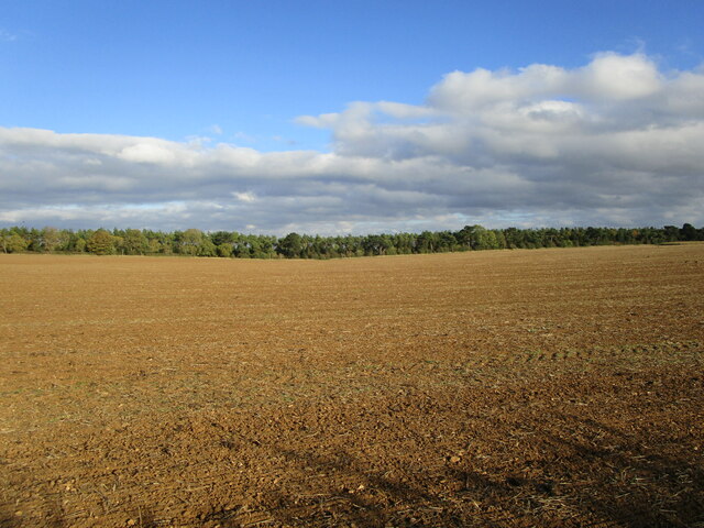
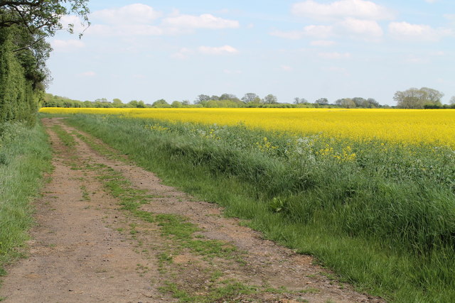
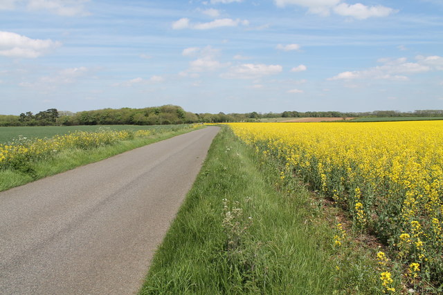
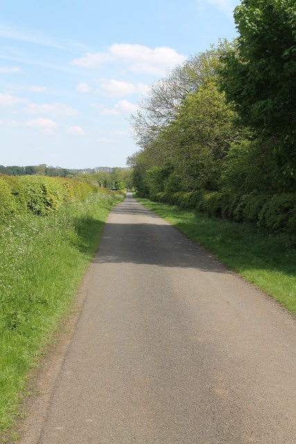
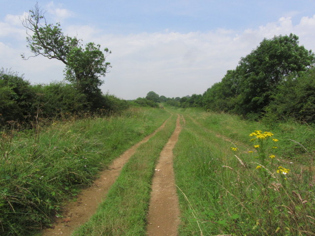
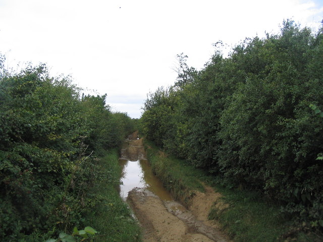
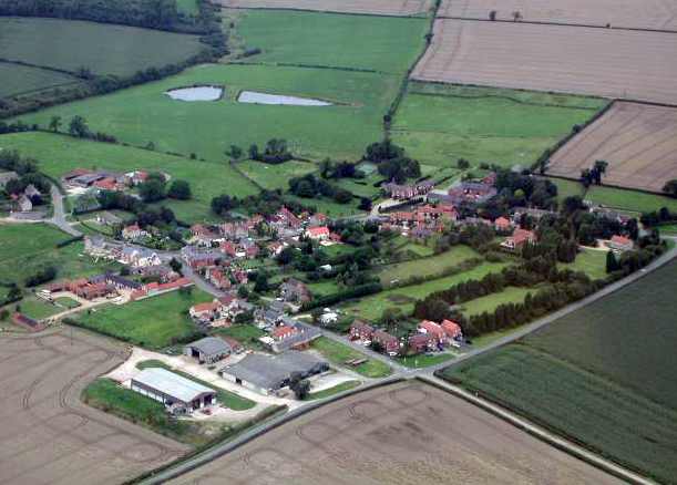
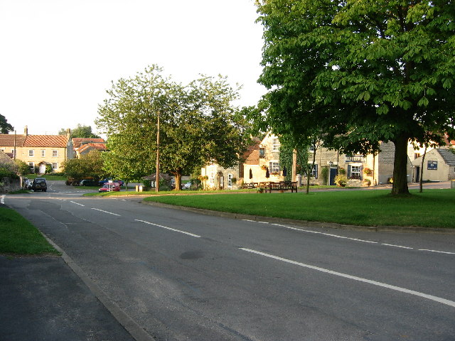
Hangar Plantation is a picturesque woodland area located in Lincolnshire, England. Situated near the village of Wood, the plantation is known for its lush greenery, dense forests, and tranquil atmosphere. Spread across a vast area, it offers a perfect retreat for nature enthusiasts and those seeking solitude amidst the beauty of the countryside.

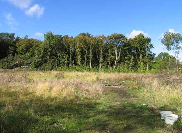
The plantation is primarily composed of various species of deciduous trees, including oak, beech, and ash, among others. These trees create a dense canopy, providing shade and shelter for a diverse range of flora and fauna. Walking through the plantation, visitors can enjoy the mesmerizing sight of sunlight filtering through the leaves and casting beautiful patterns on the forest floor.

The woodland is home to a plethora of wildlife, making it a haven for nature lovers and birdwatchers. Several species of birds, such as owls, woodpeckers, and jays, can be spotted in the area, along with mammals like squirrels, rabbits, and deer. The plantation also boasts a rich variety of plant life, with bluebells, primroses, and wild garlic carpeting the forest floor during springtime.

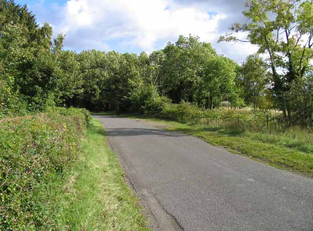
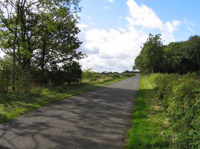
Hangar Plantation offers a network of well-maintained trails and paths, providing ample opportunities for walking, hiking, and exploring. The serenity of the surroundings makes it an ideal spot for picnics, photography, and simply unwinding in nature's embrace.

Overall, Hangar Plantation in Lincolnshire is a hidden gem, offering a peaceful escape from the hustle and bustle of daily life. With its stunning woodland views, diverse wildlife, and well-marked trails, it is a must-visit destination for anyone seeking solace in nature's beauty.

If you have any feedback on the listing, please let us know in the comments section below.

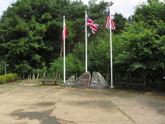
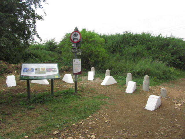
Hangar Plantation Images

Images are sourced within 2km of 52.831085/-0.70073217 or Grid Reference SK8726. Thanks to Geograph Open Source API. All images are credited.

Prepared field and narrow strip of woodland
King Lud's Entrenchments
Main Street towards Hungarton
Main Street towards Saltby
Track to Saltby Airfield RAF Saltby opened in 1942, and was closed in 1955. Now home to Buckminster Gliding Club.
Track to Saltby Airfield
RAF Saltby opened in 1942, and was closed in 1955. Now home to Buckminster Gliding Club.
Lane through the Oil Seed Rape
A lane along Cooper's Plantation
Unnamed lane near Sproxton
The Viking Way Also a track named The Drift.
The Viking Way
Also a track named The Drift.
Track to Saltby Airfield Home of Buckminster Gliding Club.
Track to Saltby Airfield
Home of Buckminster Gliding Club.
Viking Way along The Drift WNW of Skillington
Memorial at former RAF base - Saltby Airfield, Lincs
Viking Way - Vehicle barrier at The Drift near Saltby
Sproxton Road eastwards
Sproxton Road westwards
Roadside conservation area, near Croxton Kerrial and Denton Leicestershire to the left and Lincolnshire to the right. The wide verge is managed by Lincolnshire County Council for nature conservation whilst on the other side of the road the grass is cut more frequently by Leicestershire. The track straight ahead is The Drift and the Viking Way long distance footpath marking the County Boundary.
Roadside conservation area, near Croxton Kerrial and Denton
Leicestershire to the left and Lincolnshire to the right. The wide verge is managed by Lincolnshire County Council for nature conservation whilst on the other side of the road the grass is cut more frequently by Leicestershire. The track straight ahead is The Drift and the Viking Way long distance footpath marking the County Boundary.
King Lud's Entrenchments, Leicestershire A vast open field covers most of this square. There is an unfenced road through the middle of the field and to the north this woodland hides King Lud's Entrenchments, possibly part of a tribal boundary of the Bronze Age. See <span class="nowrap"><a title="http://www.themodernantiquarian.com/site/2394" rel="nofollow ugc noopener" href="http://www.themodernantiquarian.com/site/2394">Link</a><img style="margin-left:2px;" alt="External link" title="External link - shift click to open in new window" src="https://s1.geograph.org.uk/img/external.png" width="10" height="10"/></span> Keeper's Cottage can just be seen against the trees to the left: it sits on the boundary with the next square.
King Lud's Entrenchments, Leicestershire
A vast open field covers most of this square. There is an unfenced road through the middle of the field and to the north this woodland hides King Lud's Entrenchments, possibly part of a tribal boundary of the Bronze Age. See LinkExternal link Keeper's Cottage can just be seen against the trees to the left: it sits on the boundary with the next square.
Curious sheep at Skillington
Show me another place!

Hangar Plantation is located at Grid Ref: SK8726 (Lat: 52.831085, Lng: -0.70073217)

Administrative County: Lincolnshire

District: South Kesteven

Police Authority: Lincolnshire

What 3 Words

///fewer.executive.recapture. Near Colsterworth, Lincolnshire

Related Wikis

RAF Saltby

Royal Air Force Saltby or more simply RAF Saltby is a former Royal Air Force station located near Saltby, Leicestershire, England The following units were...

Buckminster Gliding Club

The Buckminster Gliding Club (BGC) is a gliding club based at Saltby Airfield on the Leicestershire / Lincolnshire border, England. It is affiliated with...

King Lud's Entrenchments and The Drift

King Lud's Entrenchments and The Drift is a 23.9 hectares (59 acres) biological Site of Special Scientific Interest which straddles the border between...

Saltby

Saltby is a village and former civil parish, now in the parish of Sproxton, in the Melton borough of Leicestershire, England. It lies close to the River...

Sproxton Quarry

Sproxton Quarry is a 5.4 hectares (13 acres) geological Site of Special Scientific Interest north-east of Sproxton in Leicestershire. It is a Geological...

Skillington

Skillington is a village and civil parish in the South Kesteven district of Lincolnshire, England. The population of the civil parish at the 2021 census...

Sproxton, Leicestershire

Sproxton () is a village and civil parish within the Borough of Melton in Leicestershire, England, close to the border with Lincolnshire. It has approximately...

Church of St John the Baptist, Buckminster

The Church of St John the Baptist is a church in Buckminster, Leicestershire. It is a Grade I listed building. == History == The church consists of a nave...

Nearby Amenities

Located within 500m of 52.831085,-0.70073217
Ele: 134.7094727
Lat/Long: 52.8345535/-0.6999228
Ele: 133.5078125
Lat/Long: 52.8345665/-0.7037852
Ele: 135.1900635
Lat/Long: 52.8345694/-0.7000141
Ele: 135.4304199
Lat/Long: 52.8340123/-0.7003508
Ele: 135.6706543
Lat/Long: 52.8342949/-0.7001911
Ele: 133.2674561
Lat/Long: 52.8317853/-0.6954062
Ele: 134
Lat/Long: 52.8315494/-0.6989305
Ele: 134
Lat/Long: 52.8314637/-0.699156
Ele: 136.8723145
Lat/Long: 52.8321219/-0.7006865
Ele: 135.1900635
Lat/Long: 52.8341466/-0.7036544
Ele: 134.7094727
Lat/Long: 52.834008/-0.7004199
Ele: 134.9497070
Lat/Long: 52.8339563/-0.7003227
Ele: 134.9497070
Lat/Long: 52.8338206/-0.7001991
Ele: 135.6706543
Lat/Long: 52.8342978/-0.7037744
Ele: 134.2287598
Lat/Long: 52.8336504/-0.7000547
Ele: 137
Lat/Long: 52.8318441/-0.7008288
Ele: 132
Lat/Long: 52.8348283/-0.7041285
Bench
Ele: 137.8336182
Lat/Long: 52.8304027/-0.701807
Description: Saltby Airfield
Ele: 137.1126709
Historic: monument
Lat/Long: 52.8303926/-0.701797
Description: Saltby Airfield
Ele: 137.5932617
Information: board
Tourism: information
Lat/Long: 52.8303715/-0.7017748
Bench
Ele: 137.5932617
Lat/Long: 52.8303809/-0.7017849
Ele: 133.5078125
Lat/Long: 52.8284621/-0.6998955
Ele: 136.8723145
Lat/Long: 52.8297071/-0.7004625
Ele: 137.3530273
Lat/Long: 52.8304854/-0.7018379
Ele: 137
Lat/Long: 52.8318831/-0.700706
Ele: 136.1513672
Lat/Long: 52.8291698/-0.7002131
Aeroway: windsock
Lat/Long: 52.8329342/-0.703615
The data included in this document is from www.openstreetmap.org. The data is made available under ODbL.

Have you been to Hangar Plantation?

Leave your review of Hangar Plantation below (or comments, questions and feedback).