Ashmill

Settlement in Devon Torridge

England

Ashmill

Ashwater War memorial
Ashwater War memorial Credit: Colin Madge

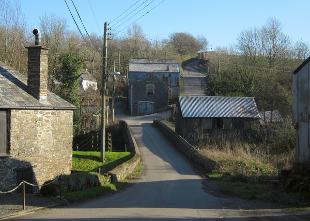
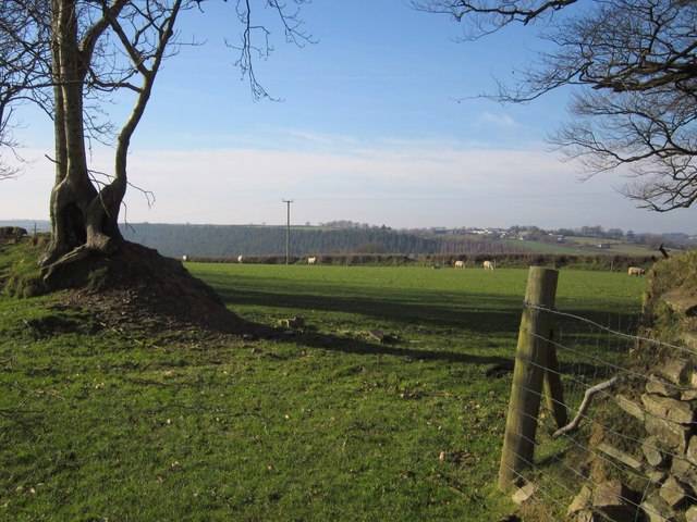
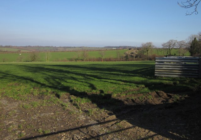
Ashmill is a small village located in the county of Devon, in the southwest of England. Situated amidst picturesque countryside, the village is surrounded by rolling hills, meandering rivers, and lush green fields. It is part of the local government district of West Devon.

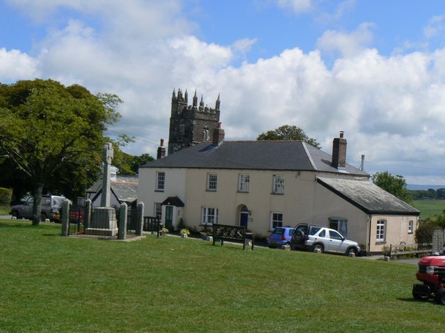
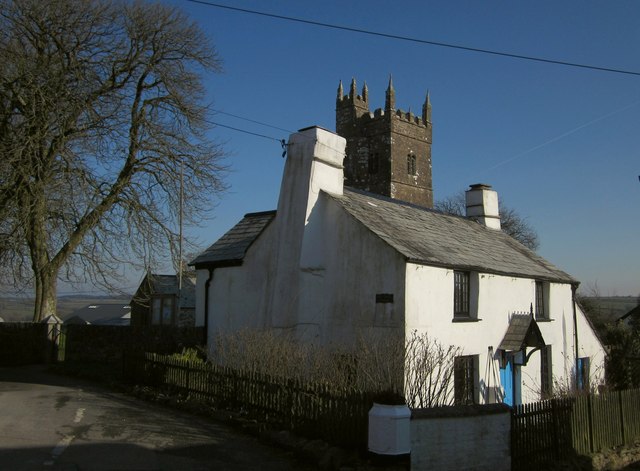
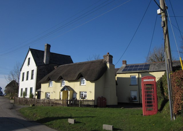
With a population of around 200 residents, Ashmill exudes a tranquil and close-knit community atmosphere. The village primarily consists of traditional stone houses and cottages, which add to its charm and rural character. The local architecture reflects the area's rich history, with some buildings dating back several centuries.

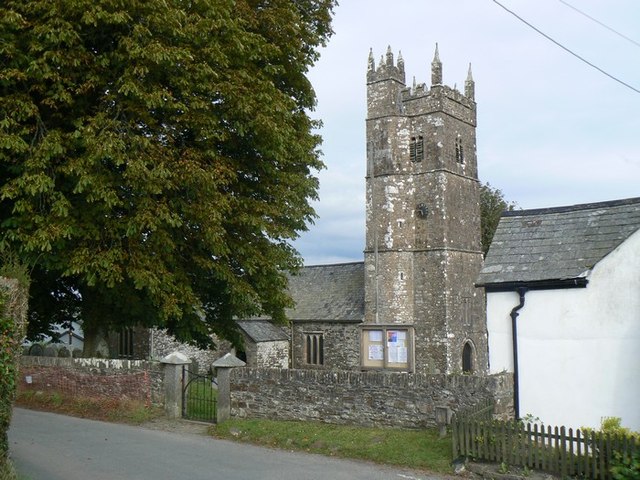
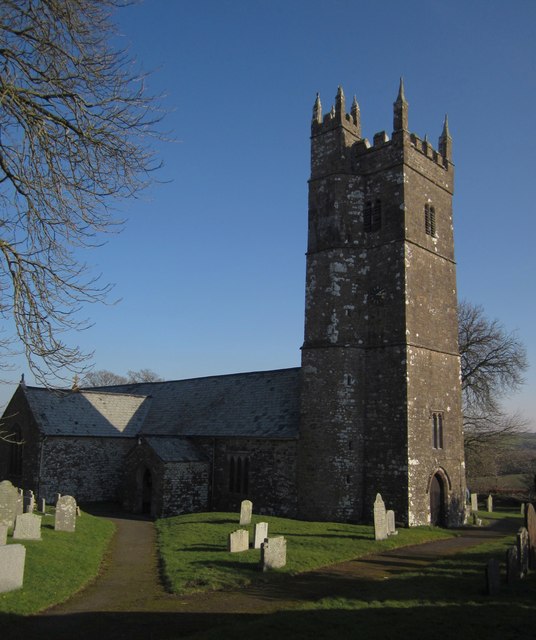
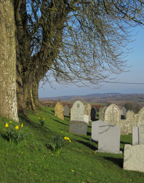
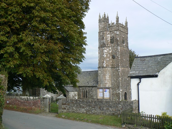
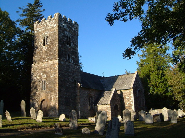
Despite its small size, Ashmill boasts a few amenities to cater to its residents. These include a village hall, a small convenience store, and a local pub, which serves as a popular gathering spot for both locals and visitors. The village is also home to a picturesque church, which is an architectural gem and a notable landmark in the area.

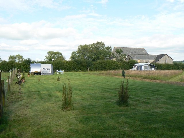
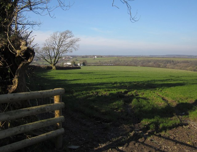
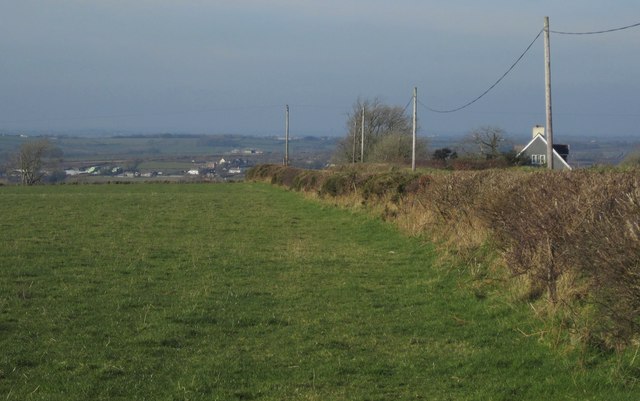
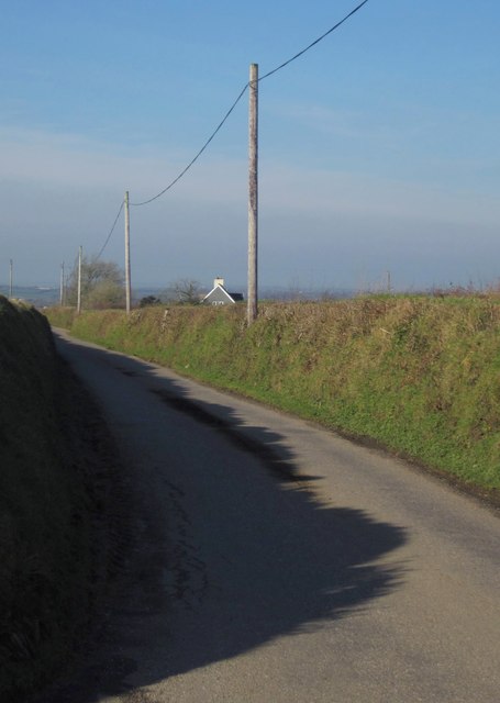
The surrounding natural beauty of Ashmill offers ample opportunities for outdoor activities and exploration. The village is ideally situated near several walking trails and cycling routes, allowing residents and visitors to soak in the stunning countryside scenery. Additionally, the nearby rivers provide opportunities for fishing and boating enthusiasts.

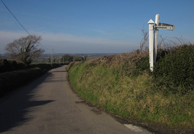
Ashmill's peaceful ambiance, combined with its idyllic setting, makes it an attractive destination for those seeking a quiet retreat away from the hustle and bustle of city life. Its close proximity to other charming villages and towns in Devon further enhances its appeal, making it an ideal base for exploring the wider region.

If you have any feedback on the listing, please let us know in the comments section below.

Ashmill Images

Images are sourced within 2km of 50.735018/-4.27587 or Grid Reference SX3995. Thanks to Geograph Open Source API. All images are credited.

Ashwater War memorial
Ashwater Church Ashwater Parish Church is dedicated to St. Peter ad Vincula, and dates from 1250.
Ashwater Church
Ashwater Parish Church is dedicated to St. Peter ad Vincula, and dates from 1250.
Ashwater village
Ashwater village
Sunny Pooh Caravan site Small caravan site in Ashwater.
Sunny Pooh Caravan site
Small caravan site in Ashwater.
Gate / Entrance to Sunny Pooh Corner
Peacock, Westmanton Adorning the roadside between Reservoir Cross and Ashmill, and apparently unconcerned by quite heavy traffic passing within a couple of metres.
Peacock, Westmanton
Adorning the roadside between Reservoir Cross and Ashmill, and apparently unconcerned by quite heavy traffic passing within a couple of metres.
Field, Westmanton The road to Ashmill, which can be seen ahead, runs behind the hedge on the left. <a href="https://www.geograph.org.uk/photo/2804730">SX3994 : Field, Westmanton</a> looks to the right across the same field.
Field, Westmanton
The road to Ashmill, which can be seen ahead, runs behind the hedge on the left. SX3994 : Field, Westmanton looks to the right across the same field.
Cottage and church, Ashwater In front of the tower of <a href="https://www.geograph.org.uk/photo/2804472">SX3895 : Church of St Peter ad Vincula, Ashwater</a> is Bell Tower Cottage, a "former farmhouse dating from between 1420 and 1540 ... medieval two room and cross passage houses are rare nationally" <span class="nowrap"><a title="http://www.britishlistedbuildings.co.uk/en-90720-bell-tower-cottage-ashwater" rel="nofollow ugc noopener" href="http://www.britishlistedbuildings.co.uk/en-90720-bell-tower-cottage-ashwater">Link</a><img style="margin-left:2px;" alt="External link" title="External link - shift click to open in new window" src="https://s1.geograph.org.uk/img/external.png" width="10" height="10"/></span> .
Cottage and church, Ashwater
In front of the tower of SX3895 : Church of St Peter ad Vincula, Ashwater is Bell Tower Cottage, a "former farmhouse dating from between 1420 and 1540 ... medieval two room and cross passage houses are rare nationally" LinkExternal link .
Church of St Peter ad Vincula, Ashwater Cherry and Pevsner surmise that the church was originally cruciform. An "odd plan" to the pinnacled stair-turret that rises above the tower. See <span class="nowrap"><a title="http://www.britishlistedbuildings.co.uk/en-90719-church-of-st-peter-ashwater" rel="nofollow ugc noopener" href="http://www.britishlistedbuildings.co.uk/en-90719-church-of-st-peter-ashwater">Link</a><img style="margin-left:2px;" alt="External link" title="External link - shift click to open in new window" src="https://s1.geograph.org.uk/img/external.png" width="10" height="10"/></span> .
Church of St Peter ad Vincula, Ashwater
Cherry and Pevsner surmise that the church was originally cruciform. An "odd plan" to the pinnacled stair-turret that rises above the tower. See LinkExternal link .
Graveyard, Ashwater The northern side of the churchyard, with a tree-lined bank rising to the road. Early daffodils.
Graveyard, Ashwater
The northern side of the churchyard, with a tree-lined bank rising to the road. Early daffodils.
Ashmill The C18 bridge across the River Carey is "Possibly on the site of "Essewater" bridge to which Bishop Stapeldon bequeathed 1 mark in 1326" <span class="nowrap"><a title="http://www.britishlistedbuildings.co.uk/en-90714-ashmill-bridge-ashwater" rel="nofollow ugc noopener" href="http://www.britishlistedbuildings.co.uk/en-90714-ashmill-bridge-ashwater">Link</a><img style="margin-left:2px;" alt="External link" title="External link - shift click to open in new window" src="https://s1.geograph.org.uk/img/external.png" width="10" height="10"/></span> . The hamlet has an industrial appearance, doubtless partly due to the fact that the station for Ashwater was here.
Ashmill
The C18 bridge across the River Carey is "Possibly on the site of "Essewater" bridge to which Bishop Stapeldon bequeathed 1 mark in 1326" LinkExternal link . The hamlet has an industrial appearance, doubtless partly due to the fact that the station for Ashwater was here.
Field near Thorndon Cross A view alongside the road between Reservoir Cross and Ashmill, which runs behind the bank and past the house on the right. Part of Ashwater is in the distance.
Field near Thorndon Cross
A view alongside the road between Reservoir Cross and Ashmill, which runs behind the bank and past the house on the right. Part of Ashwater is in the distance.
Lane to Thorndon Cross The lane runs along the right of the field shown in <a href="https://www.geograph.org.uk/photo/2804705">SX4094 : Field near Thorndon Cross</a>.
Lane to Thorndon Cross
The lane runs along the right of the field shown in SX4094 : Field near Thorndon Cross.
Thorndon Cross A pair of signposts fight for supermacy on the bank by the road to Ashmill.
Thorndon Cross
A pair of signposts fight for supermacy on the bank by the road to Ashmill.
Pasture, Westmanton A view taken across the road from <a href="https://www.geograph.org.uk/photo/2804442">SX3994 : Peacock, Westmanton</a>, with sheep grazing beyond an old tree-covered bank.
Pasture, Westmanton
A view taken across the road from SX3994 : Peacock, Westmanton, with sheep grazing beyond an old tree-covered bank.
Field, Westmanton Just north of the farm. <a href="https://www.geograph.org.uk/photo/2804447">SX3994 : Field, Westmanton</a> looks to the left across the same field.
Field, Westmanton
Just north of the farm. SX3994 : Field, Westmanton looks to the left across the same field.
Houses at Ashwater A scene on the eastern side of the village green. The K6 telephone box is listed <span class="nowrap"><a title="http://www.britishlistedbuildings.co.uk/en-90788-k6-telephone-kiosk-no-ashwater-211-ashwat" rel="nofollow ugc noopener" href="http://www.britishlistedbuildings.co.uk/en-90788-k6-telephone-kiosk-no-ashwater-211-ashwat">Link</a><img style="margin-left:2px;" alt="External link" title="External link - shift click to open in new window" src="https://s1.geograph.org.uk/img/external.png" width="10" height="10"/></span> . So too is the thatched C18 Holmdene <span class="nowrap"><a title="http://www.britishlistedbuildings.co.uk/en-90718-holmdene-ashwater" rel="nofollow ugc noopener" href="http://www.britishlistedbuildings.co.uk/en-90718-holmdene-ashwater">Link</a><img style="margin-left:2px;" alt="External link" title="External link - shift click to open in new window" src="https://s1.geograph.org.uk/img/external.png" width="10" height="10"/></span> .
Houses at Ashwater
A scene on the eastern side of the village green. The K6 telephone box is listed LinkExternal link . So too is the thatched C18 Holmdene LinkExternal link .
House, Ashwater With an oak tree at the corner of the lanes to Henford and Thorney Cross.
House, Ashwater
With an oak tree at the corner of the lanes to Henford and Thorney Cross.
Show me another place!

Ashmill is located at Grid Ref: SX3995 (Lat: 50.735018, Lng: -4.27587)

Administrative County: Devon

District: Torridge

Police Authority: Devon and Cornwall

What 3 Words

///pesky.removals.token. Near Boyton, Cornwall

Related Wikis

Ashwater railway station

Ashwater railway station was a railway station that served the hamlets of Ashwater and Ashmill in Devon, England. It was located on the North Cornwall...

Ashwater

Ashwater is a village and civil parish in the Torridge district of Devon, England. According to the 2001 census it had a population of 651 that had risen...

Bradaford

Bradaford is a village in Devon, England.

Quoditch

Quoditch is a hamlet in the parish of Ashwater, part of the Torridge district of Devon, England. Its nearest town is Holsworthy, which lies approximately...

Virginstow

Virginstow is a village and civil parish in the Torridge district of Devon, England. It is situated about 7 miles north of Launceston in Cornwall. According...

Torridge and West Devon (UK Parliament constituency)

Torridge and West Devon is a constituency represented in the House of Commons of the UK Parliament since 2005 by Geoffrey Cox, a Conservative.Under the...

Germansweek

Germansweek is a village and civil parish in the West Devon district, to the west of Okehampton in the county of Devon, England.The place-name Germansweek...

Halwill

Halwill is a village and civil parish in the Torridge district, in Devon, England just off the A3079 Okehampton to Holsworthy road. About a mile away on...

Nearby Amenities

Located within 500m of 50.735018,-4.27587
Ashwater
Historic Railway: station
Note: Name from adjacient village
Railway: site
Source: npe
Wikidata: Q4806171
Lat/Long: 50.734404/-4.2776724
Power: pole
Lat/Long: 50.7370255/-4.2809638
Power: pole
Lat/Long: 50.7364942/-4.2815781
Power: pole
Lat/Long: 50.7359713/-4.2812964
Power: pole
Lat/Long: 50.7350088/-4.2808458
Power: pole
Lat/Long: 50.7365434/-4.2782629
Power: pole
Lat/Long: 50.7364959/-4.2764792
Power: pole
Lat/Long: 50.7361886/-4.275189
Power: pole
Lat/Long: 50.7362582/-4.274548
Power: pole
Lat/Long: 50.7363618/-4.2733276
Power: pole
Lat/Long: 50.7359323/-4.2719248
Direction: SE
Generator Method: photovoltaic
Generator Output Electricity: yes
Generator Solar Modules: 12
Generator Source: solar
Generator Type: solar_photovoltaic_panel
Location: roof
Power: generator
Lat/Long: 50.7320142/-4.2789468
Generator Method: photovoltaic
Generator Output Electricity: yes
Generator Source: solar
Generator Type: solar_photovoltaic_panel
Power: generator
Lat/Long: 50.7326487/-4.2789961
Ashmill
Place: hamlet
Lat/Long: 50.7352694/-4.2776037
The data included in this document is from www.openstreetmap.org. The data is made available under ODbL.

Have you been to Ashmill?

Leave your review of Ashmill below (or comments, questions and feedback).