Casthorpe Covert

Wood, Forest in Lincolnshire South Kesteven

England

Casthorpe Covert

Walking the towpath of the Grantham Canal Two walkers heading towards Grantham on a restored stretch of the Grantham Canal in a view from Longmoor Bridge, (No. 62).
Swans on the canal, too.
Walking the towpath of the Grantham Canal Credit: Trevor Littlewood

Casthorpe Covert is a picturesque woodland located in the county of Lincolnshire, England. Covering an area of approximately 100 acres, this serene forest is nestled within the scenic countryside. It is situated near the small village of Casthorpe, adding to its charm and accessibility.

The woodland is predominantly composed of native broadleaf trees such as oak, ash, and beech, creating a diverse and vibrant ecosystem. These trees provide a lush canopy, allowing dappled sunlight to filter through the forest floor. The undergrowth is rich and varied, with ferns, bluebells, and wild garlic carpeting the forest during springtime.

Casthorpe Covert is home to a wide array of wildlife, making it a haven for nature enthusiasts. The woodland provides a habitat for numerous bird species, including woodpeckers, owls, and thrushes. Small mammals like rabbits, foxes, and badgers can also be spotted, as well as a diverse range of insects and butterflies.

The forest is crisscrossed by a network of well-maintained footpaths, allowing visitors to explore its beauty and tranquility. These paths wind through the woods, leading to hidden clearings and secluded spots, perfect for picnics or simply immersing oneself in nature.

Casthorpe Covert is managed by the local council, ensuring the preservation of its natural beauty and biodiversity. The woodland is open to the public year-round, attracting walkers, joggers, and families seeking a peaceful escape from urban life.

Overall, Casthorpe Covert offers a sanctuary of natural beauty, with its lush woodland, diverse wildlife, and tranquil atmosphere. It is a hidden gem in the Lincolnshire countryside, inviting visitors to immerse themselves in the wonders of nature.

If you have any feedback on the listing, please let us know in the comments section below.

Casthorpe Covert Images

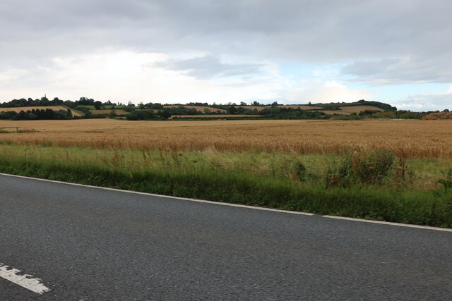
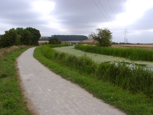
Images are sourced within 2km of 52.912834/-0.7076266 or Grid Reference SK8735. Thanks to Geograph Open Source API. All images are credited.

Walking the towpath of the Grantham Canal Two walkers heading towards Grantham on a restored stretch of the Grantham Canal in a view from Longmoor Bridge, (No. 62).
Swans on the canal, too.
Walking the towpath of the Grantham Canal
Two walkers heading towards Grantham on a restored stretch of the Grantham Canal in a view from Longmoor Bridge, (No. 62). Swans on the canal, too.
Grantham Canal: approaching bridge No. 63 The bridge is being approached from the north-west. Due to lighting conditions the already dark footbridge is being viewed against a background of shadowed trees and so is not well seen.
Grantham Canal: approaching bridge No. 63
The bridge is being approached from the north-west. Due to lighting conditions the already dark footbridge is being viewed against a background of shadowed trees and so is not well seen.
Grantham Canal approaching Denton Wharf Bridge Approaching from the north-west, heading towards Grantham.
Grantham Canal approaching Denton Wharf Bridge
Approaching from the north-west, heading towards Grantham.
Bridge carrying footpath on north side of Grantham Canal The short bridge carries the canal's towpath across a small stream which also acts as a drain via a 'spillweir' for any excess water of the canal. For a time during the summer of 2022 the bridge was removed so that work could be carried out necessitating a diversion for walkers along the path.
Bridge carrying footpath on north side of Grantham Canal
The short bridge carries the canal's towpath across a small stream which also acts as a drain via a 'spillweir' for any excess water of the canal. For a time during the summer of 2022 the bridge was removed so that work could be carried out necessitating a diversion for walkers along the path.
Demarcation line on surface of Grantham Canal The canal here is heading north towards a bend beyond which the route will be heading west. The demarcation line on the water is between a clear surface and complete coverage by duckweed. The day was a windy one and it's assumed that the small floating plants were blown to accumulate that way. The same distribution was seen at number of other locations.
Demarcation line on surface of Grantham Canal
The canal here is heading north towards a bend beyond which the route will be heading west. The demarcation line on the water is between a clear surface and complete coverage by duckweed. The day was a windy one and it's assumed that the small floating plants were blown to accumulate that way. The same distribution was seen at number of other locations.
Canal surface covered with duckweed A restored stretch of the Grantham Canal with its surface entirely covered by floating duckweed, interrupted only by a few floating tree leaves. A possible explanation is that although restored and so navigable it's unlikely that the water is disturbed by any craft other than an occasional canoe, as there's no access from the rest of the canal / river system for a vessel of any size.
Canal surface covered with duckweed
A restored stretch of the Grantham Canal with its surface entirely covered by floating duckweed, interrupted only by a few floating tree leaves. A possible explanation is that although restored and so navigable it's unlikely that the water is disturbed by any craft other than an occasional canoe, as there's no access from the rest of the canal / river system for a vessel of any size.
Fields by Grantham Road, Sedgebrook
Grantham Canal and National Cycle Route 15 Cutting through the NE of this square the newly surfaced cycleway makes for easy cycling and walking.
Grantham Canal and National Cycle Route 15
Cutting through the NE of this square the newly surfaced cycleway makes for easy cycling and walking.
Anglers beware Notice to fishermen not to fish underneath the power lines. The second pylon is a few feet from the boundary with the next square north.
Anglers beware
Notice to fishermen not to fish underneath the power lines. The second pylon is a few feet from the boundary with the next square north.
Denton Wharf, Grantham Canal Go to <span class="nowrap"><a title="http://www.granthamcanal.com/" rel="nofollow ugc noopener" href="http://www.granthamcanal.com/">Link</a><img style="margin-left:2px;" alt="External link" title="External link - shift click to open in new window" src="https://s1.geograph.org.uk/img/external.png" width="10" height="10"/></span> for lots of facts.  A small carpark and picnic area by the water. The slipway was built in 1990 by volunteers so boats could access the canal again. Not much chance of that at the moment!
Denton Wharf, Grantham Canal
Go to LinkExternal link for lots of facts. A small carpark and picnic area by the water. The slipway was built in 1990 by volunteers so boats could access the canal again. Not much chance of that at the moment!
Denton Bridge Bridge 64 over the Grantham canal. The white painted sign on the far side of the arch says Denton Wharf. Lots of duck weed on the surface.
Denton Bridge
Bridge 64 over the Grantham canal. The white painted sign on the far side of the arch says Denton Wharf. Lots of duck weed on the surface.
Detail of milepost on Cycle Route 15 at Denton Bridge The view in the background shows Halaxton Clays Wood and arable farmland in SK8734
Detail of milepost on Cycle Route 15 at Denton Bridge
The view in the background shows Halaxton Clays Wood and arable farmland in SK8734
Grantham Canal, Cycle Route 15 and pylons The bridge is number 63 over the canal. Very modern! Compare with bridge 64 in this square. The wood on the hill on the skyline is in the next square.
Grantham Canal, Cycle Route 15 and pylons
The bridge is number 63 over the canal. Very modern! Compare with bridge 64 in this square. The wood on the hill on the skyline is in the next square.
Casthorpe Bridge on the Grantham Canal, near Denton Bridge 63 on the  Denton to Sedgebrook road. A total of 46 of the 69 bridges along the Grantham Canal were reduced and culverted in the 1950s as part of a major road improvement programme across the Vale of Belvoir and this is a major obstacle to bringing the canal back into navigation. Raising the bridges to a suitable height is not just a simple task of rebuilding the old hump-back bridges. A further complication is the requirement to conform to road safety laws: a clear line of sight at bridges is needed to prevent accidents. This bridge shows a successful, if rather unattractive, rebuilding.
Casthorpe Bridge on the Grantham Canal, near Denton
Bridge 63 on the Denton to Sedgebrook road. A total of 46 of the 69 bridges along the Grantham Canal were reduced and culverted in the 1950s as part of a major road improvement programme across the Vale of Belvoir and this is a major obstacle to bringing the canal back into navigation. Raising the bridges to a suitable height is not just a simple task of rebuilding the old hump-back bridges. A further complication is the requirement to conform to road safety laws: a clear line of sight at bridges is needed to prevent accidents. This bridge shows a successful, if rather unattractive, rebuilding.
Line of old mineral roadway, near Denton A track leading down to Denton Reservoir follows the old course of a specially-built "lorry road", dating from 1961-2, which was intended to bring iron ore from new ironstone quarries at Barrowby to the mineral railway  system that criss-crosses this area. The Barrowby quarries were never, in the event, worked.
(Caption amended based on information provided by John Sutton <a title="https://www.geograph.org.uk/profile/38492" href="https://www.geograph.org.uk/profile/38492">Link</a> )
Line of old mineral roadway, near Denton
A track leading down to Denton Reservoir follows the old course of a specially-built "lorry road", dating from 1961-2, which was intended to bring iron ore from new ironstone quarries at Barrowby to the mineral railway system that criss-crosses this area. The Barrowby quarries were never, in the event, worked. (Caption amended based on information provided by John Sutton Link )
Outflow from Denton Reservoir Self explanatory! The stream is called Old Beck and flows into Foston Beck which is a tributary of the River Witham
Outflow from Denton Reservoir
Self explanatory! The stream is called Old Beck and flows into Foston Beck which is a tributary of the River Witham
Woodland near Denton Reservoir Old Beck runs through mixed woodland in the SW corner of the square
Woodland near Denton Reservoir
Old Beck runs through mixed woodland in the SW corner of the square
More woodland near Denton Reservoir! Young pine trees with dense mixed undergrowth, this woodland  to the east of Old Beck is so new it doesn't appear on the OS map.
More woodland near Denton Reservoir!
Young pine trees with dense mixed undergrowth, this woodland to the east of Old Beck is so new it doesn't appear on the OS map.
Show me another place!

Casthorpe Covert is located at Grid Ref: SK8735 (Lat: 52.912834, Lng: -0.7076266)

Administrative County: Lincolnshire

District: South Kesteven

Police Authority: Lincolnshire

What 3 Words

///emotional.oxidation.handlebar. Near Barrowby, Lincolnshire

Nearby Locations

Casthorpe Covert

Related Wikis

All Saints Church, Barrowby

All Saints Church is a Grade I listed Anglican church in Barrowby, Lincolnshire, England. The church is 2 miles (3.2 km) west from Grantham on a hillside...

Casthorpe

Casthorpe is hamlet in the civil parish of Barrowby and the South Kesteven District of Lincolnshire, England. It is 23 miles (40 km) south-southwest from...

Barrowby

Barrowby is a village and civil parish in the South Kesteven district of Lincolnshire, England. It is 2 miles (3.2 km) west of Grantham. It overlooks the...

Newbo Abbey

Newbo Abbey was a Premonstratensian house of canons regular in Lincolnshire, England, and was dedicated to the Assumption of Mary. == Pogrom == Newbo was...

Sedgebrook

Sedgebrook is an English village and civil parish in the South Kesteven district of Lincolnshire. It lies on the A52 road, 6 miles (9.7 km) west of Grantham...

Sedgebrook railway station

Sedgebrook railway station was on the Nottingham to Grantham line in the East Midlands of England. The station lay between Bottesford and Grantham. It...

Grantham Town F.C.

Grantham Town Football Club is a football club based in Grantham, Lincolnshire, England. They are currently members of the Northern Premier League Division...

West Grantham Church of England Secondary Academy

West Grantham Church of England Secondary Academy is a Church of England mixed secondary school in Grantham, Lincolnshire, England. == History == Built...

Nearby Amenities

Located within 500m of 52.912834,-0.7076266
Casthorpe Hills
Place: locality
Source: Bing
Lat/Long: 52.9100784/-0.7049222
Casthorpe Lodge
Place: isolated_dwelling
Source: Bing
Lat/Long: 52.911293/-0.7086801
The data included in this document is from www.openstreetmap.org. The data is made available under ODbL.

Have you been to Casthorpe Covert?

Leave your review of Casthorpe Covert below (or comments, questions and feedback).