Arniss Copse

Wood, Forest in Northamptonshire

England

Arniss Copse

Yardley Road north of Olney
Yardley Road north of Olney Credit: David Howard

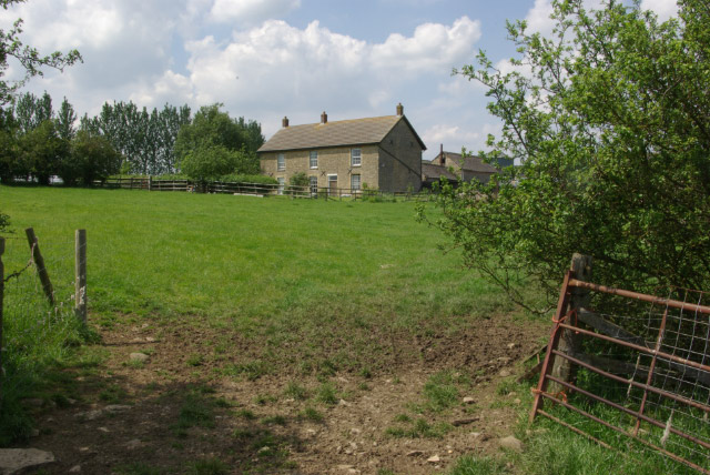
Arniss Copse is a picturesque woodland located in Northamptonshire, England. Covering an area of approximately 20 acres, it is a natural haven for biodiversity and a popular destination for nature enthusiasts. The copse is situated near the village of Arniss, in close proximity to the historic town of Northampton.

This ancient woodland is characterized by a diverse range of tree species, including oak, ash, beech, and birch. The towering trees create a dense canopy, providing shade and shelter for a variety of flora and fauna. The forest floor is adorned with a rich carpet of wildflowers, such as bluebells, primroses, and wood anemones, which bloom in a riot of colors during the spring months.

Arniss Copse is home to a plethora of wildlife, making it an ideal spot for birdwatching and animal spotting. Visitors may be lucky enough to catch a glimpse of red kites soaring overhead or spot elusive creatures like badgers, foxes, and deer. The copse is also a sanctuary for a variety of bird species, including woodpeckers, owls, and warblers, attracting bird enthusiasts from near and far.

The woodland is crisscrossed by a network of well-maintained walking trails, allowing visitors to explore its natural beauty at their leisure. These pathways offer glimpses of hidden ponds, babbling brooks, and enchanting clearings, providing a tranquil escape from the hustle and bustle of everyday life.

Arniss Copse, with its captivating beauty and abundant wildlife, offers a serene and captivating experience for all who venture into its leafy depths.

If you have any feedback on the listing, please let us know in the comments section below.

Arniss Copse Images

Images are sourced within 2km of 52.178837/-0.74518171 or Grid Reference SP8554. Thanks to Geograph Open Source API. All images are credited.

Yardley Road north of Olney
Disused Railway The Northampton to Bedford line used to run here.
Disused Railway
The Northampton to Bedford line used to run here.
Bridge over Disused Railway The bridge carried a track suitable for horses and carts to provide access to woodlands for nearby villages.
Bridge over Disused Railway
The bridge carried a track suitable for horses and carts to provide access to woodlands for nearby villages.
Barnstaple Wood This is a disused railway track (Bedford to Northampton) used as a walking track through the wood.
Barnstaple Wood
This is a disused railway track (Bedford to Northampton) used as a walking track through the wood.
Track through Great Wood The blue arrow on the post to the left of the image marks this track as a bridleway although no bridleway is shown on the map at this point. The group of walkers have come here for a tea break in the welcome shade provided by the north section of the wood.
Track through Great Wood
The blue arrow on the post to the left of the image marks this track as a bridleway although no bridleway is shown on the map at this point. The group of walkers have come here for a tea break in the welcome shade provided by the north section of the wood.
The Pastures Farm near Yardley Hastings The Pastures Farm is viewed here across the field from the B5388 Olney-Yardley Hastings road where it emerges north of the Old Pond Close woods.
The Pastures Farm near Yardley Hastings
The Pastures Farm is viewed here across the field from the B5388 Olney-Yardley Hastings road where it emerges north of the Old Pond Close woods.
Sheep Pastures at Chase Park Farm south of Yardley The sheep pastures are at the end of Howcut Lane (or Chase Park Road), a no-through road that leads southwards for about a mile out of Yardley Hastings. The very wooded Chase in the background contains the remnants of postwar ammunition dumps/bunkers now disused.
Sheep Pastures at Chase Park Farm south of Yardley
The sheep pastures are at the end of Howcut Lane (or Chase Park Road), a no-through road that leads southwards for about a mile out of Yardley Hastings. The very wooded Chase in the background contains the remnants of postwar ammunition dumps/bunkers now disused.
Blenley Farm Buildings near Yardley Hastings Westerly view from the Chase Park Road south of Yardley Hastings.
Blenley Farm Buildings near Yardley Hastings
Westerly view from the Chase Park Road south of Yardley Hastings.
New Hay Farm & Entranceway near Yardley Hastings The entrance to New Hay Farm viewed from the Chase Park Road that leads southwards from Yardley Hastings.
New Hay Farm & Entranceway near Yardley Hastings
The entrance to New Hay Farm viewed from the Chase Park Road that leads southwards from Yardley Hastings.
Blenley Farm & Grazing near Yardley Hastings Viewed from the Chase Park Road south of Yardley Hastings and opposite the entrance to New Hay Farm. Although this area is now mostly arable farming, it is good to see a few cows grazing on the remnants of earlier ridge and furrow land in front of the farm.
Blenley Farm & Grazing near Yardley Hastings
Viewed from the Chase Park Road south of Yardley Hastings and opposite the entrance to New Hay Farm. Although this area is now mostly arable farming, it is good to see a few cows grazing on the remnants of earlier ridge and furrow land in front of the farm.
Blenley Farm & Fields near Yardley Hastings A distant view of Blenley Farm across the fields, part of Yardley Chase, taken from the Howcut Lane leading southwards out of Yardley Hastings.
Blenley Farm & Fields near Yardley Hastings
A distant view of Blenley Farm across the fields, part of Yardley Chase, taken from the Howcut Lane leading southwards out of Yardley Hastings.
New Hay Farm near Yardley Hastings Viewed from New Hay copse beside Howcut Lane (or Chase Park Road) that leads southwards from Yardley Hastings.
New Hay Farm near Yardley Hastings
Viewed from New Hay copse beside Howcut Lane (or Chase Park Road) that leads southwards from Yardley Hastings.
Hungary Hall Remote farmhouse with an unusual name.
Hungary Hall
Remote farmhouse with an unusual name.
Farmland north of Olney East of the B5388 Olney - Yardley Hastings road.
Farmland north of Olney
East of the B5388 Olney - Yardley Hastings road.
Remains of a railway bridge A dismantled railway line crosses the footpath
Remains of a railway bridge
A dismantled railway line crosses the footpath
Show me another place!

Arniss Copse is located at Grid Ref: SP8554 (Lat: 52.178837, Lng: -0.74518171)

Unitary Authority: West Northamptonshire

Police Authority: Northamptonshire

What 3 Words

///sensual.ambushes.monkeys. Near Ravenstone, Buckinghamshire

Nearby Locations

Sane Copse Arniss Copse

Related Wikis

Yardley Chase

Yardley Chase is a 357.6-hectare (884-acre) biological Site of Special Scientific Interest, mostly in Northamptonshire, with a small area in the south...

Yardley Hastings

Yardley Hastings is a village and civil parish in the West Northamptonshire unitary authority area of Northamptonshire, England. It is located south-east...

Piddington railway station

Piddington was a railway station on the former Bedford to Northampton Line. Despite its name, the station was located close to the village of Horton in...

Ravenstone Priory

Ravenstone Priory was a medieval monastic house in Buckinghamshire, England. It was established c.1255 and was dissolved in 1524. == History == Ravenstone...

Have you been to Arniss Copse?

Leave your review of Arniss Copse below (or comments, questions and feedback).