Lane's Plantation

Wood, Forest in Lincolnshire South Kesteven

England

Lane's Plantation

Cycle route 64 turning off Sedgebrook Road The Rutland Arms at the end of the road to the right, popular with cyclists, walkers, and canal enthusiasts, is alwtays known as the 'Dirty Duck'
Cycle route 64 turning off Sedgebrook Road Credit: Tim Heaton

Lane's Plantation is a picturesque woodland area located in Lincolnshire, England. Situated in the heart of the county, the plantation is known for its stunning natural beauty and diverse flora and fauna. Covering an expansive area, it offers a peaceful retreat for nature lovers and outdoor enthusiasts.

The plantation is primarily characterized by its dense woodlands, dominated by a variety of tall and majestic trees. These include oak, beech, and birch trees, which create a lush canopy that provides shade and shelter for the numerous wildlife species that call Lane's Plantation their home.

The woodland floor is covered with a rich carpet of moss, ferns, and wildflowers, adding to the area's charm and biodiversity. Walking trails wind through the plantation, allowing visitors to explore its hidden corners and discover its natural wonders.

Lane's Plantation is also home to a wide range of wildlife. Visitors may spot deer, squirrels, and a variety of bird species, including woodpeckers and owls. The plantation's secluded location and peaceful atmosphere make it an ideal habitat for these creatures.

In addition to its natural beauty, Lane's Plantation has historical significance. It is believed to have been named after its original owner and has been a popular spot for locals and tourists alike for many years.

Overall, Lane's Plantation is a captivating destination for those seeking a tranquil escape in the heart of Lincolnshire. Its breathtaking woodlands, diverse wildlife, and serene ambiance make it a must-visit location for nature enthusiasts and those looking to reconnect with the natural world.

If you have any feedback on the listing, please let us know in the comments section below.

Lane's Plantation Images

Images are sourced within 2km of 52.898836/-0.72751843 or Grid Reference SK8534. Thanks to Geograph Open Source API. All images are credited.

Cycle route 64 turning off Sedgebrook Road The Rutland Arms at the end of the road to the right, popular with cyclists, walkers, and canal enthusiasts, is alwtays known as the 'Dirty Duck'
Cycle route 64 turning off Sedgebrook Road
The Rutland Arms at the end of the road to the right, popular with cyclists, walkers, and canal enthusiasts, is alwtays known as the 'Dirty Duck'
Railway bridge on Belvoir Road The bridge spans the disused track of a branch line serving former ironstone quarries
Railway bridge on Belvoir Road
The bridge spans the disused track of a branch line serving former ironstone quarries
Large sycamore, Belvoir Road
Former track bed of the Woolsthorpe Branch ironstone railway Also marked as a 'Traffic-free cycle route' on the OS 1:25000 map, though parts of the track are narrow, with little headroom. For details of the former railway, see <a href="https://www.geograph.org.uk/photo/1464830">SK8633 : Railway Bridge, Belvoir Road, near Denton</a>
Former track bed of the Woolsthorpe Branch ironstone railway
Also marked as a 'Traffic-free cycle route' on the OS 1:25000 map, though parts of the track are narrow, with little headroom. For details of the former railway, see SK8633 : Railway Bridge, Belvoir Road, near Denton
House at the end of Church Street, Denton Was two cottages built in the eighteenth century <span class="nowrap"><a title="https://historicengland.org.uk/listing/the-list/list-entry/1147427?section=official-list-entry" rel="nofollow ugc noopener" href="https://historicengland.org.uk/listing/the-list/list-entry/1147427?section=official-list-entry">Link</a><img style="margin-left:2px;" alt="External link" title="External link - shift click to open in new window" src="https://s1.geograph.org.uk/img/external.png" width="10" height="10"/></span>
House at the end of Church Street, Denton
Was two cottages built in the eighteenth century LinkExternal link
Denton Village Hall
Denton Village Hall
Pear Tree Cottage, Denton Seventeenth century cottage <span class="nowrap"><a title="https://historicengland.org.uk/listing/the-list/list-entry/1147474?section=official-list-entry" rel="nofollow ugc noopener" href="https://historicengland.org.uk/listing/the-list/list-entry/1147474?section=official-list-entry">Link</a><img style="margin-left:2px;" alt="External link" title="External link - shift click to open in new window" src="https://s1.geograph.org.uk/img/external.png" width="10" height="10"/></span>
Pear Tree Cottage, Denton
Seventeenth century cottage LinkExternal link
Cottage, Church Street, Denton Altered early eighteenth century cottage <span class="nowrap"><a title="https://historicengland.org.uk/listing/the-list/list-entry/1062373?section=official-list-entry" rel="nofollow ugc noopener" href="https://historicengland.org.uk/listing/the-list/list-entry/1062373?section=official-list-entry">Link</a><img style="margin-left:2px;" alt="External link" title="External link - shift click to open in new window" src="https://s1.geograph.org.uk/img/external.png" width="10" height="10"/></span>
Cottage, Church Street, Denton
Altered early eighteenth century cottage LinkExternal link
The Welby Arms, Denton Early nineteenth century public house <span class="nowrap"><a title="https://historicengland.org.uk/listing/the-list/list-entry/1308513?section=official-list-entry" rel="nofollow ugc noopener" href="https://historicengland.org.uk/listing/the-list/list-entry/1308513?section=official-list-entry">Link</a><img style="margin-left:2px;" alt="External link" title="External link - shift click to open in new window" src="https://s1.geograph.org.uk/img/external.png" width="10" height="10"/></span>
The Welby Arms, Denton
Early nineteenth century public house LinkExternal link
Woolsthorpe Bottom Lock, No. 16 This is one of three restored locks, close together, and named at the location presumably by the Grantham Canal Society which has its headquarters at the buildings in the image, as Woolsthorpe Top, Middle and Bottom Locks. The Collins  / Nicholson Waterways Guide No.6 however names these locks differently, the one in the image being regarded as Carpenters Shop Lock.
Woolsthorpe Bottom Lock, No. 16
This is one of three restored locks, close together, and named at the location presumably by the Grantham Canal Society which has its headquarters at the buildings in the image, as Woolsthorpe Top, Middle and Bottom Locks. The Collins / Nicholson Waterways Guide No.6 however names these locks differently, the one in the image being regarded as Carpenters Shop Lock.
Walking the towpath of the Grantham Canal Two walkers heading towards Grantham on a restored stretch of the Grantham Canal in a view from Longmoor Bridge, (No. 62).
Swans on the canal, too.
Walking the towpath of the Grantham Canal
Two walkers heading towards Grantham on a restored stretch of the Grantham Canal in a view from Longmoor Bridge, (No. 62). Swans on the canal, too.
Headland of sloping field The field is on the southern side of the Grantham Canal; it's below the line of trees and bushes at the right side of the image.
Headland of sloping field
The field is on the southern side of the Grantham Canal; it's below the line of trees and bushes at the right side of the image.
Grantham Canal: approaching bridge No. 63 The bridge is being approached from the north-west. Due to lighting conditions the already dark footbridge is being viewed against a background of shadowed trees and so is not well seen.
Grantham Canal: approaching bridge No. 63
The bridge is being approached from the north-west. Due to lighting conditions the already dark footbridge is being viewed against a background of shadowed trees and so is not well seen.
Grantham Canal approaching Denton Wharf Bridge Approaching from the north-west, heading towards Grantham.
Grantham Canal approaching Denton Wharf Bridge
Approaching from the north-west, heading towards Grantham.
Bridge carrying footpath on north side of Grantham Canal The short bridge carries the canal's towpath across a small stream which also acts as a drain via a 'spillweir' for any excess water of the canal. For a time during the summer of 2022 the bridge was removed so that work could be carried out necessitating a diversion for walkers along the path.
Bridge carrying footpath on north side of Grantham Canal
The short bridge carries the canal's towpath across a small stream which also acts as a drain via a 'spillweir' for any excess water of the canal. For a time during the summer of 2022 the bridge was removed so that work could be carried out necessitating a diversion for walkers along the path.
Grantham Canal heading east The Grantham Canal heading almost due east from a location east of Woolsthorpe Top Lock, No. 18.
Grantham Canal heading east
The Grantham Canal heading almost due east from a location east of Woolsthorpe Top Lock, No. 18.
Willis's Lock The towing path of the Grantham Canal approaching the lock from the bend to the south. The lock is one of three consecutive ones fully restored by the Grantham Canal Society.
Willis's Lock
The towing path of the Grantham Canal approaching the lock from the bend to the south. The lock is one of three consecutive ones fully restored by the Grantham Canal Society.
Demarcation line on surface of Grantham Canal The canal here is heading north towards a bend beyond which the route will be heading west. The demarcation line on the water is between a clear surface and complete coverage by duckweed. The day was a windy one and it's assumed that the small floating plants were blown to accumulate that way. The same distribution was seen at number of other locations.
Demarcation line on surface of Grantham Canal
The canal here is heading north towards a bend beyond which the route will be heading west. The demarcation line on the water is between a clear surface and complete coverage by duckweed. The day was a windy one and it's assumed that the small floating plants were blown to accumulate that way. The same distribution was seen at number of other locations.
Show me another place!

Lane's Plantation is located at Grid Ref: SK8534 (Lat: 52.898836, Lng: -0.72751843)

Administrative County: Lincolnshire

District: South Kesteven

Police Authority: Lincolnshire

What 3 Words

///sedative.attic.limes. Near Barrowby, Lincolnshire

Nearby Locations

Lane's Plantation

Related Wikis

Casthorpe

Casthorpe is hamlet in the civil parish of Barrowby and the South Kesteven District of Lincolnshire, England. It is 23 miles (40 km) south-southwest from...

Woolsthorpe by Belvoir

Woolsthorpe by Belvoir, also known as Woolsthorpe is a village and civil parish in the South Kesteven district of Lincolnshire, England. The population...

Denton, Lincolnshire

Denton is a village and civil parish in the South Kesteven district of Lincolnshire, England. The population of the civil parish was 273 at the 2011 census...

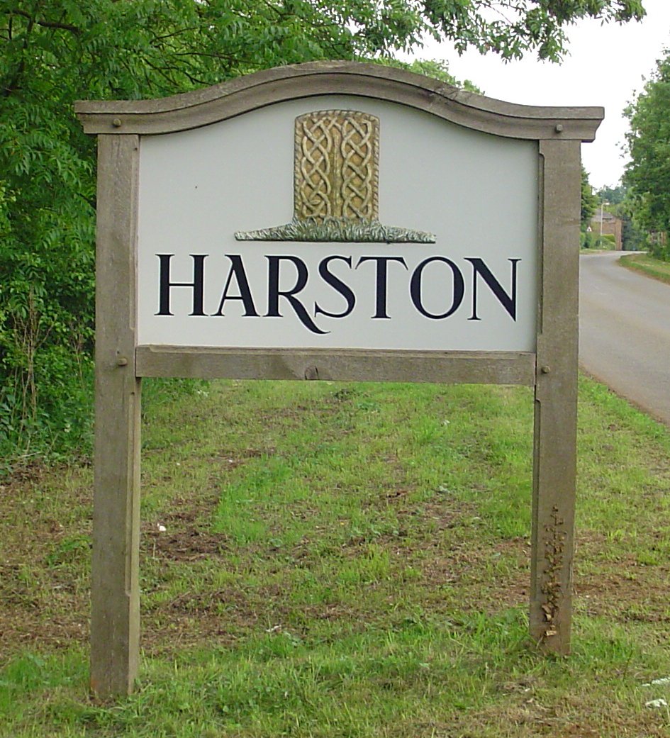
Harston, Leicestershire

Harston is a crossroads village and former civil parish, now in the parish of Belvoir, in the Melton district, in Leicestershire, England, near the border...

St Mary and St Peter's Church, Harlaxton

St Mary and St Peter's Church is a Grade I listed Church of England parish church dedicated to Saint Mary and Saint Peter in Harlaxton, Lincolnshire, England...

All Saints Church, Barrowby

All Saints Church is a Grade I listed Anglican church in Barrowby, Lincolnshire, England. The church is 2 miles (3.2 km) west from Grantham on a hillside...

Barrowby

Barrowby is a village and civil parish in the South Kesteven district of Lincolnshire, England. It is 2 miles (3.2 km) west of Grantham. It overlooks the...

Harlaxton

Harlaxton is a village and civil parish in the South Kesteven district of Lincolnshire, England. It lies on the edge of the Vale of Belvoir and just off...

Nearby Amenities

Located within 500m of 52.898836,-0.72751843
Denton Lodge Farm
Alt Name: Denton Lodge
Place: farm
Source: Bing
Lat/Long: 52.8959203/-0.7329695
Lane's Barn
Historic Place: farm
Source: Bing
Lat/Long: 52.8982235/-0.7247015
The data included in this document is from www.openstreetmap.org. The data is made available under ODbL.

Have you been to Lane's Plantation?

Leave your review of Lane's Plantation below (or comments, questions and feedback).