Benhams Copse

Wood, Forest in Berkshire

England

Benhams Copse

Heading east on the M4 where the power lines change direction
Heading east on the M4 where the power lines change direction Credit: Rob Purvis

Benhams Copse is a picturesque woodland located in the county of Berkshire, England. Covering an area of approximately 100 acres, this enchanting forest is a haven for nature enthusiasts and outdoor adventurers alike.

The copse is characterized by its dense, towering trees, predominantly consisting of beech and oak. These ancient trees provide a tranquil and serene atmosphere, inviting visitors to explore its winding paths and discover its hidden treasures. The forest floor is adorned with a lush carpet of ferns, bluebells, and other native wildflowers, creating a vibrant and colorful landscape during the spring and summer months.

Benhams Copse is home to a diverse range of wildlife, making it a popular spot for birdwatching and animal spotting. Visitors may have the chance to encounter various bird species, including woodpeckers, owls, and thrushes. Squirrels and deer are also commonly spotted within the copse, adding to its natural charm.

The woodland provides ample opportunities for recreational activities such as hiking, cycling, and picnicking. There are several well-maintained trails that wind through the copse, catering to both beginners and experienced hikers. These trails offer breathtaking views of the surrounding countryside and are suitable for all ages.

Overall, Benhams Copse in Berkshire offers a peaceful escape from the hustle and bustle of city life. Its ancient trees, diverse wildlife, and well-marked trails make it a must-visit destination for nature lovers and those seeking a serene and rejuvenating experience in the heart of the English countryside.

If you have any feedback on the listing, please let us know in the comments section below.

Benhams Copse Images

Images are sourced within 2km of 51.460211/-0.77156401 or Grid Reference SU8574. Thanks to Geograph Open Source API. All images are credited.

Heading east on the M4 where the power lines change direction
Bridge crossing the M4, with average speed camera next to it
Ryehurst Lane Heading north in the general direction of Maidenhead.
Ryehurst Lane
Heading north in the general direction of Maidenhead.
Bottle Lane Heading north in the general direction of Maidenhead.
Bottle Lane
Heading north in the general direction of Maidenhead.
Howe Lane Heading north in the general direction of Maidenhead. The road narrows for a bridge over The Cut, a stream which looks natural over much of its course, but does have some unnaturally straight sections.
Howe Lane
Heading north in the general direction of Maidenhead. The road narrows for a bridge over The Cut, a stream which looks natural over much of its course, but does have some unnaturally straight sections.
Howe Lane Heading north in the general direction of Maidenhead.
Howe Lane
Heading north in the general direction of Maidenhead.
Farmland, Shottesbrooke Spring barley to the west of Smewins Road.
Farmland, Shottesbrooke
Spring barley to the west of Smewins Road.
Grassland, Binfield Probably grazing for horses, if conforming the local norm.
Grassland, Binfield
Probably grazing for horses, if conforming the local norm.
Grassland, White Waltham A low artificial hill has been created in the foreground.  If the planning history is to be believed, it is intended to be a polo pitch. A similar application is in progress for the next field seen here.
Grassland, White Waltham
A low artificial hill has been created in the foreground. If the planning history is to be believed, it is intended to be a polo pitch. A similar application is in progress for the next field seen here.
Field and pylon near Paley Street From the M4. The trees across the field are along The Cut, a stream whose course is described at <a href="https://www.geograph.org.uk/photo/1032629">SU8675 : Paley Street: The Cut</a>.
Field and pylon near Paley Street
From the M4. The trees across the field are along The Cut, a stream whose course is described at SU8675 : Paley Street: The Cut.
B3018 Bridge, M4 The M4 is 190 miles long and runs from London to South Wales. Major centres close to the motorway include Reading, Swindon, Bristol, Newport, Cardiff and Swansea. The motorway was constructed between 1961 and 1996. The M4 originally crossed the first Severn Road Bridge. It has now been diverted to use the Second Severn Crossing and the motorway over the older bridge has been renumbered as M48.
Wikipedia: <span class="nowrap"><a title="http://en.wikipedia.org/wiki/M4_motorway" rel="nofollow ugc noopener" href="http://en.wikipedia.org/wiki/M4_motorway">Link</a><img style="margin-left:2px;" alt="External link" title="External link - shift click to open in new window" src="https://s1.geograph.org.uk/img/external.png" width="10" height="10"/></span>
B3018 Bridge, M4
The M4 is 190 miles long and runs from London to South Wales. Major centres close to the motorway include Reading, Swindon, Bristol, Newport, Cardiff and Swansea. The motorway was constructed between 1961 and 1996. The M4 originally crossed the first Severn Road Bridge. It has now been diverted to use the Second Severn Crossing and the motorway over the older bridge has been renumbered as M48. Wikipedia: LinkExternal link
M4, westbound The M4 is 190 miles long and runs from London to South Wales. Major centres close to the motorway include Reading, Swindon, Bristol, Newport, Cardiff and Swansea. The motorway was constructed between 1961 and 1996. The M4 originally crossed the first Severn Road Bridge. It has now been diverted to use the Second Severn Crossing and the motorway over the older bridge has been renumbered as M48.
Wikipedia: <span class="nowrap"><a title="http://en.wikipedia.org/wiki/M4_motorway" rel="nofollow ugc noopener" href="http://en.wikipedia.org/wiki/M4_motorway">Link</a><img style="margin-left:2px;" alt="External link" title="External link - shift click to open in new window" src="https://s1.geograph.org.uk/img/external.png" width="10" height="10"/></span>
M4, westbound
The M4 is 190 miles long and runs from London to South Wales. Major centres close to the motorway include Reading, Swindon, Bristol, Newport, Cardiff and Swansea. The motorway was constructed between 1961 and 1996. The M4 originally crossed the first Severn Road Bridge. It has now been diverted to use the Second Severn Crossing and the motorway over the older bridge has been renumbered as M48. Wikipedia: LinkExternal link
Bridge over the M4
Bridge over the M4
B3018 bridge, M4 The M4 is 190 miles long and runs from London to South Wales. Major centres close to the motorway include Reading, Swindon, Bristol, Newport, Cardiff and Swansea. The motorway was constructed between 1961 and 1996. The M4 originally crossed the first Severn Road Bridge. It has now been diverted to use the Second Severn Crossing and the motorway over the older bridge has been renumbered as M48.
Wikipedia: <span class="nowrap"><a title="http://en.wikipedia.org/wiki/M4_motorway" rel="nofollow ugc noopener" href="http://en.wikipedia.org/wiki/M4_motorway">Link</a><img style="margin-left:2px;" alt="External link" title="External link - shift click to open in new window" src="https://s1.geograph.org.uk/img/external.png" width="10" height="10"/></span>
B3018 bridge, M4
The M4 is 190 miles long and runs from London to South Wales. Major centres close to the motorway include Reading, Swindon, Bristol, Newport, Cardiff and Swansea. The motorway was constructed between 1961 and 1996. The M4 originally crossed the first Severn Road Bridge. It has now been diverted to use the Second Severn Crossing and the motorway over the older bridge has been renumbered as M48. Wikipedia: LinkExternal link
Bridge, M4 The M4 is 190 miles long and runs from London to South Wales. Major centres close to the motorway include Reading, Swindon, Bristol, Newport, Cardiff and Swansea. The motorway was constructed between 1961 and 1996. The M4 originally crossed the first Severn Road Bridge. It has now been diverted to use the Second Severn Crossing and the motorway over the older bridge has been renumbered as M48.
Wikipedia: <span class="nowrap"><a title="http://en.wikipedia.org/wiki/M4_motorway" rel="nofollow ugc noopener" href="http://en.wikipedia.org/wiki/M4_motorway">Link</a><img style="margin-left:2px;" alt="External link" title="External link - shift click to open in new window" src="https://s1.geograph.org.uk/img/external.png" width="10" height="10"/></span>
Bridge, M4
The M4 is 190 miles long and runs from London to South Wales. Major centres close to the motorway include Reading, Swindon, Bristol, Newport, Cardiff and Swansea. The motorway was constructed between 1961 and 1996. The M4 originally crossed the first Severn Road Bridge. It has now been diverted to use the Second Severn Crossing and the motorway over the older bridge has been renumbered as M48. Wikipedia: LinkExternal link
Scarecrows in a field Quite a collection of scarecrows in this field. Free range chickens seemed to be the other inhabitants.
Scarecrows in a field
Quite a collection of scarecrows in this field. Free range chickens seemed to be the other inhabitants.
Zombie Scarecrow A closer look at one of the rather creepy scarecrows shown in <a href="https://www.geograph.org.uk/photo/5373468">SU8475 : Scarecrows in a field</a>
They are made from recycled shop dummies and do look a bit scary.
I didn't see any crows, but there weren't any in the next field either, so who knows....
Zombie Scarecrow
A closer look at one of the rather creepy scarecrows shown in SU8475 : Scarecrows in a field They are made from recycled shop dummies and do look a bit scary. I didn't see any crows, but there weren't any in the next field either, so who knows....
Ivy Covered Building One of the assortment of old buildings around Beenham's Farm.
Ivy Covered Building
One of the assortment of old buildings around Beenham's Farm.
Show me another place!

Benhams Copse is located at Grid Ref: SU8574 (Lat: 51.460211, Lng: -0.77156401)

Unitary Authority: Bracknell Forest

Police Authority: Thames Valley

What 3 Words

///civil.cheered.paler. Near Binfield, Berkshire

Related Wikis

Jealott's Hill

Jealott's Hill is a village in the county of Berkshire, England, within the civil parish of Warfield. The settlement is on the A3095 road approximately...

Hawthorn Hill, Berkshire

Hawthorn Hill is a hamlet in Berkshire, England, within the civil parish of Warfield. The settlement lies at the junction of the A3095 and A330 roads,...

Moss End

Moss End is a hamlet in Berkshire, England, within the civil parish of Warfield. The settlement lies on the A3095 road and is approximately 2 miles (3...

Berks County F.C.

Berks County Football Club is a football club based in Ascot, England. They are currently members of the Combined Counties League Division One and groundshare...

Related Videos

All Saints Church - Binfield

All Saints Church in Binfield.

Cycling my World Insta360 X

A segment of the FLAB Berkshire ride9th June.

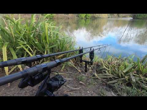
New Farm Fishery - November Day Session - Camping for a Day.

Well its a first little trip out with the Nash Scopes on a little camped up day session after a ton of rain needless to say a blank fun all ...

Nearby Amenities

Located within 500m of 51.460211,-0.77156401
Power: pole
Source: Bing
Lat/Long: 51.4566366/-0.7757609
The data included in this document is from www.openstreetmap.org. The data is made available under ODbL.

Have you been to Benhams Copse?

Leave your review of Benhams Copse below (or comments, questions and feedback).