Ayston Spinney

Wood, Forest in Rutland

England

Ayston Spinney

School playing fields, Uppingham The sports pavilion at Uppingham School is a rather grand thatched affair.
School playing fields, Uppingham Credit: Kate Jewell

Ayston Spinney is a small woodland located in Ayston, a village in the county of Rutland, England. Covering an area of approximately 5 hectares, the spinney is situated on the eastern outskirts of the village. It is characterized by a mix of broadleaf trees, predominantly oaks and birches, with an undergrowth of ferns, brambles, and wildflowers.

The woodland is a remnant of the ancient forest that once covered large parts of Rutland, and it is believed to date back several centuries. It has been managed as a nature reserve since the late 20th century, with the aim of preserving its ecological value and providing a habitat for a variety of wildlife.

Ayston Spinney is home to a diverse range of flora and fauna. The woodland provides nesting sites for birds such as great tits, blue tits, and blackbirds. It is also a habitat for small mammals including squirrels, voles, and shrews. Additionally, the spinney supports a rich insect population, with butterflies, bees, and beetles being commonly observed.

The woodland is accessible to the public via a network of footpaths that meander through the trees. These paths offer visitors the opportunity to explore the natural beauty of the spinney, observe the wildlife, and enjoy the peaceful ambiance of the forest. Ayston Spinney is a cherished local resource, treasured for its tranquility and the sense of connection it provides to the natural world.

If you have any feedback on the listing, please let us know in the comments section below.

Ayston Spinney Images

Images are sourced within 2km of 52.604693/-0.74483097 or Grid Reference SK8501. Thanks to Geograph Open Source API. All images are credited.

School playing fields, Uppingham The sports pavilion at Uppingham School is a rather grand thatched affair.
School playing fields, Uppingham
The sports pavilion at Uppingham School is a rather grand thatched affair.
Sundown on the sports field Autumnal sunset scene at the playing fields off the Leicester Road car park.
Sundown on the sports field
Autumnal sunset scene at the playing fields off the Leicester Road car park.
Foresters shed in Wardley Wood
In the middle of Wardley Wood The Rutland Round footpath is straight ahead
In the middle of Wardley Wood
The Rutland Round footpath is straight ahead
View across the A47 west of Uppingham
Roundabout entering Uppingham Heading south on the A 6003. I don't believe the sheep and two lambs are real.
Roundabout entering Uppingham
Heading south on the A 6003. I don't believe the sheep and two lambs are real.
Woodland by Uppingham Road The trees run along the A47
Woodland by Uppingham Road
The trees run along the A47
St Mary's church, Ayston Largely of the fifteenth century <span class="nowrap"><a title="https://historicengland.org.uk/listing/the-list/list-entry/1361553?section=official-list-entry" rel="nofollow ugc noopener" href="https://historicengland.org.uk/listing/the-list/list-entry/1361553?section=official-list-entry">Link</a><img style="margin-left:2px;" alt="External link" title="External link - shift click to open in new window" src="https://s1.geograph.org.uk/img/external.png" width="10" height="10"/></span> Maintained by the Churches Conservation Trust.
St Mary's church, Ayston
Largely of the fifteenth century LinkExternal link Maintained by the Churches Conservation Trust.
4 Main Street, Ayston Seventeenth century cottage <span class="nowrap"><a title="https://historicengland.org.uk/listing/the-list/list-entry/1178146?section=official-list-entry" rel="nofollow ugc noopener" href="https://historicengland.org.uk/listing/the-list/list-entry/1178146?section=official-list-entry">Link</a><img style="margin-left:2px;" alt="External link" title="External link - shift click to open in new window" src="https://s1.geograph.org.uk/img/external.png" width="10" height="10"/></span>
4 Main Street, Ayston
Seventeenth century cottage LinkExternal link
12 Main Street, Ayston Seventeenth century former farmhouse <span class="nowrap"><a title="https://historicengland.org.uk/listing/the-list/list-entry/1073702?section=official-list-entry" rel="nofollow ugc noopener" href="https://historicengland.org.uk/listing/the-list/list-entry/1073702?section=official-list-entry">Link</a><img style="margin-left:2px;" alt="External link" title="External link - shift click to open in new window" src="https://s1.geograph.org.uk/img/external.png" width="10" height="10"/></span>
12 Main Street, Ayston
Seventeenth century former farmhouse LinkExternal link
Grass field near Ayston
Stubble field near Ridlington
The beginning of a footpath to Belton in Rutland
Church Farm Farmhouse, Ridlington Dates from the eighteenth century <span class="nowrap"><a title="https://historicengland.org.uk/listing/the-list/list-entry/1361583?section=official-list-entry" rel="nofollow ugc noopener" href="https://historicengland.org.uk/listing/the-list/list-entry/1361583?section=official-list-entry">Link</a><img style="margin-left:2px;" alt="External link" title="External link - shift click to open in new window" src="https://s1.geograph.org.uk/img/external.png" width="10" height="10"/></span>
Church Farm Farmhouse, Ridlington
Dates from the eighteenth century LinkExternal link
Cottages in Ayston Date from the 1930s but in a neo-Tudor style.
Cottages in Ayston
Date from the 1930s but in a neo-Tudor style.
Cottages, Ayston
Cottages, Ayston
K6 Telephone Kiosk, Ayston That rare thing a working telephone kiosk <span class="nowrap"><a title="https://historicengland.org.uk/listing/the-list/list-entry/1252464?section=official-list-entry" rel="nofollow ugc noopener" href="https://historicengland.org.uk/listing/the-list/list-entry/1252464?section=official-list-entry">Link</a><img style="margin-left:2px;" alt="External link" title="External link - shift click to open in new window" src="https://s1.geograph.org.uk/img/external.png" width="10" height="10"/></span>
K6 Telephone Kiosk, Ayston
That rare thing a working telephone kiosk LinkExternal link
3 Main Street, Ayston Much altered seventeenth century house <span class="nowrap"><a title="https://historicengland.org.uk/listing/the-list/list-entry/1073704?section=official-list-entry" rel="nofollow ugc noopener" href="https://historicengland.org.uk/listing/the-list/list-entry/1073704?section=official-list-entry">Link</a><img style="margin-left:2px;" alt="External link" title="External link - shift click to open in new window" src="https://s1.geograph.org.uk/img/external.png" width="10" height="10"/></span>
3 Main Street, Ayston
Much altered seventeenth century house LinkExternal link
Show me another place!

Ayston Spinney is located at Grid Ref: SK8501 (Lat: 52.604693, Lng: -0.74483097)

Unitary Authority: Rutland

Police Authority: Leicestershire

What 3 Words

///chef.comedians.scrub. Near Ridlington, Rutland

Related Wikis

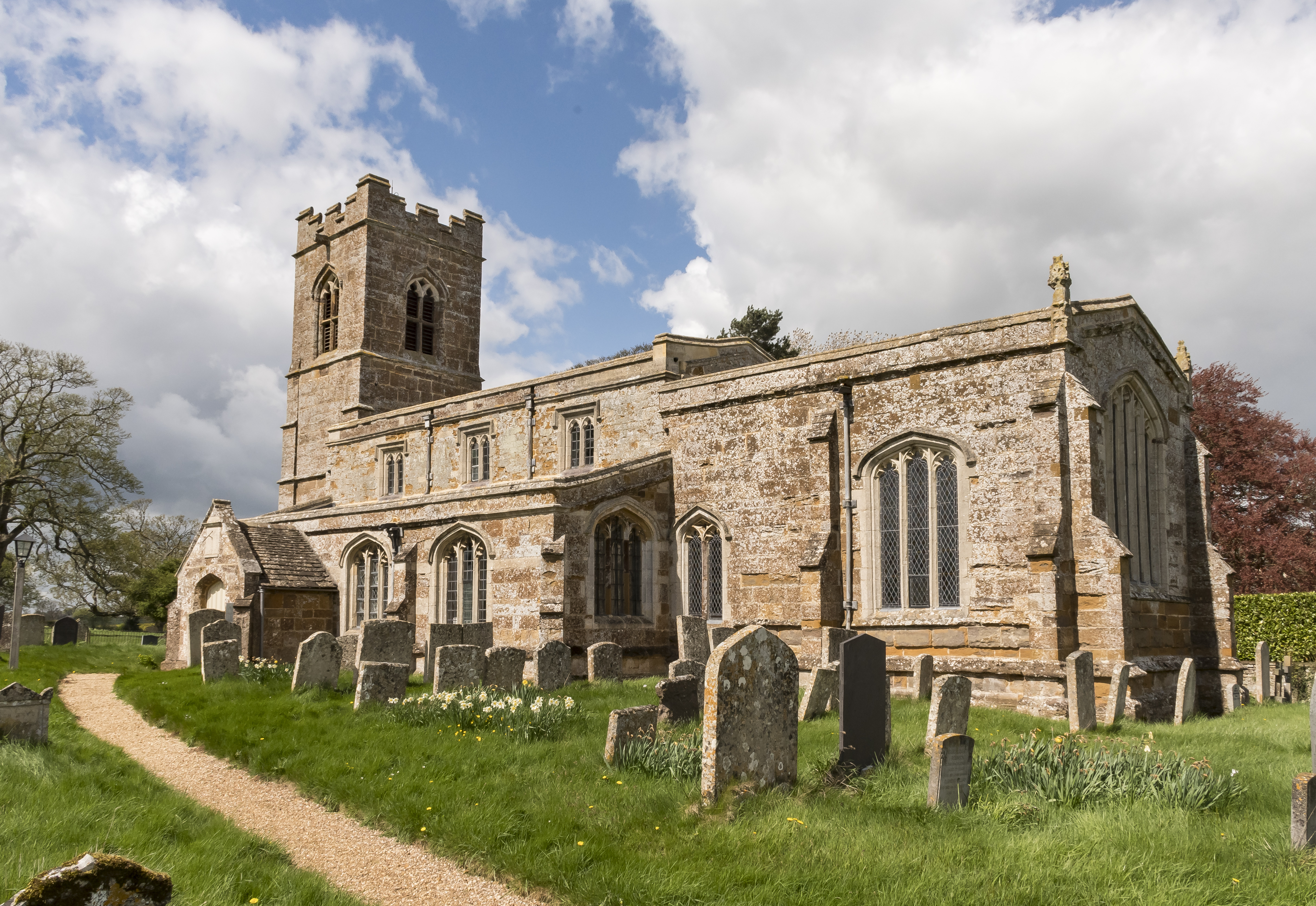
St Mary the Virgin's Church, Ayston

St Mary the Virgin's Church is a redundant Anglican church in the village of Ayston, Rutland, England. It is recorded in the National Heritage List for...
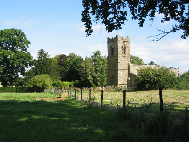
Ayston

Ayston is a village and civil parish in the county of Rutland in the East Midlands of England. It is about one mile (1.6 km) north-west of Uppingham, close...

Ridlington

Ridlington is a village and civil parish in Rutland in the East Midlands of England. The population of the village was 202 at the time of the 2001 census...

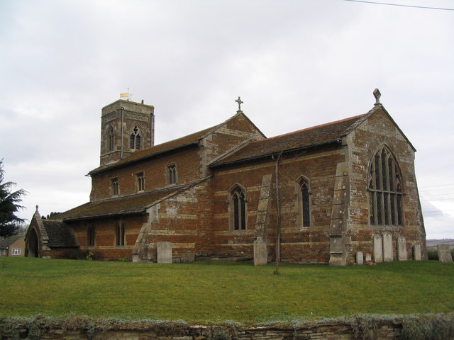
Church of St Mary Magdalene and St Andrew, Ridlington

The Church of St Mary Magdalene and St Andrew is the Church of England parish church in Ridlington, Rutland. It is a Grade II* listed building. == History... ==

Have you been to Ayston Spinney?

Leave your review of Ayston Spinney below (or comments, questions and feedback).