Coneygear Wood

Wood, Forest in Leicestershire Melton

England

Coneygear Wood

The Salt Way at Three Queens Three Queens is the name of the wood to the right of the road. It sits at the corner of the crossing of two ancient routes: the Salt Way (this road), and Sewstern Lane (crossing left to right at the start of the bend).
"The name Three Queens is said to refer to the burial barrows of three queens of the Bronze Age." <span class="nowrap"><a title="http://local-history.org.uk/waltham/pages/local-history/croxton-park-abbey/" rel="nofollow ugc noopener" href="http://local-history.org.uk/waltham/pages/local-history/croxton-park-abbey/">Link</a><img style="margin-left:2px;" alt="External link" title="External link - shift click to open in new window" src="https://s1.geograph.org.uk/img/external.png" width="10" height="10"/></span>. Several barrows have certainly been recorded here (Leicestershire historic environment record MLE3559 <span class="nowrap"><a title="https://www.heritagegateway.org.uk/Gateway/Results_Single.aspx?uid=MLE3559&resourceID=1021" rel="nofollow ugc noopener" href="https://www.heritagegateway.org.uk/Gateway/Results_Single.aspx?uid=MLE3559&resourceID=1021">Link</a><img style="margin-left:2px;" alt="External link" title="External link - shift click to open in new window" src="https://s1.geograph.org.uk/img/external.png" width="10" height="10"/></span> ), one containing the skeleton of a woman.
<span class="nowrap"><a title="https://www.bottesfordhistory.org.uk/content/about/read-it-hear-not-forgetting/not-forgetting-chapter-9-getting-about-in-the-past" rel="nofollow ugc noopener" href="https://www.bottesfordhistory.org.uk/content/about/read-it-hear-not-forgetting/not-forgetting-chapter-9-getting-about-in-the-past">Link</a><img style="margin-left:2px;" alt="External link" title="External link - shift click to open in new window" src="https://s1.geograph.org.uk/img/external.png" width="10" height="10"/></span> states "Here stood an 18th Century hostelry “of ill repute”, The Three Queens, frequented by cattle drovers and perhaps footpads. The inn eventually closed when the ancient trackways were replaced by newer roads, and there is nothing at the site now except a muddy track crossing a minor road."
The Salt Way at Three Queens Credit: Tim Heaton

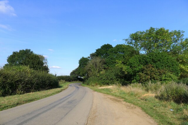
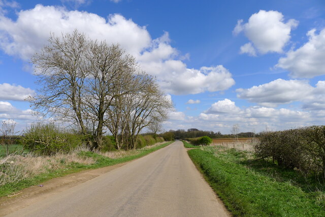
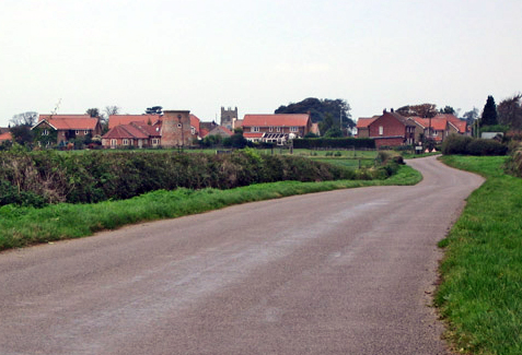
Coneygear Wood is a picturesque woodland located in Leicestershire, England. Situated on the outskirts of the town of Hinckley, it covers an area of approximately 34 hectares. The wood is predominantly made up of mixed broadleaf trees, including oak, ash, and birch, creating a diverse and vibrant ecosystem.

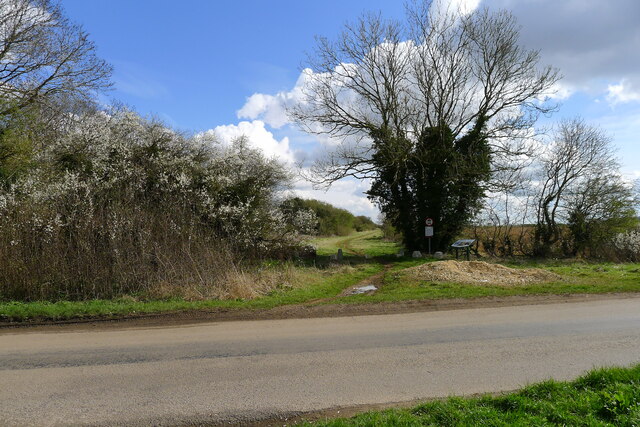
The woodland is crisscrossed by a network of well-maintained footpaths, making it a popular destination for walkers and nature enthusiasts. The paths wind their way through the trees, leading visitors to discover hidden glades, tranquil ponds, and enchanting clearings filled with wildflowers during the summer months.

Coneygear Wood is home to a variety of wildlife, including numerous species of birds, mammals, and insects. Birdwatchers may be lucky enough to spot woodpeckers, nuthatches, and tawny owls, while the patient observer may catch a glimpse of elusive mammals such as foxes, badgers, or even deer.

The wood is well-preserved and managed by the local authorities, ensuring its protection and the conservation of its natural beauty. It is a designated Local Nature Reserve, which means that it is afforded special recognition and protection due to its importance for both wildlife and the local community.

Coneygear Wood offers a peaceful retreat from the hustle and bustle of everyday life, providing visitors with the opportunity to reconnect with nature and enjoy the tranquility of the woodland surroundings. Whether it's a leisurely stroll, a picnic, or wildlife spotting, this charming woodland has something to offer for everyone.

If you have any feedback on the listing, please let us know in the comments section below.

Coneygear Wood Images

Images are sourced within 2km of 52.859947/-0.74710406 or Grid Reference SK8429. Thanks to Geograph Open Source API. All images are credited.

The Salt Way at Three Queens Three Queens is the name of the wood to the right of the road. It sits at the corner of the crossing of two ancient routes: the Salt Way (this road), and Sewstern Lane (crossing left to right at the start of the bend).
"The name Three Queens is said to refer to the burial barrows of three queens of the Bronze Age." <span class="nowrap"><a title="http://local-history.org.uk/waltham/pages/local-history/croxton-park-abbey/" rel="nofollow ugc noopener" href="http://local-history.org.uk/waltham/pages/local-history/croxton-park-abbey/">Link</a><img style="margin-left:2px;" alt="External link" title="External link - shift click to open in new window" src="https://s1.geograph.org.uk/img/external.png" width="10" height="10"/></span>. Several barrows have certainly been recorded here (Leicestershire historic environment record MLE3559 <span class="nowrap"><a title="https://www.heritagegateway.org.uk/Gateway/Results_Single.aspx?uid=MLE3559&resourceID=1021" rel="nofollow ugc noopener" href="https://www.heritagegateway.org.uk/Gateway/Results_Single.aspx?uid=MLE3559&resourceID=1021">Link</a><img style="margin-left:2px;" alt="External link" title="External link - shift click to open in new window" src="https://s1.geograph.org.uk/img/external.png" width="10" height="10"/></span> ), one containing the skeleton of a woman.
<span class="nowrap"><a title="https://www.bottesfordhistory.org.uk/content/about/read-it-hear-not-forgetting/not-forgetting-chapter-9-getting-about-in-the-past" rel="nofollow ugc noopener" href="https://www.bottesfordhistory.org.uk/content/about/read-it-hear-not-forgetting/not-forgetting-chapter-9-getting-about-in-the-past">Link</a><img style="margin-left:2px;" alt="External link" title="External link - shift click to open in new window" src="https://s1.geograph.org.uk/img/external.png" width="10" height="10"/></span> states "Here stood an 18th Century hostelry “of ill repute”, The Three Queens, frequented by cattle drovers and perhaps footpads. The inn eventually closed when the ancient trackways were replaced by newer roads, and there is nothing at the site now except a muddy track crossing a minor road."
The Salt Way at Three Queens
Three Queens is the name of the wood to the right of the road. It sits at the corner of the crossing of two ancient routes: the Salt Way (this road), and Sewstern Lane (crossing left to right at the start of the bend). "The name Three Queens is said to refer to the burial barrows of three queens of the Bronze Age." LinkExternal link. Several barrows have certainly been recorded here (Leicestershire historic environment record MLE3559 LinkExternal link ), one containing the skeleton of a woman. LinkExternal link states "Here stood an 18th Century hostelry “of ill repute”, The Three Queens, frequented by cattle drovers and perhaps footpads. The inn eventually closed when the ancient trackways were replaced by newer roads, and there is nothing at the site now except a muddy track crossing a minor road."
Gorse Lane east of Croxton Kerrial Part of the Salt Way, and a former Roman road along the top of the Lincolnshire Limestone ridge south of Grantham.
The name 'Gorse Lane' seems to be applied by local residents and businesses to the whole stretch of this road, from its junctions with the A607 in the west to the B1174 in the east. On OS and Google maps the name only appears on the eastern-most section of the road.
Gorse Lane east of Croxton Kerrial
Part of the Salt Way, and a former Roman road along the top of the Lincolnshire Limestone ridge south of Grantham. The name 'Gorse Lane' seems to be applied by local residents and businesses to the whole stretch of this road, from its junctions with the A607 in the west to the B1174 in the east. On OS and Google maps the name only appears on the eastern-most section of the road.
Sewstern Lane crossing the Salt Way at Three Queens Three Queens is the name of the wood on the left. It sits at the corner of the crossing of two ancient routes: Sewstern Lane (crossing straight ahead) and the Salt Way (road). The area around the wood contains several Bronze Age burial mounds (barrows); and the name 'Three Queens' may derive from these - because when one of the mounds was excavated, it was found to contain the skeleton of a woman. <span class="nowrap"><a title="https://heritage-explorer.lincolnshire.gov.uk/Monument/MLI33941" rel="nofollow ugc noopener" href="https://heritage-explorer.lincolnshire.gov.uk/Monument/MLI33941">Link</a><img style="margin-left:2px;" alt="External link" title="External link - shift click to open in new window" src="https://s1.geograph.org.uk/img/external.png" width="10" height="10"/></span>
<span class="nowrap"><a title="https://www.bottesfordhistory.org.uk/content/about/read-it-hear-not-forgetting/not-forgetting-chapter-9-getting-about-in-the-past" rel="nofollow ugc noopener" href="https://www.bottesfordhistory.org.uk/content/about/read-it-hear-not-forgetting/not-forgetting-chapter-9-getting-about-in-the-past">Link</a><img style="margin-left:2px;" alt="External link" title="External link - shift click to open in new window" src="https://s1.geograph.org.uk/img/external.png" width="10" height="10"/></span> states "Here stood an 18th Century hostelry "of ill repute", The Three Queens, frequented by cattle drovers and perhaps footpads. The inn eventually closed when the ancient trackways were replaced by newer roads, and there is nothing at the site now except a muddy track crossing a minor road."
Sewstern Lane crossing the Salt Way at Three Queens
Three Queens is the name of the wood on the left. It sits at the corner of the crossing of two ancient routes: Sewstern Lane (crossing straight ahead) and the Salt Way (road). The area around the wood contains several Bronze Age burial mounds (barrows); and the name 'Three Queens' may derive from these - because when one of the mounds was excavated, it was found to contain the skeleton of a woman. LinkExternal link LinkExternal link states "Here stood an 18th Century hostelry "of ill repute", The Three Queens, frequented by cattle drovers and perhaps footpads. The inn eventually closed when the ancient trackways were replaced by newer roads, and there is nothing at the site now except a muddy track crossing a minor road."
Church of St Botolph and St John the Baptist, Croxton Kerrial 15th C. church restored in 1866-68 by Scott. Has a central tower (although more eastern than central) on diagonal stepped buttresses with 8 pinnacles. 
North and south aisles with 3 bay arcades and clerestories. 
The pews date from 1534 when they were donated by Croxton Abbey at the time of dissolution. There are 42 unique pew ends.
The organ is by Nicholson of Worcester 1849.
There is no stained glass.
Church of St Botolph and St John the Baptist, Croxton Kerrial
15th C. church restored in 1866-68 by Scott. Has a central tower (although more eastern than central) on diagonal stepped buttresses with 8 pinnacles. North and south aisles with 3 bay arcades and clerestories. The pews date from 1534 when they were donated by Croxton Abbey at the time of dissolution. There are 42 unique pew ends. The organ is by Nicholson of Worcester 1849. There is no stained glass.
Croxton Lane leaving Croxton Kerrial Heading north to Knipton
Croxton Lane leaving Croxton Kerrial
Heading north to Knipton
Junction of Croxton Lane and Croxton Lane The main Croxton Lane goes to Knipton, and the Croxton Lane to the right goes to Harston
Junction of Croxton Lane and Croxton Lane
The main Croxton Lane goes to Knipton, and the Croxton Lane to the right goes to Harston
Track up the side of Croxton Banks wood The 'bank' is the face of the escarpment of Jurassic limestones and ironstones on which Croxton Kerrial sits
Track up the side of Croxton Banks wood
The 'bank' is the face of the escarpment of Jurassic limestones and ironstones on which Croxton Kerrial sits
Footpath to Croxton Kerrial The path crosses the wheat field, passes through the edge of Harston Wood, and then onto the top of the escarpment
Footpath to Croxton Kerrial
The path crosses the wheat field, passes through the edge of Harston Wood, and then onto the top of the escarpment
Footpath to Croxton Kerrial leaving the south side of Harston The grass now brown after England's driest July in over a hundred years.
Footpath to Croxton Kerrial leaving the south side of Harston
The grass now brown after England's driest July in over a hundred years.
Church of St Michael and All Angels, Harston Original 14th century tower is retained, but the rest of the church was rebuilt in the late 19th century.
Church of St Michael and All Angels, Harston
Original 14th century tower is retained, but the rest of the church was rebuilt in the late 19th century.
Track up to the A607, west of Croxton Kerrial During the driest July for over a hundred years, the rare sound of running water. The stream by the side of the path comes from Croxton Kerrial's famous spring-fed water spout <a href="https://www.geograph.org.uk/photo/30072">SK8328 : Water spout, Croxton Kerrial</a>. The spring emerges at the base of the Lincolnshire Limestone, and the miniature waterfall on the right is formed from tuffa.
Track up to the A607, west of Croxton Kerrial
During the driest July for over a hundred years, the rare sound of running water. The stream by the side of the path comes from Croxton Kerrial's famous spring-fed water spout SK8328 : Water spout, Croxton Kerrial. The spring emerges at the base of the Lincolnshire Limestone, and the miniature waterfall on the right is formed from tuffa.
View over the valley of the River Devon near Croxton Kerrial Croxton Kerrial sits on the left of the horizon. If the Roman road, the Salt Way, ran as an uninterrupted straight line to the south of Croxton Kerrial (rather than along the line of the current A607 through the village), as is suggested by some sources <span class="nowrap"><a title="https://archaeologydataservice.ac.uk/archives/view/romangl/map.html" rel="nofollow ugc noopener" href="https://archaeologydataservice.ac.uk/archives/view/romangl/map.html">Link</a><img style="margin-left:2px;" alt="External link" title="External link - shift click to open in new window" src="https://s1.geograph.org.uk/img/external.png" width="10" height="10"/></span> , it would have been along the line of this view. It would still have had to cross the valley, but possibly with an easier gradient.
View over the valley of the River Devon near Croxton Kerrial
Croxton Kerrial sits on the left of the horizon. If the Roman road, the Salt Way, ran as an uninterrupted straight line to the south of Croxton Kerrial (rather than along the line of the current A607 through the village), as is suggested by some sources LinkExternal link , it would have been along the line of this view. It would still have had to cross the valley, but possibly with an easier gradient.
Goosey goosey wander Wonder what the future holds for these geese?

Not good!
<span class="nowrap"><a title="http://www.freerangebirds.co.uk/" rel="nofollow ugc noopener" href="http://www.freerangebirds.co.uk/">Link</a><img style="margin-left:2px;" alt="External link" title="External link - shift click to open in new window" src="https://s1.geograph.org.uk/img/external.png" width="10" height="10"/></span>
Goosey goosey wander
Wonder what the future holds for these geese? Not good! LinkExternal link
April showers 1 Looking across exceedingly gloomy farmland from Saltby Road towards sunlit Terrace Hills, <a href="https://www.geograph.org.uk/gridref/SK7932">SK7932</a>, on the horizon. The haziness is caused by torrential rain which hit me just as I got back in the car.
April showers 1
Looking across exceedingly gloomy farmland from Saltby Road towards sunlit Terrace Hills, SK7932, on the horizon. The haziness is caused by torrential rain which hit me just as I got back in the car.
April showers 2 Looking across from Saltby Road towards sunlit High Leys, <a href="https://www.geograph.org.uk/gridref/SK8132">SK8132</a>, on the horizon. The haziness is caused by torrential rain which made it seem like night where I was standing.
April showers 2
Looking across from Saltby Road towards sunlit High Leys, SK8132, on the horizon. The haziness is caused by torrential rain which made it seem like night where I was standing.
Farmland near Croxton Kerrial
A607 towards Grantham
The Peacock at Croxton Kerrial
Show me another place!

Coneygear Wood is located at Grid Ref: SK8429 (Lat: 52.859947, Lng: -0.74710406)

Administrative County: Leicestershire

District: Melton

Police Authority: Leicestershire

What 3 Words

///euphoric.silly.solution. Near Barrowby, Lincolnshire

Nearby Locations

Coneygear Wood

Related Wikis

Croxton Kerrial

Croxton Kerrial (pronounced [ˈkroʊsən ˈkɛrɨl]) is a village and civil parish in the Melton borough of Leicestershire, England, 6.6 miles (10.6 km) south...

Croxton Abbey

Croxton Abbey, near Croxton Kerrial, Leicestershire, was a Premonstratensian monastery founded by William I, Count of Boulogne. == History == Croxton Abbey...

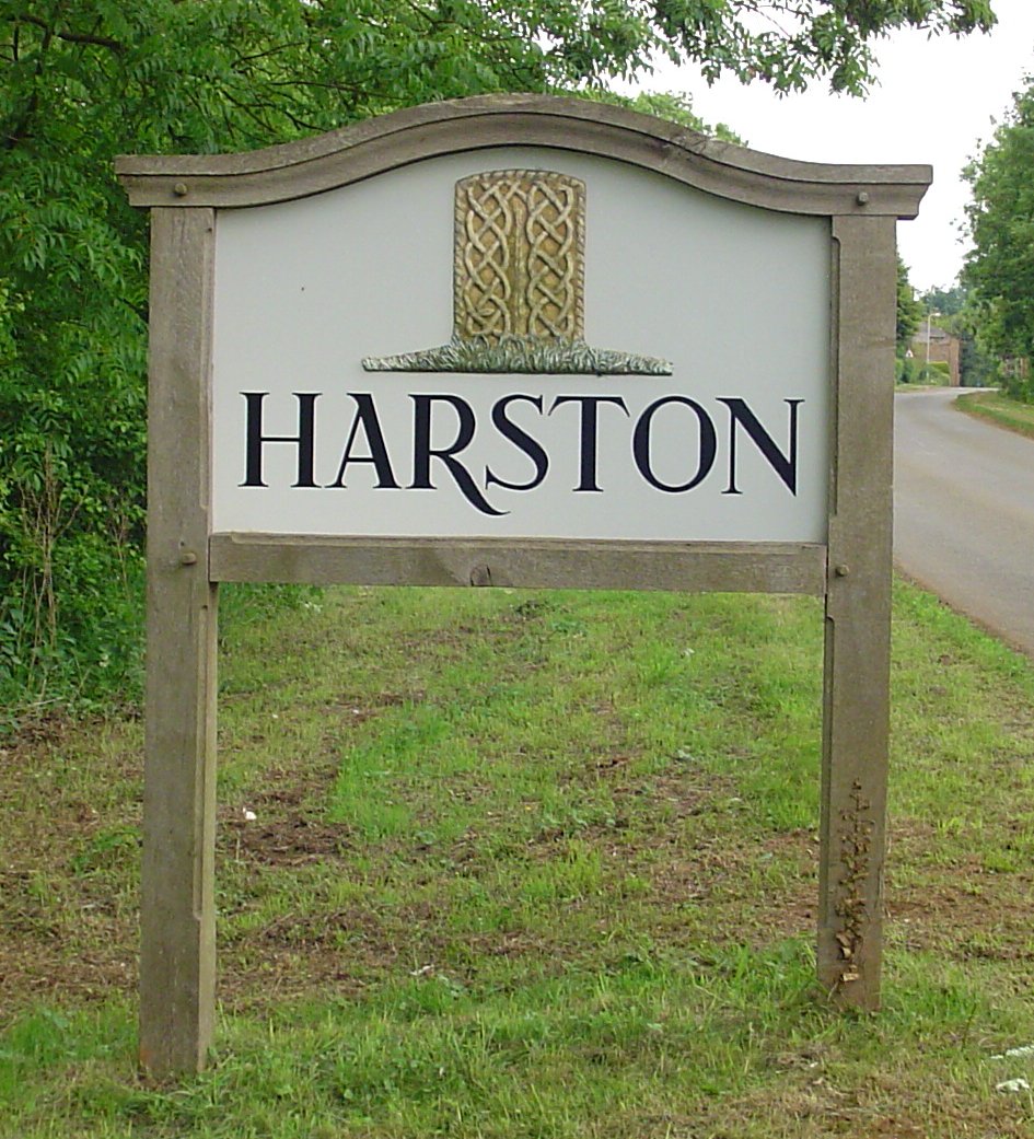
Harston, Leicestershire

Harston is a crossroads village and former civil parish, now in the parish of Belvoir, in the Melton district, in Leicestershire, England, near the border...

Knipton

Knipton is a village and former civil parish, now in the parish of Belvoir, in the Melton district, in the county of Leicestershire, England. It lies about...

King Lud's Entrenchments and The Drift

King Lud's Entrenchments and The Drift is a 23.9 hectares (59 acres) biological Site of Special Scientific Interest which straddles the border between...

Croxton Park

Croxton Park is a 97.3-hectare (240-acre) biological Site of Special Scientific Interest south-west of Croxton Kerrial in Leicestershire.This medieval...

Branston, Leicestershire

Branston is a village and former civil parish, now in the parish of Croxton Kerrial in the Melton district, in the county of Leicestershire, England. It...

Denton, Lincolnshire

Denton is a village and civil parish in the South Kesteven district of Lincolnshire, England. The population of the civil parish was 273 at the 2011 census...

Nearby Amenities

Located within 500m of 52.859947,-0.74710406
Barrier: stile
Ele: 148.8887939
Steps: 1
Stile: stepover
Lat/Long: 52.8558701/-0.7496002
Ele: 149.3693848
Lat/Long: 52.8577906/-0.7450026
Barrier: stile
Ele: 148.1678467
Steps: 1
Stile: stepover
Lat/Long: 52.8591219/-0.7417888
Parking
Description: Layby
Ele: 149.8500977
Lat/Long: 52.8592977/-0.7413745
The data included in this document is from www.openstreetmap.org. The data is made available under ODbL.

Have you been to Coneygear Wood?

Leave your review of Coneygear Wood below (or comments, questions and feedback).