Cliff Wood

Wood, Forest in Lincolnshire South Kesteven

England

Cliff Wood

Cliff Road north-east of Belvoir Castle The road runs along the top of the Belvoir escarpment, hence 'cliff'.
Cliff Road north-east of Belvoir Castle Credit: Tim Heaton

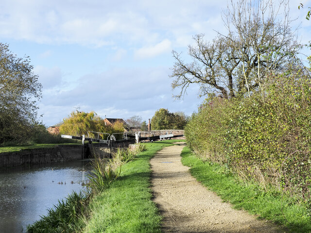
Cliff Wood is a small village located in the county of Lincolnshire, England. It is situated on the eastern coast of the country, near the North Sea. The village is surrounded by picturesque forests and woodlands, which give it its name.

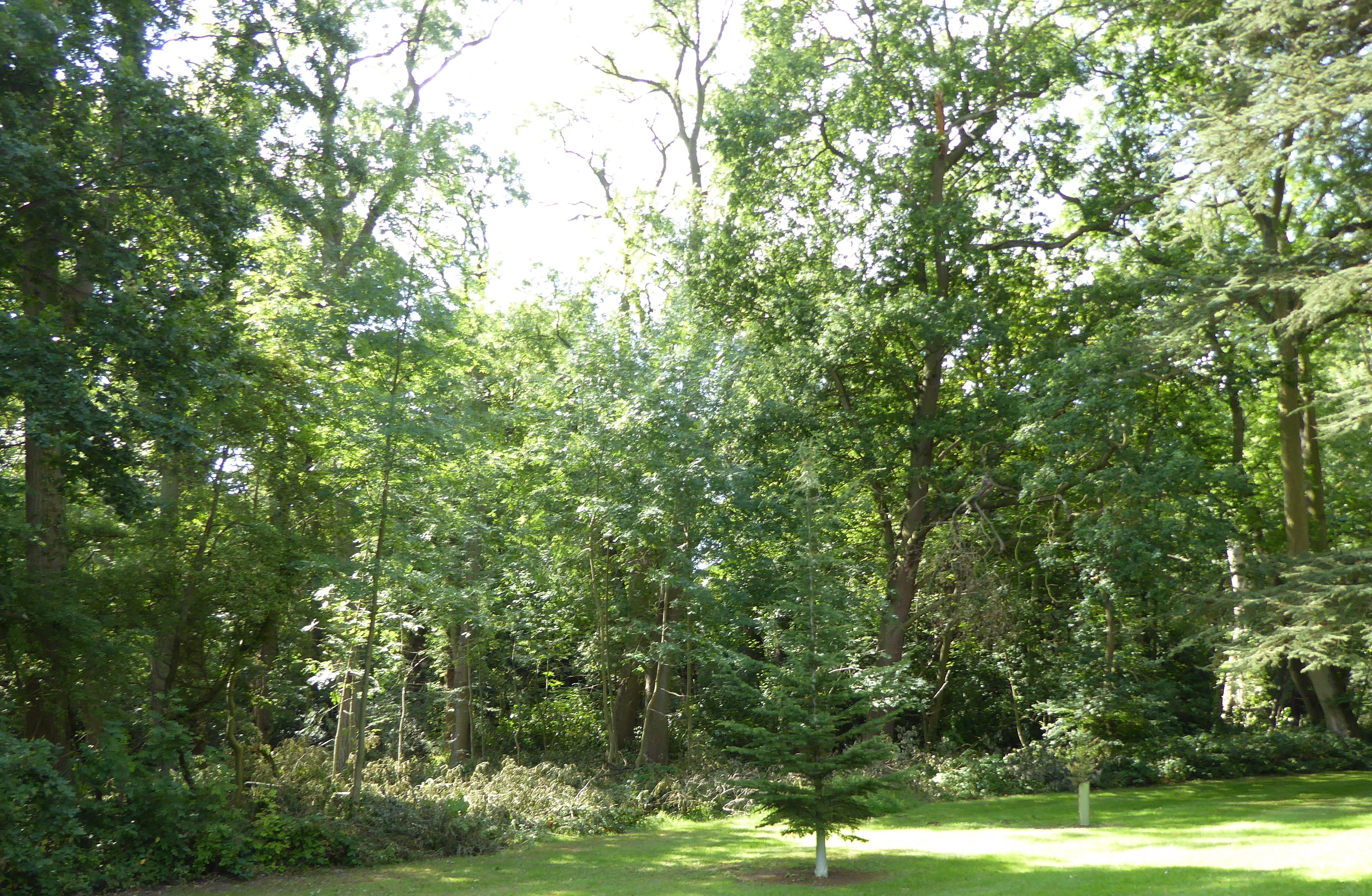
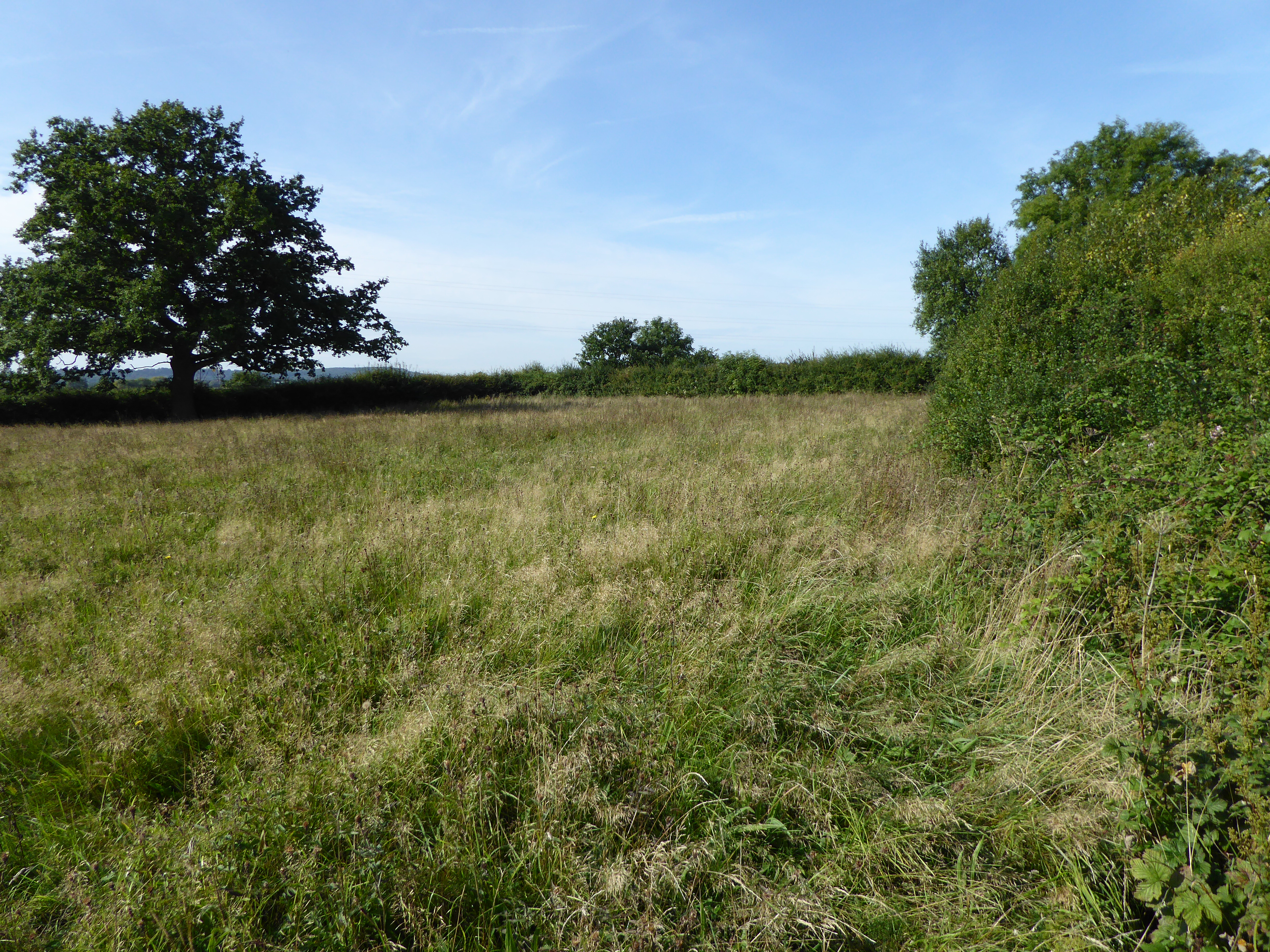
The area is known for its natural beauty and is a popular destination for nature enthusiasts and hikers. The woodlands are home to a diverse range of flora and fauna, including various species of birds and mammals. The forest provides a peaceful and serene atmosphere, making it an ideal location for those seeking tranquility and a break from the hustle and bustle of city life.

Cliff Wood itself is a tight-knit community with a population of around 500 residents. The village has a charming and quaint atmosphere, with traditional cottages and buildings lining its streets. The locals are known for their friendliness and hospitality, welcoming visitors with open arms.

Despite its small size, Cliff Wood has a few amenities to cater to the needs of its residents and visitors. There is a village shop where essential supplies can be purchased, and a local pub where one can enjoy a pint of ale and traditional British cuisine.

Overall, Cliff Wood, Lincolnshire is a picturesque village surrounded by beautiful woodlands, offering a peaceful and idyllic setting for both residents and visitors alike.

If you have any feedback on the listing, please let us know in the comments section below.

Cliff Wood Images

Images are sourced within 2km of 52.901443/-0.74867289 or Grid Reference SK8434. Thanks to Geograph Open Source API. All images are credited.

Cliff Road north-east of Belvoir Castle The road runs along the top of the Belvoir escarpment, hence 'cliff'.
Cliff Road north-east of Belvoir Castle
The road runs along the top of the Belvoir escarpment, hence 'cliff'.
Cycle route 64 turning off Sedgebrook Road The Rutland Arms at the end of the road to the right, popular with cyclists, walkers, and canal enthusiasts, is alwtays known as the 'Dirty Duck'
Cycle route 64 turning off Sedgebrook Road
The Rutland Arms at the end of the road to the right, popular with cyclists, walkers, and canal enthusiasts, is alwtays known as the 'Dirty Duck'
Large oak on Sedgebrook Road Some dead branches, but remainder looks healthy
Large oak on Sedgebrook Road
Some dead branches, but remainder looks healthy
Minor road heading east from Stenwith The road is leaving the vicinity of Stenwith having just crossed bridges over two disused transport routes, the Grantham Canal and a railway adjacent to it.
Minor road heading east from Stenwith
The road is leaving the vicinity of Stenwith having just crossed bridges over two disused transport routes, the Grantham Canal and a railway adjacent to it.
Woolsthorpe Bottom Lock, No. 16 This is one of three restored locks, close together, and named at the location presumably by the Grantham Canal Society which has its headquarters at the buildings in the image, as Woolsthorpe Top, Middle and Bottom Locks. The Collins  / Nicholson Waterways Guide No.6 however names these locks differently, the one in the image being regarded as Carpenters Shop Lock.
Woolsthorpe Bottom Lock, No. 16
This is one of three restored locks, close together, and named at the location presumably by the Grantham Canal Society which has its headquarters at the buildings in the image, as Woolsthorpe Top, Middle and Bottom Locks. The Collins / Nicholson Waterways Guide No.6 however names these locks differently, the one in the image being regarded as Carpenters Shop Lock.
Walking the towpath of the Grantham Canal Two walkers heading towards Grantham on a restored stretch of the Grantham Canal in a view from Longmoor Bridge, (No. 62).
Swans on the canal, too.
Walking the towpath of the Grantham Canal
Two walkers heading towards Grantham on a restored stretch of the Grantham Canal in a view from Longmoor Bridge, (No. 62). Swans on the canal, too.
Headland of sloping field The field is on the southern side of the Grantham Canal; it's below the line of trees and bushes at the right side of the image.
Headland of sloping field
The field is on the southern side of the Grantham Canal; it's below the line of trees and bushes at the right side of the image.
Grantham Canal: approaching bridge No. 63 The bridge is being approached from the north-west. Due to lighting conditions the already dark footbridge is being viewed against a background of shadowed trees and so is not well seen.
Grantham Canal: approaching bridge No. 63
The bridge is being approached from the north-west. Due to lighting conditions the already dark footbridge is being viewed against a background of shadowed trees and so is not well seen.
Grantham Canal heading east The Grantham Canal heading almost due east from a location east of Woolsthorpe Top Lock, No. 18.
Grantham Canal heading east
The Grantham Canal heading almost due east from a location east of Woolsthorpe Top Lock, No. 18.
Willis's Lock The towing path of the Grantham Canal approaching the lock from the bend to the south. The lock is one of three consecutive ones fully restored by the Grantham Canal Society.
Willis's Lock
The towing path of the Grantham Canal approaching the lock from the bend to the south. The lock is one of three consecutive ones fully restored by the Grantham Canal Society.
Stenwith Bridge Bridge 60 over the disused Grantham Canal. The water surface is covered with duck weed in this photograph. Go to <span class="nowrap"><a title="http://www.granthamcanal.org/" rel="nofollow ugc noopener" href="http://www.granthamcanal.org/">Link</a><img style="margin-left:2px;" alt="External link" title="External link - shift click to open in new window" src="https://s1.geograph.org.uk/img/external.png" width="10" height="10"/></span> for more information about the canal including the restoration of locks 12 to 15 commencing in 2015. Locks 12, 13 and 14 are the far side of this bridge.
Stenwith Bridge
Bridge 60 over the disused Grantham Canal. The water surface is covered with duck weed in this photograph. Go to LinkExternal link for more information about the canal including the restoration of locks 12 to 15 commencing in 2015. Locks 12, 13 and 14 are the far side of this bridge.
Lock 17, Woolsthorpe, Lincolnshire One of three restored locks on the Grantham Canal at the old Woolsthorpe wharf site.
Lock 17, Woolsthorpe, Lincolnshire
One of three restored locks on the Grantham Canal at the old Woolsthorpe wharf site.
Grantham Canal at Woolsthorpe The building on the left is the Rutland Arms, often referred to as the Dirty or Muddy Duck. The view is looking down stream towards Nottingham, approx 20 miles away. There is a disused mineral railway behind the trees on the right, now used as a cycle route. See <span class="nowrap"><a title="http://www.granthamcanal.org/" rel="nofollow ugc noopener" href="http://www.granthamcanal.org/">Link</a><img style="margin-left:2px;" alt="External link" title="External link - shift click to open in new window" src="https://s1.geograph.org.uk/img/external.png" width="10" height="10"/></span>

Note: Before closure in 2014 The Rutland Arms had been informally known as the Dirty Duck for many years. It was reopened in 2016 after refurbishment and is now officially called The Dirty Duck.
Grantham Canal at Woolsthorpe
The building on the left is the Rutland Arms, often referred to as the Dirty or Muddy Duck. The view is looking down stream towards Nottingham, approx 20 miles away. There is a disused mineral railway behind the trees on the right, now used as a cycle route. See LinkExternal link Note: Before closure in 2014 The Rutland Arms had been informally known as the Dirty Duck for many years. It was reopened in 2016 after refurbishment and is now officially called The Dirty Duck.
Lock Keeper's cottage, Woolsthorpe Lock keeper's cottage beside the Grantham Canal. The Rutland Arms is on the opposite side of the road. Note Belvoir Castle <a href="https://www.geograph.org.uk/gridref/SK8133">SK8133</a> on the horizon.

Note: Before closure in 2014 The Rutland Arms had been informally known as the Dirty Duck for many years. It was reopened in 2016 after refurbishment and is now officially called The Dirty Duck.
Lock Keeper's cottage, Woolsthorpe
Lock keeper's cottage beside the Grantham Canal. The Rutland Arms is on the opposite side of the road. Note Belvoir Castle SK8133 on the horizon. Note: Before closure in 2014 The Rutland Arms had been informally known as the Dirty Duck for many years. It was reopened in 2016 after refurbishment and is now officially called The Dirty Duck.
Line of old mineral railway, near Woolsthorpe Once a mineral railway serving the ironstone workings which were prevalent in this area in the first half of the 20th century, this is now part of the National Cycle Route Network. It runs alongside the Grantham Canal in this square, which is just to the right behind the trees.
Line of old mineral railway, near Woolsthorpe
Once a mineral railway serving the ironstone workings which were prevalent in this area in the first half of the 20th century, this is now part of the National Cycle Route Network. It runs alongside the Grantham Canal in this square, which is just to the right behind the trees.
Arable farmland adjacent to the Grantham Canal Looking Eastwards from the cycleway near Woolsthorpe. Across the field of oil seed rape the Casthorpe Hills can be seen, 2 miles away. The line of trees marks Longmoor Lane.
Arable farmland adjacent to the Grantham Canal
Looking Eastwards from the cycleway near Woolsthorpe. Across the field of oil seed rape the Casthorpe Hills can be seen, 2 miles away. The line of trees marks Longmoor Lane.
Belvoir Lower Lake The lower, (obviously!) of two man-made lakes in the Belvoir estate parkland. The Upper Lake is behind the bridge just visible in the middle distance which lies just beyond the boundary of the grid square.
Belvoir Lower Lake
The lower, (obviously!) of two man-made lakes in the Belvoir estate parkland. The Upper Lake is behind the bridge just visible in the middle distance which lies just beyond the boundary of the grid square.
Fishing platforms, Belvoir Lower Lake
Show me another place!

Cliff Wood is located at Grid Ref: SK8434 (Lat: 52.901443, Lng: -0.74867289)

Administrative County: Lincolnshire

District: South Kesteven

Police Authority: Lincolnshire

What 3 Words

///copying.flask.ripe. Near Barrowby, Lincolnshire

Nearby Locations

Cliff Wood

Related Wikis

Woolsthorpe by Belvoir

Woolsthorpe by Belvoir, also known as Woolsthorpe is a village and civil parish in the South Kesteven district of Lincolnshire, England. The population...

Casthorpe

Casthorpe is hamlet in the civil parish of Barrowby and the South Kesteven District of Lincolnshire, England. It is 23 miles (40 km) south-southwest from...

Belvoir Priory

Belvoir Priory (pronounced Beaver) was a Benedictine priory near to Belvoir Castle. Although once described as within Lincolnshire, it is currently located...

Briery Wood Heronry, Belvoir

Briery Wood Heronry is a 5.7-hectare (14-acre) biological Site of Special Scientific Interest in the grounds of Belvoir Castle in Leicestershire.This is...
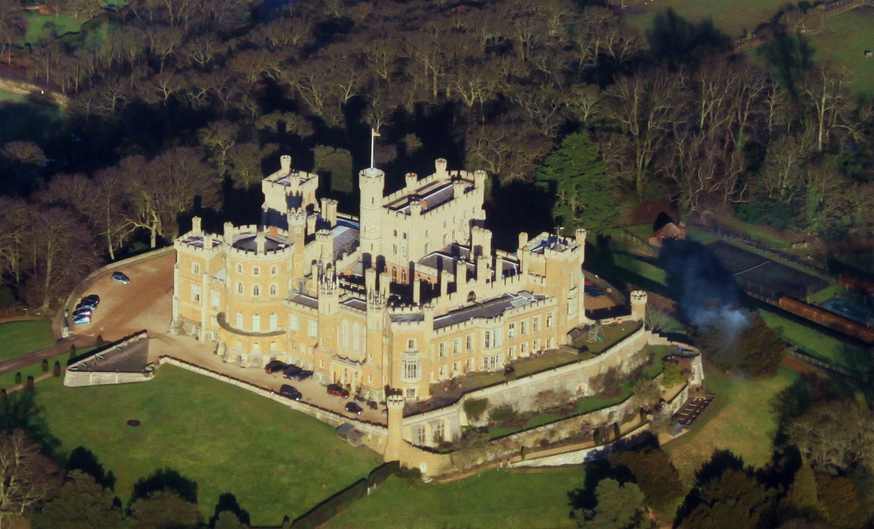
Belvoir Castle

Belvoir Castle ( BEE-vər) is a faux historic castle and stately home in Leicestershire, England, situated 6 mi (10 km) west of the town of Grantham and...

Belvoir, Leicestershire

Belvoir ( BEE-vər) is a village and civil parish in the Melton district of Leicestershire, England, close to the county boundary with Lincolnshire. The...

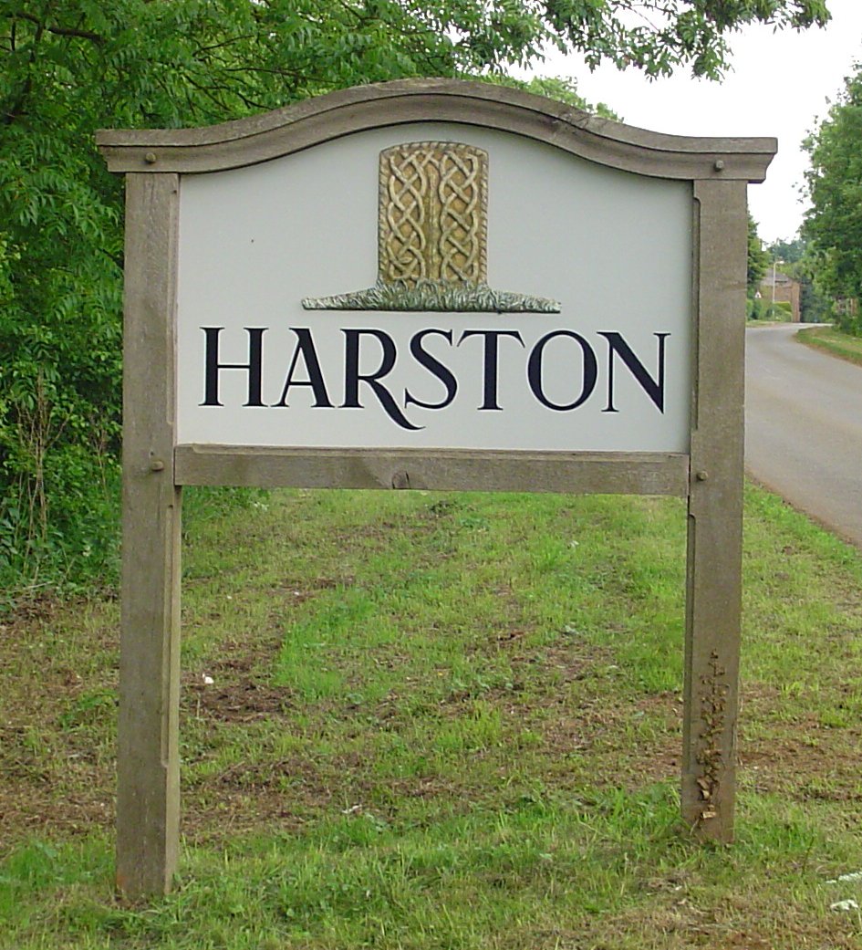
Harston, Leicestershire

Harston is a crossroads village and former civil parish, now in the parish of Belvoir, in the Melton district, in Leicestershire, England, near the border...

Muston Meadows

Muston Meadows is an 8.8-hectare (22-acre) biological Site of Special Scientific Interest south of Muston in Leicestershire. It is also a National Nature...

Nearby Amenities

Located within 500m of 52.901443,-0.74867289
Ele: 112.0000000
Lat/Long: 52.898782/-0.7429484
Glebe Farm
Place: farm
Source: Bing
Lat/Long: 52.9019926/-0.7446522
The data included in this document is from www.openstreetmap.org. The data is made available under ODbL.

Have you been to Cliff Wood?

Leave your review of Cliff Wood below (or comments, questions and feedback).