Fanny's Wood

Wood, Forest in Lincolnshire South Kesteven

England

Fanny's Wood

Belvoir Castle and gardens [23] The view from the rear of the castle shows the commanding position the castle occupies.
Located in Leicestershire, some 6 miles west of Grantham, Belvoir Castle was originally a Norman Castle. It was left in ruins after the War of the Roses. It was rebuilt in the 16th century and demolished on Cromwell’s orders in 1649 after a Civil War siege. The castle was rebuilt 1655-68 on a courtyard plan and was remodelled from 1801-30. A fire in 1816 destroyed the north and east wings, which were rebuilt. Constructed of ironstone with limestone dressings and slate roofs. The plan is highly irregular with asymmetrical facades in a Romantic Mixed Gothic style. The castle is listed, grade I, with details at: <span class="nowrap"><a title="https://historicengland.org.uk/listing/the-list/list-entry/1360870" rel="nofollow ugc noopener" href="https://historicengland.org.uk/listing/the-list/list-entry/1360870">Link</a><img style="margin-left:2px;" alt="External link" title="External link - shift click to open in new window" src="https://s1.geograph.org.uk/img/external.png" width="10" height="10"/></span>  The gardens are on the Register of Historic Parks and Garden, grade II*, with much history and detail at: <span class="nowrap"><a title="https://historicengland.org.uk/listing/the-list/list-entry/1000957" rel="nofollow ugc noopener" href="https://historicengland.org.uk/listing/the-list/list-entry/1000957">Link</a><img style="margin-left:2px;" alt="External link" title="External link - shift click to open in new window" src="https://s1.geograph.org.uk/img/external.png" width="10" height="10"/></span>
Belvoir Castle and gardens [23] Credit: Michael Dibb

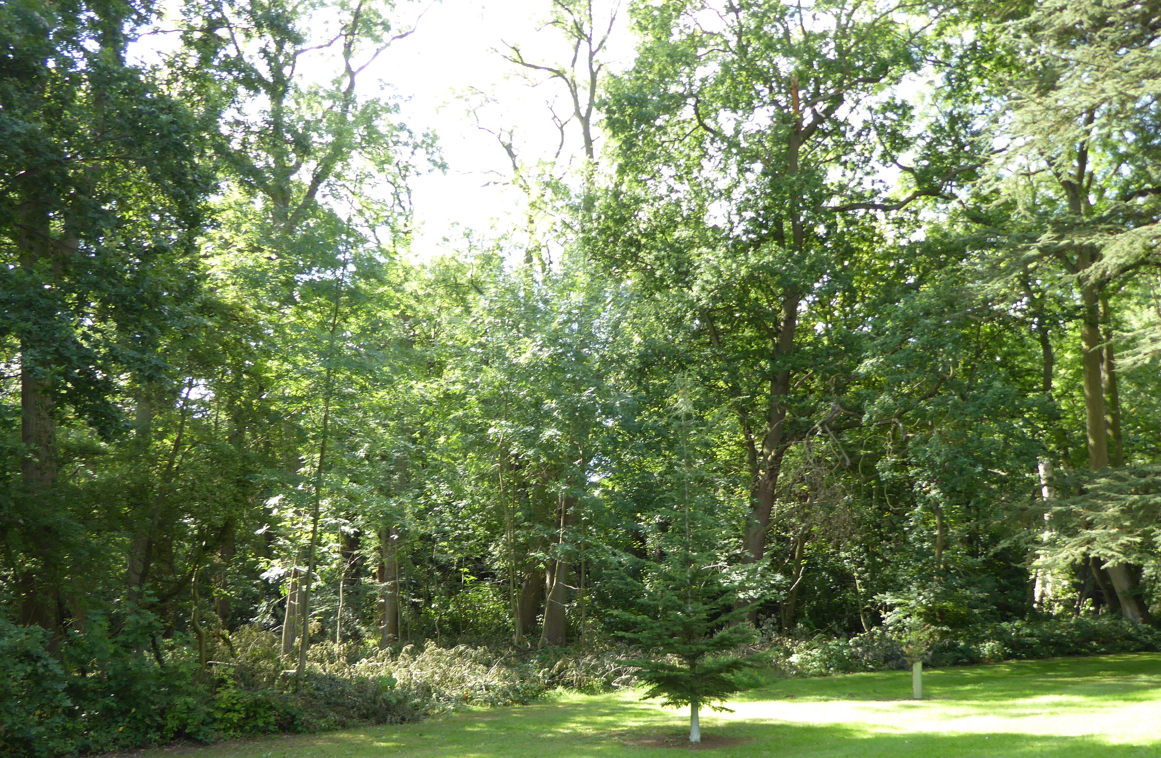
Fanny's Wood is a picturesque forest located in the county of Lincolnshire, England. Covering an area of approximately 100 acres, it is nestled within the idyllic countryside, offering visitors a tranquil and serene retreat.

The wood is home to a diverse range of flora and fauna, with a variety of trees including oak, beech, and birch dominating the landscape. These towering trees create a dense canopy, providing shade and shelter for numerous woodland creatures. Visitors can often spot squirrels darting amongst the branches or hear the delightful songs of various bird species.

The forest is crisscrossed with a network of well-maintained trails, making it perfect for leisurely walks or more adventurous hikes. These pathways wind through the wood, allowing visitors to explore its hidden corners and discover its natural wonders. Along the way, benches and picnic areas offer the opportunity to rest and take in the stunning surroundings.

Fanny's Wood is also known for its rich history and cultural significance. It is believed to have been named after a local landowner or prominent figure from the past. The wood has been cherished by the local community for generations, and efforts have been made to preserve its natural beauty and protect the wildlife that calls it home.

Overall, Fanny's Wood is a delightful destination for nature enthusiasts, families, and those seeking a peaceful escape from the hustle and bustle of everyday life. Its scenic beauty, abundant wildlife, and historical charm make it a truly enchanting woodland experience in Lincolnshire.

If you have any feedback on the listing, please let us know in the comments section below.

Fanny's Wood Images

Images are sourced within 2km of 52.896649/-0.74930155 or Grid Reference SK8433. Thanks to Geograph Open Source API. All images are credited.

Belvoir Castle and gardens [23] The view from the rear of the castle shows the commanding position the castle occupies.
Located in Leicestershire, some 6 miles west of Grantham, Belvoir Castle was originally a Norman Castle. It was left in ruins after the War of the Roses. It was rebuilt in the 16th century and demolished on Cromwell’s orders in 1649 after a Civil War siege. The castle was rebuilt 1655-68 on a courtyard plan and was remodelled from 1801-30. A fire in 1816 destroyed the north and east wings, which were rebuilt. Constructed of ironstone with limestone dressings and slate roofs. The plan is highly irregular with asymmetrical facades in a Romantic Mixed Gothic style. The castle is listed, grade I, with details at: <span class="nowrap"><a title="https://historicengland.org.uk/listing/the-list/list-entry/1360870" rel="nofollow ugc noopener" href="https://historicengland.org.uk/listing/the-list/list-entry/1360870">Link</a><img style="margin-left:2px;" alt="External link" title="External link - shift click to open in new window" src="https://s1.geograph.org.uk/img/external.png" width="10" height="10"/></span>  The gardens are on the Register of Historic Parks and Garden, grade II*, with much history and detail at: <span class="nowrap"><a title="https://historicengland.org.uk/listing/the-list/list-entry/1000957" rel="nofollow ugc noopener" href="https://historicengland.org.uk/listing/the-list/list-entry/1000957">Link</a><img style="margin-left:2px;" alt="External link" title="External link - shift click to open in new window" src="https://s1.geograph.org.uk/img/external.png" width="10" height="10"/></span>
Belvoir Castle and gardens [23]
The view from the rear of the castle shows the commanding position the castle occupies. Located in Leicestershire, some 6 miles west of Grantham, Belvoir Castle was originally a Norman Castle. It was left in ruins after the War of the Roses. It was rebuilt in the 16th century and demolished on Cromwell’s orders in 1649 after a Civil War siege. The castle was rebuilt 1655-68 on a courtyard plan and was remodelled from 1801-30. A fire in 1816 destroyed the north and east wings, which were rebuilt. Constructed of ironstone with limestone dressings and slate roofs. The plan is highly irregular with asymmetrical facades in a Romantic Mixed Gothic style. The castle is listed, grade I, with details at: LinkExternal link The gardens are on the Register of Historic Parks and Garden, grade II*, with much history and detail at: LinkExternal link
Woolsthorpe Lane entering Harston
Cliff Road north-east of Belvoir Castle The road runs along the top of the Belvoir escarpment, hence 'cliff'.
Cliff Road north-east of Belvoir Castle
The road runs along the top of the Belvoir escarpment, hence 'cliff'.
Cycle route 64 turning off Sedgebrook Road The Rutland Arms at the end of the road to the right, popular with cyclists, walkers, and canal enthusiasts, is alwtays known as the 'Dirty Duck'
Cycle route 64 turning off Sedgebrook Road
The Rutland Arms at the end of the road to the right, popular with cyclists, walkers, and canal enthusiasts, is alwtays known as the 'Dirty Duck'
Large oak on Sedgebrook Road Some dead branches, but remainder looks healthy
Large oak on Sedgebrook Road
Some dead branches, but remainder looks healthy
Large sycamore, Belvoir Road
Former track bed of the Woolsthorpe Branch ironstone railway Also marked as a 'Traffic-free cycle route' on the OS 1:25000 map, though parts of the track are narrow, with little headroom. For details of the former railway, see <a href="https://www.geograph.org.uk/photo/1464830">SK8633 : Railway Bridge, Belvoir Road, near Denton</a>
Former track bed of the Woolsthorpe Branch ironstone railway
Also marked as a 'Traffic-free cycle route' on the OS 1:25000 map, though parts of the track are narrow, with little headroom. For details of the former railway, see SK8633 : Railway Bridge, Belvoir Road, near Denton
Woolsthorpe Bottom Lock, No. 16 This is one of three restored locks, close together, and named at the location presumably by the Grantham Canal Society which has its headquarters at the buildings in the image, as Woolsthorpe Top, Middle and Bottom Locks. The Collins  / Nicholson Waterways Guide No.6 however names these locks differently, the one in the image being regarded as Carpenters Shop Lock.
Woolsthorpe Bottom Lock, No. 16
This is one of three restored locks, close together, and named at the location presumably by the Grantham Canal Society which has its headquarters at the buildings in the image, as Woolsthorpe Top, Middle and Bottom Locks. The Collins / Nicholson Waterways Guide No.6 however names these locks differently, the one in the image being regarded as Carpenters Shop Lock.
Walking the towpath of the Grantham Canal Two walkers heading towards Grantham on a restored stretch of the Grantham Canal in a view from Longmoor Bridge, (No. 62).
Swans on the canal, too.
Walking the towpath of the Grantham Canal
Two walkers heading towards Grantham on a restored stretch of the Grantham Canal in a view from Longmoor Bridge, (No. 62). Swans on the canal, too.
Headland of sloping field The field is on the southern side of the Grantham Canal; it's below the line of trees and bushes at the right side of the image.
Headland of sloping field
The field is on the southern side of the Grantham Canal; it's below the line of trees and bushes at the right side of the image.
Grantham Canal: approaching bridge No. 63 The bridge is being approached from the north-west. Due to lighting conditions the already dark footbridge is being viewed against a background of shadowed trees and so is not well seen.
Grantham Canal: approaching bridge No. 63
The bridge is being approached from the north-west. Due to lighting conditions the already dark footbridge is being viewed against a background of shadowed trees and so is not well seen.
Grantham Canal heading east The Grantham Canal heading almost due east from a location east of Woolsthorpe Top Lock, No. 18.
Grantham Canal heading east
The Grantham Canal heading almost due east from a location east of Woolsthorpe Top Lock, No. 18.
Willis's Lock The towing path of the Grantham Canal approaching the lock from the bend to the south. The lock is one of three consecutive ones fully restored by the Grantham Canal Society.
Willis's Lock
The towing path of the Grantham Canal approaching the lock from the bend to the south. The lock is one of three consecutive ones fully restored by the Grantham Canal Society.
Lock 17, Woolsthorpe, Lincolnshire One of three restored locks on the Grantham Canal at the old Woolsthorpe wharf site.
Lock 17, Woolsthorpe, Lincolnshire
One of three restored locks on the Grantham Canal at the old Woolsthorpe wharf site.
Grantham Canal at Woolsthorpe The building on the left is the Rutland Arms, often referred to as the Dirty or Muddy Duck. The view is looking down stream towards Nottingham, approx 20 miles away. There is a disused mineral railway behind the trees on the right, now used as a cycle route. See <span class="nowrap"><a title="http://www.granthamcanal.org/" rel="nofollow ugc noopener" href="http://www.granthamcanal.org/">Link</a><img style="margin-left:2px;" alt="External link" title="External link - shift click to open in new window" src="https://s1.geograph.org.uk/img/external.png" width="10" height="10"/></span>

Note: Before closure in 2014 The Rutland Arms had been informally known as the Dirty Duck for many years. It was reopened in 2016 after refurbishment and is now officially called The Dirty Duck.
Grantham Canal at Woolsthorpe
The building on the left is the Rutland Arms, often referred to as the Dirty or Muddy Duck. The view is looking down stream towards Nottingham, approx 20 miles away. There is a disused mineral railway behind the trees on the right, now used as a cycle route. See LinkExternal link Note: Before closure in 2014 The Rutland Arms had been informally known as the Dirty Duck for many years. It was reopened in 2016 after refurbishment and is now officially called The Dirty Duck.
Lock Keeper's cottage, Woolsthorpe Lock keeper's cottage beside the Grantham Canal. The Rutland Arms is on the opposite side of the road. Note Belvoir Castle <a href="https://www.geograph.org.uk/gridref/SK8133">SK8133</a> on the horizon.

Note: Before closure in 2014 The Rutland Arms had been informally known as the Dirty Duck for many years. It was reopened in 2016 after refurbishment and is now officially called The Dirty Duck.
Lock Keeper's cottage, Woolsthorpe
Lock keeper's cottage beside the Grantham Canal. The Rutland Arms is on the opposite side of the road. Note Belvoir Castle SK8133 on the horizon. Note: Before closure in 2014 The Rutland Arms had been informally known as the Dirty Duck for many years. It was reopened in 2016 after refurbishment and is now officially called The Dirty Duck.
Line of old mineral railway, near Woolsthorpe Once a mineral railway serving the ironstone workings which were prevalent in this area in the first half of the 20th century, this is now part of the National Cycle Route Network. It runs alongside the Grantham Canal in this square, which is just to the right behind the trees.
Line of old mineral railway, near Woolsthorpe
Once a mineral railway serving the ironstone workings which were prevalent in this area in the first half of the 20th century, this is now part of the National Cycle Route Network. It runs alongside the Grantham Canal in this square, which is just to the right behind the trees.
Arable farmland adjacent to the Grantham Canal Looking Eastwards from the cycleway near Woolsthorpe. Across the field of oil seed rape the Casthorpe Hills can be seen, 2 miles away. The line of trees marks Longmoor Lane.
Arable farmland adjacent to the Grantham Canal
Looking Eastwards from the cycleway near Woolsthorpe. Across the field of oil seed rape the Casthorpe Hills can be seen, 2 miles away. The line of trees marks Longmoor Lane.
Show me another place!

Fanny's Wood is located at Grid Ref: SK8433 (Lat: 52.896649, Lng: -0.74930155)

Administrative County: Lincolnshire

District: South Kesteven

Police Authority: Lincolnshire

What 3 Words

///that.inflating.bookshelf. Near Barrowby, Lincolnshire

Nearby Locations

Fanny's Wood

Related Wikis

Woolsthorpe by Belvoir

Woolsthorpe by Belvoir, also known as Woolsthorpe is a village and civil parish in the South Kesteven district of Lincolnshire, England. The population...

Briery Wood Heronry, Belvoir

Briery Wood Heronry is a 5.7-hectare (14-acre) biological Site of Special Scientific Interest in the grounds of Belvoir Castle in Leicestershire.This is...

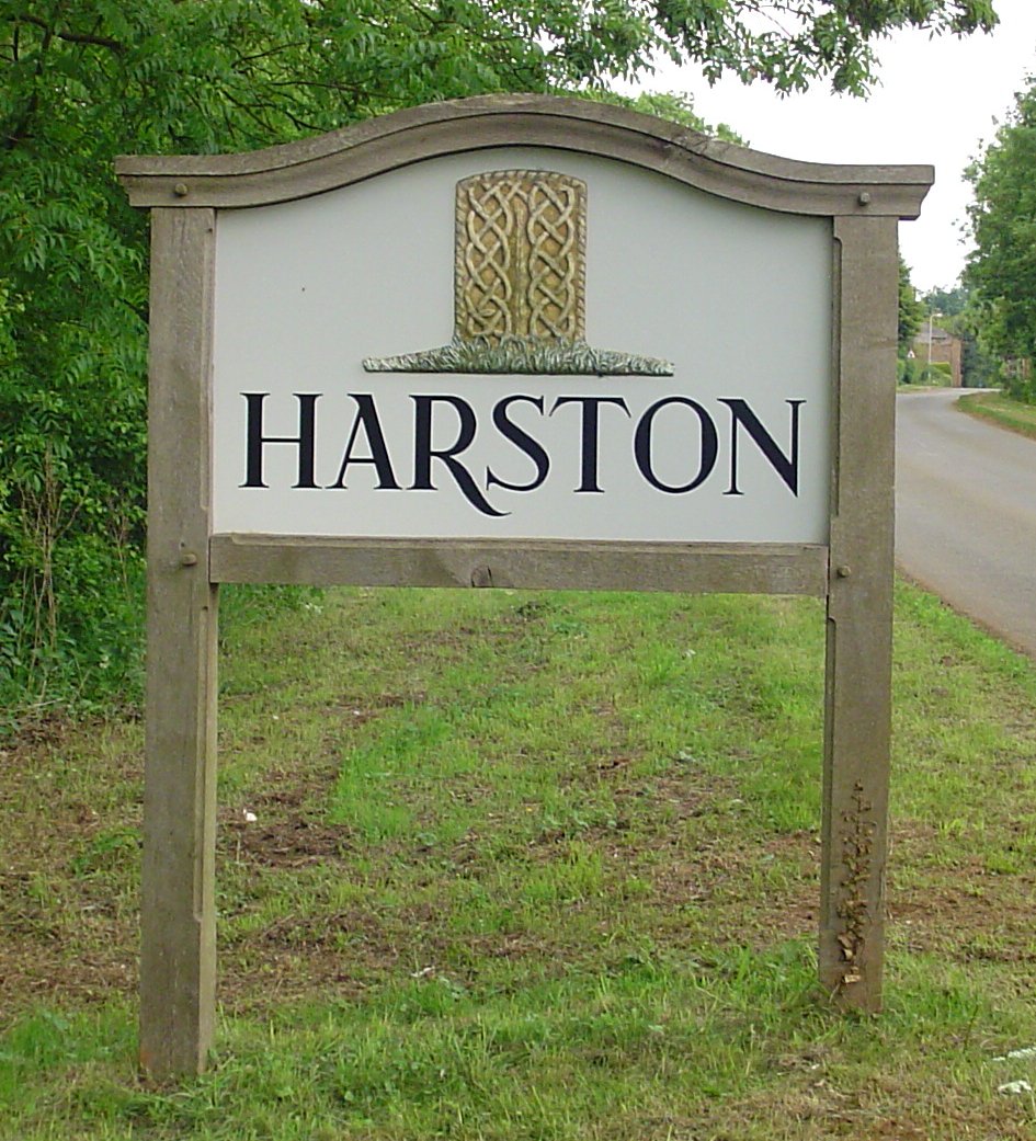
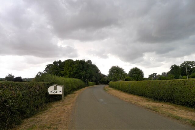
Harston, Leicestershire

Harston is a crossroads village and former civil parish, now in the parish of Belvoir, in the Melton district, in Leicestershire, England, near the border...

Belvoir Priory

Belvoir Priory (pronounced Beaver) was a Benedictine priory near to Belvoir Castle. Although once described as within Lincolnshire, it is currently located...

Nearby Amenities

Located within 500m of 52.896649,-0.74930155
Ele: 108.0330811
Lat/Long: 52.8939487/-0.7442331
Ele: 106.8312988
Lat/Long: 52.8946005/-0.7442034
Ele: 108.7540283
Lat/Long: 52.8939917/-0.7442715
Parking
Description: Patch of dirt at the side of the road
Ele: 108.5137939
Lat/Long: 52.8944961/-0.7442468
Ele: 112.0000000
Lat/Long: 52.898782/-0.7429484
Ele: 109.7154541
Lat/Long: 52.8964302/-0.7477297
Ele: 76.7905273
Lat/Long: 52.8973545/-0.7528347
Ele: 110.6766357
Lat/Long: 52.8959109/-0.7493672
Ele: 109.9556885
Lat/Long: 52.896416/-0.7475561
Barrier: stile
Ele: 110.4364014
Stile: stepover
Lat/Long: 52.896687/-0.7474577
Ele: 106.5910645
Lat/Long: 52.8948376/-0.743986
Ele: 107.7927246
Lat/Long: 52.8952723/-0.7439728
Ele: 111.6380615
Lat/Long: 52.8977557/-0.743661
Ele: 66.4562988
Lat/Long: 52.8977169/-0.7541973
Ele: 60.0000000
Lat/Long: 52.8979814/-0.7553675
Barrier: stile
Ele: 66.6966553
Steps: 2
Stile: stepover
Lat/Long: 52.8976748/-0.7541642
Ele: 102.9860840
Lat/Long: 52.8969021/-0.750957
Barrier: stile
Ele: 110.6766357
Steps: 2
Stile: stepover
Lat/Long: 52.8959274/-0.7494712
Ele: 58.5255127
Lat/Long: 52.8979483/-0.7559504
Barrier: horse_stile
Lat/Long: 52.8949272/-0.7440447
Brewer's Grave
Place: locality
Source: Bing
Lat/Long: 52.8941008/-0.7441632
Entrance: main
Lat/Long: 52.898077/-0.7556769
Entrance: yes
Lat/Long: 52.8982632/-0.7555646
Telephone
Defibrillator
Booth: K6
Covered: booth
Defibrillator Location: inside old red phone box near village hall in Woolsthorpe by Belvoir
Emergency: defibrillator
Man Made: telephone_box
Lat/Long: 52.8972338/-0.7566948
The data included in this document is from www.openstreetmap.org. The data is made available under ODbL.

Have you been to Fanny's Wood?

Leave your review of Fanny's Wood below (or comments, questions and feedback).