Ash Copse

Wood, Forest in Hampshire Hart

England

Ash Copse

Trail around Fleet Pond
Trail around Fleet Pond Credit: Mr Ignavy

Ash Copse is a woodland area located in Hampshire, England. Spanning over approximately 50 acres, it is primarily composed of ash trees, hence its name. The copse can be found near the village of Ashurst, in the New Forest district.

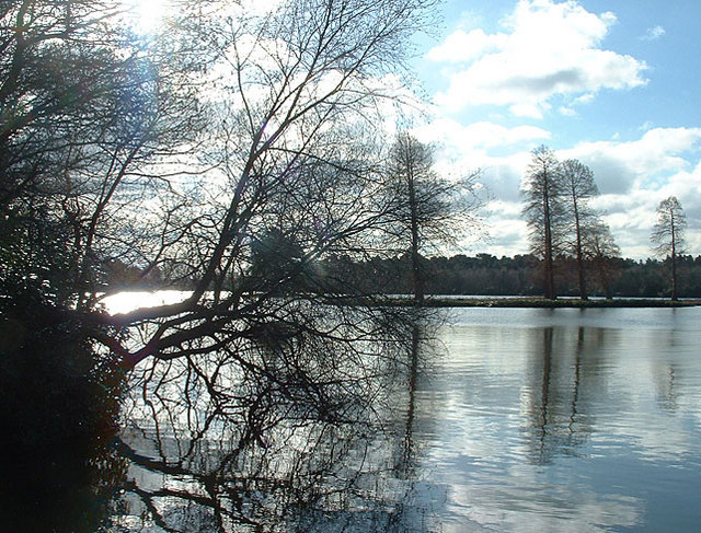
The woodland is characterized by its dense and diverse vegetation, with a variety of trees, shrubs, and plants. In addition to ash trees, there are also oak, beech, and birch trees present. The forest floor is covered with a carpet of bluebells and other wildflowers, creating a picturesque and vibrant scene during the spring months.

Ash Copse is home to a rich array of wildlife. Numerous bird species can be spotted, including woodpeckers, warblers, and finches. Mammals such as deer, foxes, and rabbits are also commonly seen in the area. The copse provides a suitable habitat for these animals, offering shelter, food, and protection.

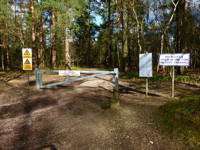
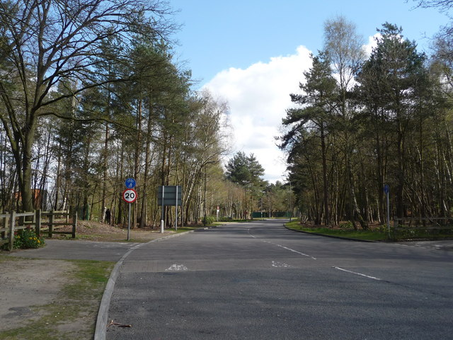
The woodland is a popular destination for nature enthusiasts, hikers, and photographers. There are several walking trails that wind through the copse, allowing visitors to explore its beauty and tranquility. These trails offer opportunities for birdwatching, wildlife spotting, and enjoying the peaceful surroundings.

Ash Copse is managed by local authorities and conservation organizations to preserve its natural beauty and protect its wildlife. Efforts are made to maintain the delicate balance of the ecosystem and promote biodiversity.

Overall, Ash Copse is a stunning woodland area in Hampshire, offering a peaceful retreat and a chance to connect with nature.

If you have any feedback on the listing, please let us know in the comments section below.

Ash Copse Images

Images are sourced within 2km of 51.294608/-0.80322459 or Grid Reference SU8355. Thanks to Geograph Open Source API. All images are credited.

Trail around Fleet Pond
Access track for slipway See <a href="https://www.geograph.org.uk/photo/7674419">SU8255 : Slipway for Fleet Pond</a>.
Access track for slipway
Looking across Fleet Pond The two ponds were created during the 12th century when embankments were built across the low-lying land on Crookham Common to form two large fish ponds. Once stocked with fish the ponds attracted wildfowl and became an important food source for the local population.
Throughout the 13th & 14th century the ponds were managed by local monks.
In 1491 the ponds were leased to the tenant farmer of Fleet Farm for an annual rent of "one hundred fishes supplied fresh to Winchester".
Fast forward to 1904 and a new railway station was built by the ponds. In 1912 Geoffrey de Havilland conducted floatplane trials on the main pond.
During the second world war the ponds were drained and planted with willow to stop them being used as a marker for the Luftwaffe trying to bomb the RAE at Farnborough. The ponds were refilled in 1947 and reeds planted.
In 1973 Fleet Urban District Council purchased the ponds for £10,000; ownership was subsequently transferred to Hart District Council.
In 1976 the Fleet Pond Society was formed and by 1985 the circular footpath along with bridges and walkways was completed.
Looking across Fleet Pond
The two ponds were created during the 12th century when embankments were built across the low-lying land on Crookham Common to form two large fish ponds. Once stocked with fish the ponds attracted wildfowl and became an important food source for the local population. Throughout the 13th & 14th century the ponds were managed by local monks. In 1491 the ponds were leased to the tenant farmer of Fleet Farm for an annual rent of "one hundred fishes supplied fresh to Winchester". Fast forward to 1904 and a new railway station was built by the ponds. In 1912 Geoffrey de Havilland conducted floatplane trials on the main pond. During the second world war the ponds were drained and planted with willow to stop them being used as a marker for the Luftwaffe trying to bomb the RAE at Farnborough. The ponds were refilled in 1947 and reeds planted. In 1973 Fleet Urban District Council purchased the ponds for £10,000; ownership was subsequently transferred to Hart District Council. In 1976 the Fleet Pond Society was formed and by 1985 the circular footpath along with bridges and walkways was completed.
Path around Fleet Pond The two ponds were created during the 12th century when embankments were built across the low-lying land on Crookham Common to form two large fish ponds. Once stocked with fish the ponds attracted wildfowl and became an important food source for the local population.
Throughout the 13th & 14th century the ponds were managed by local monks.
In 1491 the ponds were leased to the tenant farmer of Fleet Farm for an annual rent of "one hundred fishes supplied fresh to Winchester".
Fast forward to 1904 and a new railway station was built by the ponds. In 1912 Geoffrey de Havilland conducted floatplane trials on the main pond.
During the second world war the ponds were drained and planted with willow to stop them being used as a marker for the Luftwaffe trying to bomb the RAE at Farnborough. The ponds were refilled in 1947 and reeds planted.
In 1973 Fleet Urban District Council purchased the ponds for £10,000; ownership was subsequently transferred to Hart District Council.
In 1976 the Fleet Pond Society was formed and by 1985 the circular footpath along with bridges and walkways was completed.
Path around Fleet Pond
The two ponds were created during the 12th century when embankments were built across the low-lying land on Crookham Common to form two large fish ponds. Once stocked with fish the ponds attracted wildfowl and became an important food source for the local population. Throughout the 13th & 14th century the ponds were managed by local monks. In 1491 the ponds were leased to the tenant farmer of Fleet Farm for an annual rent of "one hundred fishes supplied fresh to Winchester". Fast forward to 1904 and a new railway station was built by the ponds. In 1912 Geoffrey de Havilland conducted floatplane trials on the main pond. During the second world war the ponds were drained and planted with willow to stop them being used as a marker for the Luftwaffe trying to bomb the RAE at Farnborough. The ponds were refilled in 1947 and reeds planted. In 1973 Fleet Urban District Council purchased the ponds for £10,000; ownership was subsequently transferred to Hart District Council. In 1976 the Fleet Pond Society was formed and by 1985 the circular footpath along with bridges and walkways was completed.
Footbridge by Fleet Pond The stream flows from the Basingstoke canal, to the right, into Fleet Pond, to the left.
Footbridge by Fleet Pond
The stream flows from the Basingstoke canal, to the right, into Fleet Pond, to the left.
Footpath to Avondale Road
After the rush hour - Fleet Station
Hawley From the road bridge at J4A in the M3, looking southwest across the middle of the square.
Hawley
From the road bridge at J4A in the M3, looking southwest across the middle of the square.
Rafborough The famous Monkey Puzzle roundabout (with the tree in the background) just north of Farnborough Aerodrome in Hampshire.
Rafborough
The famous Monkey Puzzle roundabout (with the tree in the background) just north of Farnborough Aerodrome in Hampshire.
Farnborough, Hants Looking south towards Farnborough Aerodrome and the Frank Whittle Memorial jet aircraft on the plinth outside the gate.
Farnborough, Hants
Looking south towards Farnborough Aerodrome and the Frank Whittle Memorial jet aircraft on the plinth outside the gate.
Fleet Pond from the north east Pleasant place to visit.
Fleet Pond from the north east
Pleasant place to visit.
M3 Motorway and Ancells Business Park, Fleet This square has the M3 motorway passing through it, but is otherwise made up of fields and woods used for MOD training. Ancells Business Park occupies part of the SW section, this photo shows some of its buildings in the distance, taken from the disused bridge crossing the motorway.
M3 Motorway and Ancells Business Park, Fleet
This square has the M3 motorway passing through it, but is otherwise made up of fields and woods used for MOD training. Ancells Business Park occupies part of the SW section, this photo shows some of its buildings in the distance, taken from the disused bridge crossing the motorway.
Kenilworth Road Kenilworth Road at midnight during lightning storm in September 2005.
Kenilworth Road
Kenilworth Road at midnight during lightning storm in September 2005.
Nokia Southwood Familiar to anyone heading to the M3 from Southwood is the entrance to the large Nokia site.
Photograph taken with Sony Cybershot DSC-U30.
Nokia Southwood
Familiar to anyone heading to the M3 from Southwood is the entrance to the large Nokia site. Photograph taken with Sony Cybershot DSC-U30.
Hawley Lake and sailing club near M3J4a A bleak winter's day at the lake; a cormorant stretches its wings, optimistic ducks stay close.
Hawley Lake and sailing club near M3J4a
A bleak winter's day at the lake; a cormorant stretches its wings, optimistic ducks stay close.
Hawley Lake in Winter, 2006 Wonderful place for dog-walking (unless yours leaps into water) but look out for any soldiers in camouflage or you might not even notice them!
Hawley Lake in Winter, 2006
Wonderful place for dog-walking (unless yours leaps into water) but look out for any soldiers in camouflage or you might not even notice them!
Show me another place!

Ash Copse is located at Grid Ref: SU8355 (Lat: 51.294608, Lng: -0.80322459)

Administrative County: Hampshire

District: Hart

Police Authority: Hampshire

What 3 Words

///sprinter.edgy.embodied. Near Fleet, Hampshire

Nearby Locations

Ash Copse Ethy Copse

Related Wikis

Fleet Spurs F.C.

Fleet Spurs Football Club are a football club based in Fleet, England. They play in the Hampshire Premier League Senior Division. The club is affiliated...

South East England

South East England is one of the nine official regions of England in the United Kingdom at the first level of ITL for statistical purposes. It consists...

Cove, Hampshire

Cove is an ancient village turned suburb, forming the western part of Farnborough in the county of Hampshire in the south-east of England. The appropriate...

Bramshot Halt railway station

Bramshot Halt railway station served the adjacent Bramshot Golf Course from 1913 to 1946 on the London and Southampton Railway and was located between...

Foxlease and Ancells Meadows

Foxlease and Ancells Meadows is a 68.8-hectare (170-acre) biological Site of Special Scientific Interest on the western outskirts of Farnborough in Hampshire...

Southwood Camp

Southwood Camp was a military installation at Southwood in Hampshire. == History == The camp was completed in 1939 and was used by Canadian signals and...

Ancells Farm

Ancells Farm is a 12-hectare (30-acre) nature reserve in Fleet in Hampshire. It is managed by the Hampshire and Isle of Wight Wildlife Trust. It is part...

Guillemont Barracks

Guillemont Barracks, located just off of junction 4a of the M3, on the Minley Road (A327), was a military installation at Minley in Hampshire. == History... ==

Nearby Amenities

Located within 500m of 51.294608,-0.80322459
Crossing
Bicycle: yes
Crossing: unmarked
Crossing Island: yes
Kerb: lowered
Sloped Curb: yes
Tactile Paving: yes
Lat/Long: 51.2916817/-0.7998029
Crossing
Bicycle: yes
Crossing Island: yes
Kerb: lowered
Sloped Curb: yes
Lat/Long: 51.2916234/-0.799813
Crossing
Bicycle: yes
Crossing: unmarked
Crossing Island: yes
Crossing Markings: no
Kerb: lowered
Tactile Paving: yes
Lat/Long: 51.2936914/-0.7967923
Traffic Signals
Source: seen on journey
Traffic Signals Direction: backward
Lat/Long: 51.2941389/-0.8033263
Crossing
Bicycle: yes
Crossing Island: yes
Kerb: lowered
Sloped Curb: yes
Lat/Long: 51.2920513/-0.7980638
Barrier: kerb
Kerb: flush
Tactile Paving: yes
Lat/Long: 51.2914795/-0.80065
Crossing
Bicycle: dismount
Crossing Island: yes
Kerb: lowered
Sloped Curb: yes
Lat/Long: 51.2918877/-0.7992911
Crossing
Bicycle: dismount
Crossing Island: yes
Kerb: lowered
Sloped Curb: yes
Lat/Long: 51.2919052/-0.7992078
Crossing
Bicycle: yes
Crossing: unmarked
Crossing Island: yes
Kerb: lowered
Sloped Curb: yes
Tactile Paving: yes
Lat/Long: 51.2917606/-0.7988195
Crossing
Bicycle: yes
Crossing: unmarked
Crossing Island: yes
Kerb: lowered
Sloped Curb: yes
Tactile Paving: yes
Lat/Long: 51.2918416/-0.7989064
Crossing
Bicycle: yes
Crossing: unmarked
Crossing Island: no
Kerb: lowered
Sloped Curb: yes
Tactile Paving: yes
Lat/Long: 51.2914834/-0.8007059
Barrier: bollard
Lat/Long: 51.2922667/-0.7979167
Crossing
Bicycle: yes
Crossing: unmarked
Crossing Island: no
Kerb: lowered
Sloped Curb: yes
Tactile Paving: yes
Lat/Long: 51.2910438/-0.8033774
Crossing
Bicycle: yes
Crossing: uncontrolled
Crossing Island: yes
Kerb: lowered
Sloped Curb: yes
Tactile Paving: yes
Lat/Long: 51.2915091/-0.8018033
Crossing
Bicycle: yes
Crossing: uncontrolled
Crossing Island: yes
Kerb: lowered
Sloped Curb: yes
Tactile Paving: yes
Lat/Long: 51.2916141/-0.8018346
Barrier: bollard
Bicycle: yes
Foot: yes
Horse: yes
Lat/Long: 51.2912849/-0.8036946
Barrier: cycle_barrier
Lat/Long: 51.2960502/-0.8088761
Barrier: bollard
Lat/Long: 51.2917874/-0.8017465
Purple Bike Shed
Addr Housenumber: 15
Addr Postcode: GU14 0QS
Addr Street: Oldwood Chase
Shop: bicycle
Source: www.purplebikeshed.com
Website: https://www.purplebikeshed.com/
Lat/Long: 51.2918775/-0.7980356
Post Box
Collection Times: Mo-Fr 09:00; Sa 07:00
Ref: GU14 72D
Royal Cypher: EIIR
Royal Cypher Wikidata: Q33102113
Lat/Long: 51.2935925/-0.7993222
Give Way
Lat/Long: 51.2921592/-0.7993228
Give Way
Lat/Long: 51.2924989/-0.79954
Crossing
Lat/Long: 51.2924239/-0.7969572
Parking Entrance
Lat/Long: 51.2927946/-0.7990893
Parking Entrance
Lat/Long: 51.2925531/-0.8012929
Barrier: cycle_barrier
Lat/Long: 51.2918799/-0.7983224
Barrier: bollard
Lat/Long: 51.2924601/-0.8028452
Barrier: bollard
Lat/Long: 51.2922887/-0.8026068
Bus Stop
BMW UK
Bus: yes
Public Transport: platform
Shelter: yes
Lat/Long: 51.2921766/-0.7977347
Bus Stop
BMW UK
Bench: no
Bin: no
Bus: yes
Departures Board: timetable
Lit: yes
Public Transport: platform
Shelter: no
Tactile Paving: no
Lat/Long: 51.291941/-0.7983385
Barrier: cattle_grid
Lat/Long: 51.2922678/-0.8042006
Barrier: cattle_grid
Lat/Long: 51.2932099/-0.8068875
The Bungalow
Building: house
Source: OS_OpenData_StreetView
Lat/Long: 51.2983154/-0.8064223
Traffic Calming: island
Lat/Long: 51.2932004/-0.8060763
Crossing
Crossing: uncontrolled
Kerb: lowered
Sloped Curb: yes
Traffic Calming: choker
Lat/Long: 51.2942239/-0.7962151
Barrier: bollard
Lat/Long: 51.2936237/-0.796783
Traffic Signals
Source: guess
Traffic Signals Direction: backward
Lat/Long: 51.293981/-0.8031273
Traffic Signals
Source: seen on journey
Traffic Signals Direction: backward
Lat/Long: 51.2940838/-0.8028115
Car Wash
Access: private
Lat/Long: 51.292822/-0.8005804
Crossing
Kerb: lowered
Lat/Long: 51.2924785/-0.8002651
Entrance: yes
Lat/Long: 51.2923239/-0.7992303
Access: private
Entrance: main
Lat/Long: 51.2925608/-0.7998386
Entrance: main
Lat/Long: 51.2922245/-0.8003202
Access: private
Entrance: yes
Lat/Long: 51.2921315/-0.801302
BMW Financial Services
Addr Housenumber: 1
Addr Street: Summit Avenue
Office: financial
Opening Hours: Mo-Fr 09:00-17:00
Short Name: BMW FS GB
Website: https://www.bmw.co.uk/finance
Lat/Long: 51.2921531/-0.8008174
Restaurant
Access: customers
Cuisine: regional;sandwich
Internet Access: wlan
Opening Hours: Mo-Fr 08:00-16:00
Operator: Graysons
Self Service: yes
Takeaway: yes
Lat/Long: 51.2925227/-0.7984062
Give Way
Direction: forward
Lat/Long: 51.2923872/-0.8001504
Bus Stop
Trunk Road
Bench: no
Bus: yes
Departures Board: no
Lit: yes
Naptan AtcoCode: 1900HAA91478
Naptan NaptanCode: hamjtgjm
Public Transport: platform
Shelter: no
Lat/Long: 51.2937088/-0.7962008
Entrance: yes
Level: 1
Lat/Long: 51.292474/-0.8013001
Access: private
Entrance: yes
Lat/Long: 51.2923436/-0.8012655
Entrance: staircase
Lat/Long: 51.2926189/-0.8013096
Crossing
Lat/Long: 51.2927848/-0.7970329
Bench
Backrest: yes
Lat/Long: 51.2923631/-0.8018409
Bench
Backrest: yes
Lat/Long: 51.2923233/-0.8019832
Bench
Backrest: yes
Lat/Long: 51.2922142/-0.802024
Smoking Area
Bin: yes
Shelter: yes
Lat/Long: 51.2924088/-0.8014346
Traffic Signals
Source: seen on journey
Traffic Signals Direction: backward
Lat/Long: 51.2942123/-0.8033229
Traffic Signals
Source: seen on journey
Traffic Signals Direction: backward
Lat/Long: 51.2939736/-0.8032297
Traffic Signals
Source: seen on journey
Traffic Signals Direction: backward
Lat/Long: 51.2940078/-0.8027633
Man Made: mast
Lat/Long: 51.2928956/-0.8066422
Restaurant
Access: customers
Cuisine: buffet;regional
Level: 0
Opening Hours: Mo-Fr 08:00-16:00
Operator: Graysons
Outdoor Seating: yes
Payment Cash: only
Self Service: yes
Takeaway: yes
Lat/Long: 51.2922335/-0.8012755
Crossing
Crossing: zebra
Lat/Long: 51.2925687/-0.7993793
Entrance: staircase
Lat/Long: 51.2928832/-0.7991118
Entrance: staircase
Motorcar: no
Lat/Long: 51.2928027/-0.7985255
Entrance: yes
Lat/Long: 51.2926177/-0.7984792
Entrance: staircase
Lat/Long: 51.2930256/-0.797666
Shop: deli
Lat/Long: 51.2931705/-0.8053062
Smoking Area
Lat/Long: 51.2925925/-0.7979927
Entrance: yes
Lat/Long: 51.2924467/-0.802309
Leisure: bird_hide
Lat/Long: 51.2918568/-0.8007949
Bus Stop
Trunk Road
Bench: no
Bin: no
Bus: yes
Departures Board: no
Public Transport: platform
Shelter: no
Tactile Paving: no
Lat/Long: 51.2936724/-0.7974348
Cafe
Isetta Cafe
Cuisine: coffee_shop
Internet Access: wlan
Level: 2
Outdoor Seating: no
Takeaway: yes
Lat/Long: 51.2927622/-0.7999316
Traffic Sign: maxspeed
Lat/Long: 51.2923654/-0.8000559
Life Ring
Emergency: life_ring
Lat/Long: 51.2922125/-0.8015564
Access: private
Entrance: service
Lat/Long: 51.2925826/-0.7988445
Alphera
Full Name: Alphera Financial Services
Office: financial
Lat/Long: 51.292296/-0.8007837
Barrier: yes
Lat/Long: 51.2922177/-0.8003916
Access: private
Entrance: yes
Lat/Long: 51.2924067/-0.7982817
Barrier: yes
Lat/Long: 51.2923291/-0.7991714
Access: private
Entrance: yes
Lat/Long: 51.2925959/-0.7999087
Access: private
Entrance: yes
Lat/Long: 51.2926087/-0.7997641
Charging Station
Capacity: 1
Lat/Long: 51.292339/-0.7994625
Charging Station
Capacity: 1
Lat/Long: 51.2923004/-0.7994532
Charging Station
Capacity: 1
Lat/Long: 51.2922061/-0.8000426
Charging Station
Capacity: 1
Lat/Long: 51.2922484/-0.8000528
Bramshot Farm Country Park
Leisure: park
Lat/Long: 51.2958954/-0.8054125
Generator Method: photovoltaic
Generator Output Electricity: yes
Generator Source: solar
Generator Type: solar_photovoltaic_panel
Location: roof
Power: generator
Lat/Long: 51.2959416/-0.797066
Generator Method: photovoltaic
Generator Output Electricity: yes
Generator Source: solar
Generator Type: solar_photovoltaic_panel
Location: roof
Power: generator
Lat/Long: 51.2957856/-0.7979323
Crossing
Crossing: marked
Tactile Paving: yes
Lat/Long: 51.2934773/-0.8044225
Crossing
Crossing: marked
Lat/Long: 51.2936563/-0.80387
Information: map
Operator: Hart District Council
Tourism: information
Lat/Long: 51.2909094/-0.8031978
Information: guidepost
Tourism: information
Lat/Long: 51.291063/-0.8012278
Bench
Backrest: yes
Material: wood
Seats: 5
Lat/Long: 51.2907724/-0.8023408
Barrier: kissing_gate
Lat/Long: 51.2915006/-0.8007959
Barrier: kissing_gate
Lat/Long: 51.2909382/-0.8032137
Crossing
Crossing: marked
Lat/Long: 51.293837/-0.8040375
Crossing
Crossing: marked
Lat/Long: 51.2937444/-0.8037521
Give Way
Direction: forward
Lat/Long: 51.2939182/-0.8040582
Crossing
Crossing: marked
Lat/Long: 51.2938914/-0.8040416
Charging Station
Instavolt Fleet
Addr Street: Cove Road
Description: 125kW
Lat/Long: 51.2935587/-0.8039621
Bus Stop
Cove Services
Bench: no
Bin: no
Bus: yes
Departures Board: timetable
Lit: yes
Public Transport: platform
Shelter: no
Tactile Paving: no
Lat/Long: 51.2932013/-0.8032192
Bus Stop
Cove Services
Bench: no
Bin: no
Bus: yes
Lit: yes
Public Transport: platform
Shelter: no
Tactile Paving: no
Lat/Long: 51.2931126/-0.8032956
Give Way
Lat/Long: 51.2937946/-0.7962004
Direction: 170
Generator Method: photovoltaic
Generator Output Electricity: yes
Generator Solar Modules: 18
Generator Source: solar
Generator Type: solar_photovoltaic_panel
Location: roof
Power: generator
Lat/Long: 51.2931381/-0.8092947
The data included in this document is from www.openstreetmap.org. The data is made available under ODbL.

Have you been to Ash Copse?

Leave your review of Ash Copse below (or comments, questions and feedback).