Beanland's Plantation

Wood, Forest in Lincolnshire West Lindsey

England

Beanland's Plantation

Bench Mark Marton White Swan Bench Mark Marton White Swan, Stow Park Rd 30m up from junction with A156.
Bench Mark Marton White Swan Credit: Mike Price

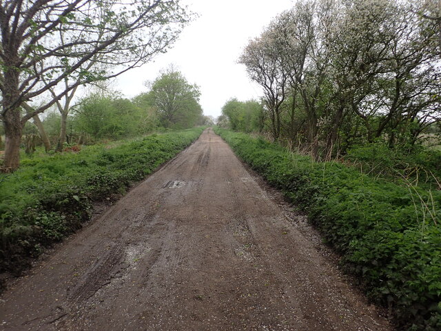
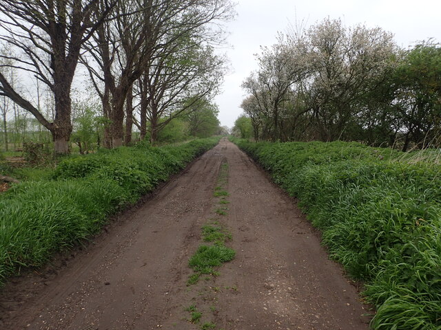
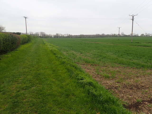
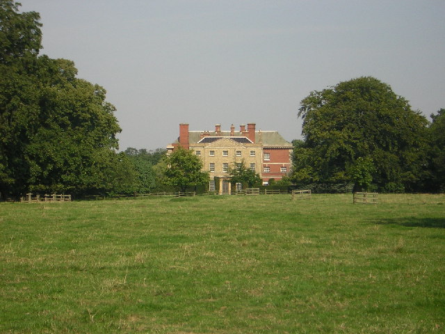
Beanland's Plantation is a picturesque woodland area located in Lincolnshire, England. It stretches across several acres, providing a serene and tranquil environment for visitors to immerse themselves in nature. Known for its dense forest cover, the plantation is home to a diverse range of plant species, including oak, beech, birch, and pine trees.

The woodland is characterized by its rich biodiversity and serves as a habitat for various wildlife species. It is not uncommon to spot squirrels, rabbits, and numerous bird species such as woodpeckers and owls within the plantation. The presence of a small stream running through the plantation adds to its natural charm and provides a refreshing ambiance.

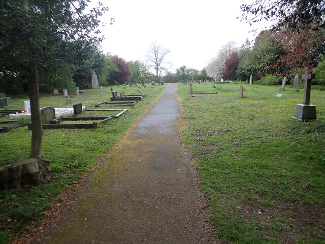
Visitors can explore the plantation through a network of well-maintained walking trails, allowing them to experience the beauty of the woodland up close. The trails are suitable for all ages and offer a peaceful retreat from the hustle and bustle of everyday life. In addition, the plantation provides picnic areas and benches, enabling visitors to relax and enjoy the surroundings.

Beanland's Plantation also hosts educational programs and workshops focused on environmental conservation and the importance of forests. These initiatives aim to raise awareness about the significance of preserving natural habitats and promoting sustainable practices.

Overall, Beanland's Plantation in Lincolnshire is a haven for nature enthusiasts and offers a perfect escape for those seeking solace amidst the beauty of a well-preserved woodland.

If you have any feedback on the listing, please let us know in the comments section below.

Beanland's Plantation Images

Images are sourced within 2km of 53.342948/-0.74949972 or Grid Reference SK8383. Thanks to Geograph Open Source API. All images are credited.

Bench Mark Marton White Swan Bench Mark Marton White Swan, Stow Park Rd 30m up from junction with A156.
Bench Mark Marton White Swan
Bench Mark Marton White Swan, Stow Park Rd 30m up from junction with A156.
Littleborough Lane Littleborough Lane starts off as a normal road in the village of Marton but beyond the last house, as seen here, it becomes a rough track on its way to the River Trent. For more about Littleborough Lane see <a title="www.geograph.org.uk/photo/6686918" href="https://www.geograph.org.uk/photo/6686918">Link</a>
Littleborough Lane
Littleborough Lane starts off as a normal road in the village of Marton but beyond the last house, as seen here, it becomes a rough track on its way to the River Trent. For more about Littleborough Lane see Link
Sunset over West Burton Power Station This view is from Gainsborough Road near Lea Fields Crematorium. The power station is just the other side of the River Trent. For a close up see <a title="www.geograph.org.uk/photo/3867796" href="https://www.geograph.org.uk/photo/3867796">Link</a>
Sunset over West Burton Power Station
This view is from Gainsborough Road near Lea Fields Crematorium. The power station is just the other side of the River Trent. For a close up see Link
Marton Cemetery Marton Cemetery is on Trent Port Road which leads from Marton Church to Trent Port.
Marton Cemetery
Marton Cemetery is on Trent Port Road which leads from Marton Church to Trent Port.
St Margaret's Church, Marton St Margaret's Church has a Saxon tower with herring-bone masonry and a Norman Arcade. There is an unusual collection of Anglo-Scandinavian stone sculptures built into the fabric of the church, including a cross-head, a cross base and fragments of grave covers which all date from between 920 AD and 970 AD.
St Margaret's Church, Marton
St Margaret's Church has a Saxon tower with herring-bone masonry and a Norman Arcade. There is an unusual collection of Anglo-Scandinavian stone sculptures built into the fabric of the church, including a cross-head, a cross base and fragments of grave covers which all date from between 920 AD and 970 AD.
Littleborough Lane Littleborough Lane starts off as a normal road in the village of Marton but beyond the last house, as seen here, it becomes a rough track on its way to the River Trent. For more about Littleborough Lane see <a title="www.geograph.org.uk/photo/6686918" href="https://www.geograph.org.uk/photo/6686918">Link</a>
Littleborough Lane
Littleborough Lane starts off as a normal road in the village of Marton but beyond the last house, as seen here, it becomes a rough track on its way to the River Trent. For more about Littleborough Lane see Link
St Mary's Church, Marton St Margaret's Church has a Saxon tower with herring-bone masonry and a Norman Arcade. There is an unusual collection of Anglo-Scandinavian stone sculptures built into the fabric of the church, including a cross-head, a cross base and fragments of grave covers which all date from between 920 AD and 970 AD.
St Mary's Church, Marton
St Margaret's Church has a Saxon tower with herring-bone masonry and a Norman Arcade. There is an unusual collection of Anglo-Scandinavian stone sculptures built into the fabric of the church, including a cross-head, a cross base and fragments of grave covers which all date from between 920 AD and 970 AD.
Stow Park Road Just ahead is the junction with High Street in the centre of Marton.
Stow Park Road
Just ahead is the junction with High Street in the centre of Marton.
Footpath to Willingham Road This footpath leads the short distance from Stow Park Road past a new housing development to reach Willingham Road, just beyond the trees in the distance.
Footpath to Willingham Road
This footpath leads the short distance from Stow Park Road past a new housing development to reach Willingham Road, just beyond the trees in the distance.
Footpath to Willingham Road This footpath leads the short distance from Stow Park Road past a new housing development to reach Willingham Road, just beyond the trees in the distance. Beyond those, Burton Wood can be seen.
Footpath to Willingham Road
This footpath leads the short distance from Stow Park Road past a new housing development to reach Willingham Road, just beyond the trees in the distance. Beyond those, Burton Wood can be seen.
Knaith Hall Regency Gothick exterior belies Tudor origins - see the 5 chimneys ! A delightful house overlooking the Trent
Knaith Hall
Regency Gothick exterior belies Tudor origins - see the 5 chimneys ! A delightful house overlooking the Trent
Gate Burton Hall In lovely parkland, Gate Burton Hall dates from 1774 with early 20th century additions all round.
Gate Burton Hall
In lovely parkland, Gate Burton Hall dates from 1774 with early 20th century additions all round.
St.Helen's church, Gate Burton, Lincs. Entirely Victorian church of 1866 with a Norman font
St.Helen's church, Gate Burton, Lincs.
Entirely Victorian church of 1866 with a Norman font
St.Mary's church, Knaith, Lincs. A fragment of a Cistercian nunnery dating back to the 11th century now the parish church of St.Mary
St.Mary's church, Knaith, Lincs.
A fragment of a Cistercian nunnery dating back to the 11th century now the parish church of St.Mary
Lincoln to Retford line Looking north across Gate Burton parish from Willingham Road bridge, the line leads to Gainsborough and on to join the main GNER London to Edinburgh line at Retford
Lincoln to Retford line
Looking north across Gate Burton parish from Willingham Road bridge, the line leads to Gainsborough and on to join the main GNER London to Edinburgh line at Retford
The Chateau By Rotherham architect John Platt in 1747 when he was just 19 years old. Standing on a grassy knoll by the River Trent it was originally a weekend retreat for a Gainsborough lawyer but was sadly derelict until rescued by The Landmark Trust and now available for rent as a holiday home <span class="nowrap"><a title="http://www.landmarktrust.org.uk/" rel="nofollow ugc noopener" href="http://www.landmarktrust.org.uk/">Link</a><img style="margin-left:2px;" alt="External link" title="External link - shift click to open in new window" src="https://s1.geograph.org.uk/img/external.png" width="10" height="10"/></span>
The Chateau
By Rotherham architect John Platt in 1747 when he was just 19 years old. Standing on a grassy knoll by the River Trent it was originally a weekend retreat for a Gainsborough lawyer but was sadly derelict until rescued by The Landmark Trust and now available for rent as a holiday home LinkExternal link
Littleborough Church, Notts Littleborough was the Roman town of Segelocum, it is the site of a ford, crossing the River Trent.
Littleborough Church, Notts
Littleborough was the Roman town of Segelocum, it is the site of a ford, crossing the River Trent.
Track to Norbury Hills View eastwards from Gainsborough Road near Knaith
Track to Norbury Hills
View eastwards from Gainsborough Road near Knaith
Show me another place!

Beanland's Plantation is located at Grid Ref: SK8383 (Lat: 53.342948, Lng: -0.74949972)

Administrative County: Lincolnshire

District: West Lindsey

Police Authority: Lincolnshire

What 3 Words

///ramp.sisters.tweed. Near Willingham, Lincolnshire

Nearby Locations

Beanland's Plantation

Related Wikis

A156 road

The A156 is an 11 miles (18 km) long road that runs from the A57 near Saxilby and heads north to Gainsborough. The road runs entirely within Lincolnshire...

Gate Burton

Gate Burton (sometimes called Burton Gate), is a village and civil parish in the West Lindsey district of Lincolnshire, England. It is situated 4 miles...

Knaith

Knaith is a village and civil parish about 3 miles (5 km) south of the town of Gainsborough in the West Lindsey district of Lincolnshire, England. The...

Littleborough, Nottinghamshire

Littleborough is a village and former civil parish, now in the parish of Sturton le Steeple, in the Bassetlaw district, in the county of Nottinghamshire...

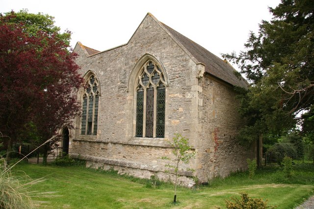
St Nicholas Church, Littleborough

St Nicholas Church is a redundant Anglican church in the hamlet of Littleborough, Nottinghamshire, England. It is recorded in the National Heritage List...

Marton, Lincolnshire

Marton is a village and civil parish in the West Lindsey district of Lincolnshire, England. It is situated at the junction between the A156 and the A1500...

Lea railway station

Lea railway station was a station in Lea, Lincolnshire, England, south of Gainsborough. It was opened in 1849 by the Great Northern Railway, but was closed...

Heynings Priory

Heynings Priory was a priory in Knaith, Lincolnshire, England. The priory of Heynings was founded by Rayner de Evermue, Lord of Knaith, for Cistercian...

Related Videos

MARTON: West Lindsey Parish #37 of 128

In Roman times, this was a way station, slightly north of the larger Roman fort at Torksey. Torksey as we learned there, is at the ...

KNAITH: West Lindsey Parish #35 of 128

This is one of those that's split into two distinct parts and Heynings is an important name to this parish. That's because of Heynings ...

GATE BURTON: West Lindsey Parish #36 of 128

This is a very short video, owing to the fact that I can't film all of this one. The main public roads are the A156, the very same that ...

Nearby Amenities

Located within 500m of 53.342948,-0.74949972
Burton Chateau
Place: isolated_dwelling
Lat/Long: 53.3411725/-0.754953
Chateau Cottage
Place: isolated_dwelling
Lat/Long: 53.3421226/-0.7554331
Rose Cottage
Place: isolated_dwelling
Lat/Long: 53.3404574/-0.7464075
The data included in this document is from www.openstreetmap.org. The data is made available under ODbL.

Have you been to Beanland's Plantation?

Leave your review of Beanland's Plantation below (or comments, questions and feedback).