Churchill Spinney
Wood, Forest in Northamptonshire
England
Churchill Spinney

Churchill Spinney is a small woodland area located in Northamptonshire, England. Situated near the village of Woodford, it covers an area of approximately 10 acres and is a popular destination for nature enthusiasts and hikers.
The spinney is characterized by its dense forest of predominantly deciduous trees, including oak, beech, and birch. These trees provide a rich habitat for a variety of wildlife, such as squirrels, rabbits, and numerous species of birds. The forest floor is covered with a thick carpet of moss, ferns, and wildflowers, adding to the area's natural beauty.
There are several well-maintained footpaths that wind through the spinney, allowing visitors to explore its serene surroundings. These paths offer peaceful walks, with the sound of birdsong and rustling leaves providing a calming atmosphere. The spinney also features a small stream that meanders through the woodland, adding to its picturesque charm.
Churchill Spinney is a haven for nature lovers, offering a tranquil escape from the hustle and bustle of everyday life. It provides opportunities for outdoor activities such as birdwatching, photography, and picnicking. The area is particularly stunning during the autumn months when the foliage transforms into a vibrant display of oranges, yellows, and reds.
Overall, Churchill Spinney is a delightful woodland retreat, offering a glimpse into the natural beauty of Northamptonshire. Its dense forest, diverse wildlife, and peaceful ambiance make it an ideal destination for those seeking a connection with nature.
If you have any feedback on the listing, please let us know in the comments section below.
Churchill Spinney Images
Images are sourced within 2km of 52.376266/-0.78041855 or Grid Reference SP8376. Thanks to Geograph Open Source API. All images are credited.


Churchill Spinney is located at Grid Ref: SP8376 (Lat: 52.376266, Lng: -0.78041855)
Unitary Authority: North Northamptonshire
Police Authority: Northamptonshire
What 3 Words
///flotation.promises.slim. Near Broughton, Northamptonshire
Nearby Locations
Related Wikis
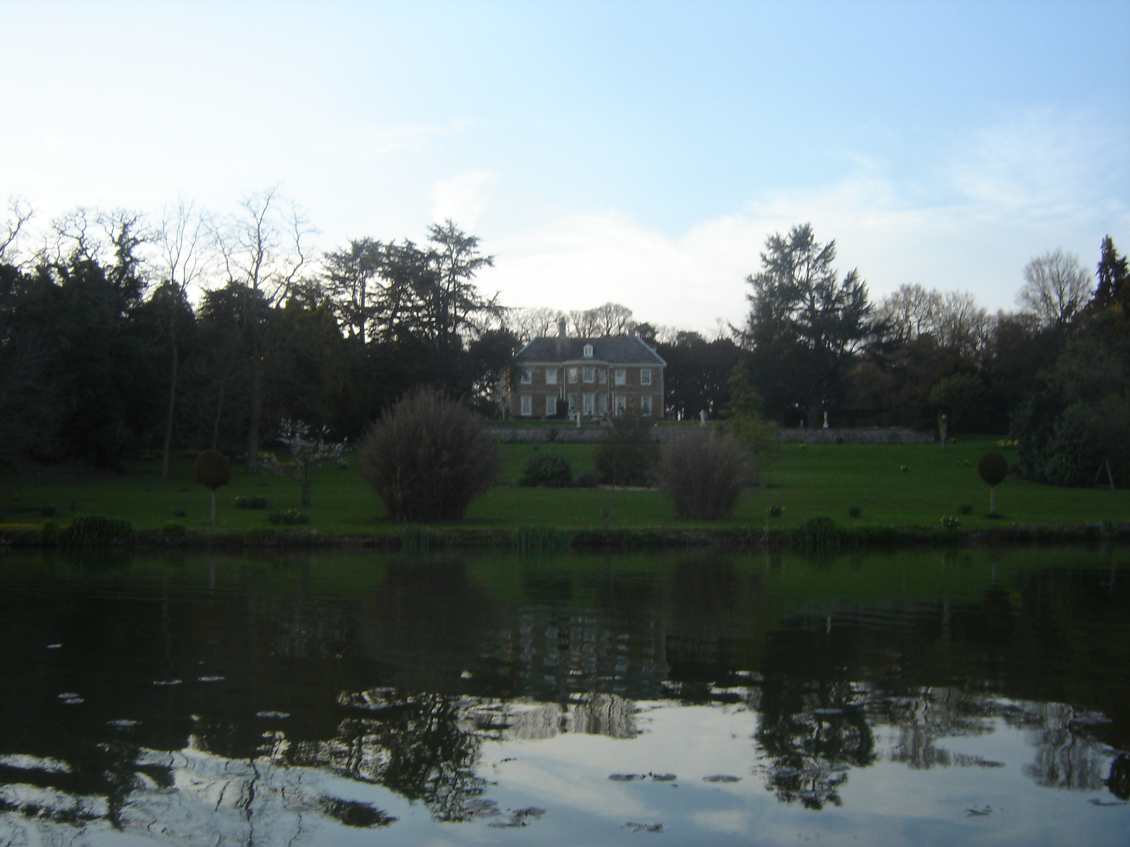
Cransley Hall
Cransley Hall is a Grade II* listed[1] country manor house in the village of Great Cransley, near Kettering in Northamptonshire. It is set in its own grounds...

Broughton, Northamptonshire
Broughton is a large village and civil parish in North Northamptonshire, England. The village is around 2 miles (3.2 km) south-west of Kettering and is...

Cransley
Cransley is a civil parish in Northamptonshire, England. It contains the village of Great Cransley but Little Cransley is in the adjacent parish of Broughton...
Kettering Ironstone Railway
The Kettering Ironstone Railway was an industrial 3 ft (914 mm) narrow gauge railway that served the ironstone quarries around Kettering. == History... ==
Nearby Amenities
Located within 500m of 52.376266,-0.78041855Have you been to Churchill Spinney?
Leave your review of Churchill Spinney below (or comments, questions and feedback).