Bescaby Oaks

Wood, Forest in Leicestershire Melton

England

Bescaby Oaks

View over the valley of the River Devon near Croxton Kerrial Croxton Kerrial sits on the left of the horizon. If the Roman road, the Salt Way, ran as an uninterrupted straight line to the south of Croxton Kerrial (rather than along the line of the current A607 through the village), as is suggested by some sources <span class="nowrap"><a title="https://archaeologydataservice.ac.uk/archives/view/romangl/map.html" rel="nofollow ugc noopener" href="https://archaeologydataservice.ac.uk/archives/view/romangl/map.html">Link</a><img style="margin-left:2px;" alt="External link" title="External link - shift click to open in new window" src="https://s1.geograph.org.uk/img/external.png" width="10" height="10"/></span> , it would have been along the line of this view. It would still have had to cross the valley, but possibly with an easier gradient.
View over the valley of the River Devon near Croxton Kerrial Credit: Tim Heaton

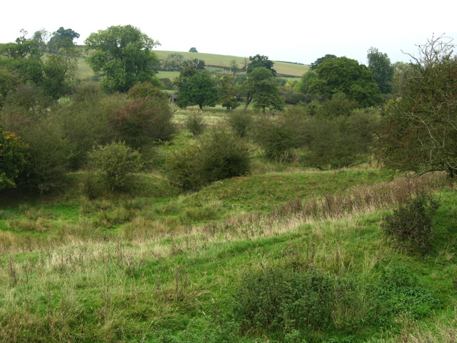
Bescaby Oaks is a stunning wood nestled in the heart of Leicestershire, England. Spanning over 50 acres, this enchanting forest is renowned for its majestic oak trees and picturesque landscapes. Located near the village of Harby, Bescaby Oaks offers visitors a tranquil escape from the hustle and bustle of everyday life.

The woodland is home to a diverse range of flora and fauna, making it a haven for nature lovers and wildlife enthusiasts. The ancient oaks, some of which are believed to be over 500 years old, provide a habitat for various bird species, including woodpeckers, owls, and thrushes. Squirrels can often be seen darting between branches, adding to the woodland's charm.

Visitors to Bescaby Oaks can explore its network of walking trails, which wind through the forest and offer breathtaking views of the surrounding countryside. The paths are well-maintained and suitable for all ages and abilities, making it an ideal destination for families and avid hikers alike.

The wood is open to the public year-round and is particularly popular during the autumn months when the foliage transforms into a vibrant display of reds, oranges, and golds. This makes Bescaby Oaks an idyllic spot for photographers and nature enthusiasts seeking to capture the beauty of the changing seasons.

With its tranquil atmosphere, diverse wildlife, and stunning landscapes, Bescaby Oaks is a true gem in Leicestershire's natural landscape. Whether you're seeking a peaceful walk, an escape into nature, or simply a place to unwind, Bescaby Oaks offers a truly magical experience for all who visit.

If you have any feedback on the listing, please let us know in the comments section below.

Bescaby Oaks Images

Images are sourced within 2km of 52.833435/-0.76940601 or Grid Reference SK8326. Thanks to Geograph Open Source API. All images are credited.

View over the valley of the River Devon near Croxton Kerrial Croxton Kerrial sits on the left of the horizon. If the Roman road, the Salt Way, ran as an uninterrupted straight line to the south of Croxton Kerrial (rather than along the line of the current A607 through the village), as is suggested by some sources <span class="nowrap"><a title="https://archaeologydataservice.ac.uk/archives/view/romangl/map.html" rel="nofollow ugc noopener" href="https://archaeologydataservice.ac.uk/archives/view/romangl/map.html">Link</a><img style="margin-left:2px;" alt="External link" title="External link - shift click to open in new window" src="https://s1.geograph.org.uk/img/external.png" width="10" height="10"/></span> , it would have been along the line of this view. It would still have had to cross the valley, but possibly with an easier gradient.
View over the valley of the River Devon near Croxton Kerrial
Croxton Kerrial sits on the left of the horizon. If the Roman road, the Salt Way, ran as an uninterrupted straight line to the south of Croxton Kerrial (rather than along the line of the current A607 through the village), as is suggested by some sources LinkExternal link , it would have been along the line of this view. It would still have had to cross the valley, but possibly with an easier gradient.
The A607 east of Lings Hill Continuing the straight line of the Salt Way in the direction of Croxton Kerrial.
The A607 east of Lings Hill
Continuing the straight line of the Salt Way in the direction of Croxton Kerrial.
Pasture near Croxton Park On the right, behind an overgrown dry-stone wall, Kennel Plantation.   Beneath the clump of trees on the left (middle distance) is a low, barrow-like mound - was this once the site of the windmill which gave the ridge its name?
Pasture near Croxton Park
On the right, behind an overgrown dry-stone wall, Kennel Plantation. Beneath the clump of trees on the left (middle distance) is a low, barrow-like mound - was this once the site of the windmill which gave the ridge its name?
April showers 1 Looking across exceedingly gloomy farmland from Saltby Road towards sunlit Terrace Hills, <a href="https://www.geograph.org.uk/gridref/SK7932">SK7932</a>, on the horizon. The haziness is caused by torrential rain which hit me just as I got back in the car.
April showers 1
Looking across exceedingly gloomy farmland from Saltby Road towards sunlit Terrace Hills, SK7932, on the horizon. The haziness is caused by torrential rain which hit me just as I got back in the car.
A607 towards Grantham
Farm track and footpath towards Branston
Farmland near Croxton Kerrial
A607 towards Grantham
Farmland near Croxton Kerrial
Farmland, Barn Lodge Farm
Track to Barn Lodge Farm
Minor road towards Saltby
Farmland near Croxton Park
Track towards Old Wood (footpath)
Byway off Croxton Road
Croxton Road towards Saltby
Oilseed rape crop off Croxton Road
Farmland off Croxton Road
Show me another place!

Bescaby Oaks is located at Grid Ref: SK8326 (Lat: 52.833435, Lng: -0.76940601)

Administrative County: Leicestershire

District: Melton

Police Authority: Leicestershire

What 3 Words

///corkscrew.cloth.snaps. Near Wymondham, Leicestershire

Nearby Locations

Bescaby Oaks

Related Wikis

Croxton Park

Croxton Park is a 97.3-hectare (240-acre) biological Site of Special Scientific Interest south-west of Croxton Kerrial in Leicestershire.This medieval...
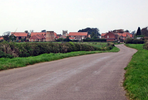
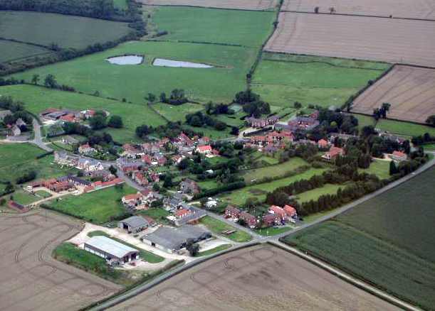
Bescaby

Bescaby is a hamlet, deserted medieval village and former civil parish, now in the parish of Sproxton, in the Melton district, in Leicestershire, England...

Framland

Framland was a hundred in north-east Leicestershire, England, roughly corresponding to today's borough of Melton. It was recorded in the Domesday Book...

Croxton Abbey

Croxton Abbey, near Croxton Kerrial, Leicestershire, was a Premonstratensian monastery founded by William I, Count of Boulogne. == History == Croxton Abbey...

Stonesby

Stonesby is a village and former civil parish, now in the parish of Sproxton, within the Melton borough of Leicestershire, England. It is 6 miles (9.7...

Stonesby Quarry

Stonesby Quarry is a 3.2 hectares (7.9 acres) biological Site of Special Scientific Interest between Stonesby and Waltham on the Wolds in Leicestershire...

Croxton Kerrial

Croxton Kerrial (pronounced [ˈkroʊsən ˈkɛrɨl]) is a village and civil parish in the Melton borough of Leicestershire, England, 6.6 miles (10.6 km) south...

Saltby

Saltby is a village and former civil parish, now in the parish of Sproxton, in the Melton borough of Leicestershire, England. It lies close to the River...

Have you been to Bescaby Oaks?

Leave your review of Bescaby Oaks below (or comments, questions and feedback).